North Salem is a town in Eel River Township, Hendricks County, Indiana, United States. The population was 518 at the 2010 Census.
| Name: | North Salem town |
|---|---|
| LSAD Code: | 43 |
| LSAD Description: | town (suffix) |
| State: | Indiana |
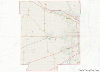
| County: | Hendricks County |
| Elevation: | 892 ft (272 m) |
| Total Area: | 0.34 sq mi (0.89 km²) |
| Land Area: | 0.34 sq mi (0.89 km²) |
| Water Area: | 0.00 sq mi (0.00 km²) |
| Total Population: | 464 |
| Population Density: | 1,352.77/sq mi (522.16/km²) |
| ZIP code: | 46165 |
| Area code: | 765 |
| FIPS code: | 1855080 |
| GNISfeature ID: | 0440289 |
| Website: | http://north-salem.com/ |
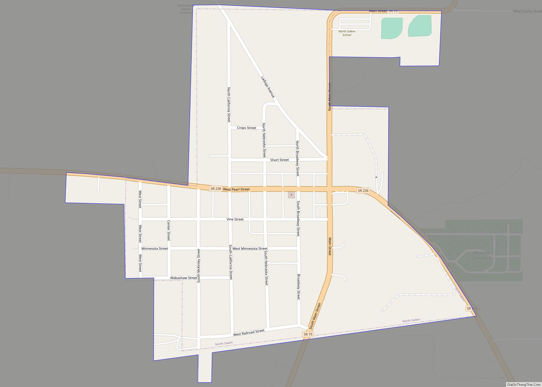
Online Interactive Map
Click on ![]() to view map in "full screen" mode.
to view map in "full screen" mode.
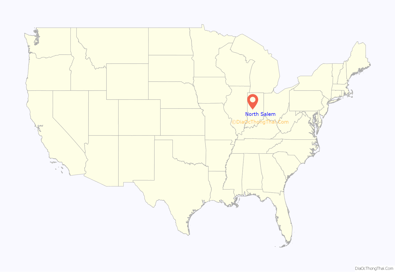
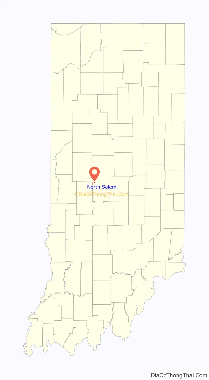
North Salem location map. Where is North Salem town?
History
North Salem was laid out in 1835. A post office was established at North Salem in 1839. North Salem was incorporated as a town in 1899.
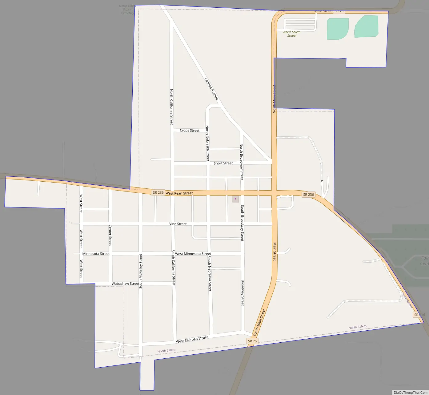
North Salem Road Map
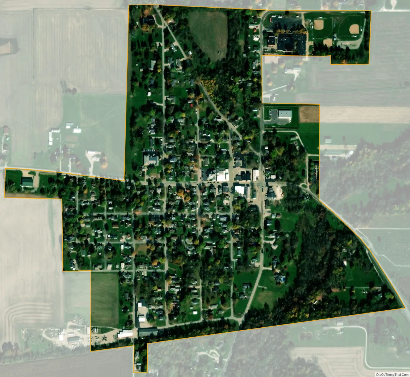
North Salem city Satellite Map
Geography
North Salem is located at 39°51′34″N 86°38′45″W / 39.85944°N 86.64583°W / 39.85944; -86.64583 (39.859423, -86.645722).
According to the 2010 census, North Salem has a total area of 0.26 square miles (0.67 km), all land.
The nearby waterways Eel River and Big Walnut Creek offer ample fishing and scenery.
The surrounding land consists of low flat farmland to the east and deep ravines and woodland to the west.
See also
Map of Indiana State and its subdivision:- Adams
- Allen
- Bartholomew
- Benton
- Blackford
- Boone
- Brown
- Carroll
- Cass
- Clark
- Clay
- Clinton
- Crawford
- Daviess
- De Kalb
- Dearborn
- Decatur
- Delaware
- Dubois
- Elkhart
- Fayette
- Floyd
- Fountain
- Franklin
- Fulton
- Gibson
- Grant
- Greene
- Hamilton
- Hancock
- Harrison
- Hendricks
- Henry
- Howard
- Huntington
- Jackson
- Jasper
- Jay
- Jefferson
- Jennings
- Johnson
- Knox
- Kosciusko
- LaGrange
- Lake
- Lake Michigan
- LaPorte
- Lawrence
- Madison
- Marion
- Marshall
- Martin
- Miami
- Monroe
- Montgomery
- Morgan
- Newton
- Noble
- Ohio
- Orange
- Owen
- Parke
- Perry
- Pike
- Porter
- Posey
- Pulaski
- Putnam
- Randolph
- Ripley
- Rush
- Saint Joseph
- Scott
- Shelby
- Spencer
- Starke
- Steuben
- Sullivan
- Switzerland
- Tippecanoe
- Tipton
- Union
- Vanderburgh
- Vermillion
- Vigo
- Wabash
- Warren
- Warrick
- Washington
- Wayne
- Wells
- White
- Whitley
- Alabama
- Alaska
- Arizona
- Arkansas
- California
- Colorado
- Connecticut
- Delaware
- District of Columbia
- Florida
- Georgia
- Hawaii
- Idaho
- Illinois
- Indiana
- Iowa
- Kansas
- Kentucky
- Louisiana
- Maine
- Maryland
- Massachusetts
- Michigan
- Minnesota
- Mississippi
- Missouri
- Montana
- Nebraska
- Nevada
- New Hampshire
- New Jersey
- New Mexico
- New York
- North Carolina
- North Dakota
- Ohio
- Oklahoma
- Oregon
- Pennsylvania
- Rhode Island
- South Carolina
- South Dakota
- Tennessee
- Texas
- Utah
- Vermont
- Virginia
- Washington
- West Virginia
- Wisconsin
- Wyoming