Owensville is the third largest town and the smallest of the five larger communities in Gibson County, Indiana, United States. The population was 1,330 in 2017.
| Name: | Owensville town |
|---|---|
| LSAD Code: | 43 |
| LSAD Description: | town (suffix) |
| State: | Indiana |
| County: | Gibson County |
| Elevation: | 525 ft (160 m) |
| Total Area: | 0.57 sq mi (1.47 km²) |
| Land Area: | 0.57 sq mi (1.47 km²) |
| Water Area: | 0.00 sq mi (0.00 km²) |
| Total Population: | 1,338 |
| Population Density: | 2,351.49/sq mi (907.92/km²) |
| ZIP code: | 47665 |
| Area code: | 812, 930 |
| FIPS code: | 1857528 |
| GNISfeature ID: | 2396843 |
| Website: | http://owensville.org/1.html |
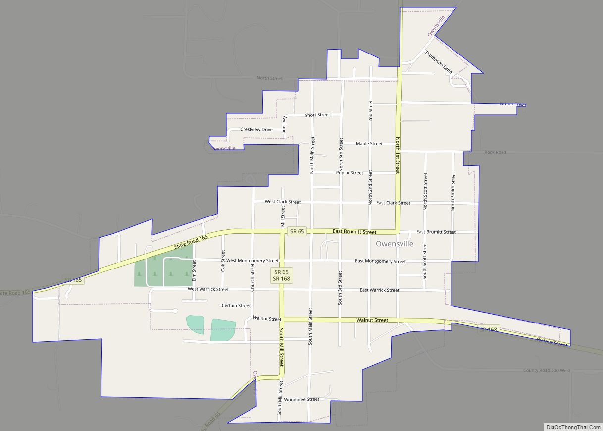
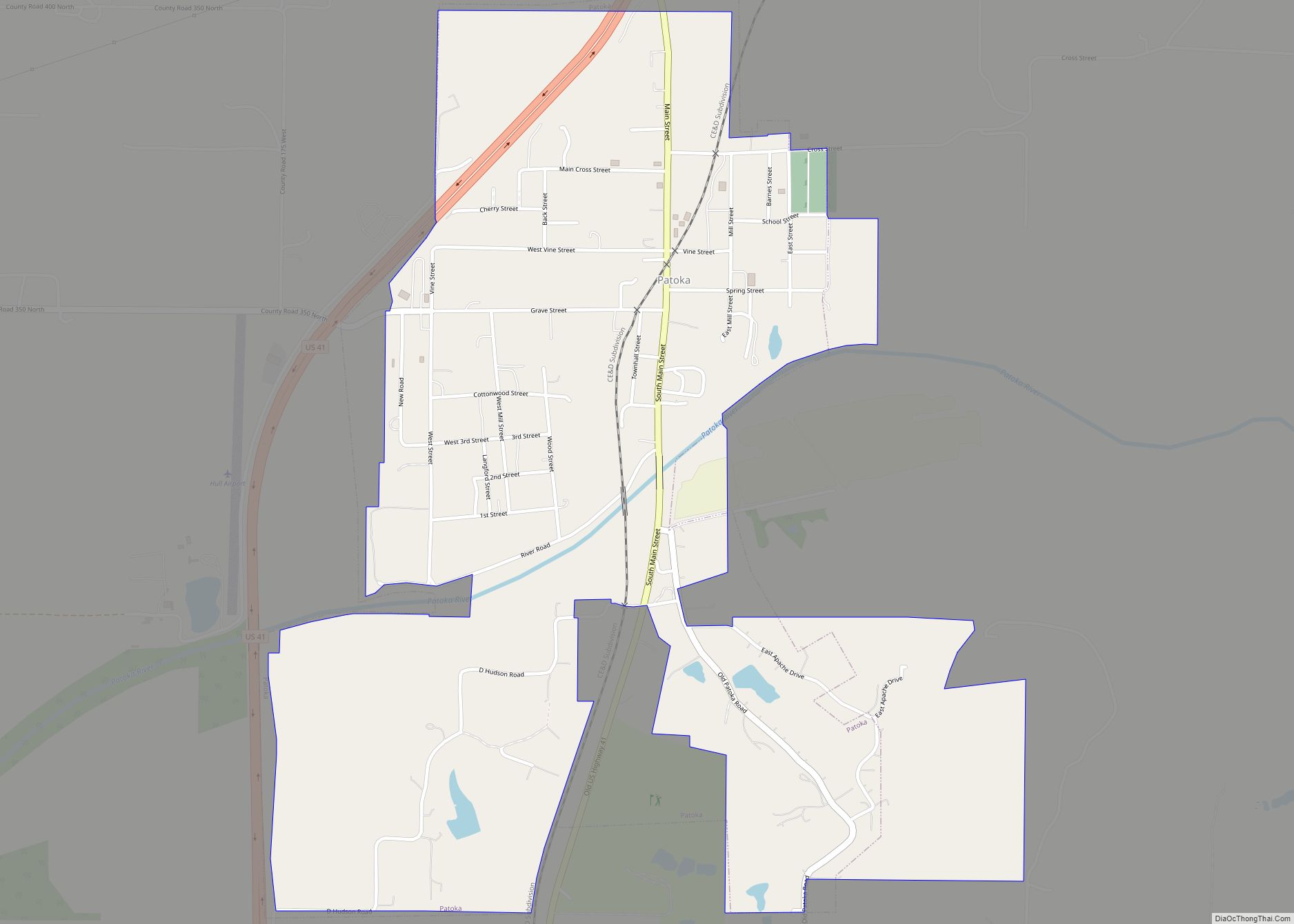
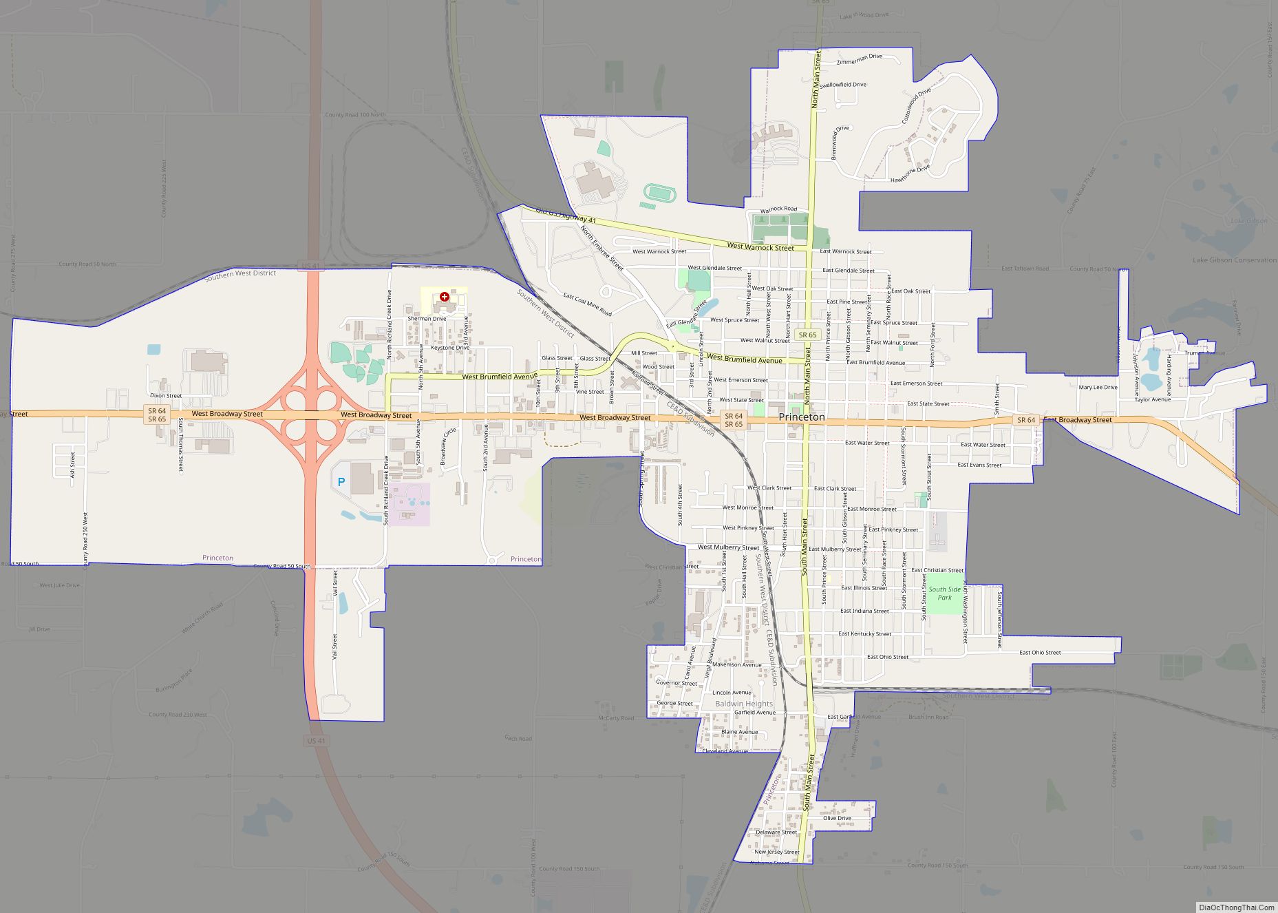
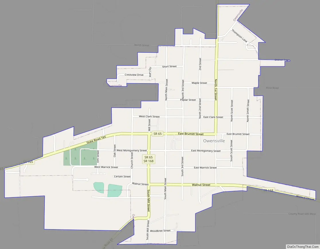
Online Interactive Map
Click on ![]() to view map in "full screen" mode.
to view map in "full screen" mode.
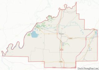
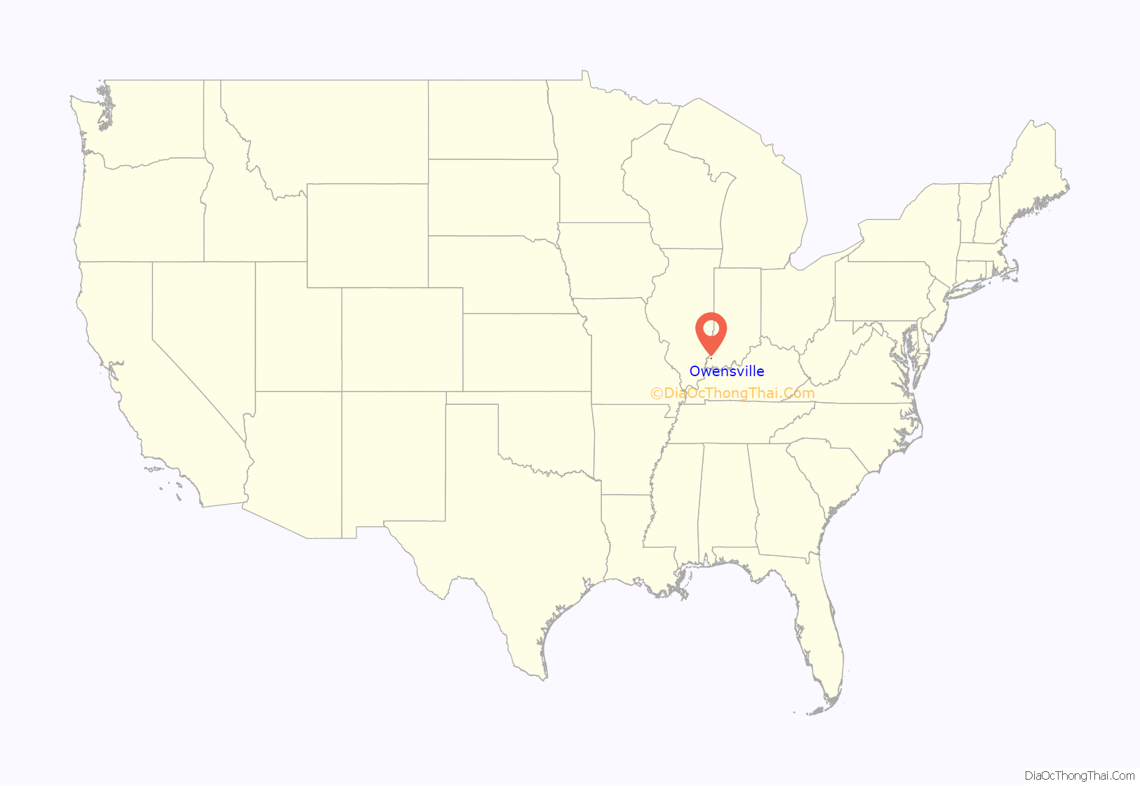
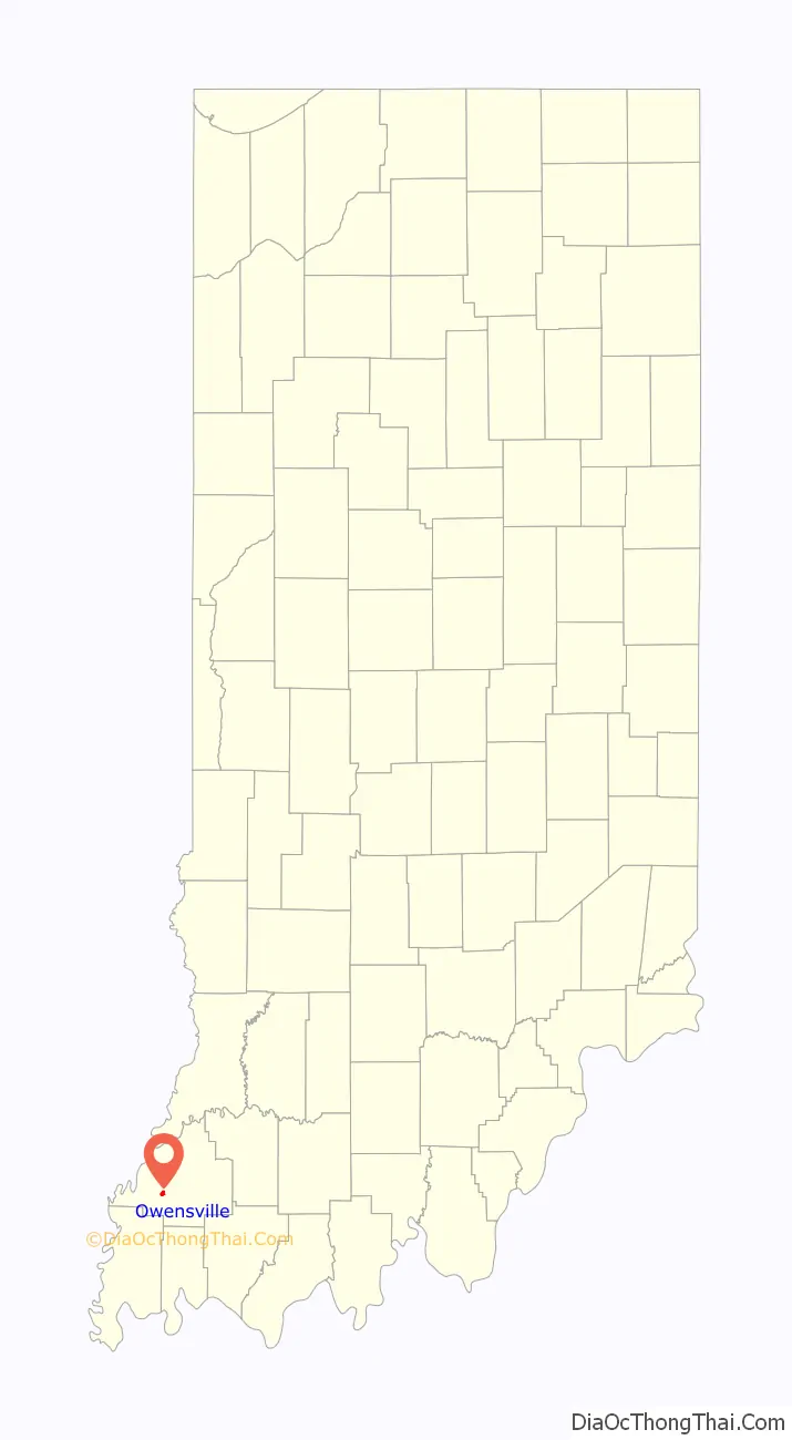
Owensville location map. Where is Owensville town?
History
Owensville was established in 1817 by Phillip Briscoe, when he filed the town plat consisting of 52 parcels and five out-parcels. A fire in 1876 destroyed many of the wood framed businesses on the eastern side of the town square.
It was not until 1881 that Owensville incorporated.
On March 18, 1925, the Tri-State Tornado struck just northwest of the town, killing nine people.
On February 28, 2017, an EF3 wedge tornado, originating in Crossville, Illinois, passed to the south of the town, destroying or heavily damaging several structures along Indiana 65. The highway was closed for several days as power crews replaced several large power poles.
On April 8, 2024, Owensville, along with most of the rest of southwestern Indiana will view a total solar eclipse, lasting approximately 3 minutes and 55 seconds.
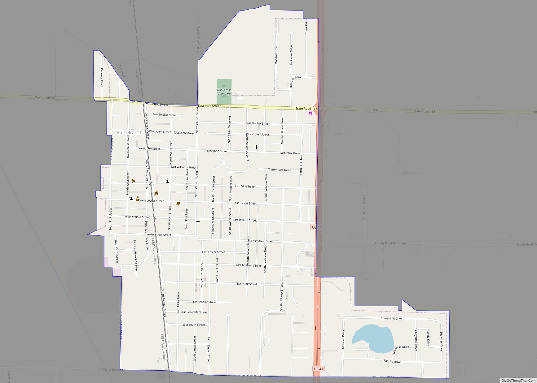
Owensville Road Map
Owensville city Satellite Map

Geography
Owensville is located at 38°16′18″N 87°41′26″W / 38.27167°N 87.69056°W / 38.27167; -87.69056 (38.271769, -87.690652).
According to the 2010 census, Owensville has a total area of 0.59 square miles (1.53 km), all land.
Climate
The climate in this area is characterized by hot, humid summers and generally mild to cool winters. According to the Köppen Climate Classification system, Owensville has a humid subtropical climate, abbreviated “Cfa” on climate maps, although areas just north of town have a humid continental climate. Local meteorologists often tend to use nearby Interstate 64 for comparison of local weather events.
In relation to climate, in 2004, the National Weather Service installed a NEXRAD Doppler Radar station approximately 2 miles west of the town.
See also
Map of Indiana State and its subdivision:- Adams
- Allen
- Bartholomew
- Benton
- Blackford
- Boone
- Brown
- Carroll
- Cass
- Clark
- Clay
- Clinton
- Crawford
- Daviess
- De Kalb
- Dearborn
- Decatur
- Delaware
- Dubois
- Elkhart
- Fayette
- Floyd
- Fountain
- Franklin
- Fulton
- Gibson
- Grant
- Greene
- Hamilton
- Hancock
- Harrison
- Hendricks
- Henry
- Howard
- Huntington
- Jackson
- Jasper
- Jay
- Jefferson
- Jennings
- Johnson
- Knox
- Kosciusko
- LaGrange
- Lake
- Lake Michigan
- LaPorte
- Lawrence
- Madison
- Marion
- Marshall
- Martin
- Miami
- Monroe
- Montgomery
- Morgan
- Newton
- Noble
- Ohio
- Orange
- Owen
- Parke
- Perry
- Pike
- Porter
- Posey
- Pulaski
- Putnam
- Randolph
- Ripley
- Rush
- Saint Joseph
- Scott
- Shelby
- Spencer
- Starke
- Steuben
- Sullivan
- Switzerland
- Tippecanoe
- Tipton
- Union
- Vanderburgh
- Vermillion
- Vigo
- Wabash
- Warren
- Warrick
- Washington
- Wayne
- Wells
- White
- Whitley
- Alabama
- Alaska
- Arizona
- Arkansas
- California
- Colorado
- Connecticut
- Delaware
- District of Columbia
- Florida
- Georgia
- Hawaii
- Idaho
- Illinois
- Indiana
- Iowa
- Kansas
- Kentucky
- Louisiana
- Maine
- Maryland
- Massachusetts
- Michigan
- Minnesota
- Mississippi
- Missouri
- Montana
- Nebraska
- Nevada
- New Hampshire
- New Jersey
- New Mexico
- New York
- North Carolina
- North Dakota
- Ohio
- Oklahoma
- Oregon
- Pennsylvania
- Rhode Island
- South Carolina
- South Dakota
- Tennessee
- Texas
- Utah
- Vermont
- Virginia
- Washington
- West Virginia
- Wisconsin
- Wyoming