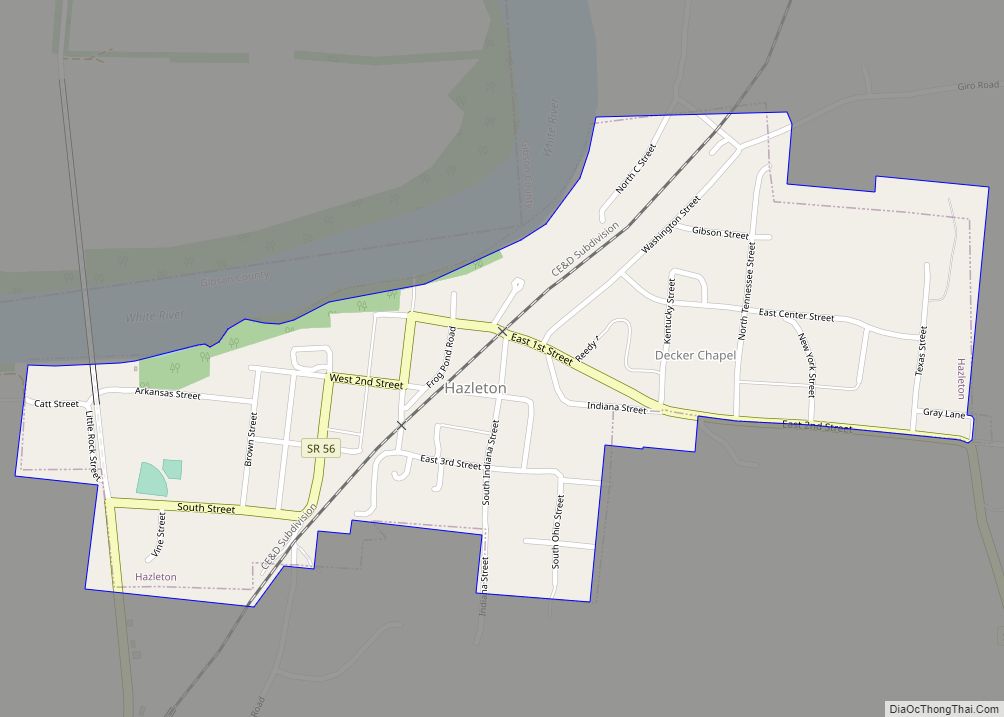
Hazleton is a town in White River Township, Gibson County, Indiana, United States. The population was 263 at the 2010 census making it the second smallest community in the county. While having almost no connection to it, it is part of the Evansville, Indiana, Metropolitan Area.
| Name: | Hazleton town |
|---|---|
| LSAD Code: | 43 |
| LSAD Description: | town (suffix) |
| State: | Indiana |
| County: | Gibson County |
| Elevation: | 449 ft (137 m) |
| Total Area: | 0.35 sq mi (0.90 km²) |
| Land Area: | 0.35 sq mi (0.90 km²) |
| Water Area: | 0.00 sq mi (0.00 km²) |
| Total Population: | 194 |
| Population Density: | 560.69/sq mi (216.30/km²) |
| ZIP code: | 47640 |
| Area code: | 812, 930 |
| FIPS code: | 1832728 |
| GNISfeature ID: | 2396992 |
Online Interactive Map
Click on ![]() to view map in "full screen" mode.
to view map in "full screen" mode.
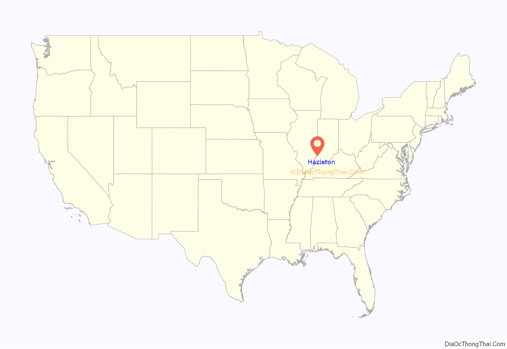
Hazleton location map. Where is Hazleton town?

History
Hazleton is the second-oldest town in Gibson County after Patoka. It was named in honor of Gervas Hazleton, believed to be the second settler to permanently locate to the county. Hazleton first lived in a crude camp lit by large log fires that was a popular stopover for early migrants to the area.
The town was platted in 1856 by Lucius French. T. S. Fuller erected the town’s first frame building, and John Breedlove built the town’s blacksmith shop. The first steamboat of any note to travel up the White River was the Cleopatria in 1884.
On March 10, 1897, a passenger train of the Evansville and Terre Haute Railroad (now the Chicago & Eastern Illinois) wrecked near Hazleton. An embankment which carried the tracks past the White River had been weakened by the river’s flood waters, and collapsed under the weight of the train, causing it to derail. Around a dozen people are believed to have been killed, though most bodies were never found.
Hazleton Road Map
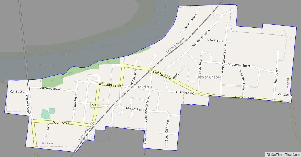
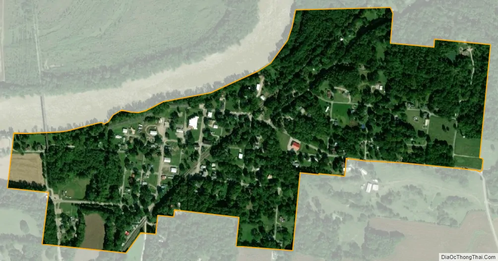
Hazleton city Satellite Map
Geography
Hazleton is located at 38°29′20″N 87°32′30″W / 38.48889°N 87.54167°W / 38.48889; -87.54167 (38.488953, -87.541652). The town is situated along the south bank of the White River in northern Gibson County (the river marks the county line between Gibson and Knox counties). State Road 56 connects the town with U.S. Route 41, which runs northward to Vincennes and southward to the Evansville area. Hazleton is 422 feet (129 m) above sea level.
According to the 2010 census, Hazleton has a total area of 0.33 square miles (0.85 km), all land.
See also
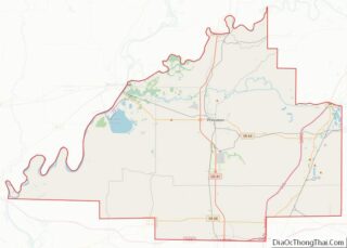
Map of Indiana State and its subdivision:- Adams
- Allen
- Bartholomew
- Benton
- Blackford
- Boone
- Brown
- Carroll
- Cass
- Clark
- Clay
- Clinton
- Crawford
- Daviess
- De Kalb
- Dearborn
- Decatur
- Delaware
- Dubois
- Elkhart
- Fayette
- Floyd
- Fountain
- Franklin
- Fulton
- Gibson
- Grant
- Greene
- Hamilton
- Hancock
- Harrison
- Hendricks
- Henry
- Howard
- Huntington
- Jackson
- Jasper
- Jay
- Jefferson
- Jennings
- Johnson
- Knox
- Kosciusko
- LaGrange
- Lake
- Lake Michigan
- LaPorte
- Lawrence
- Madison
- Marion
- Marshall
- Martin
- Miami
- Monroe
- Montgomery
- Morgan
- Newton
- Noble
- Ohio
- Orange
- Owen
- Parke
- Perry
- Pike
- Porter
- Posey
- Pulaski
- Putnam
- Randolph
- Ripley
- Rush
- Saint Joseph
- Scott
- Shelby
- Spencer
- Starke
- Steuben
- Sullivan
- Switzerland
- Tippecanoe
- Tipton
- Union
- Vanderburgh
- Vermillion
- Vigo
- Wabash
- Warren
- Warrick
- Washington
- Wayne
- Wells
- White
- Whitley
- Alabama
- Alaska
- Arizona
- Arkansas
- California
- Colorado
- Connecticut
- Delaware
- District of Columbia
- Florida
- Georgia
- Hawaii
- Idaho
- Illinois
- Indiana
- Iowa
- Kansas
- Kentucky
- Louisiana
- Maine
- Maryland
- Massachusetts
- Michigan
- Minnesota
- Mississippi
- Missouri
- Montana
- Nebraska
- Nevada
- New Hampshire
- New Jersey
- New Mexico
- New York
- North Carolina
- North Dakota
- Ohio
- Oklahoma
- Oregon
- Pennsylvania
- Rhode Island
- South Carolina
- South Dakota
- Tennessee
- Texas
- Utah
- Vermont
- Virginia
- Washington
- West Virginia
- Wisconsin
- Wyoming