Grand Rivers is a home rule-class city in Livingston County, Kentucky, in the United States. The population was 382 at the 2010 census, up from 343 in 2000. It is part of the Paducah micropolitan area.
| Name: | Grand Rivers city |
|---|---|
| LSAD Code: | 25 |
| LSAD Description: | city (suffix) |
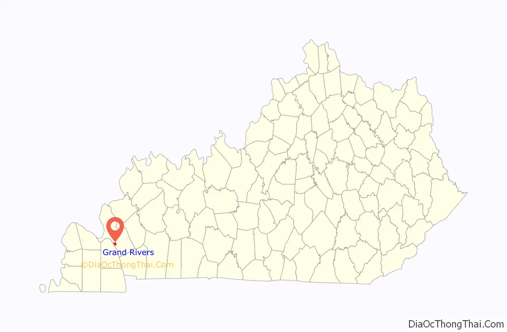
| State: | Kentucky |
| County: | Livingston County |
| Elevation: | 423 ft (129 m) |
| Total Area: | 1.97 sq mi (5.10 km²) |
| Land Area: | 1.85 sq mi (4.80 km²) |
| Water Area: | 0.12 sq mi (0.30 km²) |
| Total Population: | 345 |
| Population Density: | 186.18/sq mi (71.90/km²) |
| ZIP code: | 42045 |
| Area code: | 270 & 364 |
| FIPS code: | 2132212 |
| GNISfeature ID: | 2403725 |
| Website: | www.grandrivers.org |
Online Interactive Map
Click on ![]() to view map in "full screen" mode.
to view map in "full screen" mode.
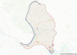
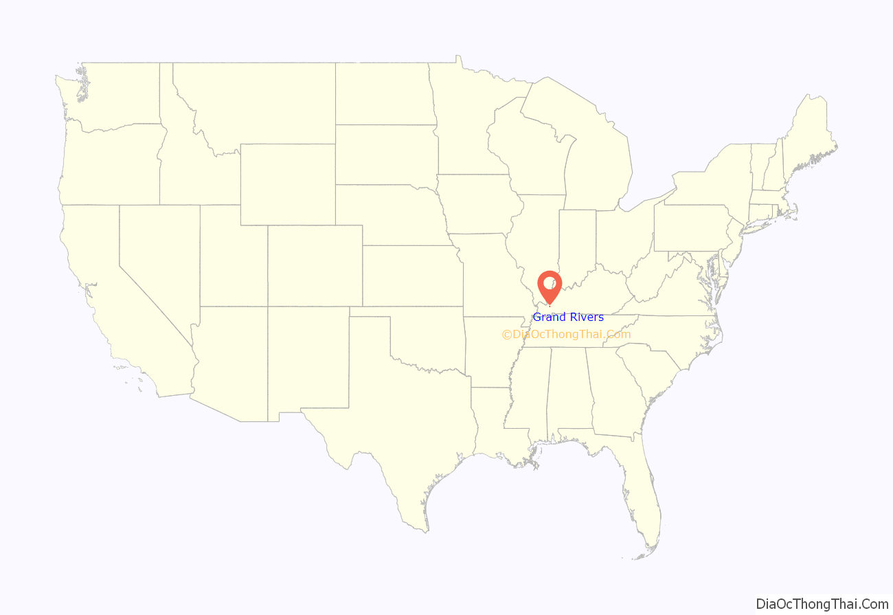
Grand Rivers location map. Where is Grand Rivers city?
History
Grand Rivers may have originally been known as Narrows from its position between the Cumberland and Tennessee Rivers. The local post office was established in 1879 as Otisville; changed its name in 1882 to Bernard; and was then changed again to Nickells the next year after the name of a new Illinois Central station.
The settlement was formally incorporated by the state assembly in 1890 as Grand Rivers. This newly expanded community was part of local businessman Thomas W. Lawson’s attempt to develop local iron deposits into a major steel industry. (The enterprise failed within a few years.) The name refers the Cumberland and Tennessee rivers which previously met near the site, prior to the TVA’s creation of Kentucky Lake and Lake Barkley. The Tennessee’s confluence with the Ohio is located within 40 miles of the town as well.
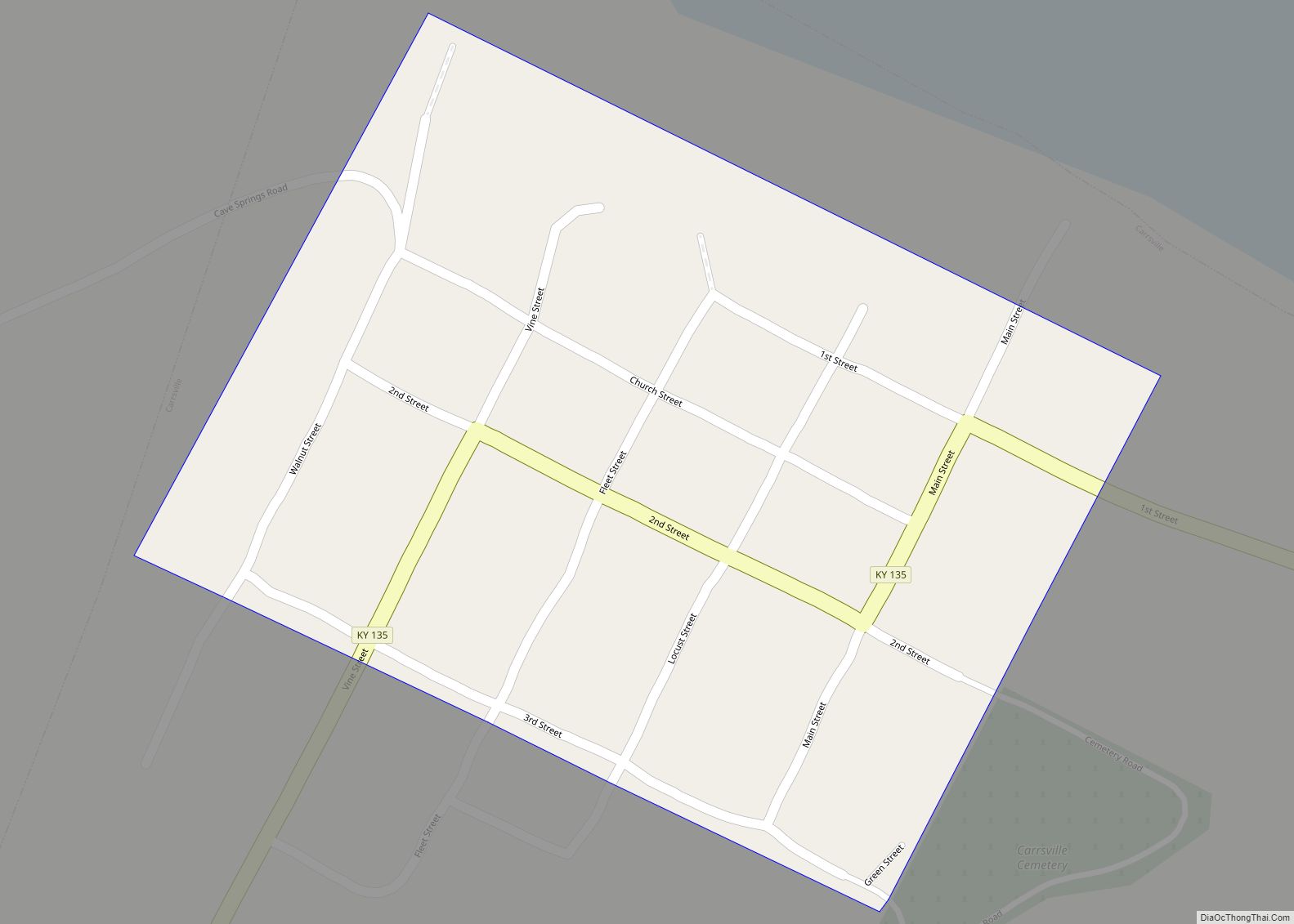
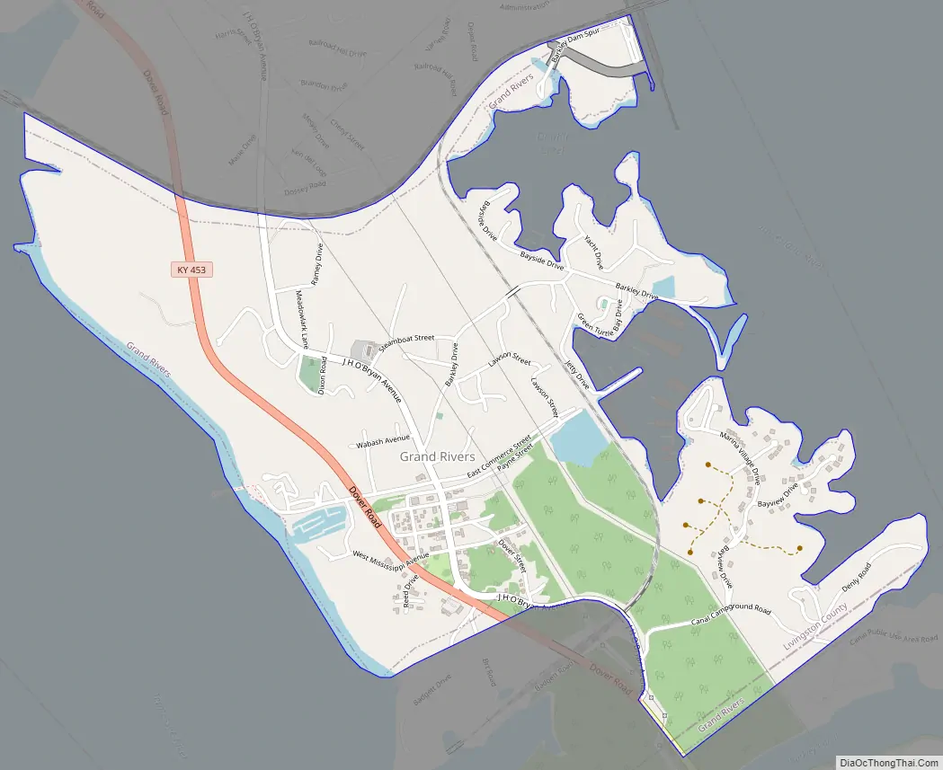
Grand Rivers Road Map
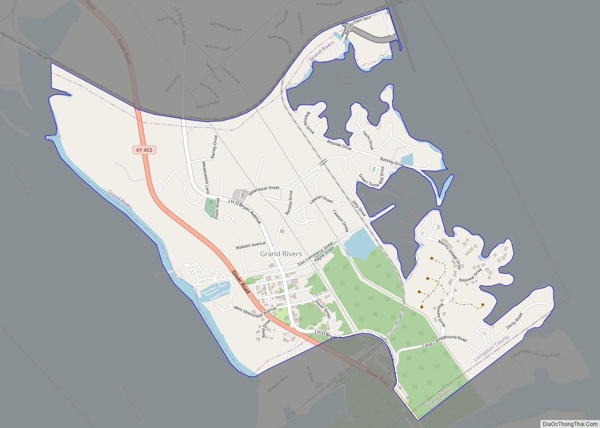
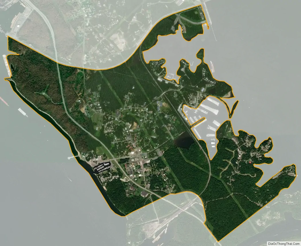
Grand Rivers city Satellite Map
Geography
According to the United States Census Bureau, the city has a total area of 1.9 square miles (4.9 km), of which 1.8 square miles (4.8 km) is land and 0.04 square miles (0.10 km) (2.13%) is water.
The town was formerly located at the narrowest point between the Cumberland River and the Tennessee. Both were dammed and artificial lakes created by the Tennessee Valley Authority and the Army Corps of Engineers in the early 20th century; the town now lies on an isthmus of land between Kentucky Lake and Lake Barkley.
See also
Map of Kentucky State and its subdivision:- Adair
- Allen
- Anderson
- Ballard
- Barren
- Bath
- Bell
- Boone
- Bourbon
- Boyd
- Boyle
- Bracken
- Breathitt
- Breckinridge
- Bullitt
- Butler
- Caldwell
- Calloway
- Campbell
- Carlisle
- Carroll
- Carter
- Casey
- Christian
- Clark
- Clay
- Clinton
- Crittenden
- Cumberland
- Daviess
- Edmonson
- Elliott
- Estill
- Fayette
- Fleming
- Floyd
- Franklin
- Fulton
- Gallatin
- Garrard
- Grant
- Graves
- Grayson
- Green
- Greenup
- Hancock
- Hardin
- Harlan
- Harrison
- Hart
- Henderson
- Henry
- Hickman
- Hopkins
- Jackson
- Jefferson
- Jessamine
- Johnson
- Kenton
- Knott
- Knox
- Larue
- Laurel
- Lawrence
- Lee
- Leslie
- Letcher
- Lewis
- Lincoln
- Livingston
- Logan
- Lyon
- Madison
- Magoffin
- Marion
- Marshall
- Martin
- Mason
- McCracken
- McCreary
- McLean
- Meade
- Menifee
- Mercer
- Metcalfe
- Monroe
- Montgomery
- Morgan
- Muhlenberg
- Nelson
- Nicholas
- Ohio
- Oldham
- Owen
- Owsley
- Pendleton
- Perry
- Pike
- Powell
- Pulaski
- Robertson
- Rockcastle
- Rowan
- Russell
- Scott
- Shelby
- Simpson
- Spencer
- Taylor
- Todd
- Trigg
- Trimble
- Union
- Warren
- Washington
- Wayne
- Webster
- Whitley
- Wolfe
- Woodford
- Alabama
- Alaska
- Arizona
- Arkansas
- California
- Colorado
- Connecticut
- Delaware
- District of Columbia
- Florida
- Georgia
- Hawaii
- Idaho
- Illinois
- Indiana
- Iowa
- Kansas
- Kentucky
- Louisiana
- Maine
- Maryland
- Massachusetts
- Michigan
- Minnesota
- Mississippi
- Missouri
- Montana
- Nebraska
- Nevada
- New Hampshire
- New Jersey
- New Mexico
- New York
- North Carolina
- North Dakota
- Ohio
- Oklahoma
- Oregon
- Pennsylvania
- Rhode Island
- South Carolina
- South Dakota
- Tennessee
- Texas
- Utah
- Vermont
- Virginia
- Washington
- West Virginia
- Wisconsin
- Wyoming