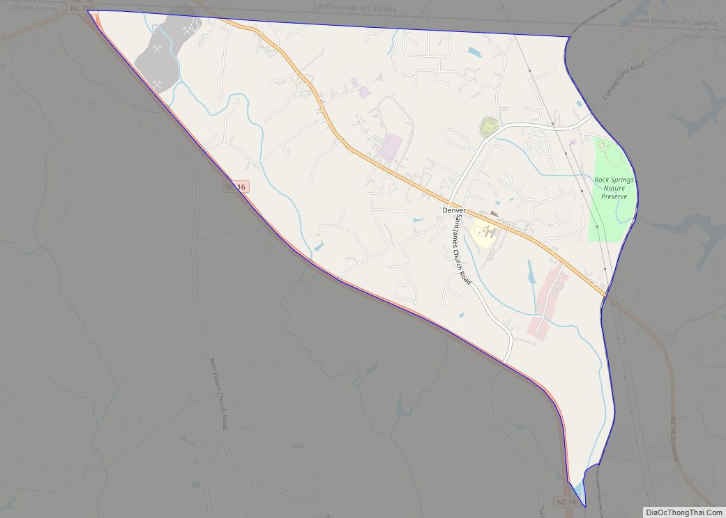
Denver, formerly known as Dry Pond, is a census-designated place and unincorporated community in Lincoln County, North Carolina, United States. As of the 2010 census it had a population of 2,309.
Known as “Dry Pond” until 1873, it was renamed “Denver” (after the capital of the then territory of Colorado) as a marketing and growth strategy directed towards the emerging railroad industry. This change was championed by D. Matt Thompson, a local principal. The town was incorporated as such from 1877 until 1971, when the town lost its charter and was reincorporated back into Lincoln County. (denvernc.com)
| Name: | Denver CDP |
|---|---|
| LSAD Code: | 57 |
| LSAD Description: | CDP (suffix) |
| State: | North Carolina |
| County: | Lincoln County |
| Elevation: | 902 ft (275 m) |
| Total Area: | 5.93 sq mi (15.37 km²) |
| Land Area: | 5.93 sq mi (15.35 km²) |
| Water Area: | 0.01 sq mi (0.02 km²) |
| Total Population: | 2,697 |
| Population Density: | 455.04/sq mi (175.68/km²) |
| ZIP code: | 28037 |
| Area code: | 704 |
| FIPS code: | 3717000 |
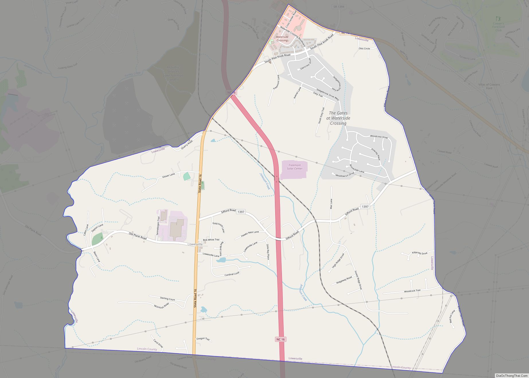
Online Interactive Map
Click on ![]() to view map in "full screen" mode.
to view map in "full screen" mode.
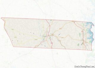
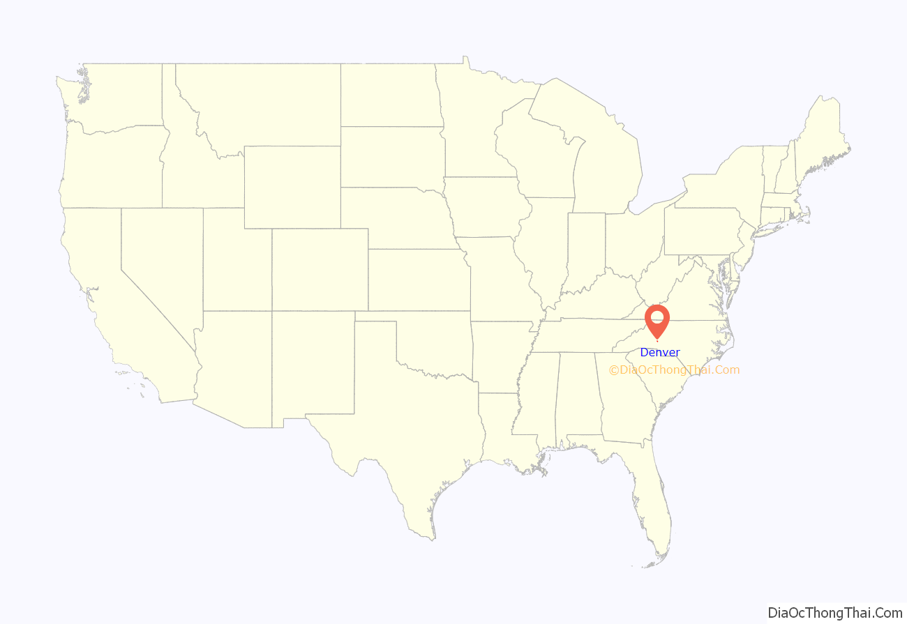
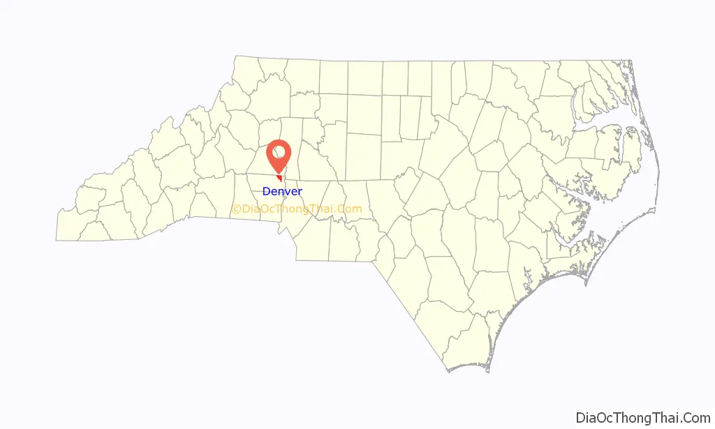
Denver location map. Where is Denver CDP?
History
Period of foundation
The community of Dry Pond derived its name from a small pond, which once stood at what is now the corner of Highway 16 Business and Campground Road, now the site of the local First Federal branch. The pond would dry up in the heat of summer months.
18th century
Adam Sherrill and his family first settled in the area in 1747, and they were followed by John Beatty two years later. The actual location of Denver was first settled around 1770. People of Scotch-Irish and German descent from Pennsylvania, were among the first white settlers. Most of the early Scotch Irish were Presbyterians, and their first place of worship in what would become the Denver area was John Beatty’s house, which was located about one mile west of Beatty’s Ford, near the present-day Triangle community. Now known as Unity Presbyterian, the first meetinghouse for this congregation was originally built of logs. In 1808, it was decided to erect a larger building, and a plot of several acres was conveyed for the purpose by James Little to “James Connor, Alexander Brevard, John Reid and Joseph Graham, trustees.” Dr Humphrey Hunter, a native of Ireland and a soldier in the American Revolutionary War, was pastor from 1796 to 1804. Next came Rev. Henry N. Pharr. He was succeeded by Patrick Sparrow, whose father was a potter at Vesuvius furnace, part of the Graham family’s local iron industry. Sparrow was the first professor of languages at Davidson College, and afterwards president of Hampden–Sydney College in Virginia. A long-time minister at Unity was Robert Hall Morrison, who was first president of Davidson College.
The Presbyterians were soon joined by early Methodists from Maryland, who initially took up residence near what is now Terrell. Longtime leaders of the Methodists in the region were Rev. Daniel Asbury and Rev. Jeremiah Munday, pioneer Methodist ministers. When he was younger, Asbury traveled to Kentucky with some family members (among them the Callaways) and, along with their leader Daniel Boone, he and approximately 20 people were taken hostage by a band of Shawnee. They were carried to the far northwest (present-day Ohio) and held in captivity for five years. Asbury later was traded to the British in what is now Detroit, and returned to his home in Virginia. In 1791, Asbury established in Lincoln County the first Methodist church west of the Catawba River, which is now known as Bethel United Methodist Church. Rev. Jeremiah Mundy was a native of Virginia and came to Lincoln County in 1799. He was a soldier in the Revolutionary War three years and a minister for 35 years. These Methodists brought with them the institution of “camp meeting”, which quickly became one of the most important traditions for the region. Interdenominational from the beginning, the local Rock Springs Camp Meeting grows out of these early meetings and traces its history to 1794, when Daniel Asbury, William McKendree (who would become a bishop), William Fulwood and James Hall, a Presbyterian, held the first gathering near present-day Rehobeth Church in Terrell.
Native Americans
Most of the land that these Europeans claimed had long been the home of the Catawba and Cherokee people. The Catawba River in this part of North Carolina acted as a border between the two nations, who were often at odds with each other. In the earliest days of European settlement, there were episodes of violence between the Native Americans and the new settlers, and eventually a fort was constructed near present-day Statesville to help provide a level of defense for the western portion of the colony.
General William Lee Davidson
On February 1, 1781, British forces under the command of Lt. General Cornwallis clashed with North Carolina troops led by Brig. Gen. William Lee Davidson at Cowan’s Ford, the southernmost limit of present-day Denver. The British were pursuing Nathanael Greene’s forces following the Patriot victory at Cowpens, South Carolina, and Davidson’s troops had been sent to stall and harass his advance. With Davidson was Captain Joseph Graham, a local, who had raised 56 cavalrymen. He had promised that those who furnished their own horses and equipment and served six weeks would be considered as having served a tour of three months.
Local blacksmiths made 45 rough swords for the new mounted troops. Only fifteen of Graham’s troops had pistols, but all had rifles, not the ideal weapon for horseback fighting. Davidson, charged with guarding four of the Catawba River crossings, had sent 500 troops to Beattie’s Ford, keeping only 25 at Cowan’s. But the river was high and Cornwallis did not have access to his heavy guns. Led by a local Tory guide, Frederick Hager, the British began to cross the river early as the Americans were still sleeping. The sentry was not alerted until Cornwallis’ troops were within 100 yards of the shore. The battle began, and the strong current was on the American’s side. Greatly outnumbered, the local forces were able to hold their own, slowly falling back into the woods while returning fire. The British finally took the ford and advanced. General Davidson was shot, and the militia, seeing this, fled. Major Graham’s cavalry covered their retreat. The battle had helped a larger force under the command of Daniel Morgan reach the Yadkin River unopposed. It is said that Frederick Hager was the man who shot the gun that killed General Davidson.
19th century
Most of the early settlers were subsistence farmers who relied heavily upon hunting to supplement their tables. Grist mills and saw mills were among the first local industries, but the production of iron soon became the biggest industry for the area. By 1810, Lincoln County boasted six ironmaking operations, including Vesuvius, Mt. Welcome, Mount Tirzah, Mount Carmel, High Shoals, and Madison. A number of individuals and partners took the lead in establishing ironworks in eastern Lincoln County, most just to the west of present-day Denver, near Pumpkin Center and in the direction of Iron Station. The partnership of Peter Forney, Joseph Graham, John Davidson, and Alexander Brevard was responsible for the construction of Vesuvius Furnace in 1795. Peter Forney built Madison Iron Furnace along Leeper’s Creek in 1809. These two sites, like other local ironworks, changed hands at various points. Other individuals involved in the development of the iron industry in Lincoln County include Turner Abernethy, John Fulenwider, Dr. William Johnston, Jonas W. Derr, and J.F. Reinhardt. James Madison Smith later erected Stonewall Furnace in 1862 to help meet the demand for iron brought on by the Civil War. Operations at Rehoboth (begun in the 1820s) and Madison furnaces also resumed during the turbulent years from 1862 to 1865 to supply much-needed iron for the Southern war effort.
Dry Pond
There was a Dry Pond Post Office beginning right before the Civil War, although it moved across the line to Catawba County near what is now Kiestler’s Store Road in December 1868. In 1873, in an attempt to attract a railroad spur and thinking that the moniker “Dry Pond” didn’t present a nice enough image for the railroad planners, headmaster of the local Rock Springs Academy, D. Matt Thompson, led the effort to have Dry Pond renamed for the capital of Colorado, which was just then petitioning for statehood.
In the years before the Civil War, North Carolina’s wealthy class in need of a break from the summer heat, could escape to Lincoln County’s Catawba Springs resort. The popular antebellum destination, named for the Catawba people formerly living in the area, was built amidst seven mineral springs near Denver. Guests vacationed there as early as the 1790s. In 1824, geology professor Denison Olmstead recommended the waters of the springs for complaints concerning the liver and weakness. There is little evidence that healing actually occurred; nonetheless Catawba Springs became a popular stop on the stagecoach lines from Salisbury to Asheville.
Revolutionary War veteran and state legislator Captain John Reid was the first known proprietor of Catawba Springs. After his death in 1821, the spa passed through a series of owners: Charles Jugnot, William Simonton, and Joseph Hampton. In 1838, Hampton renovated and expanded Catawba Springs, including the construction of a two-story, 100-room hotel. After the renovation, during parties and on holidays, as many as 500 guests assembled on the porch of the hotel. Before that time, the spa could only accommodate sixty to seventy guests in its cabins. Most guests were members of the southern planter class from North and South Carolina. Among the names of prominent North Carolina families listed in the hotel records are the Grahams, Brevards, Alexanders, Caldwells, Davidsons, and Polks. Some guests made their way to the spa from Mississippi, Alabama, and Louisiana. Students from nearby Davidson College could also be found enjoying themselves there on the weekends. During the early 1840s, Peter S. Ney ran a school for boys at the resort known as Stewart’s Seminary.
American Civil War
During the Civil War, the local area raised two units for the Confederacy. In March 1862, a group of local men, most of whom were related, formed a company known as the “Dry Pond Dixies” (Company G, 52nd regiment of North Carolina Troops) and joined the Confederacy. Added to their number were a number of Quakers from Randolph County, who did not fight but tended the wounded. The second group was known as the Beatty’s Ford Rifles (Company K 23rd Regiment).
The Civil War put an end to the southern planter aristocracy, and with its patron base depleted, Catawba Springs closed in the mid-1860s. As North Carolina recovered from the devastation of the war, railways and eventually good highways, led to the opening of mountain resorts. (A similar, but unrelated, resort operated under the name Sparkling Catawba Springs in Catawba County during the latter part of the nineteenth and early twentieth century.) The buildings were demolished in 1930, and the springs now bubble invisibly into a farm pond. A faint, lingering scent of sulfur is all that remains.
Town incorporation
In October 1874, Denver’s first postmaster, John A. Kids, was appointed. Mail to the Catawba Springs post office was transferred to the Denver post office the next year. Two years later, the community was incorporated as a town by the state of North Carolina. Unfortunately for the citizens of the area, the railroad chose not to run through the growing small town, and it began to dry up like the pond for which it was originally named.
For much of its existence, “downtown” consisted of a few houses, a handful of stores, a couple of churches, a school, a barber shop, a post office, a bank, and a cotton gin. The 1902 Soil Survey map of the Hickory, North Carolina area, shows Denver having a small grid of streets running along what are now Highway 16 Business and Campground Road. By 1914, the soil survey map of Lincoln County showed only a grid of three short streets running northwest to southeast parallel to what is now Highway 16 Business and one street running parallel to Campground Road (which still exists and was called by locals for many years “Back Street”). Apparently, one of the short streets perpendicular to Campground Road ran beside what is now the telephone building on St. James Church Road, and another of these perpendicular streets connected to what is now Campground Road right at the Rock Springs Campground. Another part of the “street grid” for Denver was Cemetery Road. It ran beside Denver United Methodist Church and was perpendicular to Highway 16, then turned in front of the community cemetery and intersected with Campground Road. The portion that ran beside the church and perpendicular to the highway was “graded under” by the church in the late 1990s.
For a brief period during the 1890s–1910s, Denver was home to small-scale gold prospecting, particularly in the area near the former Triangle School and the community now known as Westport.
20th century to present
Denver remained largely a farming community, with cotton as the primary cash crop supplemented by “truck farming” vegetables to area towns (with tomatoes and strawberries being among the most often marketed vegetable crops). Members of local families began commuting to work in textile mills in the surrounding communities of Mooresville, Lincolnton, Cornelius, Maiden, and Mount Holly just before World War II, and continued up until the early 1970s. Having failed to elect a local government for many years, Denver lost its official incorporated status in 1971 by vote of the state legislature.
It was the filling of a much larger pond, Lake Norman, that led Denver to grow in ways that its early boosters probably could have never fathomed. In 1962, Duke Power built the Cowans Ford Dam, flooding the fertile farmland along the Catawba River “bottoms”, the land which had attracted the area’s first settlers. Soon, weekend and summer “getaway” homes began to appear lakeside, and after a few years, these were replaced by more luxurious lake homes, as individuals began to move to the area to live near the water. Denver is now largely a bedroom community for Charlotte, which is 25 miles (40 km) to the south.
One of Denver’s major features is its “main street”, which is now known as Old Highway 16. This road, once State Highway 16, was one of North Carolina’s first state highways, receiving that designation in 1928. Present-day Highway 16 is a four-lane road running along the southwest edge of the community.
During the 1970s, the town hosted one of the largest cross-country motorcycle races in the nation, the “Denver 100”, which was a successful fundraiser for the local volunteer fire department. Participants rode through the center of barns, along creek banks, and through pastures—most of which have now disappeared under various housing developments.
Up until recently, most African Americans in the area lived in the community known as “Little Egypt”, which is the general area near East Lincoln High School along Saint James Church Road.
Denver is home to the Rock Springs Campground that has been the site of revivals and camp meetings since 1794.
Major local industries included modular home builder R-Anell Homes, which recently moved from Denver to a manufacturing facility in Cherryville.
National Register of Historic Places
The William A. Graham Jr. Farm, Munday House, and Rock Springs Camp Meeting Ground are listed on the National Register of Historic Places.
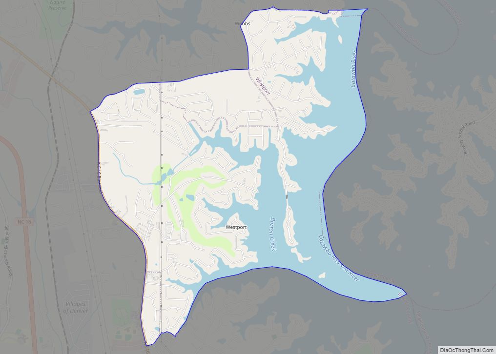
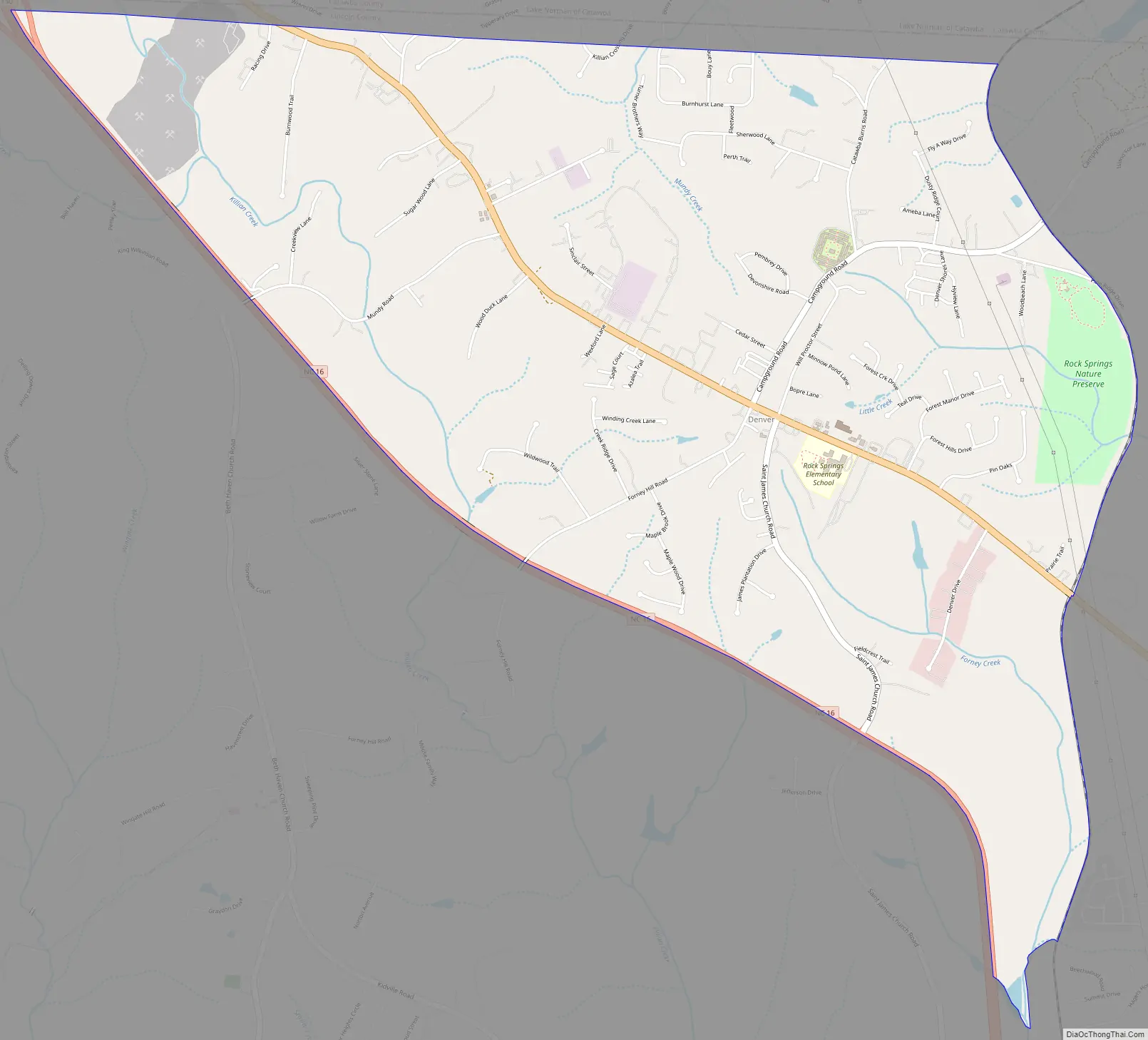
Denver Road Map
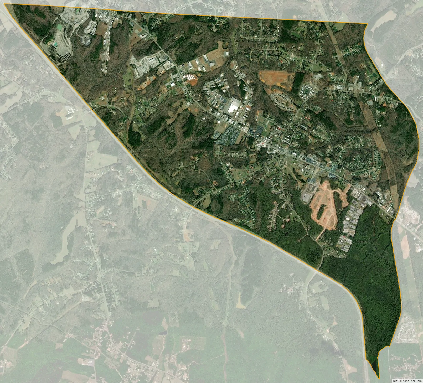
Denver city Satellite Map
Geography
Denver is situated on North Carolina State Highway 16, west of Lake Norman. It is about 25 miles (40 km) north of downtown Charlotte and 15 miles (24 km) southeast of Newton. Denver’s northern border is the Catawba County line.
According to the U.S. Census Bureau, the Denver CDP has a total area of 5.9 square miles (15.4 km), of which 0.01 square miles (0.02 km), or 0.14%, are water.
Denver’s ZIP code is 28037. The elevation is 902 feet (275 m) above sea level.
See also
Map of North Carolina State and its subdivision:- Alamance
- Alexander
- Alleghany
- Anson
- Ashe
- Avery
- Beaufort
- Bertie
- Bladen
- Brunswick
- Buncombe
- Burke
- Cabarrus
- Caldwell
- Camden
- Carteret
- Caswell
- Catawba
- Chatham
- Cherokee
- Chowan
- Clay
- Cleveland
- Columbus
- Craven
- Cumberland
- Currituck
- Dare
- Davidson
- Davie
- Duplin
- Durham
- Edgecombe
- Forsyth
- Franklin
- Gaston
- Gates
- Graham
- Granville
- Greene
- Guilford
- Halifax
- Harnett
- Haywood
- Henderson
- Hertford
- Hoke
- Hyde
- Iredell
- Jackson
- Johnston
- Jones
- Lee
- Lenoir
- Lincoln
- Macon
- Madison
- Martin
- McDowell
- Mecklenburg
- Mitchell
- Montgomery
- Moore
- Nash
- New Hanover
- Northampton
- Onslow
- Orange
- Pamlico
- Pasquotank
- Pender
- Perquimans
- Person
- Pitt
- Polk
- Randolph
- Richmond
- Robeson
- Rockingham
- Rowan
- Rutherford
- Sampson
- Scotland
- Stanly
- Stokes
- Surry
- Swain
- Transylvania
- Tyrrell
- Union
- Vance
- Wake
- Warren
- Washington
- Watauga
- Wayne
- Wilkes
- Wilson
- Yadkin
- Yancey
- Alabama
- Alaska
- Arizona
- Arkansas
- California
- Colorado
- Connecticut
- Delaware
- District of Columbia
- Florida
- Georgia
- Hawaii
- Idaho
- Illinois
- Indiana
- Iowa
- Kansas
- Kentucky
- Louisiana
- Maine
- Maryland
- Massachusetts
- Michigan
- Minnesota
- Mississippi
- Missouri
- Montana
- Nebraska
- Nevada
- New Hampshire
- New Jersey
- New Mexico
- New York
- North Carolina
- North Dakota
- Ohio
- Oklahoma
- Oregon
- Pennsylvania
- Rhode Island
- South Carolina
- South Dakota
- Tennessee
- Texas
- Utah
- Vermont
- Virginia
- Washington
- West Virginia
- Wisconsin
- Wyoming