Clarkston is a city in DeKalb County, Georgia, United States. The population was 7,554 as of the 2010 census.
The city is noted for its ethnic diversity, and is often referred to as “the most diverse square mile in America” and “the Ellis Island of the South.” In the 1990s, refugee resettlement programs identified Clarkston as a good fit for displaced persons of many backgrounds. The rental market was open, residents were moving farther out from the Atlanta urban core, and Clarkston was the last stop on a transit line into the city. At present students attending Clarkston High School come from over 50 countries; the local mosque (Masjid al-Momineen, or Mosque of the Faithful in English) has a diverse and sizable congregation; and over half the population is estimated by some to be foreign born.
| Name: | Clarkston city |
|---|---|
| LSAD Code: | 25 |
| LSAD Description: | city (suffix) |
| State: | Georgia |
| County: | DeKalb County |
| Elevation: | 1,020 ft (311 m) |
| Total Area: | 1.86 sq mi (4.81 km²) |
| Land Area: | 1.84 sq mi (4.78 km²) |
| Water Area: | 0.01 sq mi (0.04 km²) |
| Total Population: | 14,756 |
| Population Density: | 7,997.83/sq mi (3,088.40/km²) |
| ZIP code: | 30021 |
| Area code: | 404, 678 |
| FIPS code: | 1316544 |
| GNISfeature ID: | 0331411 |
| Website: | www.clarkstonga.gov |
Online Interactive Map
Click on ![]() to view map in "full screen" mode.
to view map in "full screen" mode.
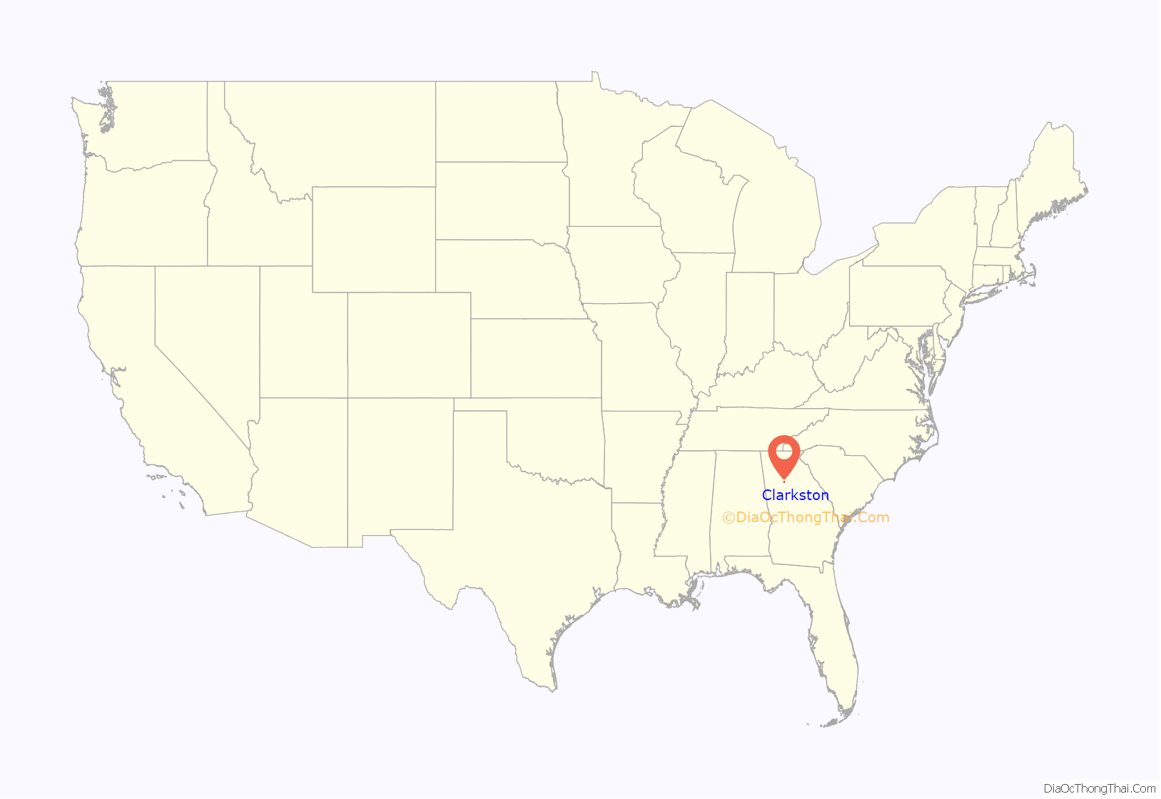
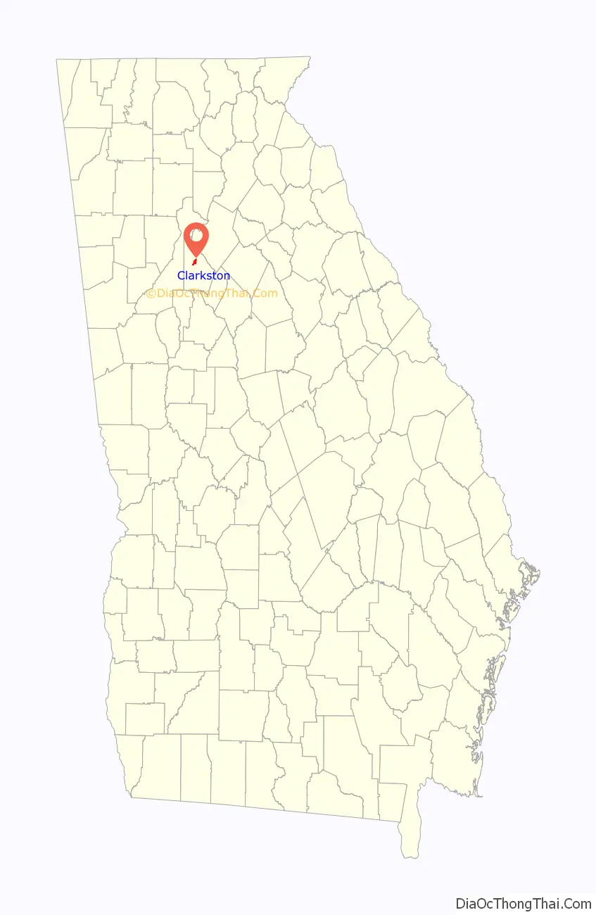
Clarkston location map. Where is Clarkston city?
History
A post office called Clarkston has been in operation since 1876. The Georgia General Assembly incorporated the place in 1882 as the “Town of Clarkston”, with municipal corporate limits extending in a one-half mile radius from the Georgia Railroad depot. The community was named after W. W. Clark, a railroad official.
Clarkston Road Map
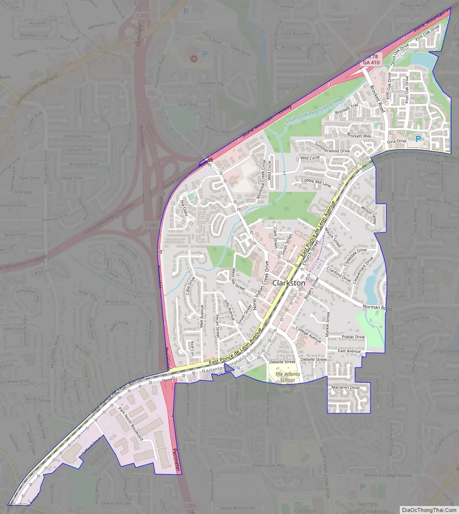
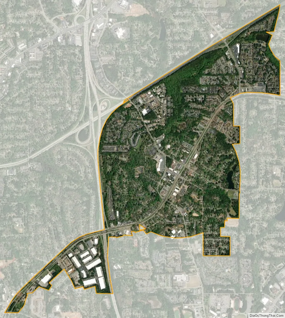
Clarkston city Satellite Map
Geography
Clarkston is located at 33°48′37″N 84°14′24″W / 33.81028°N 84.24000°W / 33.81028; -84.24000 (33.810304, −84.239877).
According to the United States Census Bureau, the city has a total area of 1.1 square miles (2.8 km), of which 1.0 square mile (2.6 km) is land and 0.94% is water.
Clarkston is on the Eastern Continental Divide.
See also
Map of Georgia State and its subdivision:- Appling
- Atkinson
- Bacon
- Baker
- Baldwin
- Banks
- Barrow
- Bartow
- Ben Hill
- Berrien
- Bibb
- Bleckley
- Brantley
- Brooks
- Bryan
- Bulloch
- Burke
- Butts
- Calhoun
- Camden
- Candler
- Carroll
- Catoosa
- Charlton
- Chatham
- Chattahoochee
- Chattooga
- Cherokee
- Clarke
- Clay
- Clayton
- Clinch
- Cobb
- Coffee
- Colquitt
- Columbia
- Cook
- Coweta
- Crawford
- Crisp
- Dade
- Dawson
- Decatur
- DeKalb
- Dodge
- Dooly
- Dougherty
- Douglas
- Early
- Echols
- Effingham
- Elbert
- Emanuel
- Evans
- Fannin
- Fayette
- Floyd
- Forsyth
- Franklin
- Fulton
- Gilmer
- Glascock
- Glynn
- Gordon
- Grady
- Greene
- Gwinnett
- Habersham
- Hall
- Hancock
- Haralson
- Harris
- Hart
- Heard
- Henry
- Houston
- Irwin
- Jackson
- Jasper
- Jeff Davis
- Jefferson
- Jenkins
- Johnson
- Jones
- Lamar
- Lanier
- Laurens
- Lee
- Liberty
- Lincoln
- Long
- Lowndes
- Lumpkin
- Macon
- Madison
- Marion
- McDuffie
- McIntosh
- Meriwether
- Miller
- Mitchell
- Monroe
- Montgomery
- Morgan
- Murray
- Muscogee
- Newton
- Oconee
- Oglethorpe
- Paulding
- Peach
- Pickens
- Pierce
- Pike
- Polk
- Pulaski
- Putnam
- Quitman
- Rabun
- Randolph
- Richmond
- Rockdale
- Schley
- Screven
- Seminole
- Spalding
- Stephens
- Stewart
- Sumter
- Talbot
- Taliaferro
- Tattnall
- Taylor
- Telfair
- Terrell
- Thomas
- Tift
- Toombs
- Towns
- Treutlen
- Troup
- Turner
- Twiggs
- Union
- Upson
- Walker
- Walton
- Ware
- Warren
- Washington
- Wayne
- Webster
- Wheeler
- White
- Whitfield
- Wilcox
- Wilkes
- Wilkinson
- Worth
- Alabama
- Alaska
- Arizona
- Arkansas
- California
- Colorado
- Connecticut
- Delaware
- District of Columbia
- Florida
- Georgia
- Hawaii
- Idaho
- Illinois
- Indiana
- Iowa
- Kansas
- Kentucky
- Louisiana
- Maine
- Maryland
- Massachusetts
- Michigan
- Minnesota
- Mississippi
- Missouri
- Montana
- Nebraska
- Nevada
- New Hampshire
- New Jersey
- New Mexico
- New York
- North Carolina
- North Dakota
- Ohio
- Oklahoma
- Oregon
- Pennsylvania
- Rhode Island
- South Carolina
- South Dakota
- Tennessee
- Texas
- Utah
- Vermont
- Virginia
- Washington
- West Virginia
- Wisconsin
- Wyoming