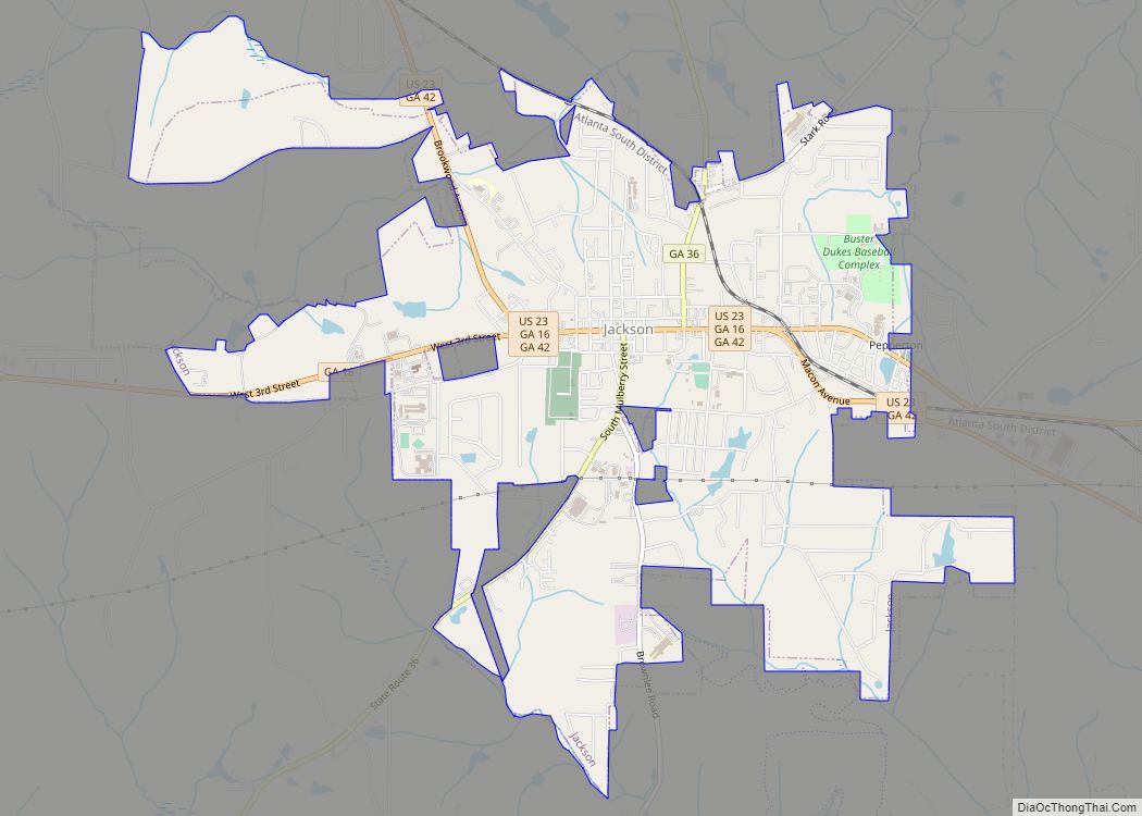
Jackson is a city in and the county seat of Butts County, Georgia, United States. The population was 5,045 in 2010, up from 3,934 at the 2000 census. The community was named after governor James Jackson.
| Name: | Jackson city |
|---|---|
| LSAD Code: | 25 |
| LSAD Description: | city (suffix) |
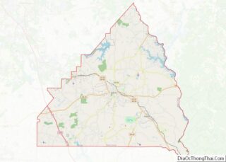
| State: | Georgia |
| County: | Butts County |
| Elevation: | 705 ft (215 m) |
| Total Area: | 6.10 sq mi (15.79 km²) |
| Land Area: | 6.08 sq mi (15.74 km²) |
| Water Area: | 0.02 sq mi (0.04 km²) |
| Total Population: | 5,557 |
| Population Density: | 914.28/sq mi (352.98/km²) |
| ZIP code: | 30233 |
| Area code: | 770 |
| FIPS code: | 1341596 |
| GNISfeature ID: | 0332079 |
| Website: | www.cityofjacksonga.com |
Online Interactive Map
Click on ![]() to view map in "full screen" mode.
to view map in "full screen" mode.
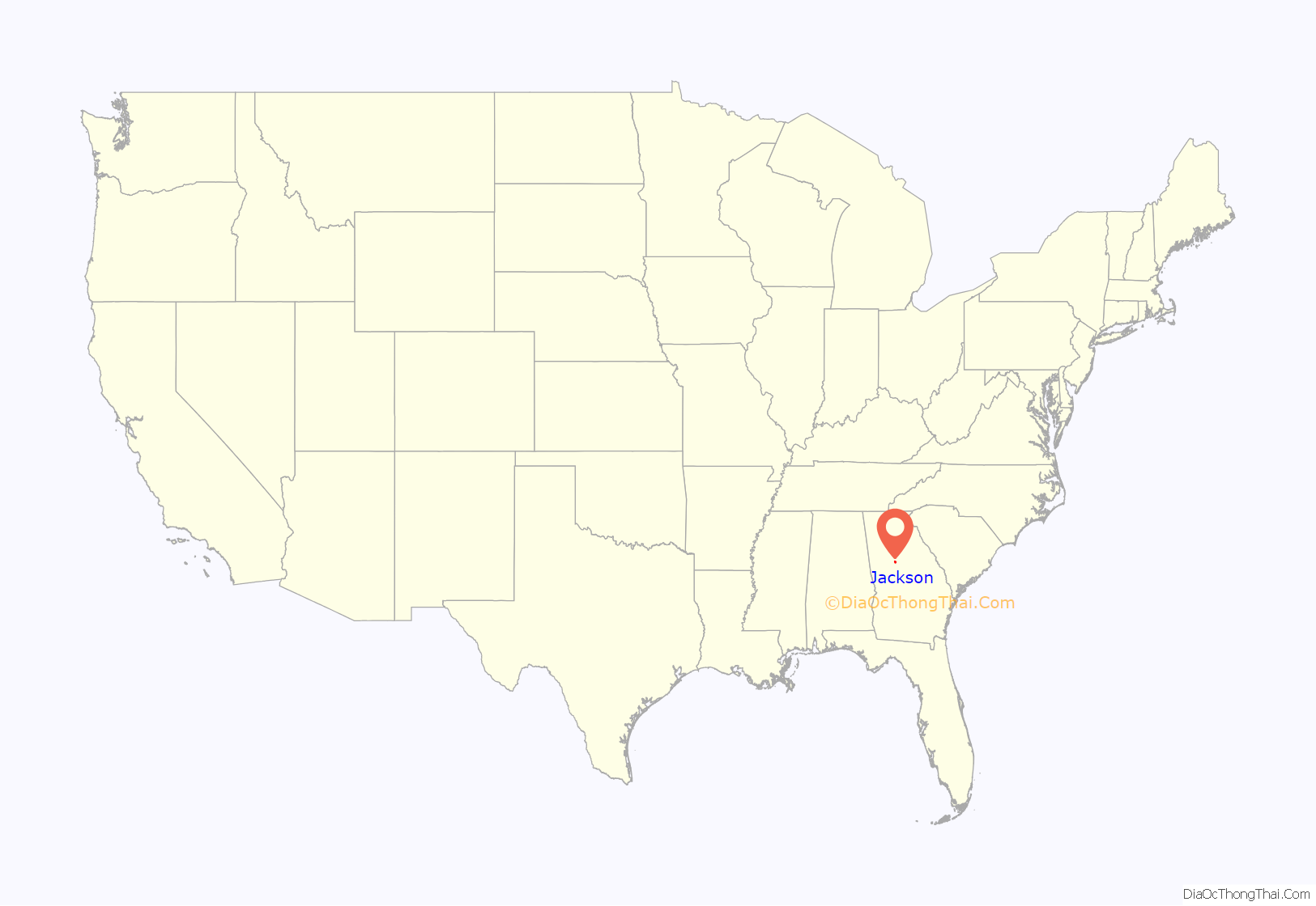
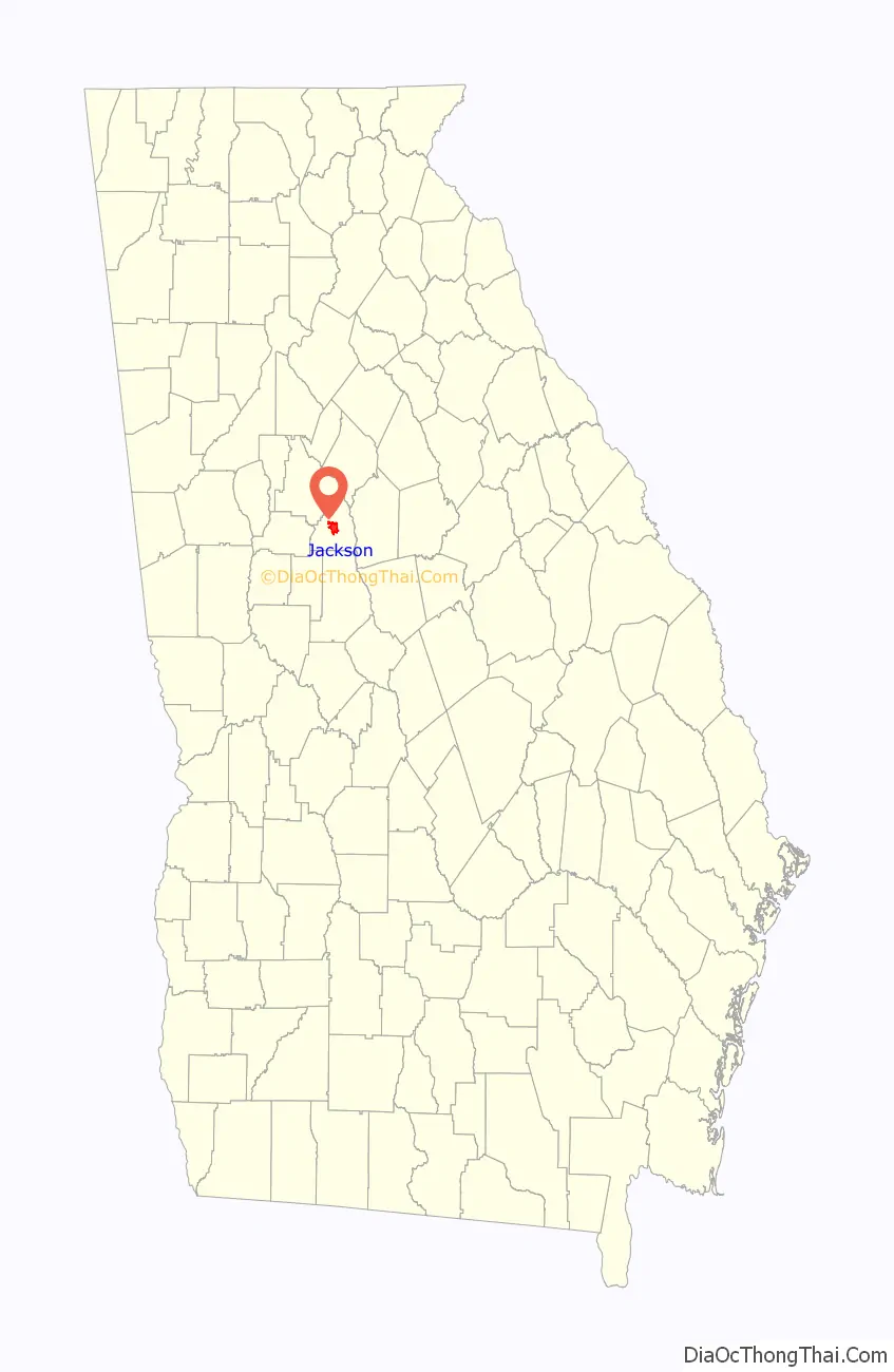
Jackson location map. Where is Jackson city?
History
Founded in 1826, Jackson began as a 303-acre (1.23 km) plot purchased for the purpose of starting the town. The plot was divided into squares and each square into lots. The first buyer of a lot in the new town was John D. Swift of Newton County, Georgia. During the Civil War, much of Jackson was razed by the army of General William T. Sherman during his March to the Sea. After the war, Jackson, like much of the South, struggled economically for decades. Jackson remained little more than a small village until the arrival of the railroads in the latter half of the 19th century. On May 5, 1882, the first train arrived in Jackson, heralding a new era in the transportation of people and goods.
During the 20th century, Jackson grew and industrial textile mills became the largest employer of local citizens. The arrival of Interstate 75 just a few miles to the southwest of the city gave citizens quick access to Atlanta and Macon. The numerous schools throughout the county consolidated into one central school system located in Jackson, and the schools desegregated in 1968. In the 1970s, Jackson slowly became a bedroom community. City taxes were also abolished in the 1970s.
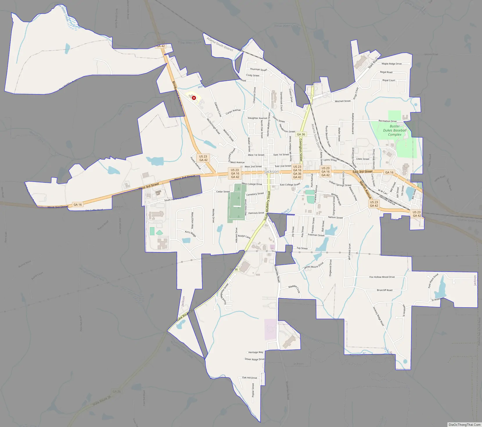
Jackson Road Map
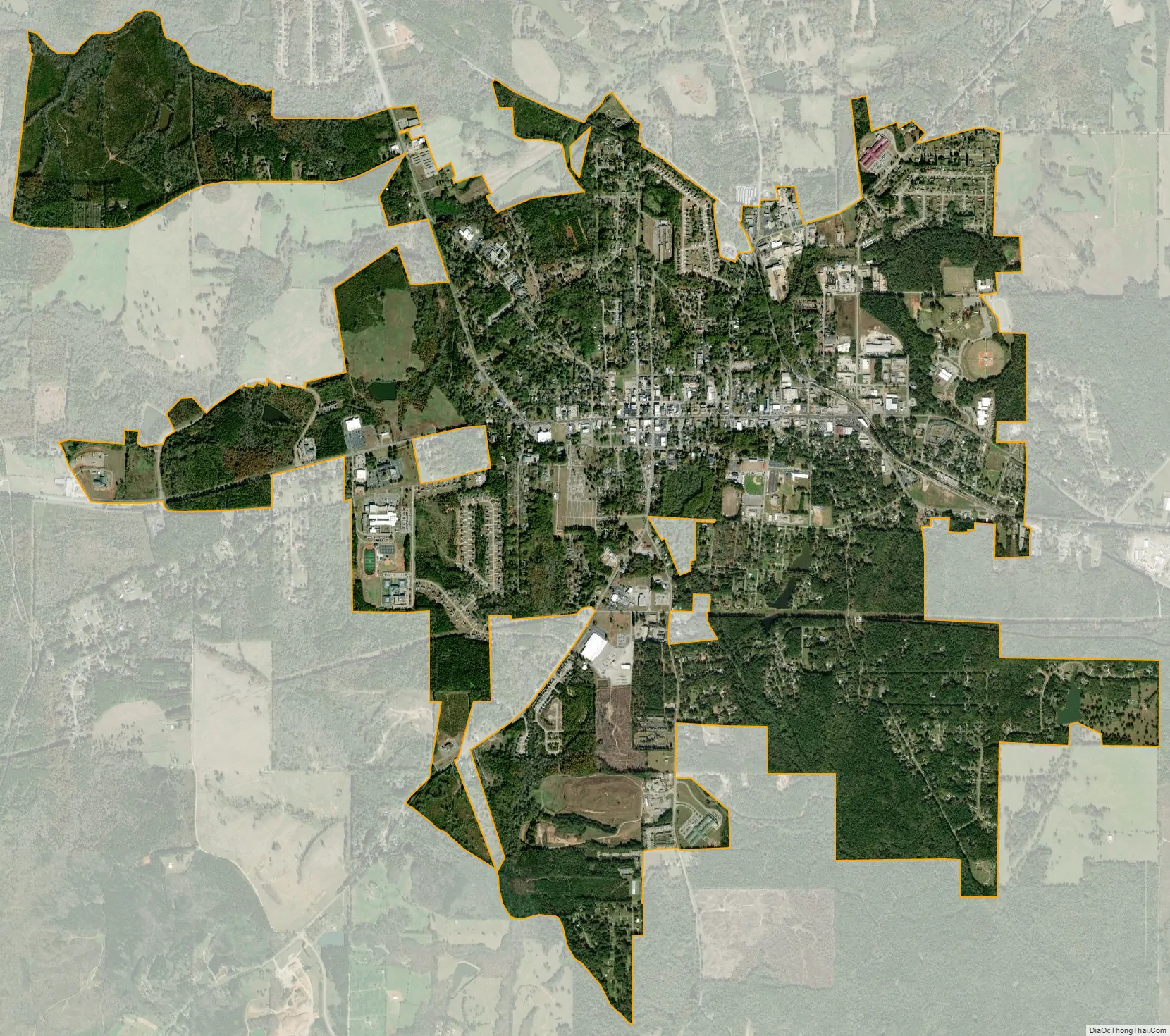
Jackson city Satellite Map
Geography
Jackson is located in the center of Butts County at 33°17′37″N 83°57′45″W / 33.293600°N 83.962372°W / 33.293600; -83.962372. It is 46 miles (74 km) southeast of downtown Atlanta. The center of population of Georgia is located 9 miles (14 km) northeast of Jackson near the Butts County/Newton County line.
According to the United States Census Bureau, the city has a total area of 6.3 square miles (16.2 km), of which 6.2 square miles (16.1 km) is land and 0.04 square miles (0.1 km), or 0.50%, is water.
See also
Map of Georgia State and its subdivision:- Appling
- Atkinson
- Bacon
- Baker
- Baldwin
- Banks
- Barrow
- Bartow
- Ben Hill
- Berrien
- Bibb
- Bleckley
- Brantley
- Brooks
- Bryan
- Bulloch
- Burke
- Butts
- Calhoun
- Camden
- Candler
- Carroll
- Catoosa
- Charlton
- Chatham
- Chattahoochee
- Chattooga
- Cherokee
- Clarke
- Clay
- Clayton
- Clinch
- Cobb
- Coffee
- Colquitt
- Columbia
- Cook
- Coweta
- Crawford
- Crisp
- Dade
- Dawson
- Decatur
- DeKalb
- Dodge
- Dooly
- Dougherty
- Douglas
- Early
- Echols
- Effingham
- Elbert
- Emanuel
- Evans
- Fannin
- Fayette
- Floyd
- Forsyth
- Franklin
- Fulton
- Gilmer
- Glascock
- Glynn
- Gordon
- Grady
- Greene
- Gwinnett
- Habersham
- Hall
- Hancock
- Haralson
- Harris
- Hart
- Heard
- Henry
- Houston
- Irwin
- Jackson
- Jasper
- Jeff Davis
- Jefferson
- Jenkins
- Johnson
- Jones
- Lamar
- Lanier
- Laurens
- Lee
- Liberty
- Lincoln
- Long
- Lowndes
- Lumpkin
- Macon
- Madison
- Marion
- McDuffie
- McIntosh
- Meriwether
- Miller
- Mitchell
- Monroe
- Montgomery
- Morgan
- Murray
- Muscogee
- Newton
- Oconee
- Oglethorpe
- Paulding
- Peach
- Pickens
- Pierce
- Pike
- Polk
- Pulaski
- Putnam
- Quitman
- Rabun
- Randolph
- Richmond
- Rockdale
- Schley
- Screven
- Seminole
- Spalding
- Stephens
- Stewart
- Sumter
- Talbot
- Taliaferro
- Tattnall
- Taylor
- Telfair
- Terrell
- Thomas
- Tift
- Toombs
- Towns
- Treutlen
- Troup
- Turner
- Twiggs
- Union
- Upson
- Walker
- Walton
- Ware
- Warren
- Washington
- Wayne
- Webster
- Wheeler
- White
- Whitfield
- Wilcox
- Wilkes
- Wilkinson
- Worth
- Alabama
- Alaska
- Arizona
- Arkansas
- California
- Colorado
- Connecticut
- Delaware
- District of Columbia
- Florida
- Georgia
- Hawaii
- Idaho
- Illinois
- Indiana
- Iowa
- Kansas
- Kentucky
- Louisiana
- Maine
- Maryland
- Massachusetts
- Michigan
- Minnesota
- Mississippi
- Missouri
- Montana
- Nebraska
- Nevada
- New Hampshire
- New Jersey
- New Mexico
- New York
- North Carolina
- North Dakota
- Ohio
- Oklahoma
- Oregon
- Pennsylvania
- Rhode Island
- South Carolina
- South Dakota
- Tennessee
- Texas
- Utah
- Vermont
- Virginia
- Washington
- West Virginia
- Wisconsin
- Wyoming