Pitts is a city in Wilcox County, Georgia, United States. Per the 2020 census, the population was 252.
| Name: | Pitts city |
|---|---|
| LSAD Code: | 25 |
| LSAD Description: | city (suffix) |
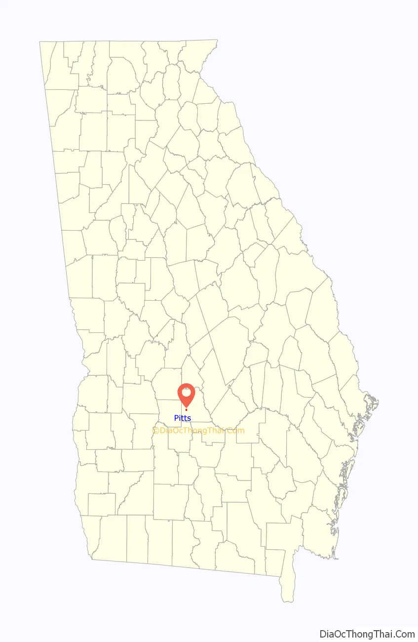
| State: | Georgia |
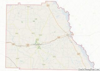
| County: | Wilcox County |
| Elevation: | 381 ft (116 m) |
| Total Area: | 0.80 sq mi (2.07 km²) |
| Land Area: | 0.80 sq mi (2.07 km²) |
| Water Area: | 0.00 sq mi (0.00 km²) |
| Total Population: | 252 |
| Population Density: | 314.61/sq mi (121.45/km²) |
| ZIP code: | 31072 |
| Area code: | 229 |
| FIPS code: | 1361544 |
| GNISfeature ID: | 0332700 |
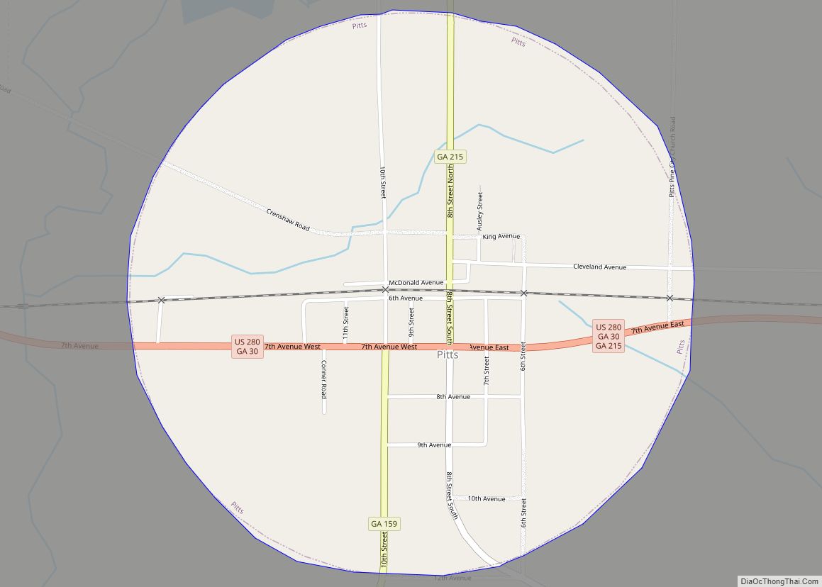
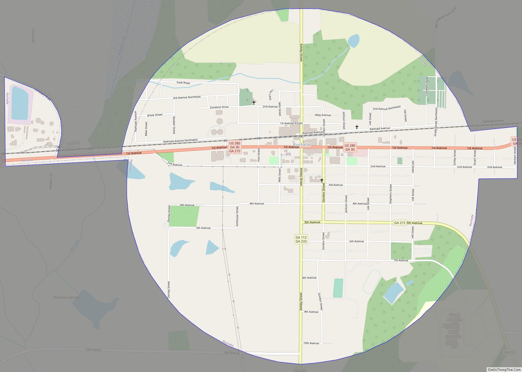
Online Interactive Map
Click on ![]() to view map in "full screen" mode.
to view map in "full screen" mode.
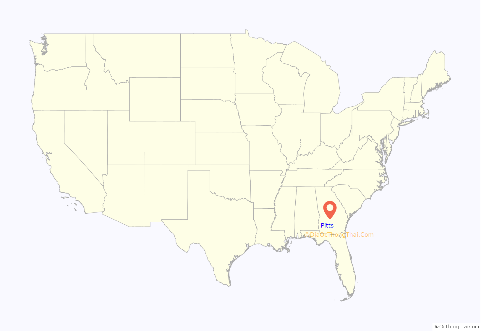
Pitts location map. Where is Pitts city?
History
The community which later became Pitts began as a settlement in the area of the home of Lyston Clyde Peebles, Sr., two miles east of the Alapaha River. Brock Owens and Ashley J. Pitts operated the first store there in the mid-1880s. Pitts was called Kings’ Crossing at the time. When application was made for a post office, the Postmaster General preferred a shorter name. J.A. King suggested the name Pitts, in honor of his son-in-law, Ashley J. Pitts. The name was accepted, and the post office was established on 1 November 1888 with Pitts as postmaster.
The Georgia General Assembly incorporated Pitts as a town in 1905.
On April 20, 1921, various people throughout southwest and south-central Georgia observed a meteor trail across the sky which culminated in an explosion and impact at a minimum of four spots slightly north of Pitts. Three fragments of the meteorite were recovered, one falling within a few feet of a child playing outside. It was classified as an iron meteorite. The largest recovered fragment weighed 3.76 kilograms and is currently housed in the Smithsonian Institution Collection. The other fragments remain in private collections. Local accounts and fragments were collected and documented in the Geological Survey of Georgia Bulletin, Issue 29.
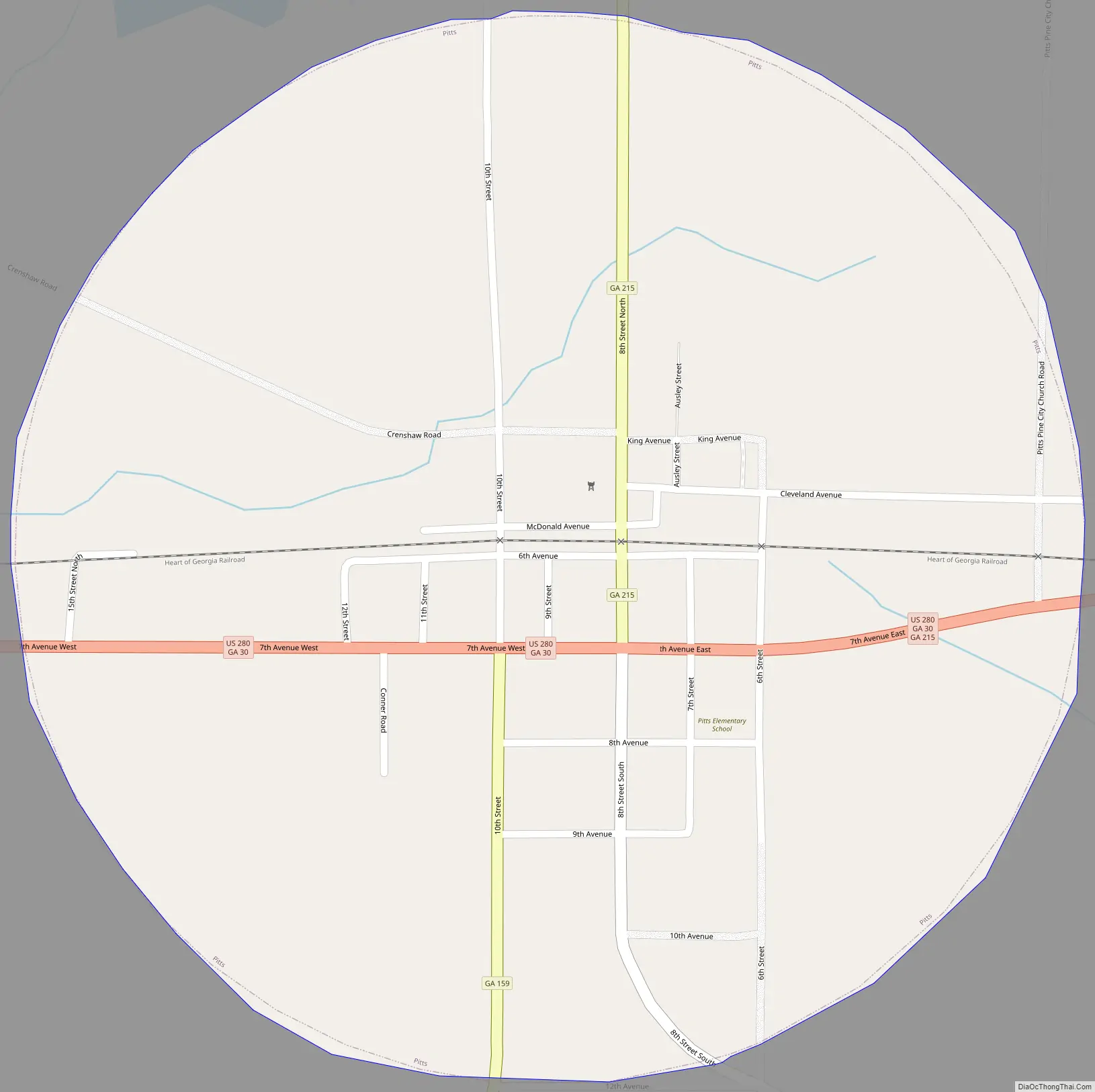
Pitts Road Map
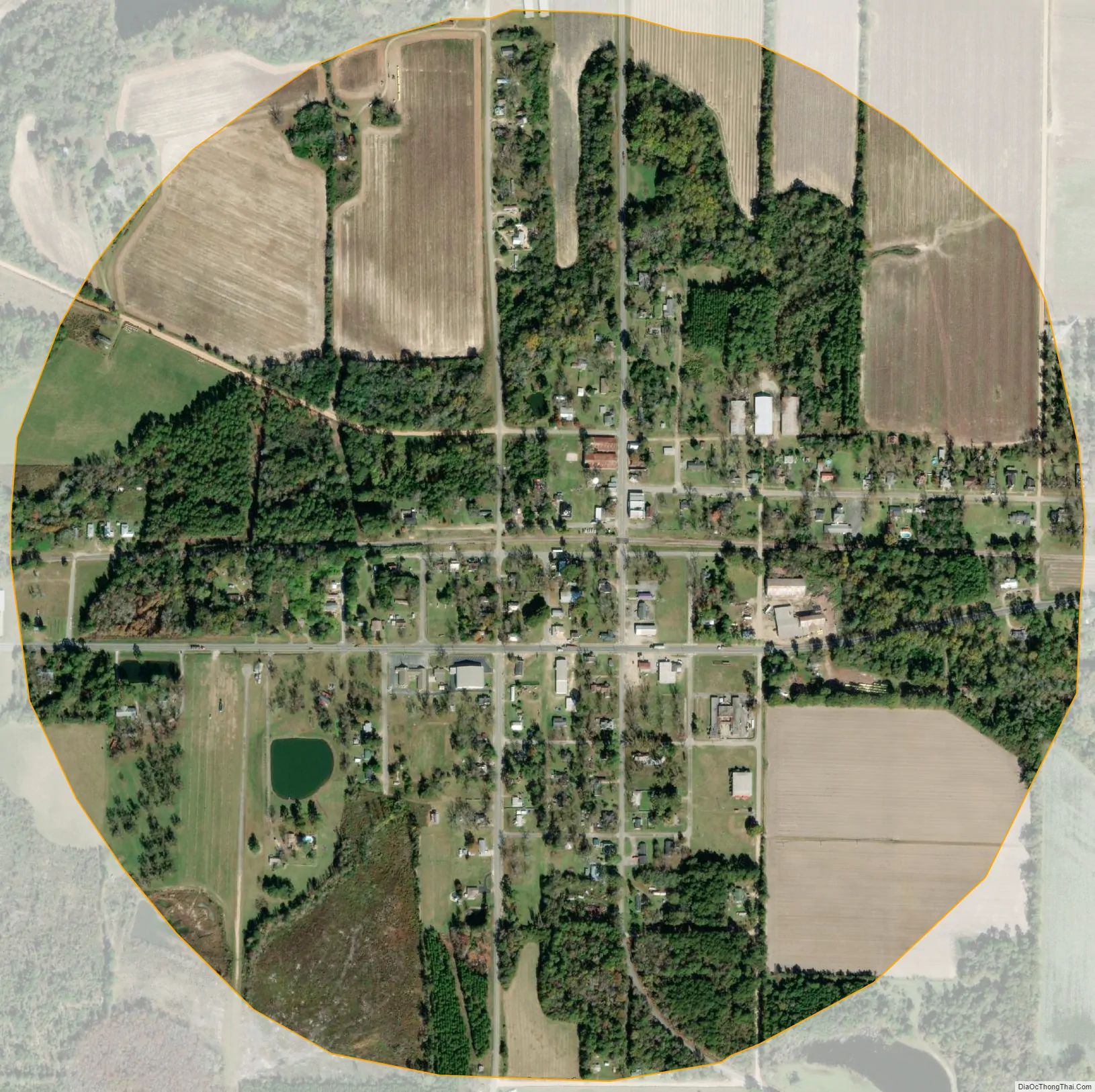
Pitts city Satellite Map
Geography
Pitts is located at 31°56′43″N 83°32′24″W / 31.94528°N 83.54000°W / 31.94528; -83.54000 (31.945270, -83.540004).
According to the United States Census Bureau, the city has a total area of 0.8 square miles (2.1 km), all land.
See also
Map of Georgia State and its subdivision:- Appling
- Atkinson
- Bacon
- Baker
- Baldwin
- Banks
- Barrow
- Bartow
- Ben Hill
- Berrien
- Bibb
- Bleckley
- Brantley
- Brooks
- Bryan
- Bulloch
- Burke
- Butts
- Calhoun
- Camden
- Candler
- Carroll
- Catoosa
- Charlton
- Chatham
- Chattahoochee
- Chattooga
- Cherokee
- Clarke
- Clay
- Clayton
- Clinch
- Cobb
- Coffee
- Colquitt
- Columbia
- Cook
- Coweta
- Crawford
- Crisp
- Dade
- Dawson
- Decatur
- DeKalb
- Dodge
- Dooly
- Dougherty
- Douglas
- Early
- Echols
- Effingham
- Elbert
- Emanuel
- Evans
- Fannin
- Fayette
- Floyd
- Forsyth
- Franklin
- Fulton
- Gilmer
- Glascock
- Glynn
- Gordon
- Grady
- Greene
- Gwinnett
- Habersham
- Hall
- Hancock
- Haralson
- Harris
- Hart
- Heard
- Henry
- Houston
- Irwin
- Jackson
- Jasper
- Jeff Davis
- Jefferson
- Jenkins
- Johnson
- Jones
- Lamar
- Lanier
- Laurens
- Lee
- Liberty
- Lincoln
- Long
- Lowndes
- Lumpkin
- Macon
- Madison
- Marion
- McDuffie
- McIntosh
- Meriwether
- Miller
- Mitchell
- Monroe
- Montgomery
- Morgan
- Murray
- Muscogee
- Newton
- Oconee
- Oglethorpe
- Paulding
- Peach
- Pickens
- Pierce
- Pike
- Polk
- Pulaski
- Putnam
- Quitman
- Rabun
- Randolph
- Richmond
- Rockdale
- Schley
- Screven
- Seminole
- Spalding
- Stephens
- Stewart
- Sumter
- Talbot
- Taliaferro
- Tattnall
- Taylor
- Telfair
- Terrell
- Thomas
- Tift
- Toombs
- Towns
- Treutlen
- Troup
- Turner
- Twiggs
- Union
- Upson
- Walker
- Walton
- Ware
- Warren
- Washington
- Wayne
- Webster
- Wheeler
- White
- Whitfield
- Wilcox
- Wilkes
- Wilkinson
- Worth
- Alabama
- Alaska
- Arizona
- Arkansas
- California
- Colorado
- Connecticut
- Delaware
- District of Columbia
- Florida
- Georgia
- Hawaii
- Idaho
- Illinois
- Indiana
- Iowa
- Kansas
- Kentucky
- Louisiana
- Maine
- Maryland
- Massachusetts
- Michigan
- Minnesota
- Mississippi
- Missouri
- Montana
- Nebraska
- Nevada
- New Hampshire
- New Jersey
- New Mexico
- New York
- North Carolina
- North Dakota
- Ohio
- Oklahoma
- Oregon
- Pennsylvania
- Rhode Island
- South Carolina
- South Dakota
- Tennessee
- Texas
- Utah
- Vermont
- Virginia
- Washington
- West Virginia
- Wisconsin
- Wyoming