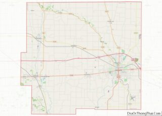
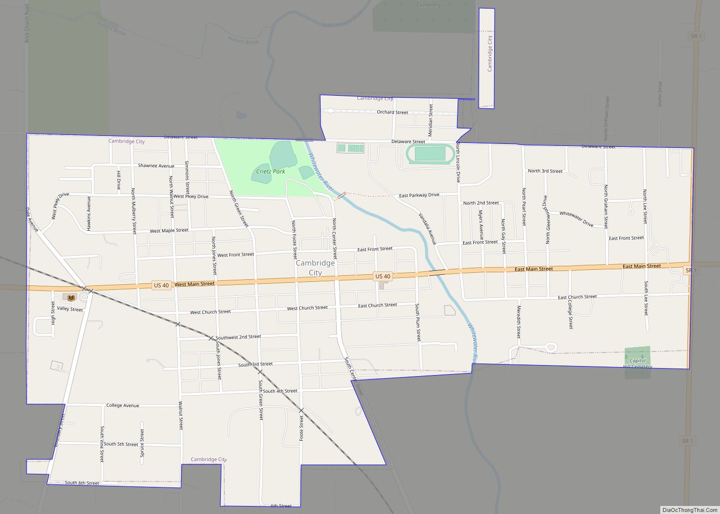
Cambridge City is a town in Jackson Township, Wayne County, in the U.S. state of Indiana. The population was 1,870 at the 2010 census.
| Name: | Cambridge City town |
|---|---|
| LSAD Code: | 43 |
| LSAD Description: | town (suffix) |
| State: | Indiana |
| County: | Wayne County |
| Elevation: | 935 ft (285 m) |
| Total Area: | 1.02 sq mi (2.63 km²) |
| Land Area: | 1.01 sq mi (2.61 km²) |
| Water Area: | 0.01 sq mi (0.02 km²) |
| Total Population: | 1,751 |
| Population Density: | 1,735.38/sq mi (669.92/km²) |
| ZIP code: | 47327 |
| Area code: | 765 |
| FIPS code: | 1809874 |
| GNISfeature ID: | 431999 |
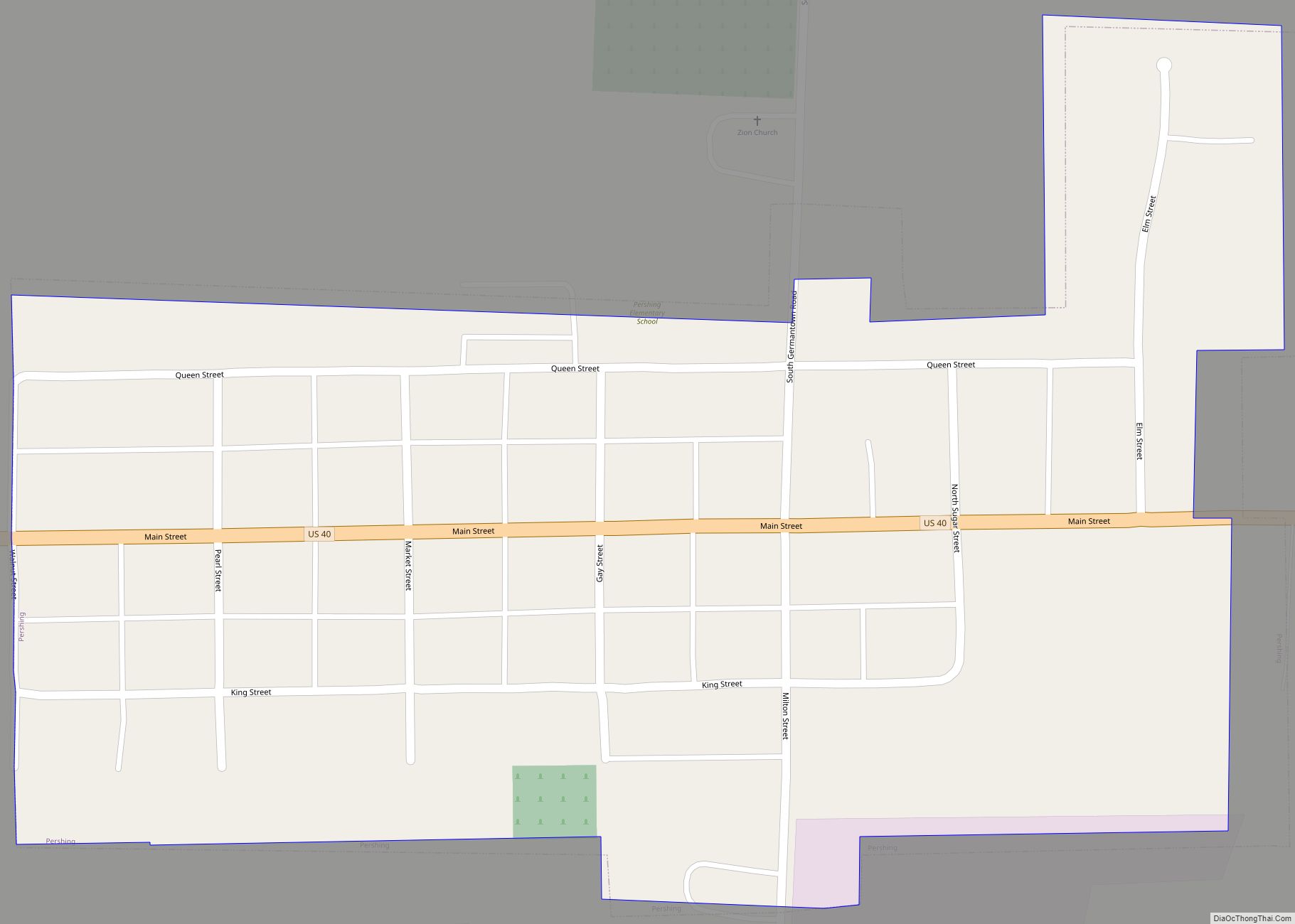
Online Interactive Map
Click on ![]() to view map in "full screen" mode.
to view map in "full screen" mode.
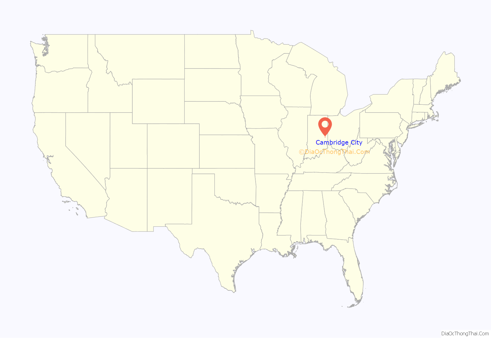
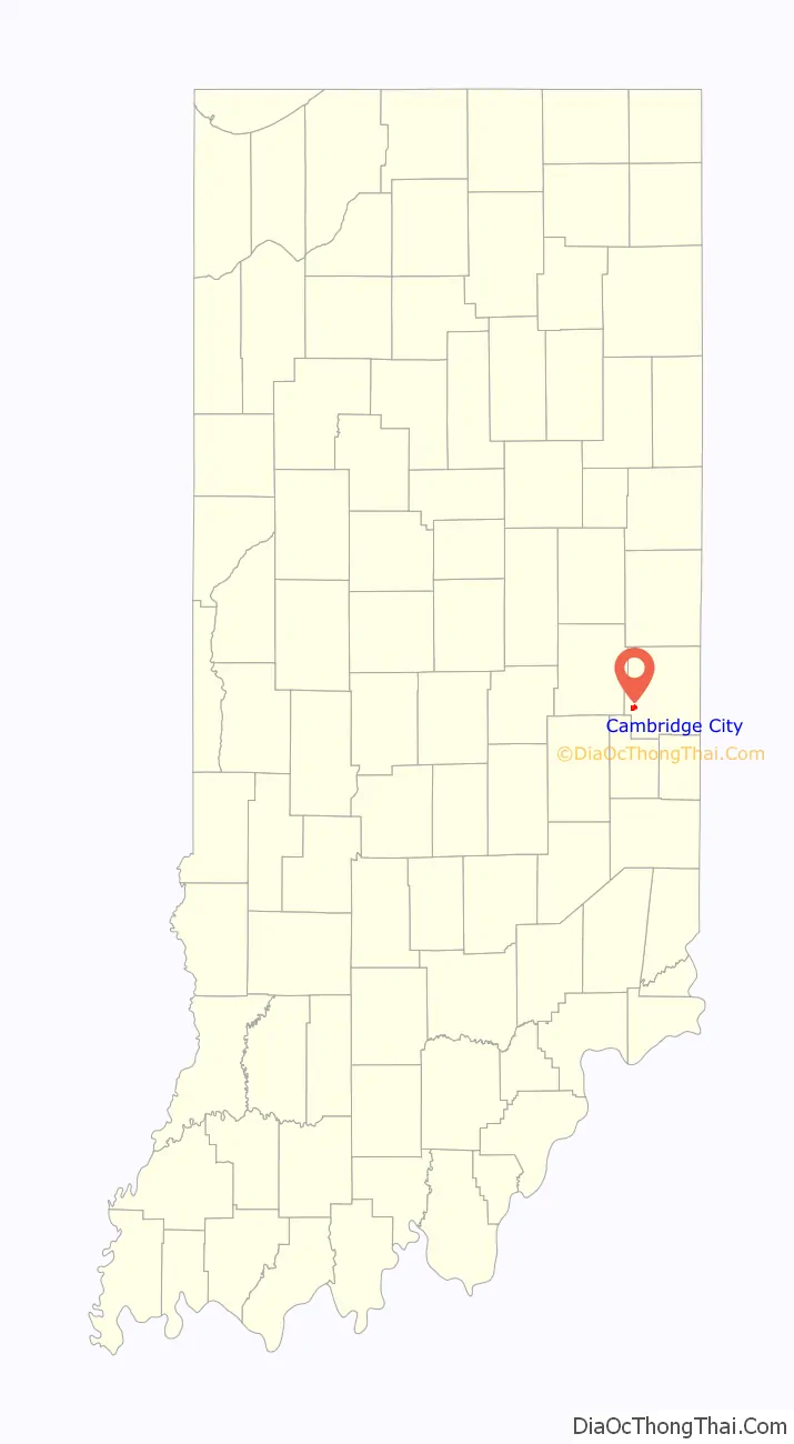
Cambridge City location map. Where is Cambridge City town?
History
Cambridge City was laid out and platted in 1836. The community was named after the city of Cambridge, in England.
The Cambridge City post office has been in operation since 1835.
Cambridge City experienced growth when the Whitewater Canal was extended to that point in 1846.
Situated along the historic National Road (U.S. Route 40), Cambridge City is currently a prominent destination for antique seekers.
The Cambridge City Historic District, Conklin-Montgomery House, and Lackey-Overbeck House are listed on the National Register of Historic Places.
Cambridge City Road Map
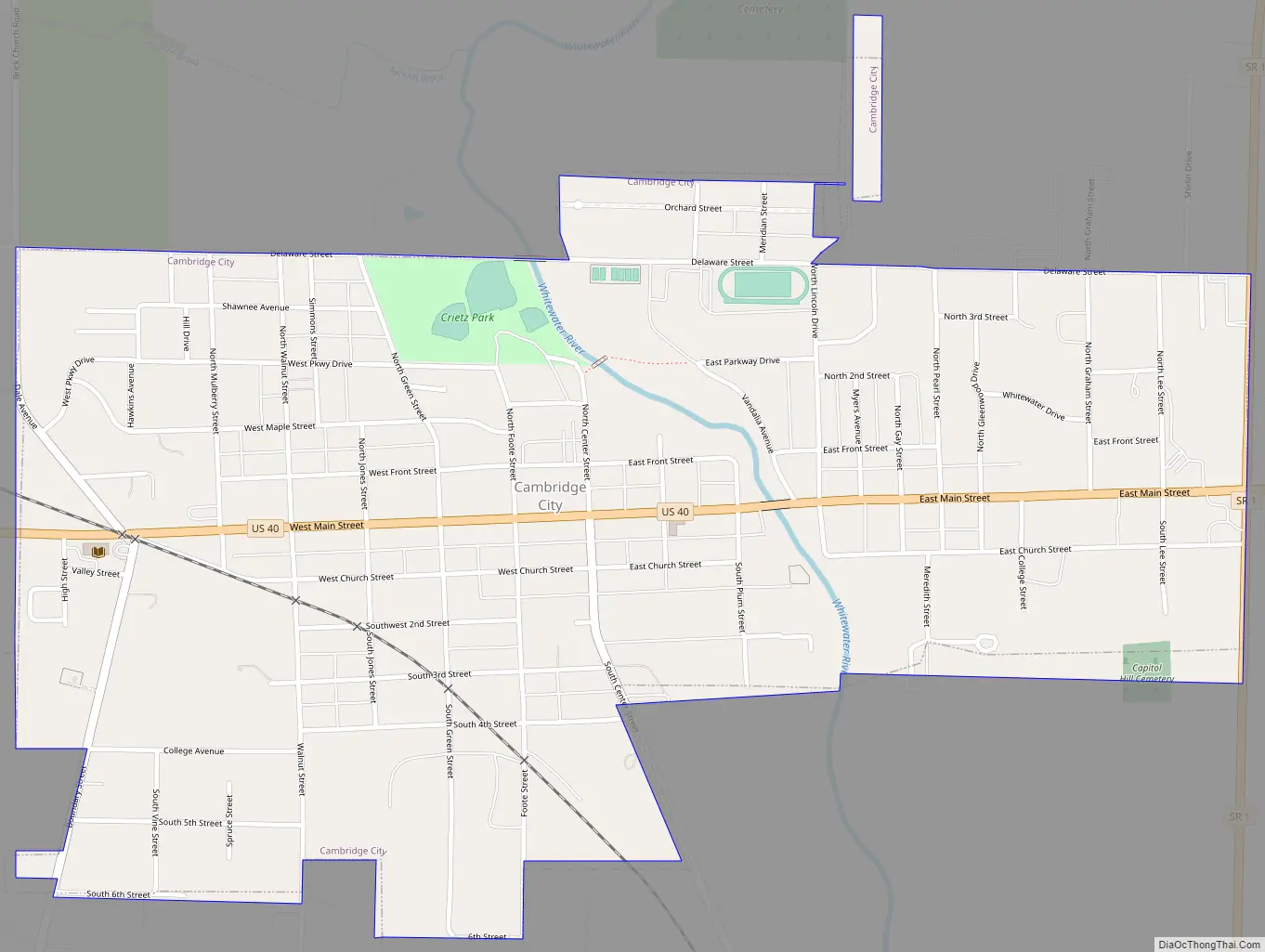
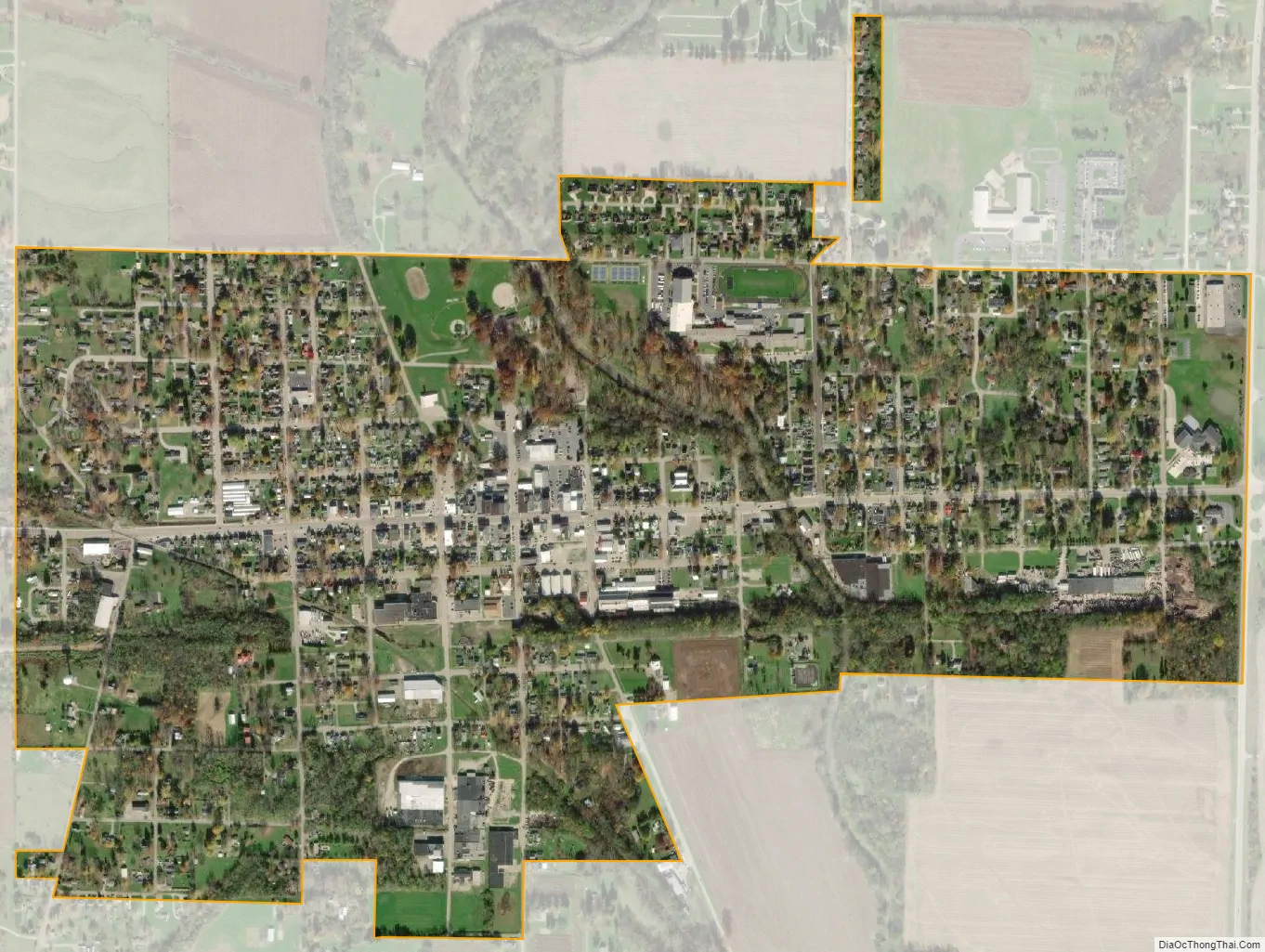
Cambridge City city Satellite Map
Geography
Cambridge City is located at 39°48′47″N 85°10′15″W / 39.81306°N 85.17083°W / 39.81306; -85.17083 (39.812996, -85.170812).
According to the 2010 census, Cambridge City has a total area of 1.02 square miles (2.64 km), of which 1.01 square miles (2.62 km) (or 99.02%) is land and 0.01 square miles (0.03 km) (or 0.98%) is water.
See also
Map of Indiana State and its subdivision:- Adams
- Allen
- Bartholomew
- Benton
- Blackford
- Boone
- Brown
- Carroll
- Cass
- Clark
- Clay
- Clinton
- Crawford
- Daviess
- De Kalb
- Dearborn
- Decatur
- Delaware
- Dubois
- Elkhart
- Fayette
- Floyd
- Fountain
- Franklin
- Fulton
- Gibson
- Grant
- Greene
- Hamilton
- Hancock
- Harrison
- Hendricks
- Henry
- Howard
- Huntington
- Jackson
- Jasper
- Jay
- Jefferson
- Jennings
- Johnson
- Knox
- Kosciusko
- LaGrange
- Lake
- Lake Michigan
- LaPorte
- Lawrence
- Madison
- Marion
- Marshall
- Martin
- Miami
- Monroe
- Montgomery
- Morgan
- Newton
- Noble
- Ohio
- Orange
- Owen
- Parke
- Perry
- Pike
- Porter
- Posey
- Pulaski
- Putnam
- Randolph
- Ripley
- Rush
- Saint Joseph
- Scott
- Shelby
- Spencer
- Starke
- Steuben
- Sullivan
- Switzerland
- Tippecanoe
- Tipton
- Union
- Vanderburgh
- Vermillion
- Vigo
- Wabash
- Warren
- Warrick
- Washington
- Wayne
- Wells
- White
- Whitley
- Alabama
- Alaska
- Arizona
- Arkansas
- California
- Colorado
- Connecticut
- Delaware
- District of Columbia
- Florida
- Georgia
- Hawaii
- Idaho
- Illinois
- Indiana
- Iowa
- Kansas
- Kentucky
- Louisiana
- Maine
- Maryland
- Massachusetts
- Michigan
- Minnesota
- Mississippi
- Missouri
- Montana
- Nebraska
- Nevada
- New Hampshire
- New Jersey
- New Mexico
- New York
- North Carolina
- North Dakota
- Ohio
- Oklahoma
- Oregon
- Pennsylvania
- Rhode Island
- South Carolina
- South Dakota
- Tennessee
- Texas
- Utah
- Vermont
- Virginia
- Washington
- West Virginia
- Wisconsin
- Wyoming