Hagerstown is a town in Jefferson Township, Wayne County, in the U.S. state of Indiana. As of the 2010 census, the population was 1,787.
| Name: | Hagerstown town |
|---|---|
| LSAD Code: | 43 |
| LSAD Description: | town (suffix) |
| State: | Indiana |
| County: | Wayne County |
| Elevation: | 1,007 ft (307 m) |
| Total Area: | 1.32 sq mi (3.42 km²) |
| Land Area: | 1.32 sq mi (3.41 km²) |
| Water Area: | 0.00 sq mi (0.01 km²) |
| Total Population: | 1,681 |
| Population Density: | 1,275.42/sq mi (492.35/km²) |
| ZIP code: | 47346 |
| Area code: | 765 |
| FIPS code: | 1830402 |
| GNISfeature ID: | 452048 |
| Website: | http://www.hagerstown.in.gov/ |
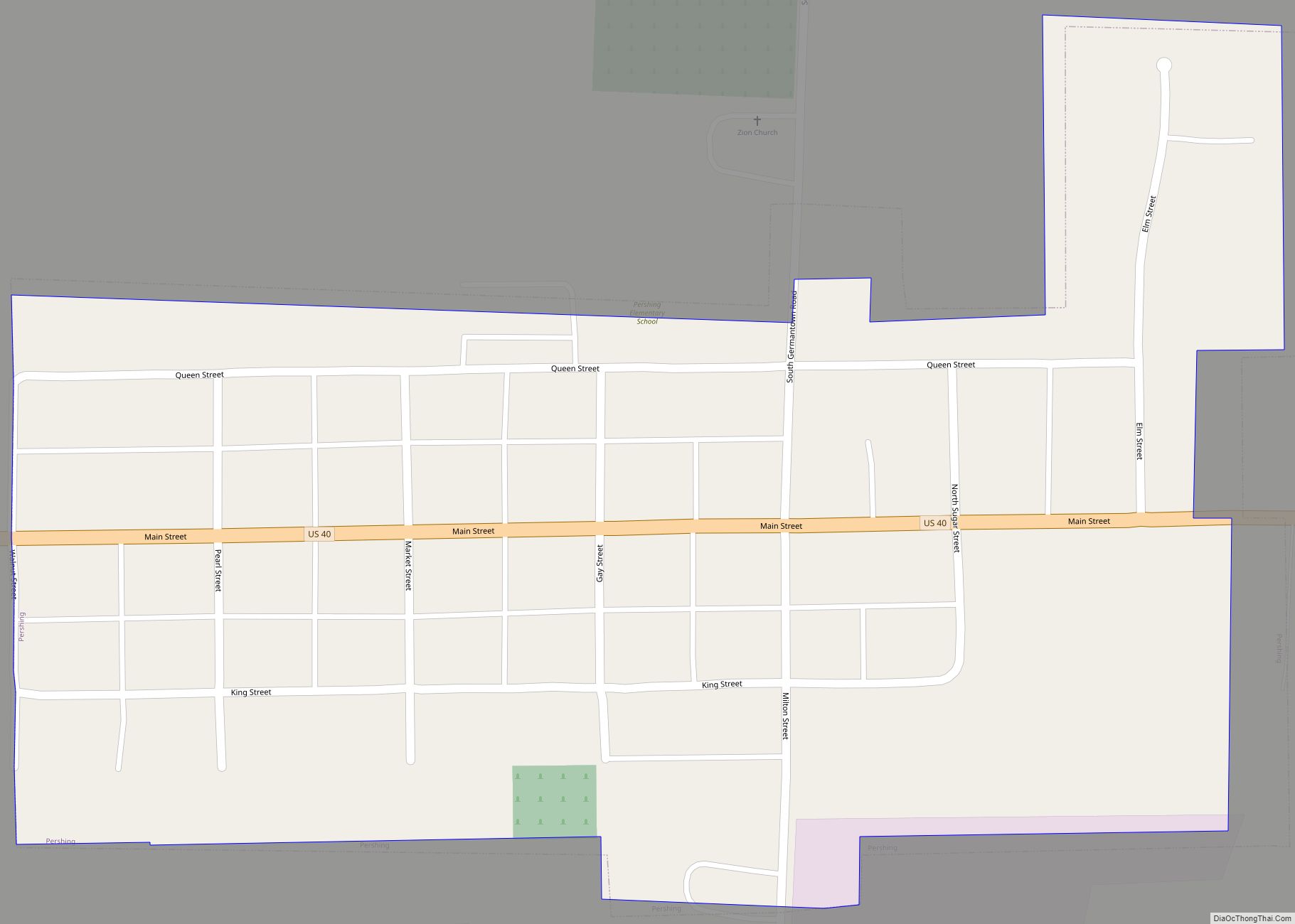
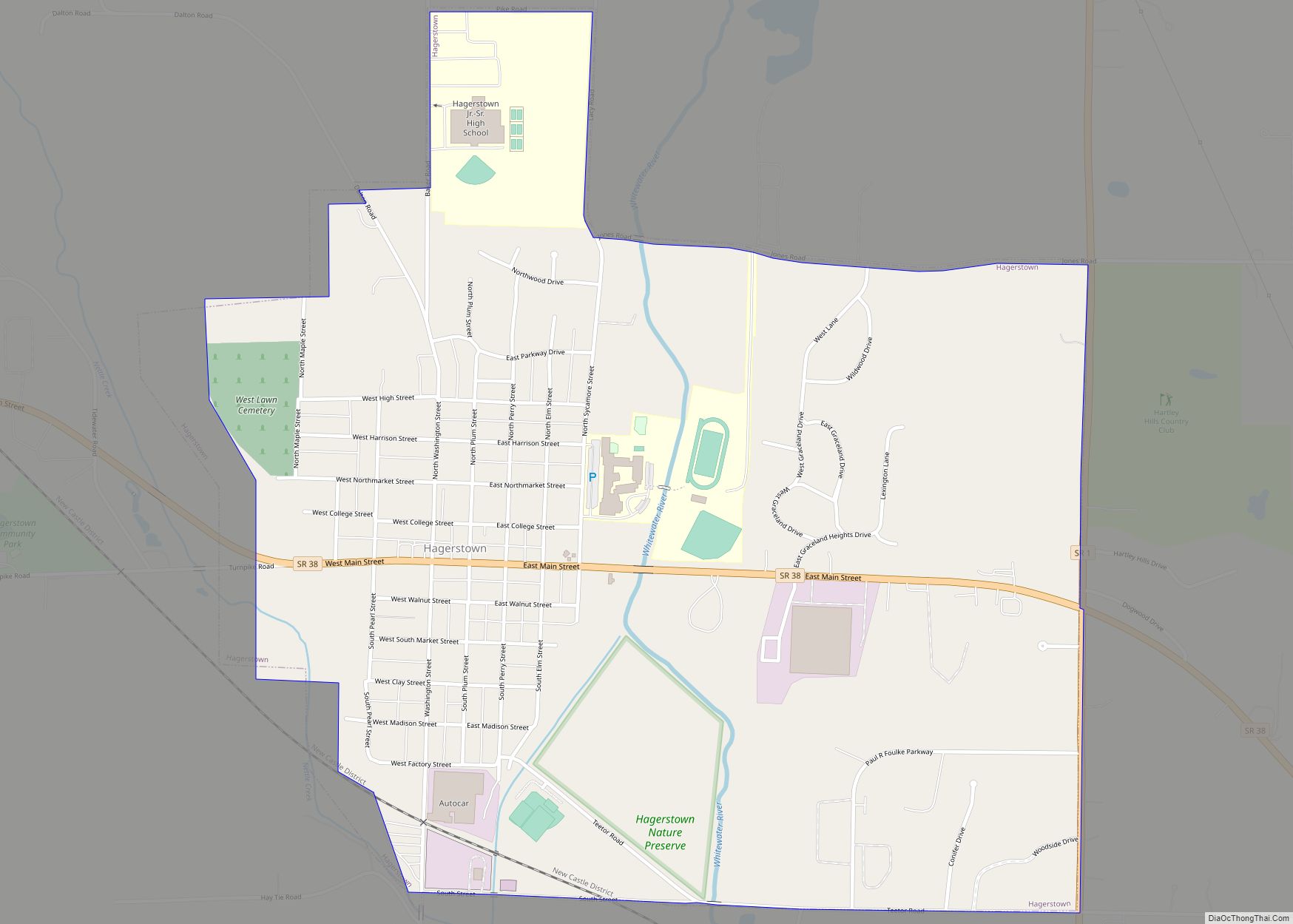
Online Interactive Map
Click on ![]() to view map in "full screen" mode.
to view map in "full screen" mode.
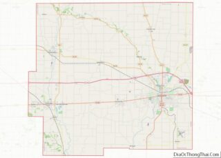
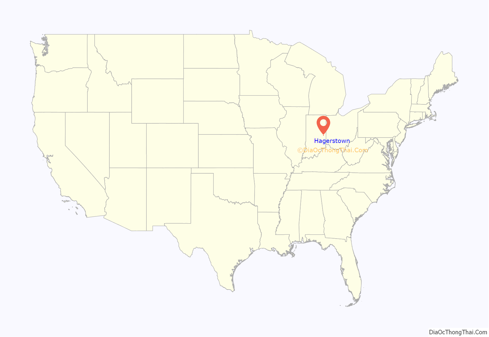
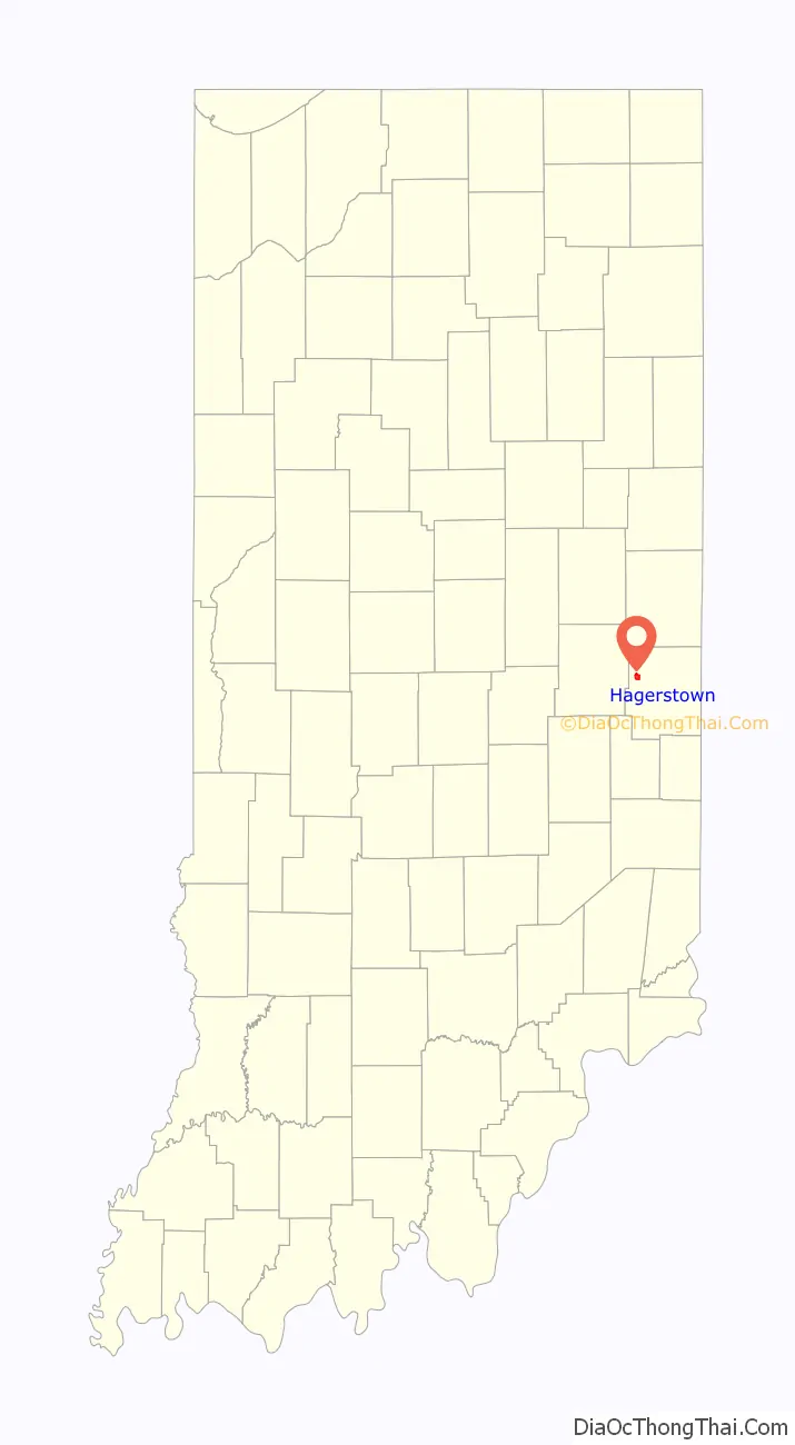
Hagerstown location map. Where is Hagerstown town?
History
Hagerstown was laid out and platted in 1832. The town was named after the city of Hagerstown, Maryland. The Hagerstown post office has been in operation since 1836.
The Whitewater Canal, which was built in the mid-19th century and extends to Lawrenceburg, Indiana, has its northern terminus in Hagerstown. This section was funded by the Hagerstown Canal Company.
The Hagerstown I.O.O.F. Hall and John and Caroline Stonebraker House are listed on the National Register of Historic Places.
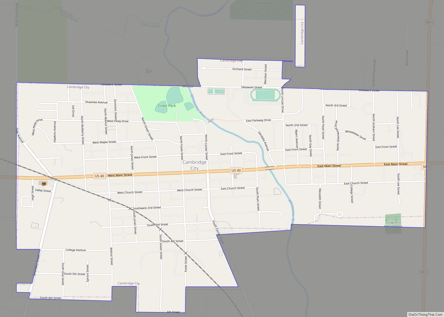
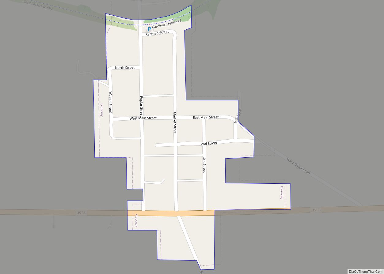
Hagerstown Road Map

Hagerstown city Satellite Map

Geography
Hagerstown is located at 39°54′41″N 85°9′38″W / 39.91139°N 85.16056°W / 39.91139; -85.16056 (39.911307, -85.160564). The town lies 61 miles (98 kilometers) ENE of Indianapolis, Indiana, 17 miles (27 kilometers) NW of Richmond, Indiana, and 63 miles (101 kilometers) WNW of Dayton, Ohio in the Midwestern region of the United States.
Terrain surrounding Hagerstown consists of flat land at an elevation of roughly 1000 feet above sea level that is used primarily for agriculture.
According to the 2010 census, Hagerstown has a total area of 1.34 square miles (3.47 km), all land.
See also
Map of Indiana State and its subdivision:- Adams
- Allen
- Bartholomew
- Benton
- Blackford
- Boone
- Brown
- Carroll
- Cass
- Clark
- Clay
- Clinton
- Crawford
- Daviess
- De Kalb
- Dearborn
- Decatur
- Delaware
- Dubois
- Elkhart
- Fayette
- Floyd
- Fountain
- Franklin
- Fulton
- Gibson
- Grant
- Greene
- Hamilton
- Hancock
- Harrison
- Hendricks
- Henry
- Howard
- Huntington
- Jackson
- Jasper
- Jay
- Jefferson
- Jennings
- Johnson
- Knox
- Kosciusko
- LaGrange
- Lake
- Lake Michigan
- LaPorte
- Lawrence
- Madison
- Marion
- Marshall
- Martin
- Miami
- Monroe
- Montgomery
- Morgan
- Newton
- Noble
- Ohio
- Orange
- Owen
- Parke
- Perry
- Pike
- Porter
- Posey
- Pulaski
- Putnam
- Randolph
- Ripley
- Rush
- Saint Joseph
- Scott
- Shelby
- Spencer
- Starke
- Steuben
- Sullivan
- Switzerland
- Tippecanoe
- Tipton
- Union
- Vanderburgh
- Vermillion
- Vigo
- Wabash
- Warren
- Warrick
- Washington
- Wayne
- Wells
- White
- Whitley
- Alabama
- Alaska
- Arizona
- Arkansas
- California
- Colorado
- Connecticut
- Delaware
- District of Columbia
- Florida
- Georgia
- Hawaii
- Idaho
- Illinois
- Indiana
- Iowa
- Kansas
- Kentucky
- Louisiana
- Maine
- Maryland
- Massachusetts
- Michigan
- Minnesota
- Mississippi
- Missouri
- Montana
- Nebraska
- Nevada
- New Hampshire
- New Jersey
- New Mexico
- New York
- North Carolina
- North Dakota
- Ohio
- Oklahoma
- Oregon
- Pennsylvania
- Rhode Island
- South Carolina
- South Dakota
- Tennessee
- Texas
- Utah
- Vermont
- Virginia
- Washington
- West Virginia
- Wisconsin
- Wyoming