East Germantown is a town in Jackson Township, Wayne County, in the U.S. state of Indiana. The population was 410 at the 2010 census.
| Name: | East Germantown town |
|---|---|
| LSAD Code: | 43 |
| LSAD Description: | town (suffix) |
| State: | Indiana |
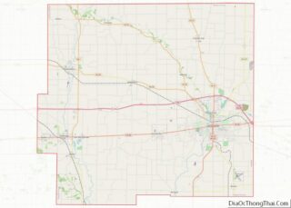
| County: | Wayne County |
| Elevation: | 951 ft (290 m) |
| Total Area: | 0.12 sq mi (0.30 km²) |
| Land Area: | 0.12 sq mi (0.30 km²) |
| Water Area: | 0.00 sq mi (0.00 km²) |
| Total Population: | 261 |
| Population Density: | 2,230.77/sq mi (863.62/km²) |
| ZIP code: | 47327 |
| Area code: | 765 |
| FIPS code: | 1819756 |
| GNISfeature ID: | 433906 |
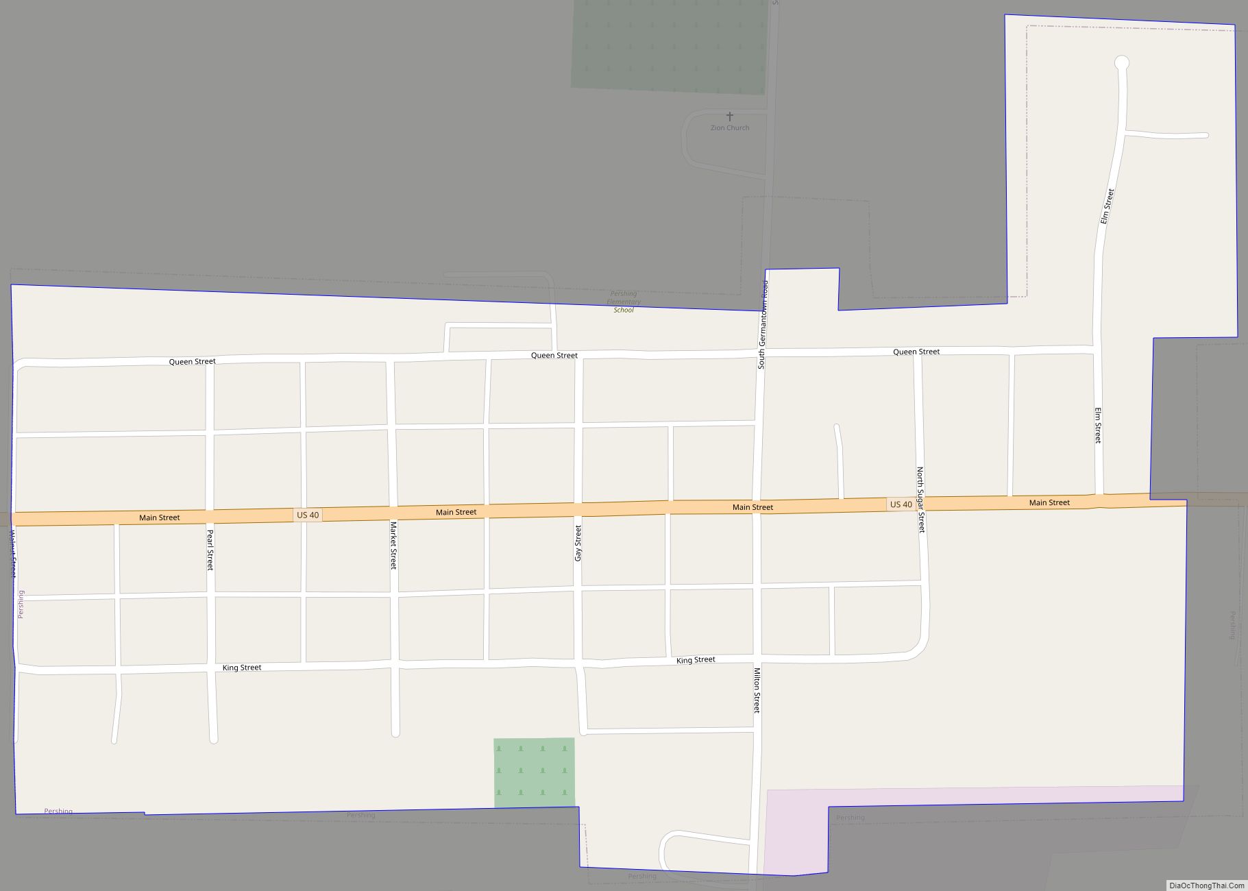
Online Interactive Map
Click on ![]() to view map in "full screen" mode.
to view map in "full screen" mode.
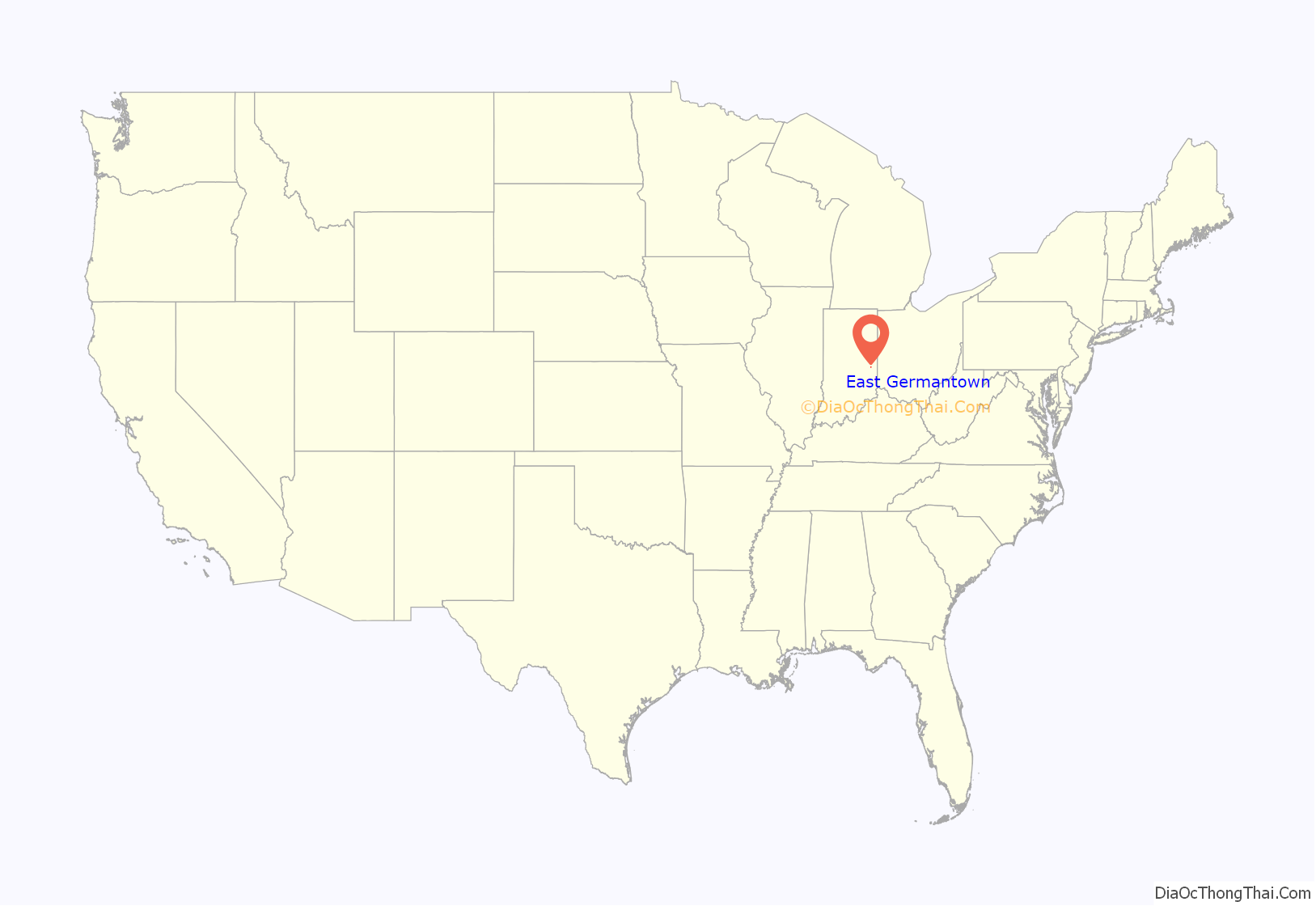
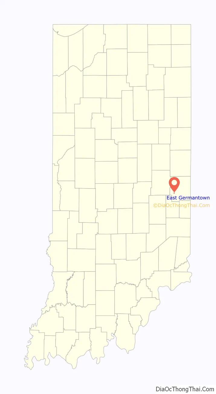
East Germantown location map. Where is East Germantown town?
History
East Germantown was originally called Georgetown, and under the latter name was laid out and platted in 1827.
The East Germantown Civil War Band was assigned to the 12th Indiana Volunteer Infantry Regiment in 1862.
A post office operated from 31 March 1846 until 4 August 1917 under the name of East Germantown, when its name officially changed to Pershing due to events surrounding World War I.
A resolution to change the town name from East Germantown to Pershing, in honor of General Pershing, was introduced by the town board. A faction campaigned the day before the name-change vote by telling people that since their deeds mentioned “East Germantown”, changing to “Pershing” would invalidate their ownership. Ernest G. Lamott (1911–1980), secretary-treasurer of the town board at the time, said the vote went for “East Germantown” since voters had no way of proving or disproving this assertion in the hours before the election.
The postmaster in 1917, Frank Sipe, succeeded in getting the post office name changed to “Pershing”. However, the railroad continued with the name East Germantown since there is another Pershing, an unincorporated community, in Fulton County.
The local Pershing Elementary School at 519 Queen Street is now the administrative offices for the Western Wayne School Corporation.
East Germantown Road Map
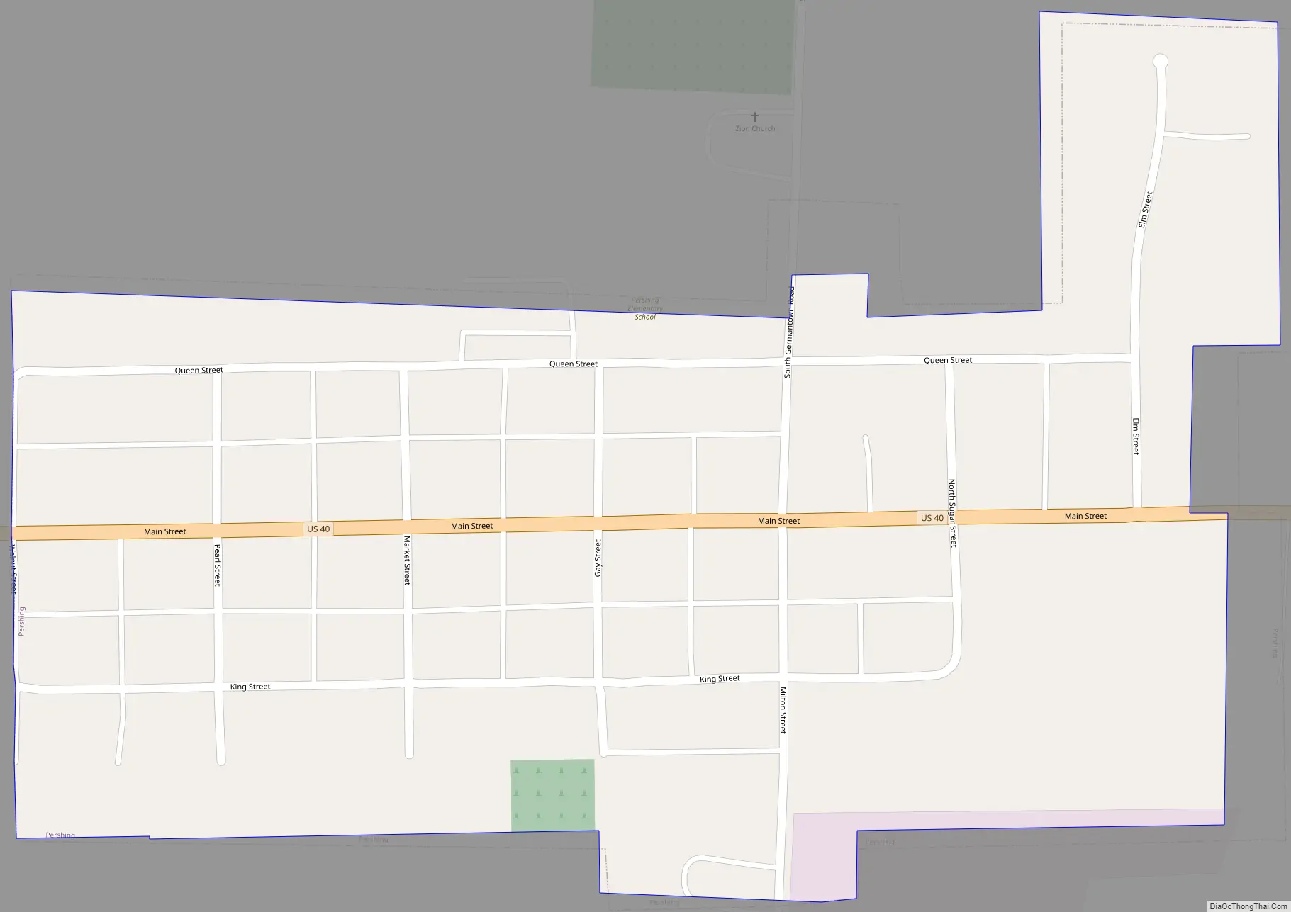
East Germantown city Satellite Map

Geography
East Germantown is located at 39°48′46″N 85°8′17″W / 39.81278°N 85.13806°W / 39.81278; -85.13806 (39.812803, -85.138020).
According to the 2010 census, East Germantown has a total area of 0.13 square miles (0.34 km), all land.
See also
Map of Indiana State and its subdivision:- Adams
- Allen
- Bartholomew
- Benton
- Blackford
- Boone
- Brown
- Carroll
- Cass
- Clark
- Clay
- Clinton
- Crawford
- Daviess
- De Kalb
- Dearborn
- Decatur
- Delaware
- Dubois
- Elkhart
- Fayette
- Floyd
- Fountain
- Franklin
- Fulton
- Gibson
- Grant
- Greene
- Hamilton
- Hancock
- Harrison
- Hendricks
- Henry
- Howard
- Huntington
- Jackson
- Jasper
- Jay
- Jefferson
- Jennings
- Johnson
- Knox
- Kosciusko
- LaGrange
- Lake
- Lake Michigan
- LaPorte
- Lawrence
- Madison
- Marion
- Marshall
- Martin
- Miami
- Monroe
- Montgomery
- Morgan
- Newton
- Noble
- Ohio
- Orange
- Owen
- Parke
- Perry
- Pike
- Porter
- Posey
- Pulaski
- Putnam
- Randolph
- Ripley
- Rush
- Saint Joseph
- Scott
- Shelby
- Spencer
- Starke
- Steuben
- Sullivan
- Switzerland
- Tippecanoe
- Tipton
- Union
- Vanderburgh
- Vermillion
- Vigo
- Wabash
- Warren
- Warrick
- Washington
- Wayne
- Wells
- White
- Whitley
- Alabama
- Alaska
- Arizona
- Arkansas
- California
- Colorado
- Connecticut
- Delaware
- District of Columbia
- Florida
- Georgia
- Hawaii
- Idaho
- Illinois
- Indiana
- Iowa
- Kansas
- Kentucky
- Louisiana
- Maine
- Maryland
- Massachusetts
- Michigan
- Minnesota
- Mississippi
- Missouri
- Montana
- Nebraska
- Nevada
- New Hampshire
- New Jersey
- New Mexico
- New York
- North Carolina
- North Dakota
- Ohio
- Oklahoma
- Oregon
- Pennsylvania
- Rhode Island
- South Carolina
- South Dakota
- Tennessee
- Texas
- Utah
- Vermont
- Virginia
- Washington
- West Virginia
- Wisconsin
- Wyoming