Pittsboro is a town in Middle Township, Hendricks County, Indiana, United States. The population was 2,928 at the 2010 Census, up from 1,588 at the 2000 census. By 2018 the estimated population was 3,480.
| Name: | Pittsboro town |
|---|---|
| LSAD Code: | 43 |
| LSAD Description: | town (suffix) |
| State: | Indiana |
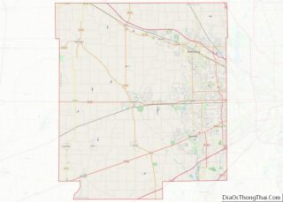
| County: | Hendricks County |
| Elevation: | 938 ft (286 m) |
| Total Area: | 3.79 sq mi (9.83 km²) |
| Land Area: | 3.78 sq mi (9.80 km²) |
| Water Area: | 0.01 sq mi (0.03 km²) |
| Total Population: | 3,682 |
| Population Density: | 973.56/sq mi (375.88/km²) |
| ZIP code: | 46167 |
| Area code: | 317 |
| FIPS code: | 1860192 |
| GNISfeature ID: | 0441210 |
| Website: | www.townofpittsboro.org |
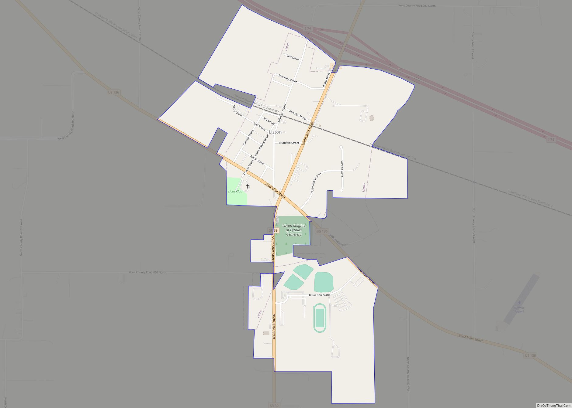
Online Interactive Map
Click on ![]() to view map in "full screen" mode.
to view map in "full screen" mode.
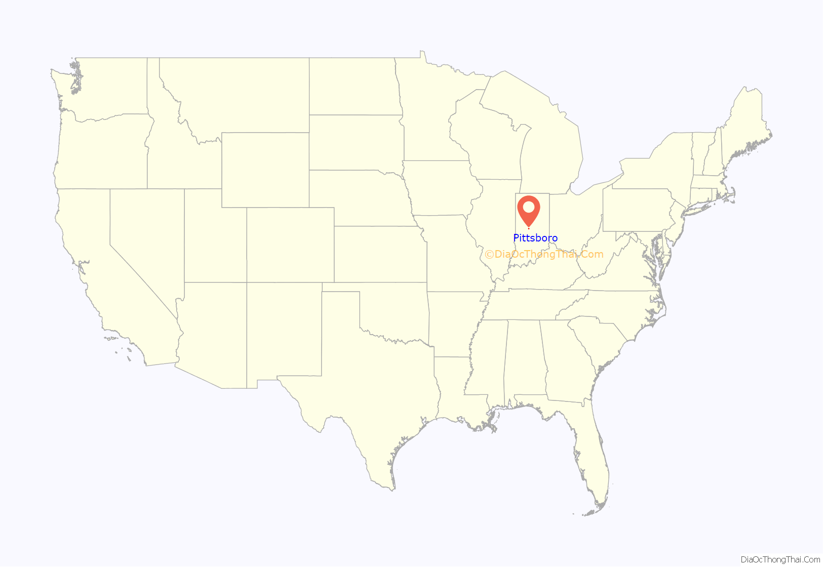
Pittsboro location map. Where is Pittsboro town?
History
The town of Pittsboro was founded on December 9, 1834, by Simon T. Hadley and Wiliam L. Matlock. The town was named “Pittsborough” in honor of Hadley’s home in North Carolina. The spelling was later changed to “Pittsboro”.
On April 6, 1906, an election was held for incorporation of the town. The result of the election was 83 favorable and 38 opposed. After incorporation came many infrastructure improvements and new services. Sidewalks were laid, street lights installed, and water service begun.
In 2008 Pittsboro had a parade for Olympic silver medalist Bridget Sloan. It led to the high school in neighboring Lizton, where she thanked her fans for supporting her. Hundreds of people had lined Main Street with signs and banners.
In 2009 Pittsboro celebrated its 175th birthday. The celebration was from June 26 through 28 and included a temporary museum of the town’s history and historic signs on many of the town’s buildings. The celebration also included food, activities, music, a parade, and fireworks.
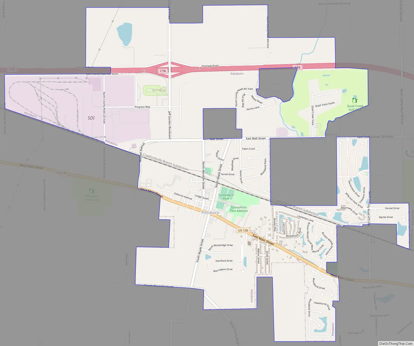
Pittsboro Road Map
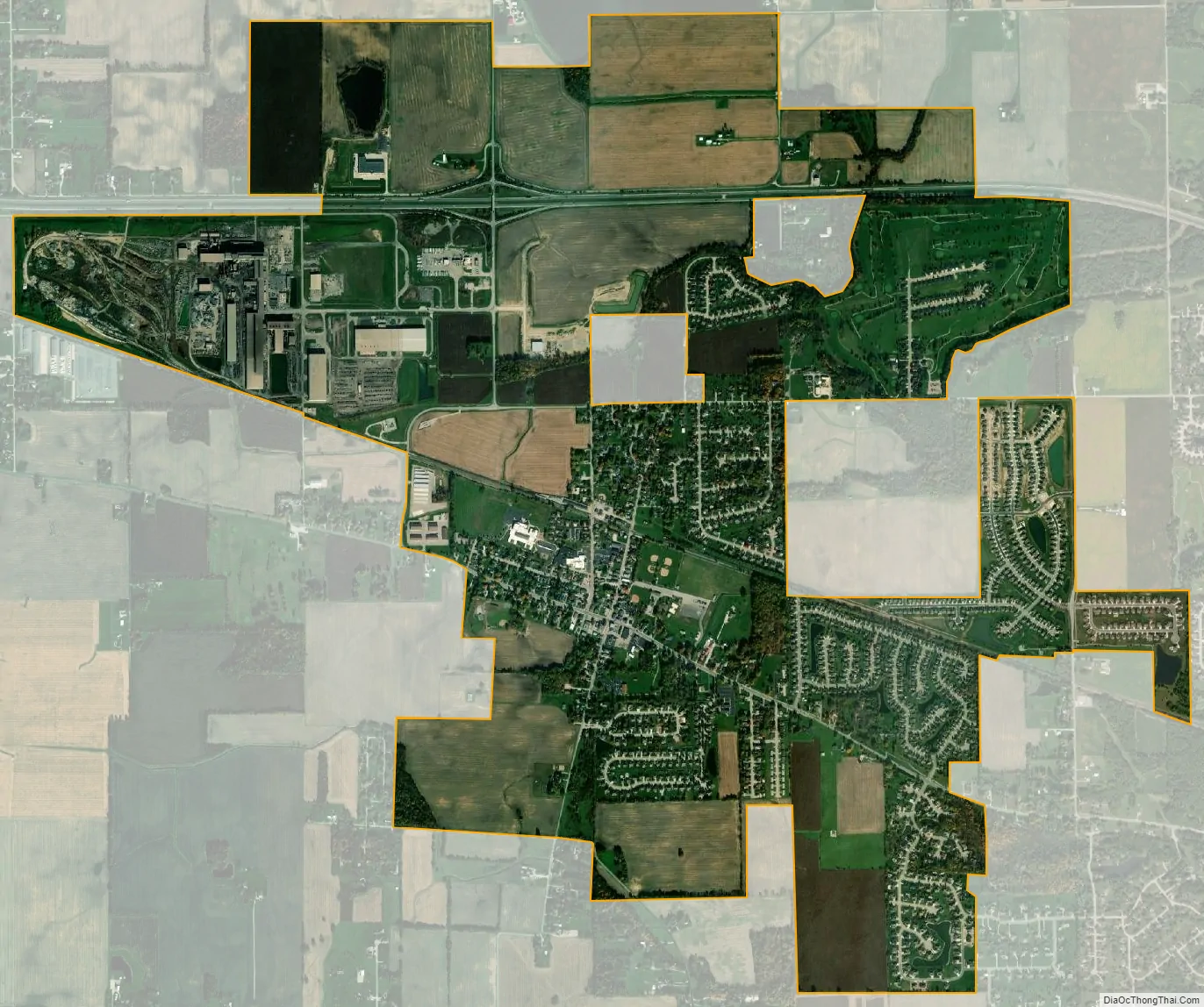
Pittsboro city Satellite Map
Geography
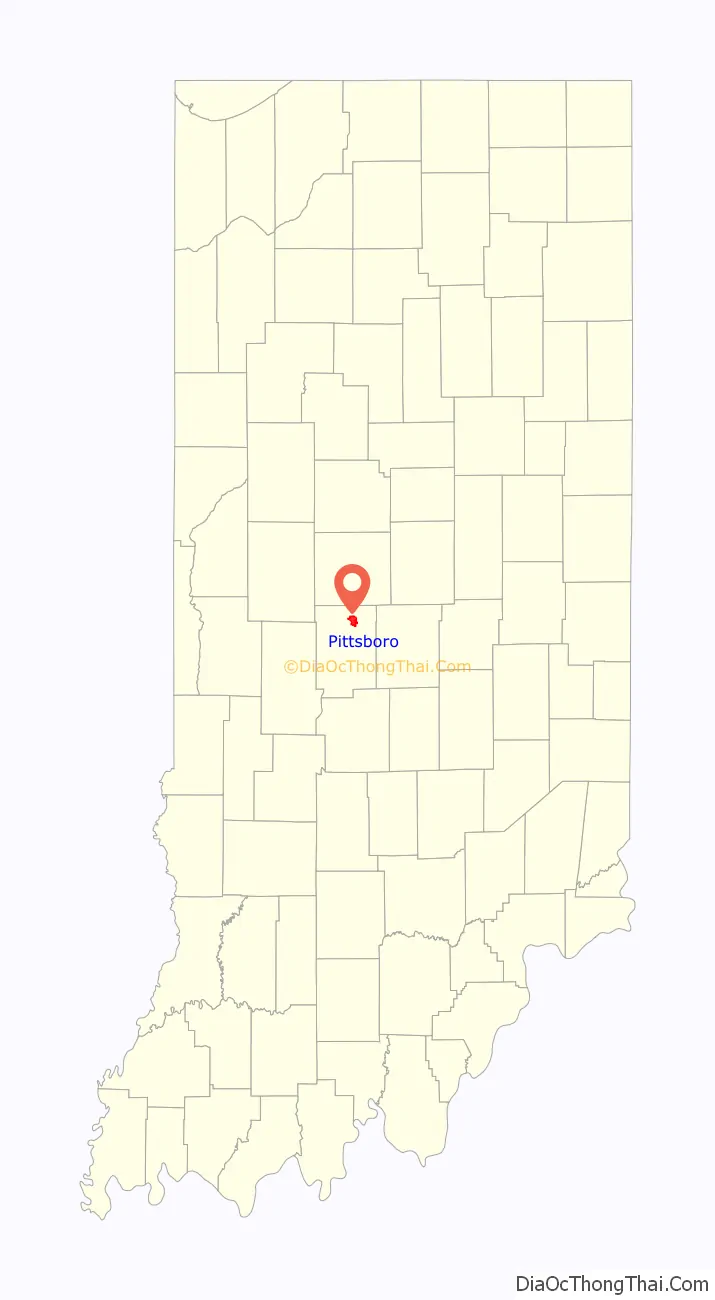
Pittsboro is located in northeastern Hendricks County at 39°52′2″N 86°27′41″W / 39.86722°N 86.46139°W / 39.86722; -86.46139 (39.867218, -86.461349). U.S. Route 136 is the town’s Main Street, leading southeast 18 miles (29 km) to downtown Indianapolis and northwest 10 miles (16 km) to Jamestown. Interstate 74, running parallel to US-136, forms the northern border of the town, with access from Exit 61.
According to the 2010 census, Pittsboro has a total area of 2.95 square miles (7.64 km), all land.
See also
Map of Indiana State and its subdivision:- Adams
- Allen
- Bartholomew
- Benton
- Blackford
- Boone
- Brown
- Carroll
- Cass
- Clark
- Clay
- Clinton
- Crawford
- Daviess
- De Kalb
- Dearborn
- Decatur
- Delaware
- Dubois
- Elkhart
- Fayette
- Floyd
- Fountain
- Franklin
- Fulton
- Gibson
- Grant
- Greene
- Hamilton
- Hancock
- Harrison
- Hendricks
- Henry
- Howard
- Huntington
- Jackson
- Jasper
- Jay
- Jefferson
- Jennings
- Johnson
- Knox
- Kosciusko
- LaGrange
- Lake
- Lake Michigan
- LaPorte
- Lawrence
- Madison
- Marion
- Marshall
- Martin
- Miami
- Monroe
- Montgomery
- Morgan
- Newton
- Noble
- Ohio
- Orange
- Owen
- Parke
- Perry
- Pike
- Porter
- Posey
- Pulaski
- Putnam
- Randolph
- Ripley
- Rush
- Saint Joseph
- Scott
- Shelby
- Spencer
- Starke
- Steuben
- Sullivan
- Switzerland
- Tippecanoe
- Tipton
- Union
- Vanderburgh
- Vermillion
- Vigo
- Wabash
- Warren
- Warrick
- Washington
- Wayne
- Wells
- White
- Whitley
- Alabama
- Alaska
- Arizona
- Arkansas
- California
- Colorado
- Connecticut
- Delaware
- District of Columbia
- Florida
- Georgia
- Hawaii
- Idaho
- Illinois
- Indiana
- Iowa
- Kansas
- Kentucky
- Louisiana
- Maine
- Maryland
- Massachusetts
- Michigan
- Minnesota
- Mississippi
- Missouri
- Montana
- Nebraska
- Nevada
- New Hampshire
- New Jersey
- New Mexico
- New York
- North Carolina
- North Dakota
- Ohio
- Oklahoma
- Oregon
- Pennsylvania
- Rhode Island
- South Carolina
- South Dakota
- Tennessee
- Texas
- Utah
- Vermont
- Virginia
- Washington
- West Virginia
- Wisconsin
- Wyoming