Nappanee is a city in Elkhart and Kosciusko counties in the U.S. state of Indiana. The population was 6,648 as of the 2010 U.S. Census and had grown to 6,913 by the 2020 U.S. Census. The name Nappanee probably means “flour” in Algonquian. The town has several tourist attractions: Amish Acres, Nappanee Raceway, The Arts & Crafts Festival, and the Apple Festival.
| Name: | Nappanee city |
|---|---|
| LSAD Code: | 25 |
| LSAD Description: | city (suffix) |
| State: | Indiana |
| County: | Elkhart County, Kosciusko County |
| Elevation: | 876 ft (267 m) |
| Total Area: | 4.78 sq mi (12.37 km²) |
| Land Area: | 4.78 sq mi (12.37 km²) |
| Water Area: | 0.00 sq mi (0.00 km²) 0% |
| Total Population: | 6,949 |
| Population Density: | 1,455.29/sq mi (561.91/km²) |
| ZIP code: | 46550 |
| Area code: | 574 |
| FIPS code: | 1852020 |
| GNISfeature ID: | 439936 |
| Website: | http://www.nappanee.org/ |
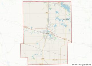
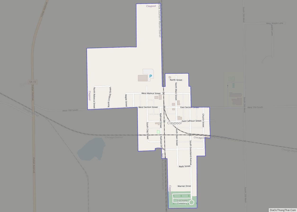
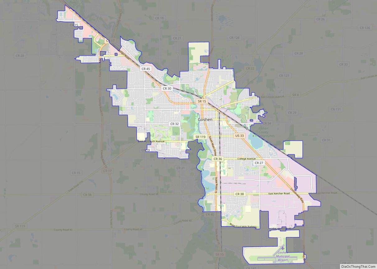
Online Interactive Map
Click on ![]() to view map in "full screen" mode.
to view map in "full screen" mode.
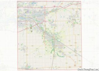
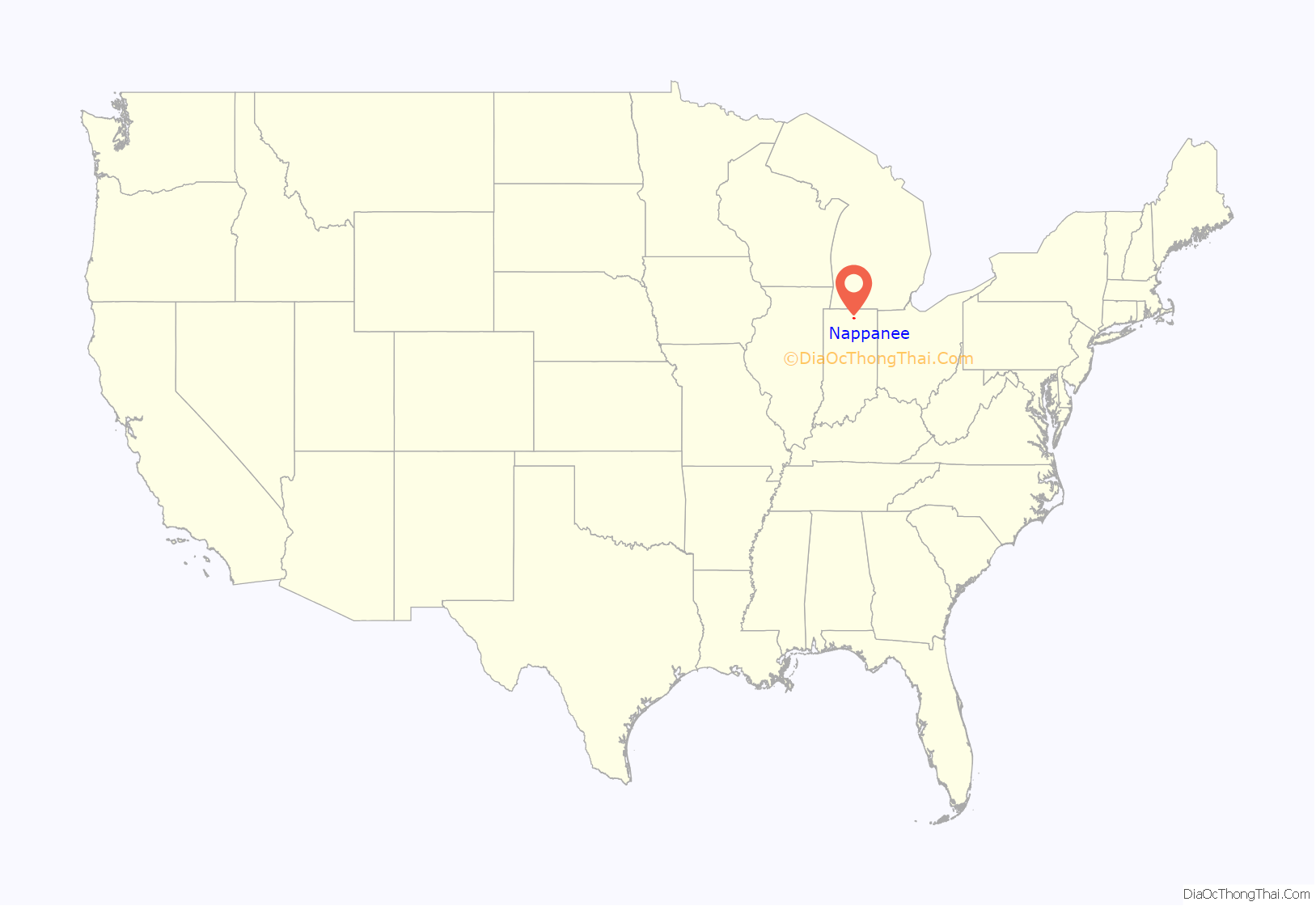
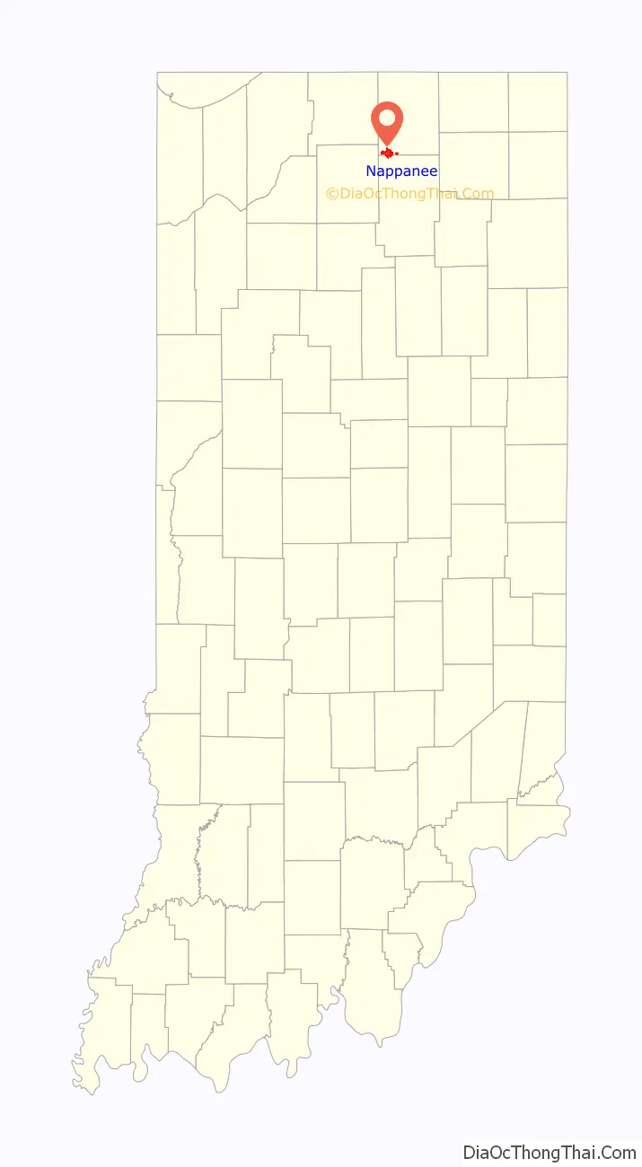
Nappanee location map. Where is Nappanee city?
History
Several hundred years ago, the Mound Builders built north of the marshes. Pottawatomi arrived in the area from near Green Bay, Wisconsin in the 1700s, partially displacing Miami inhabitants. The Pottawatomis had settlements on the Elkhart River at Elkhart, Goshen, and Waterford, and at Monoquet between Leesburg and Warsaw in what became Kosciusko County, Indiana. Thus, the Plymouth-Goshen Road near Nappanee probably follows the course of an old Indian Trail. The first white settlers came to the area In 1830, as various treaties and what Pottawatomi call the “Trail of Death” led to the relocation of Native Americans.
Railroad town
By 1870, seven farms had been established and forty people were settled around Nappanee. Locke Township had been founded in 1836 and named after Samuel Lockwood, and by 1863 a settlement called Wisler Town existed, but the actual platting of the village of Locke Town, approximately six miles from Nappanee, took place in December 1867. It would receive its last addition in 1874, the year that Nappanee was platted (on December 12, 1874).
The B&O Railroad sought a route westward from Sandusky, Ohio to the booming inland port of Chicago, Illinois in 1872. While the land around what became Nappanee and nearby Bremen was flat, permitting a straight crossing from Walkerton, it was also marshy, which led to engineering challenges. The section through Nappanee was finally completed as a single track in the late summer of 1874 and replaced by steel rails in 1882. Farmers sold the railroad land so that its tracks would run right next to Nappanee on its route to Chicago, although the railroad was unable to acquire the five acres needed to build a side track to the existing town of Locke. Nonetheless, on December 6, 1874, about three weeks after the railroad reached the outskirts of Chicago, it commenced service to what it first called Locke’s Station. By the month’s end, Daniel Metzler, Henry Stahly, and John Culp Jr. had platted the town of Nappanee; Culp gave the railroad three acres for a station and Metzler two acres. By 1875, trains arrived almost daily at the new depot and discharged freight and passengers. The Eby brothers of Locke said they suggested the name because they came from Napanee, Ontario; one of the Metzlers said their father selected the name in part because of its native American connotations. Over time the B&O Railroad eventually became CSX.
Development
The town’s first industry was a sawmill, and later additions were box-making, charcoal, and furniture businesses. The first brickyard (using local resources) was established before 1879. The first canning company was established in 1894, and a hemp factory was built by 1913. The hemp factory never reached full capacity, and was burned down in 1920, not rebuilt. Mobile home construction had started in Elkhart and Goshen by World War II, and the Walco and Franklin Coach Company were built in Nappanee after the war. Once the land was cleared, corn and wheat were planted, and agriculture has long been important in the area. By the early 20th century, onions had become a major crop (including an autumn festival), and other farmer-entrepreneurs grew hemp, spearmint and peppermint.
Nappanee was governed as a township from 1874 until 1889 when it incorporated as a town (then electing a town marshal and establishing a fire company and soon a waterworks). The town library was started as a ladies’ subscription service in 1895 and became a public library in 1925 after sufficient building funds were amassed to purchase an existing house, although a dedicated building wasn’t opened until 1937. In 1895, some tried to establish a college in Nappanee, but unlike various fellowships and fraternal and literary societies, the proposal never was implemented. In 1925 Nappanee incorporated as a city. Early in the 20th century, various Nappanee natives became noted cartoonists, including Merrill Blosser, Max Gwin, Bill Holman, Fred Neher and Henry Maust, and political cartoonist Francis (Mike) Parks was educated in Nappanee before working for New York, Omaha and San Francisco newspapers. A marker outside the public library notes Nappanee’s cartooning history. The Frank and Katharine Coppes House, Downtown Nappanee Historic District, Arthur Miller House, Nappanee Eastside Historic District, Nappanee West Park and Pavilion, and Stahly-Nissley-Kuhns Farm are listed on the National Register of Historic Places.
A tornado touched down in Nappanee around 10:30 PM on 18 October 2007, injuring at least five people and damaging 200 to 250 buildings, half of them severely. The tornado was classified as an EF3. The damage included three recreational vehicles factories that are among the community’s largest employers: Fairmont Homes, Franklin Coach, and Gulf Stream Coach.
Amish migration to Nappanee
The religious group that broke off of the Mennonites was formed in 1525 in Switzerland as part of the Radical Reformation and quickly spread to Germany and the Netherlands. As a more radical branch of the wider Protestant Reformation against Catholic practices, the Mennonites were vigorously persecuted by religious and worldly authorities. During the last decade of the 17th century a group from the Mennonites led by Jakob Ammann separated to form the Amish group which was named after its leader.
During the 18th century, the Amish were attracted to the promise of religious freedom in William Penn’s colony and thus settled in Pennsylvania. Amish then migrated to Middlebury in 1841 coming from Holmes County, Ohio, where they had migrated to from Pennsylvania, starting in 1809. Nappanee’s Amish originate from the early Amish immigrants from southwest Germany, notably the Palatinate, to Pennsylvania in the middle of the 18th century.
Amish families who became Old Order Amish in the second half of the 19th century first arrived in southwest Elkhart County in the early 1840s, and various other religious conservative denominations followed them. The First Mennonite Church in the area was founded in 1854, but members worshiped in homes, then built a schoolhouse in 1867 and also used it for services for several years (as did other denominations with their permission).
The first permanent building was erected in 1878, two years after the United Brethren Church moved from the schoolhouse into its own building (only to sell it and build a new building in 1888 and remodel it in 1928). Nappanee is still surrounded by family farms of conservative Anabaptists, including the Amish, Mennonites, and the Schwarzenau Brethren.
National Register of Historic Places
- Arthur Miller House
- Frank and Katharine Coppes House
- Downtown Nappanee Historic District
- Nappanee Eastside Historic District
- Nappanee West Park and Pavilion
- Stahly–Nissley–Kuhns Farm
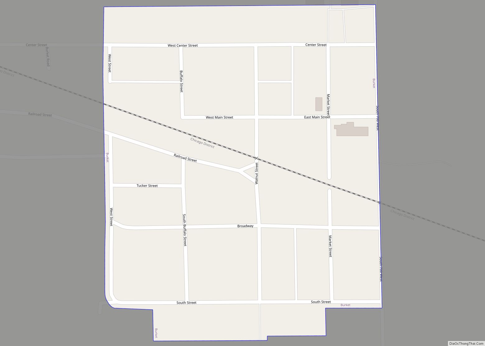
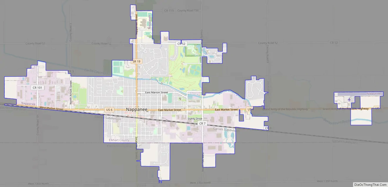
Nappanee Road Map
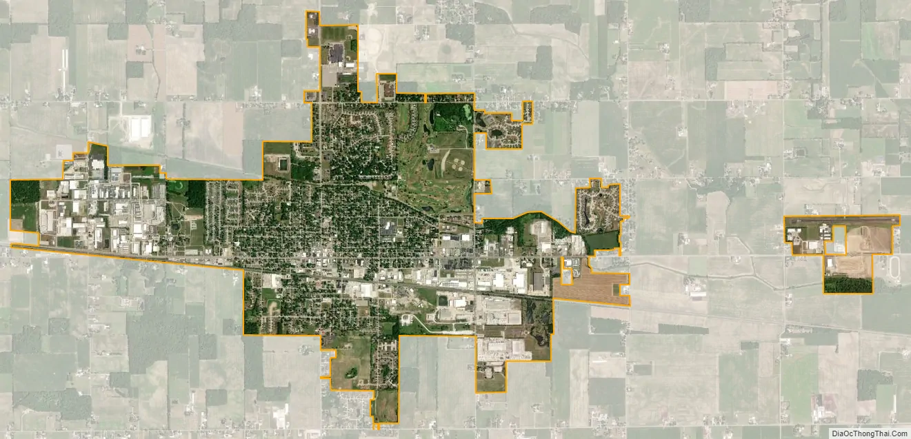
Nappanee city Satellite Map
Geography
According to the 2010 census, the city has a total area of 4.15 square miles (10.7 km), all land.
Nappanee is now surrounded by fertile farmland as the headwaters of the Wabash River in northern Indiana, but initially was one of the least desirable areas of what became Elkhart County, due to dense woods and widespread swamps, particularly tamarack marshes. Actually, it drains into two watersheds—precipitation south of what became Market Street drains into the Wabash River, thence to the Ohio River, Mississippi River, and ultimately the Gulf of Mexico. Precipitation north of Market Street drains into the Great Lakes, and ultimately the St. Lawrence River and the Atlantic Ocean.
See also
Map of Indiana State and its subdivision:- Adams
- Allen
- Bartholomew
- Benton
- Blackford
- Boone
- Brown
- Carroll
- Cass
- Clark
- Clay
- Clinton
- Crawford
- Daviess
- De Kalb
- Dearborn
- Decatur
- Delaware
- Dubois
- Elkhart
- Fayette
- Floyd
- Fountain
- Franklin
- Fulton
- Gibson
- Grant
- Greene
- Hamilton
- Hancock
- Harrison
- Hendricks
- Henry
- Howard
- Huntington
- Jackson
- Jasper
- Jay
- Jefferson
- Jennings
- Johnson
- Knox
- Kosciusko
- LaGrange
- Lake
- Lake Michigan
- LaPorte
- Lawrence
- Madison
- Marion
- Marshall
- Martin
- Miami
- Monroe
- Montgomery
- Morgan
- Newton
- Noble
- Ohio
- Orange
- Owen
- Parke
- Perry
- Pike
- Porter
- Posey
- Pulaski
- Putnam
- Randolph
- Ripley
- Rush
- Saint Joseph
- Scott
- Shelby
- Spencer
- Starke
- Steuben
- Sullivan
- Switzerland
- Tippecanoe
- Tipton
- Union
- Vanderburgh
- Vermillion
- Vigo
- Wabash
- Warren
- Warrick
- Washington
- Wayne
- Wells
- White
- Whitley
- Alabama
- Alaska
- Arizona
- Arkansas
- California
- Colorado
- Connecticut
- Delaware
- District of Columbia
- Florida
- Georgia
- Hawaii
- Idaho
- Illinois
- Indiana
- Iowa
- Kansas
- Kentucky
- Louisiana
- Maine
- Maryland
- Massachusetts
- Michigan
- Minnesota
- Mississippi
- Missouri
- Montana
- Nebraska
- Nevada
- New Hampshire
- New Jersey
- New Mexico
- New York
- North Carolina
- North Dakota
- Ohio
- Oklahoma
- Oregon
- Pennsylvania
- Rhode Island
- South Carolina
- South Dakota
- Tennessee
- Texas
- Utah
- Vermont
- Virginia
- Washington
- West Virginia
- Wisconsin
- Wyoming