Schererville /ˈʃɛərvɪl/ is a town in St. John Township, Lake County, Indiana, United States. The population was 29,646 at the 2020 census It is a suburb of Chicago, located 30 miles south of the city.
| Name: | Schererville town |
|---|---|
| LSAD Code: | 43 |
| LSAD Description: | town (suffix) |
| State: | Indiana |
| County: | Lake County |
| Founded: | 1866 |
| Elevation: | 669 ft (204 m) |
| Total Area: | 15.15 sq mi (39.23 km²) |
| Land Area: | 15.12 sq mi (39.15 km²) |
| Water Area: | 0.03 sq mi (0.09 km²) |
| Total Population: | 29,646 |
| Population Density: | 1,961.23/sq mi (757.26/km²) |
| ZIP code: | 46375 |
| Area code: | 219 |
| FIPS code: | 1868220 |
| GNISfeature ID: | 0443066 |
| Website: | www.schererville.org |
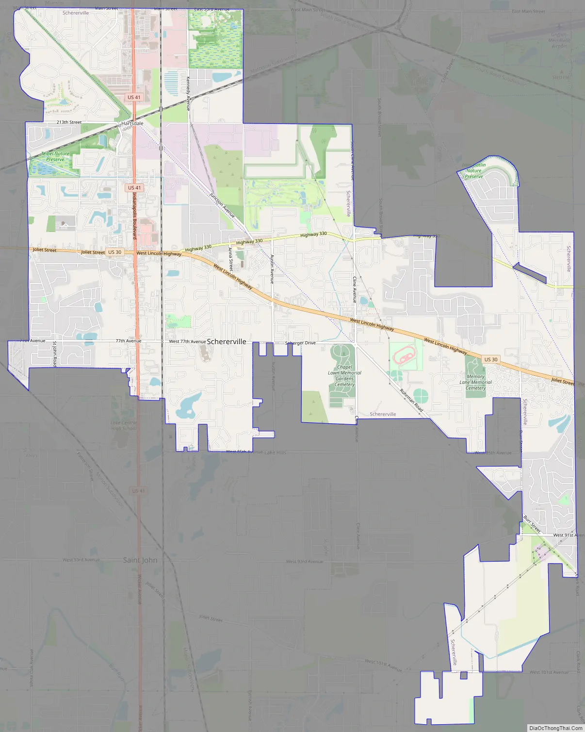
Online Interactive Map
Click on ![]() to view map in "full screen" mode.
to view map in "full screen" mode.
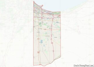
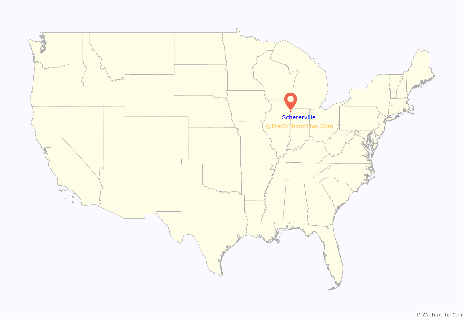
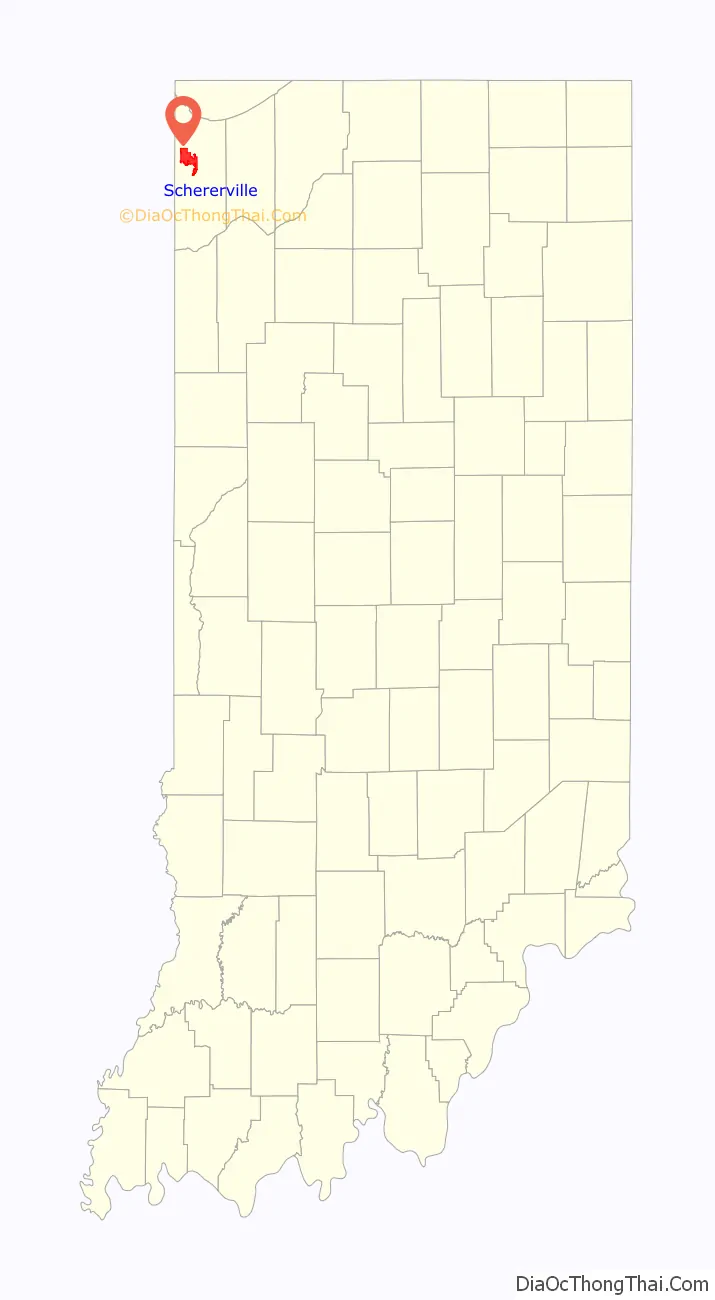
Schererville location map. Where is Schererville town?
History
Long before Indiana became a state, long before the founding of Schererville, people called the area the “Crossroads,” as several Native American trails intersected here, that later became routes for the wagons of settlers traveling west.
One of those settlers was Nicholas Scherer, who was born in 1830 at Scheuern, today part of Tholey, Saarland, in southwestern Germany, who arrived in the U.S. in 1846. When he came to this place at the southern tip of Lake Michigan in 1865, he founded the community that bears his name.
Today, trails still cross at Schererville, the modern trails of a motorized society, U.S. Highways 41 and 30. Nearby are newer trails, I-80/94 and I-65. All these are primary transcontinental routes and gives Schererville its slogan: “Crossroads of the Nation.”
The town was named one of the “100 Best Places to Live in the U.S.” by Money Magazine in 2007.
Schererville’s former Town Council President, Perry Ferrini, died on December 13, 2009. The Town Council’s new president became Jerry Tippy, and the vacant seat held by Perry was filled by Sharon Moore on January 9, 2010.
The town of Schererville celebrated its sesquicentennial in September, 2016.
Schererville Road Map
Schererville city Satellite Map

Geography
Schererville is located at 41°29′21″N 87°26′35″W / 41.48917°N 87.44306°W / 41.48917; -87.44306 (41.489135, -87.443137) in Lake County, Indiana. Schererville is 11 miles south of the Lake Michigan shore and 2 miles east of the Indiana/Illinois state line.
Considered part of the Chicago metropolitan area and located just 30 miles from Chicago, Schererville is considered a suburb of this municipality. Many residents commute daily for school and work.
According to the 2010 census, Schererville has a total area of 14.763 square miles (38.24 km), of which 14.71 square miles (38.10 km) (or 99.64%) is land and 0.053 square miles (0.14 km) (or 0.36%) is water.
One of Schererville’s neighborhoods, Briar Ridge, spans both Schererville and adjacent Dyer. The ridge south of Route 30 is the Glenwood Shoreline.
See also
Map of Indiana State and its subdivision:- Adams
- Allen
- Bartholomew
- Benton
- Blackford
- Boone
- Brown
- Carroll
- Cass
- Clark
- Clay
- Clinton
- Crawford
- Daviess
- De Kalb
- Dearborn
- Decatur
- Delaware
- Dubois
- Elkhart
- Fayette
- Floyd
- Fountain
- Franklin
- Fulton
- Gibson
- Grant
- Greene
- Hamilton
- Hancock
- Harrison
- Hendricks
- Henry
- Howard
- Huntington
- Jackson
- Jasper
- Jay
- Jefferson
- Jennings
- Johnson
- Knox
- Kosciusko
- LaGrange
- Lake
- Lake Michigan
- LaPorte
- Lawrence
- Madison
- Marion
- Marshall
- Martin
- Miami
- Monroe
- Montgomery
- Morgan
- Newton
- Noble
- Ohio
- Orange
- Owen
- Parke
- Perry
- Pike
- Porter
- Posey
- Pulaski
- Putnam
- Randolph
- Ripley
- Rush
- Saint Joseph
- Scott
- Shelby
- Spencer
- Starke
- Steuben
- Sullivan
- Switzerland
- Tippecanoe
- Tipton
- Union
- Vanderburgh
- Vermillion
- Vigo
- Wabash
- Warren
- Warrick
- Washington
- Wayne
- Wells
- White
- Whitley
- Alabama
- Alaska
- Arizona
- Arkansas
- California
- Colorado
- Connecticut
- Delaware
- District of Columbia
- Florida
- Georgia
- Hawaii
- Idaho
- Illinois
- Indiana
- Iowa
- Kansas
- Kentucky
- Louisiana
- Maine
- Maryland
- Massachusetts
- Michigan
- Minnesota
- Mississippi
- Missouri
- Montana
- Nebraska
- Nevada
- New Hampshire
- New Jersey
- New Mexico
- New York
- North Carolina
- North Dakota
- Ohio
- Oklahoma
- Oregon
- Pennsylvania
- Rhode Island
- South Carolina
- South Dakota
- Tennessee
- Texas
- Utah
- Vermont
- Virginia
- Washington
- West Virginia
- Wisconsin
- Wyoming