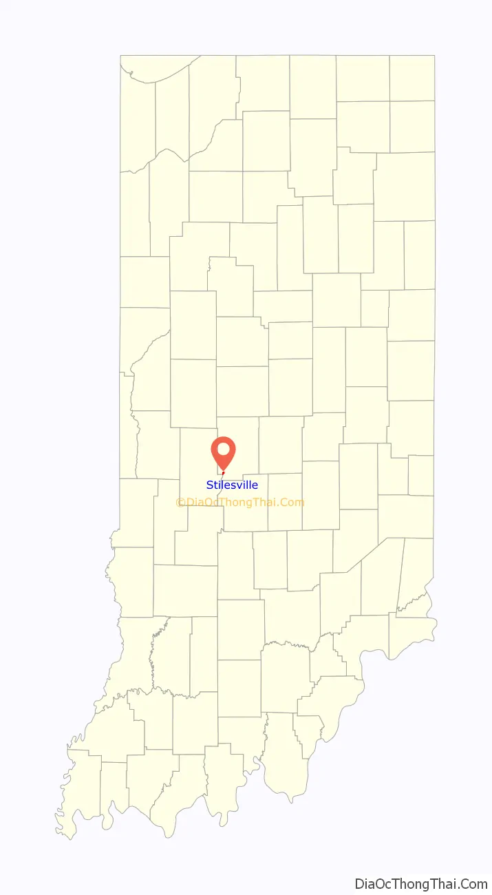
Stilesville is a town in Franklin Township, Hendricks County, Indiana, United States. The population was 316 at the 2010 Census.
| Name: | Stilesville town |
|---|---|
| LSAD Code: | 43 |
| LSAD Description: | town (suffix) |
| State: | Indiana |
| County: | Hendricks County |
| Elevation: | 804 ft (245 m) |
| Total Area: | 0.38 sq mi (0.98 km²) |
| Land Area: | 0.37 sq mi (0.97 km²) |
| Water Area: | 0.01 sq mi (0.02 km²) |
| Total Population: | 269 |
| Population Density: | 721.18/sq mi (278.54/km²) |
| ZIP code: | 46180 |
| Area code: | 317 |
| FIPS code: | 1873178 |
| GNISfeature ID: | 0444163 |
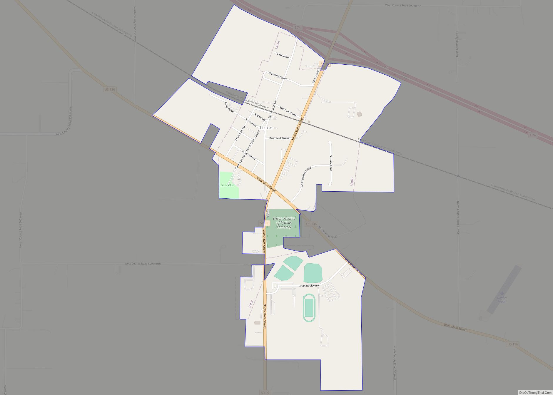
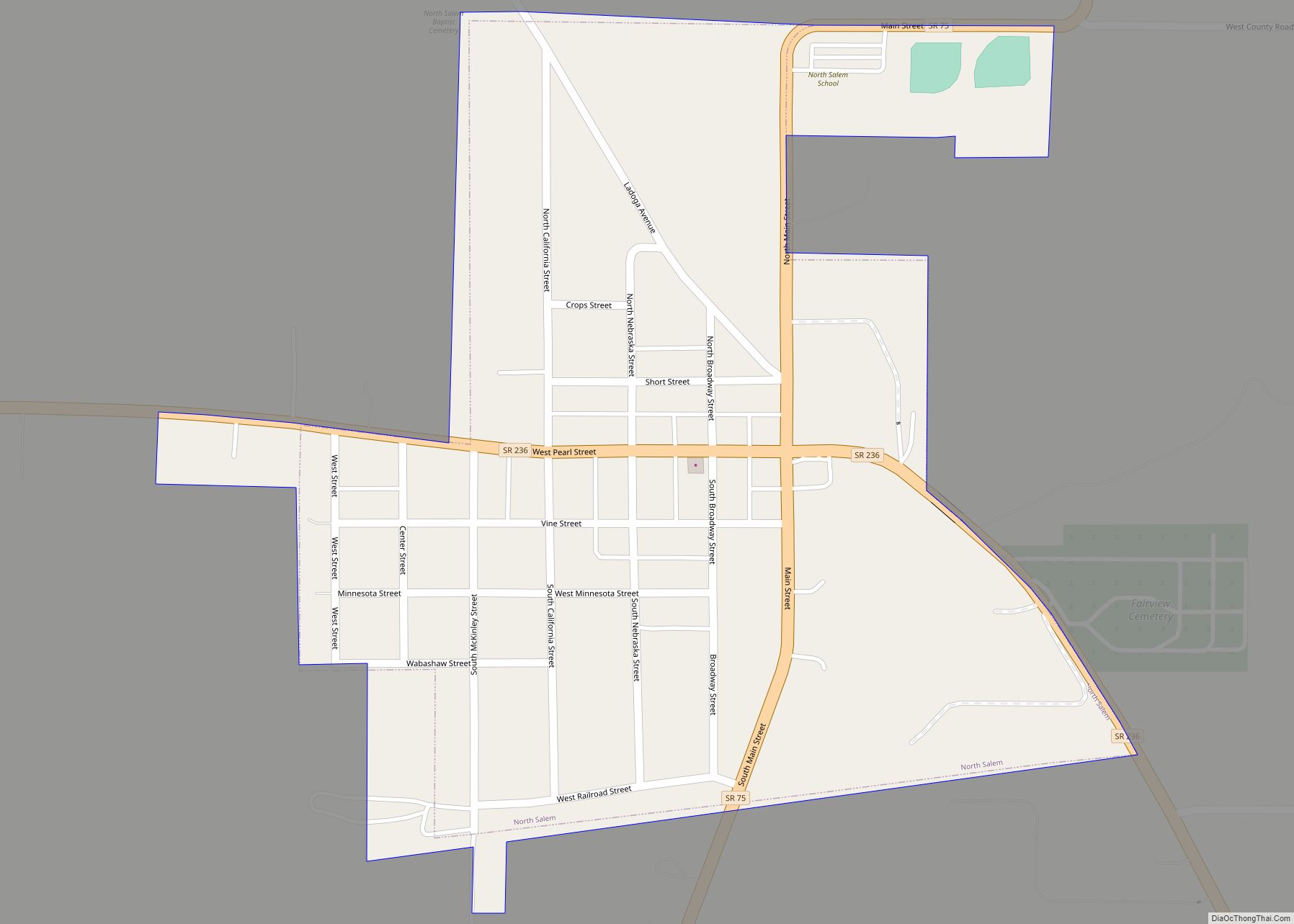
Online Interactive Map
Click on ![]() to view map in "full screen" mode.
to view map in "full screen" mode.
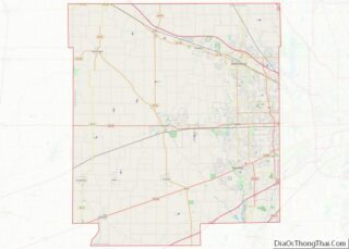
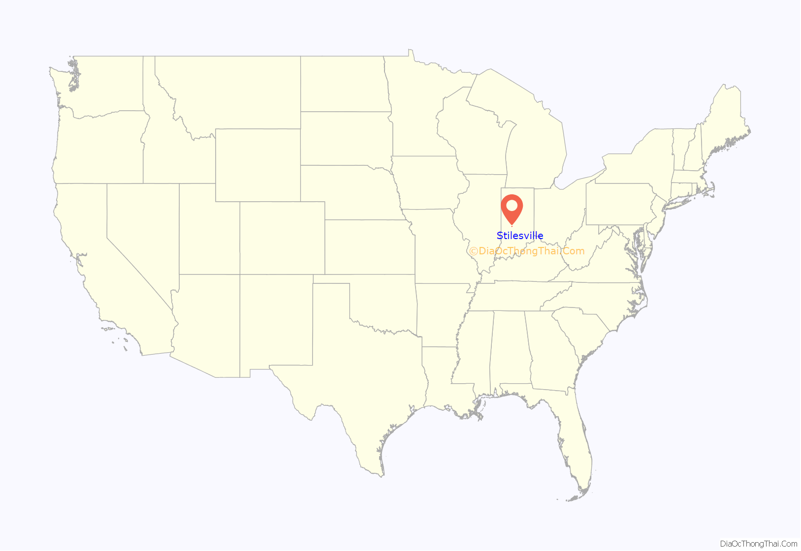
Stilesville location map. Where is Stilesville town?
History
Stilesville was laid out in 1828. It was named for Jeremiah Stiles, a pioneer settler. The National Road was built through Stilesville in 1830.
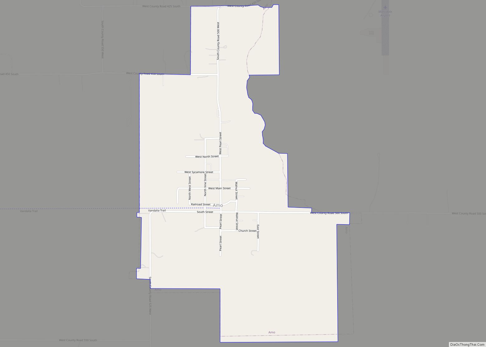
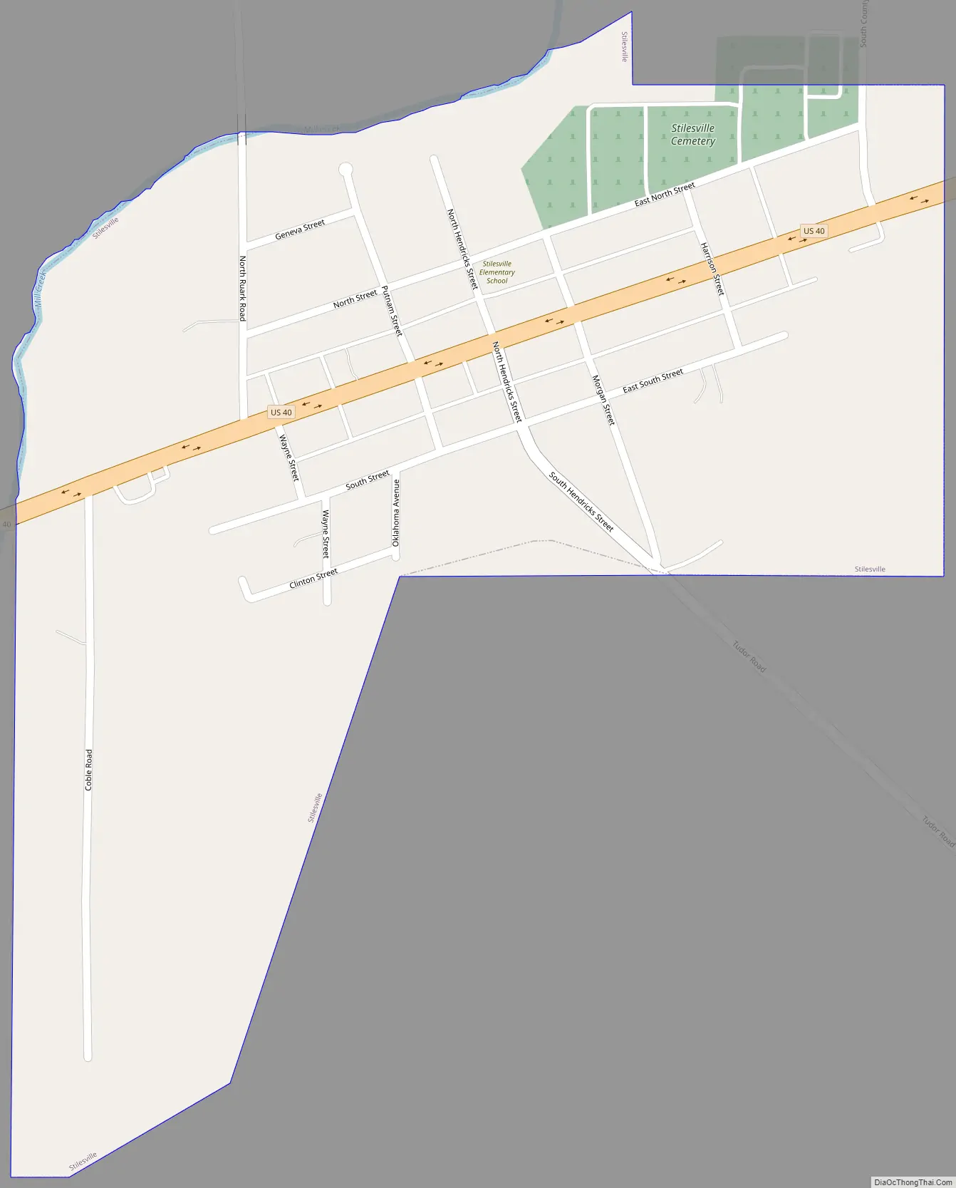
Stilesville Road Map
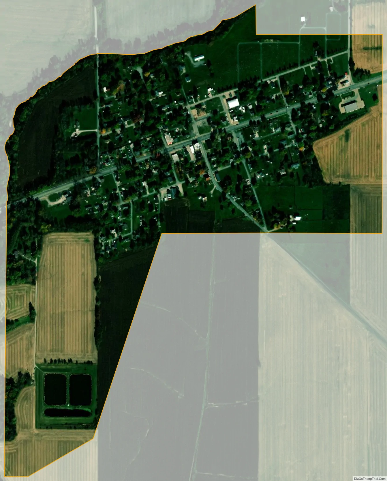
Stilesville city Satellite Map
Geography
Stilesville is located at 39°38′22″N 86°37′58″W / 39.63944°N 86.63278°W / 39.63944; -86.63278 (39.639509, -86.632754).
According to the 2010 census, Stilesville has a total area of 0.376 square miles (0.97 km), of which 0.37 square miles (0.96 km) (or 98.4%) is land and 0.006 square miles (0.02 km) (or 1.6%) is water.
See also
Map of Indiana State and its subdivision:- Adams
- Allen
- Bartholomew
- Benton
- Blackford
- Boone
- Brown
- Carroll
- Cass
- Clark
- Clay
- Clinton
- Crawford
- Daviess
- De Kalb
- Dearborn
- Decatur
- Delaware
- Dubois
- Elkhart
- Fayette
- Floyd
- Fountain
- Franklin
- Fulton
- Gibson
- Grant
- Greene
- Hamilton
- Hancock
- Harrison
- Hendricks
- Henry
- Howard
- Huntington
- Jackson
- Jasper
- Jay
- Jefferson
- Jennings
- Johnson
- Knox
- Kosciusko
- LaGrange
- Lake
- Lake Michigan
- LaPorte
- Lawrence
- Madison
- Marion
- Marshall
- Martin
- Miami
- Monroe
- Montgomery
- Morgan
- Newton
- Noble
- Ohio
- Orange
- Owen
- Parke
- Perry
- Pike
- Porter
- Posey
- Pulaski
- Putnam
- Randolph
- Ripley
- Rush
- Saint Joseph
- Scott
- Shelby
- Spencer
- Starke
- Steuben
- Sullivan
- Switzerland
- Tippecanoe
- Tipton
- Union
- Vanderburgh
- Vermillion
- Vigo
- Wabash
- Warren
- Warrick
- Washington
- Wayne
- Wells
- White
- Whitley
- Alabama
- Alaska
- Arizona
- Arkansas
- California
- Colorado
- Connecticut
- Delaware
- District of Columbia
- Florida
- Georgia
- Hawaii
- Idaho
- Illinois
- Indiana
- Iowa
- Kansas
- Kentucky
- Louisiana
- Maine
- Maryland
- Massachusetts
- Michigan
- Minnesota
- Mississippi
- Missouri
- Montana
- Nebraska
- Nevada
- New Hampshire
- New Jersey
- New Mexico
- New York
- North Carolina
- North Dakota
- Ohio
- Oklahoma
- Oregon
- Pennsylvania
- Rhode Island
- South Carolina
- South Dakota
- Tennessee
- Texas
- Utah
- Vermont
- Virginia
- Washington
- West Virginia
- Wisconsin
- Wyoming