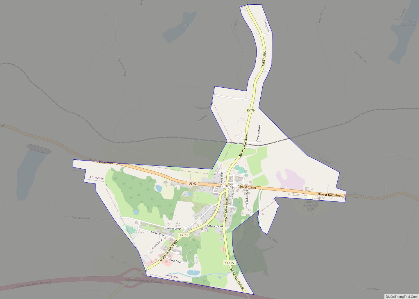
Caneyville is a home rule-class city in Grayson County, Kentucky, in the United States. The population was 608 at the 2010 census. Named for its location on Caney Creek, Caneyville had a post office by 1837 and a town charter by 1840 and was incorporated by the state legislature in 1880.
| Name: | Caneyville city |
|---|---|
| LSAD Code: | 25 |
| LSAD Description: | city (suffix) |
| State: | Kentucky |
| County: | Grayson County |
| Incorporated: | 1880 |
| Elevation: | 492 ft (150 m) |
| Total Area: | 1.66 sq mi (4.29 km²) |
| Land Area: | 1.65 sq mi (4.27 km²) |
| Water Area: | 0.01 sq mi (0.03 km²) |
| Total Population: | 529 |
| Population Density: | 321.00/sq mi (123.93/km²) |
| ZIP code: | 42721 |
| Area code: | 270 & 364 |
| FIPS code: | 2112538 |
| GNISfeature ID: | 0488876 |
| Website: | caneyville.ky.gov |
Online Interactive Map
Click on ![]() to view map in "full screen" mode.
to view map in "full screen" mode.
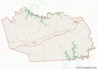
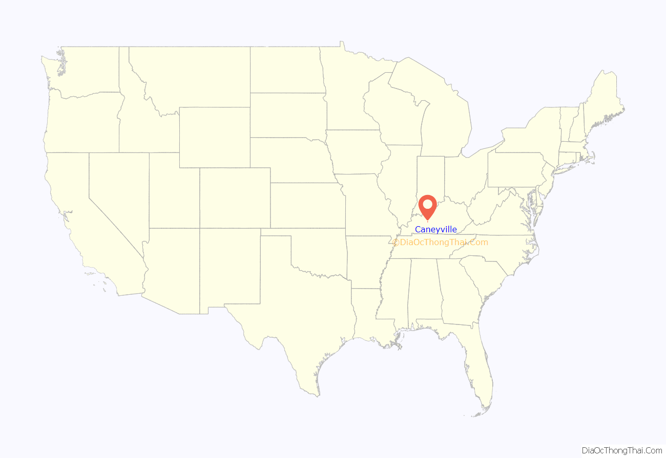
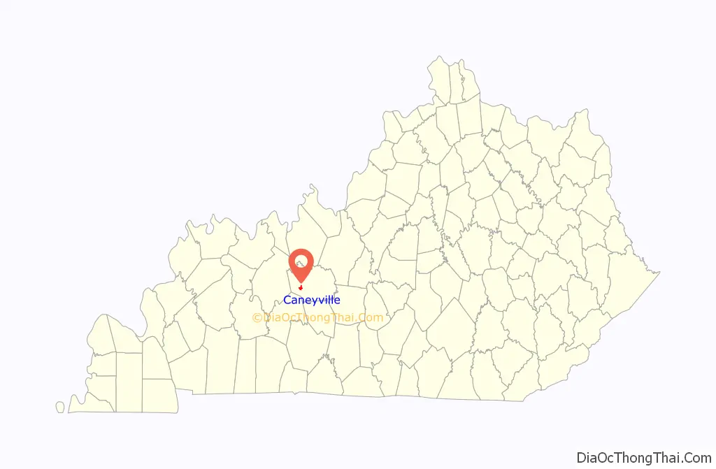
Caneyville location map. Where is Caneyville city?
Caneyville Road Map
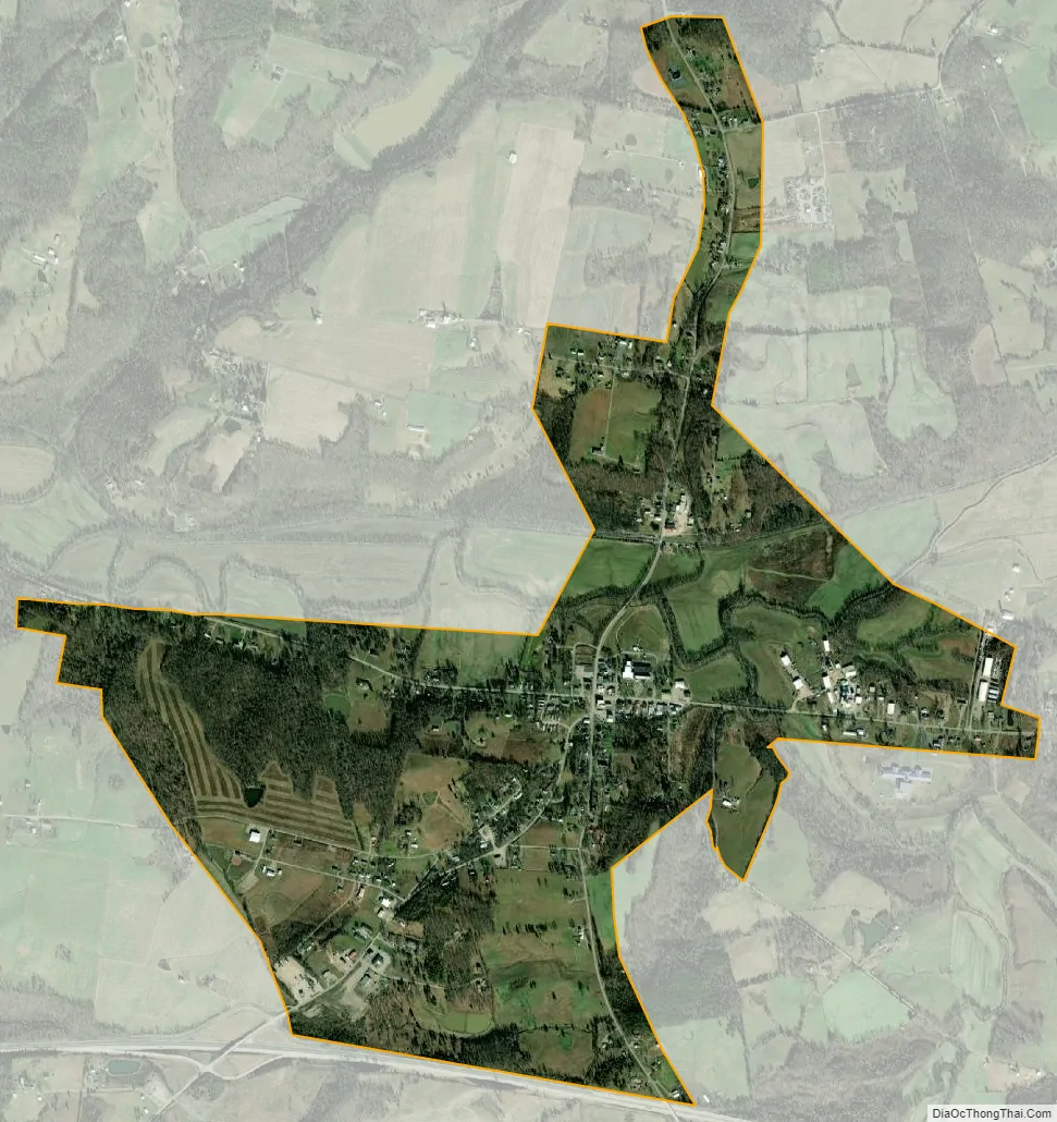
Caneyville city Satellite Map
Geography
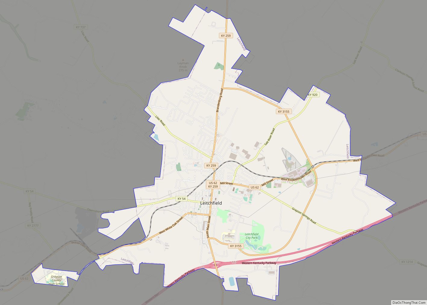
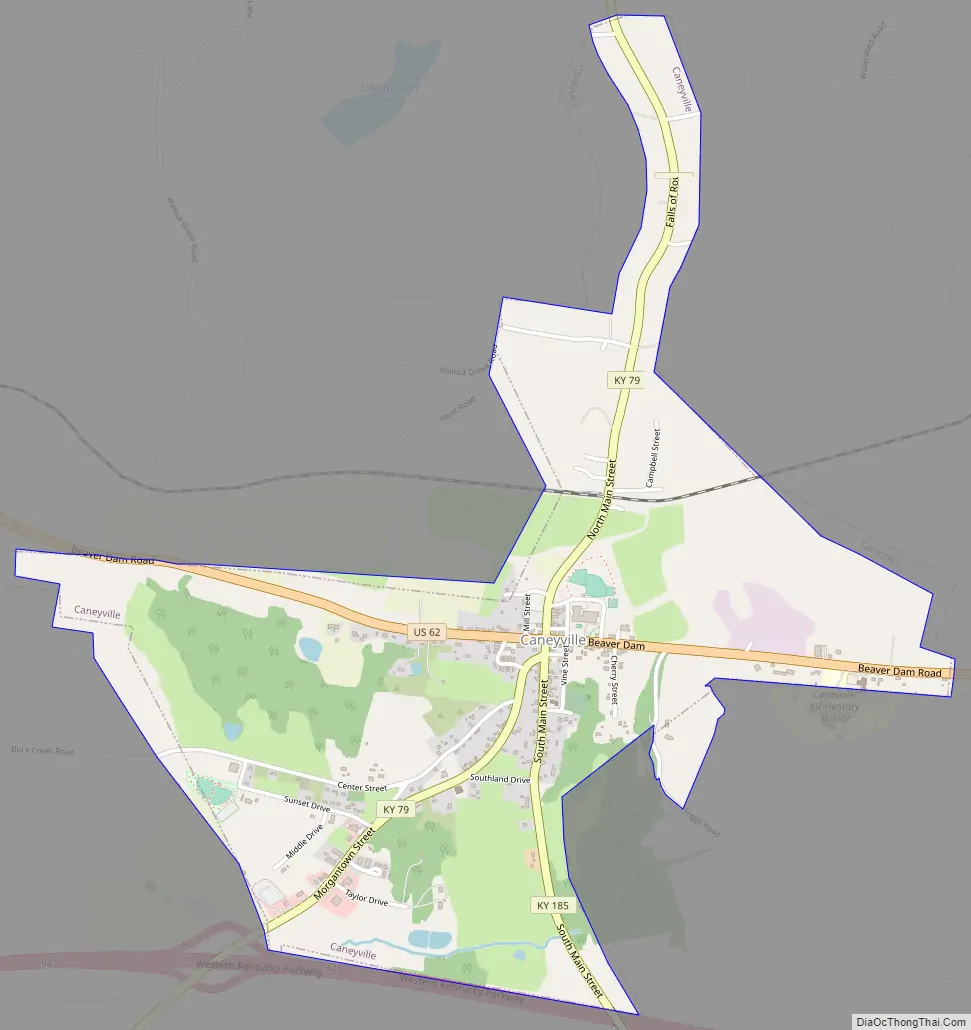
Caneyville is located in western Grayson County. U.S. Route 62 passes through the center of Caneyville, leading east 14 miles (23 km) to Leitchfield, the county seat.
According to the United States Census Bureau, Caneyville has a total area of 1.6 square miles (4.2 km), of which 0.01 square miles (0.03 km), or 0.59%, is water. Caney Creek, a west-flowing tributary of the Rough River, is formed in the north part of Caneyville at the junction of its North and South Forks. Water in Caney Creek flows via the Rough River and the Green River.
See also
Map of Kentucky State and its subdivision:- Adair
- Allen
- Anderson
- Ballard
- Barren
- Bath
- Bell
- Boone
- Bourbon
- Boyd
- Boyle
- Bracken
- Breathitt
- Breckinridge
- Bullitt
- Butler
- Caldwell
- Calloway
- Campbell
- Carlisle
- Carroll
- Carter
- Casey
- Christian
- Clark
- Clay
- Clinton
- Crittenden
- Cumberland
- Daviess
- Edmonson
- Elliott
- Estill
- Fayette
- Fleming
- Floyd
- Franklin
- Fulton
- Gallatin
- Garrard
- Grant
- Graves
- Grayson
- Green
- Greenup
- Hancock
- Hardin
- Harlan
- Harrison
- Hart
- Henderson
- Henry
- Hickman
- Hopkins
- Jackson
- Jefferson
- Jessamine
- Johnson
- Kenton
- Knott
- Knox
- Larue
- Laurel
- Lawrence
- Lee
- Leslie
- Letcher
- Lewis
- Lincoln
- Livingston
- Logan
- Lyon
- Madison
- Magoffin
- Marion
- Marshall
- Martin
- Mason
- McCracken
- McCreary
- McLean
- Meade
- Menifee
- Mercer
- Metcalfe
- Monroe
- Montgomery
- Morgan
- Muhlenberg
- Nelson
- Nicholas
- Ohio
- Oldham
- Owen
- Owsley
- Pendleton
- Perry
- Pike
- Powell
- Pulaski
- Robertson
- Rockcastle
- Rowan
- Russell
- Scott
- Shelby
- Simpson
- Spencer
- Taylor
- Todd
- Trigg
- Trimble
- Union
- Warren
- Washington
- Wayne
- Webster
- Whitley
- Wolfe
- Woodford
- Alabama
- Alaska
- Arizona
- Arkansas
- California
- Colorado
- Connecticut
- Delaware
- District of Columbia
- Florida
- Georgia
- Hawaii
- Idaho
- Illinois
- Indiana
- Iowa
- Kansas
- Kentucky
- Louisiana
- Maine
- Maryland
- Massachusetts
- Michigan
- Minnesota
- Mississippi
- Missouri
- Montana
- Nebraska
- Nevada
- New Hampshire
- New Jersey
- New Mexico
- New York
- North Carolina
- North Dakota
- Ohio
- Oklahoma
- Oregon
- Pennsylvania
- Rhode Island
- South Carolina
- South Dakota
- Tennessee
- Texas
- Utah
- Vermont
- Virginia
- Washington
- West Virginia
- Wisconsin
- Wyoming