Columbia is a home rule-class city just above Russell Creek in Adair County, Kentucky, in the United States. The population was 4,452 at the 2010 census. Columbia is the seat of its county.
| Name: | Columbia city |
|---|---|
| LSAD Code: | 25 |
| LSAD Description: | city (suffix) |
| State: | Kentucky |
| County: | Adair County |
| Elevation: | 748 ft (228 m) |
| Total Area: | 4.91 sq mi (12.72 km²) |
| Land Area: | 4.87 sq mi (12.62 km²) |
| Water Area: | 0.04 sq mi (0.10 km²) |
| Total Population: | 4,845 |
| Population Density: | 994.46/sq mi (383.94/km²) |
| ZIP code: | 42715, 42728, 42735 |
| Area code: | 270 & 364 |
| FIPS code: | 2116750 |
| GNISfeature ID: | 0489885 |
| Website: | www.cityofcolumbiaky.com |
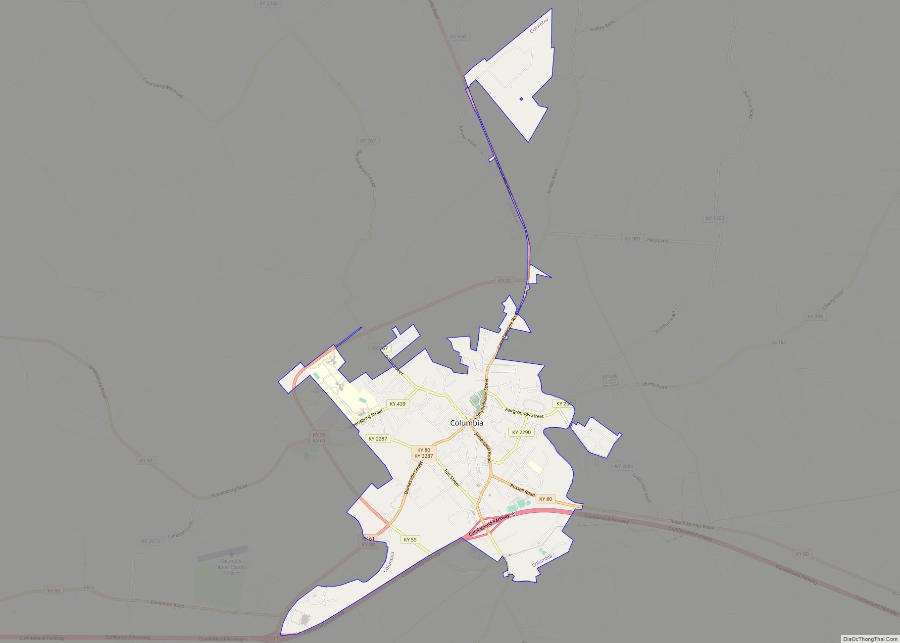
Online Interactive Map
Click on ![]() to view map in "full screen" mode.
to view map in "full screen" mode.
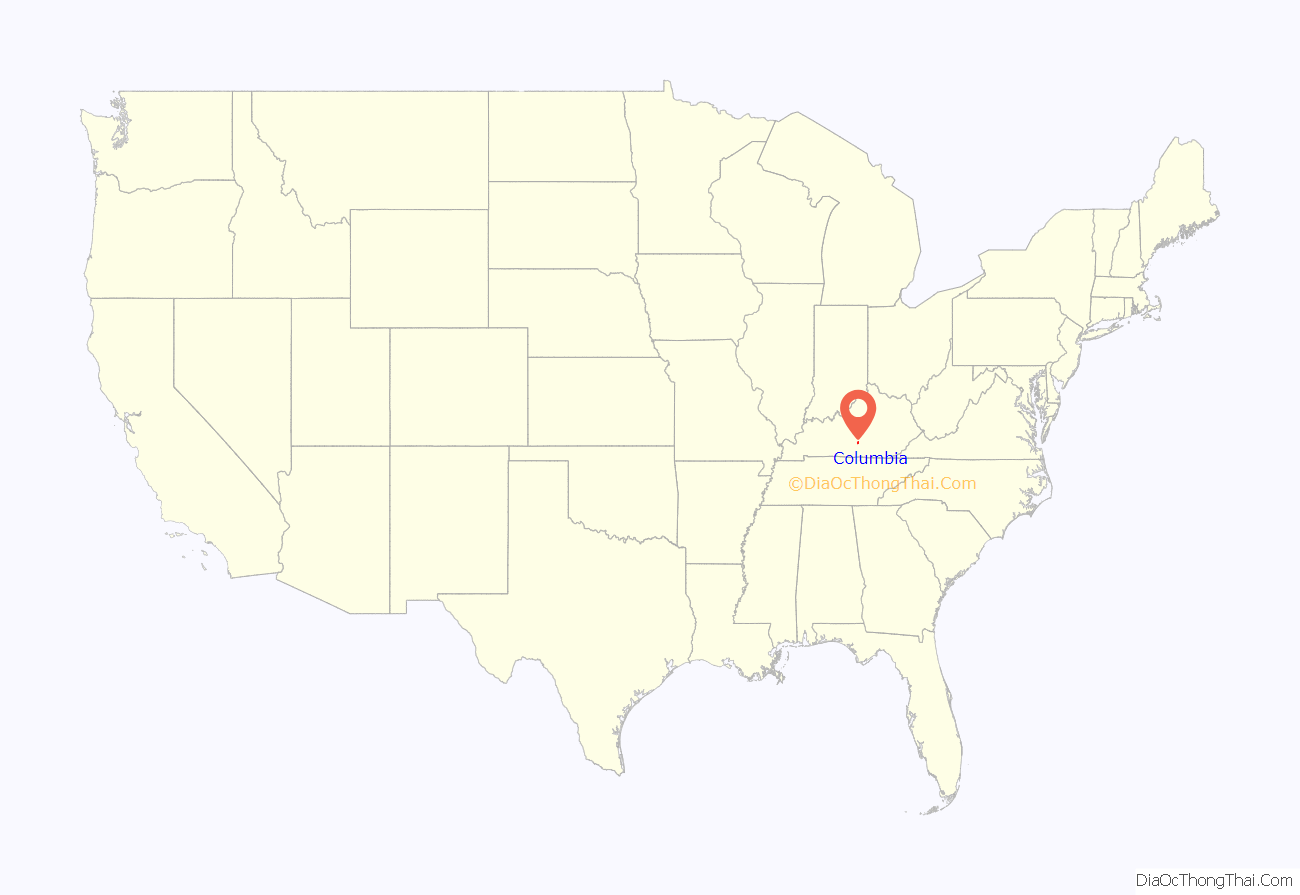
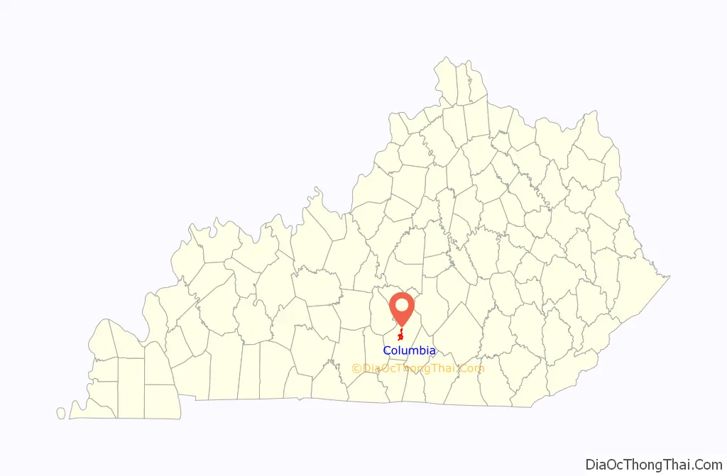
Columbia location map. Where is Columbia city?
History
The area was settled c. 1802 by Daniel Trabue. The post office was opened on April 1, 1806, by John Field, who also ran the local store.
Camp Boyle, located north of the town square, was an important camp and muster site for the Union Army during the Civil War (1861-1865). The 13th Kentucky Cavalry Regiment (Union) was organized in Columbia.
Columbia Road Map
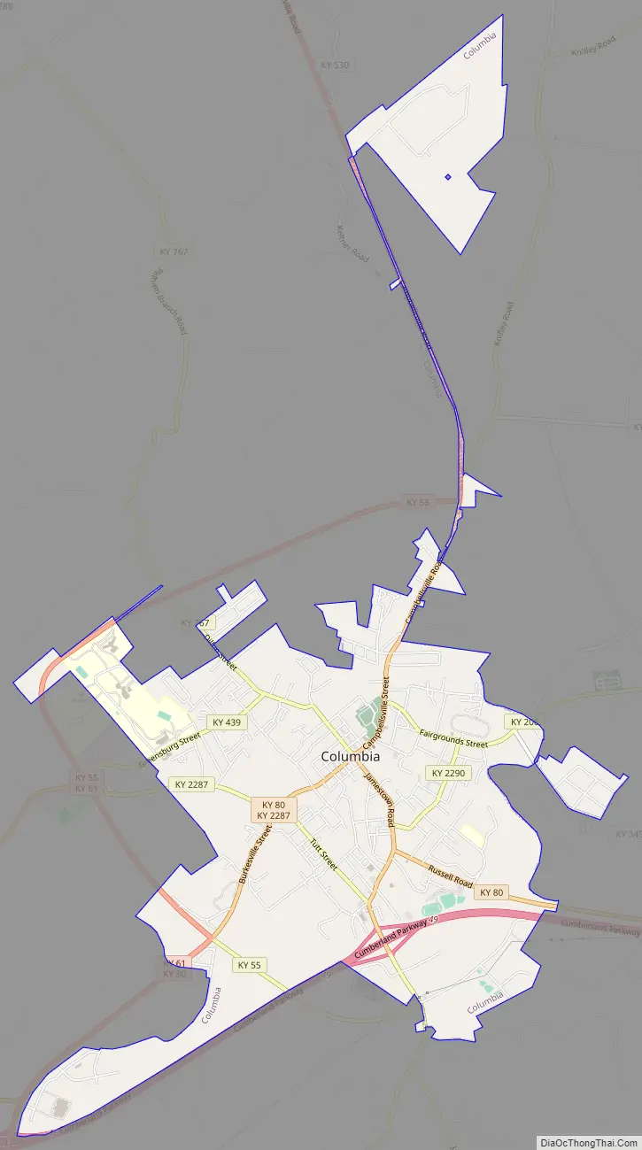
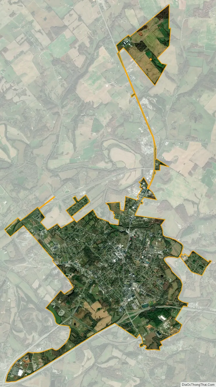
Columbia city Satellite Map
Geography
Columbia is located at 37°6′2″N 85°18′22″W / 37.10056°N 85.30611°W / 37.10056; -85.30611 (37.100652, −85.306056).
According to the United States Census Bureau, the city has a total area of 3.4 square miles (8.9 km), all land.
See also
Map of Kentucky State and its subdivision:- Adair
- Allen
- Anderson
- Ballard
- Barren
- Bath
- Bell
- Boone
- Bourbon
- Boyd
- Boyle
- Bracken
- Breathitt
- Breckinridge
- Bullitt
- Butler
- Caldwell
- Calloway
- Campbell
- Carlisle
- Carroll
- Carter
- Casey
- Christian
- Clark
- Clay
- Clinton
- Crittenden
- Cumberland
- Daviess
- Edmonson
- Elliott
- Estill
- Fayette
- Fleming
- Floyd
- Franklin
- Fulton
- Gallatin
- Garrard
- Grant
- Graves
- Grayson
- Green
- Greenup
- Hancock
- Hardin
- Harlan
- Harrison
- Hart
- Henderson
- Henry
- Hickman
- Hopkins
- Jackson
- Jefferson
- Jessamine
- Johnson
- Kenton
- Knott
- Knox
- Larue
- Laurel
- Lawrence
- Lee
- Leslie
- Letcher
- Lewis
- Lincoln
- Livingston
- Logan
- Lyon
- Madison
- Magoffin
- Marion
- Marshall
- Martin
- Mason
- McCracken
- McCreary
- McLean
- Meade
- Menifee
- Mercer
- Metcalfe
- Monroe
- Montgomery
- Morgan
- Muhlenberg
- Nelson
- Nicholas
- Ohio
- Oldham
- Owen
- Owsley
- Pendleton
- Perry
- Pike
- Powell
- Pulaski
- Robertson
- Rockcastle
- Rowan
- Russell
- Scott
- Shelby
- Simpson
- Spencer
- Taylor
- Todd
- Trigg
- Trimble
- Union
- Warren
- Washington
- Wayne
- Webster
- Whitley
- Wolfe
- Woodford
- Alabama
- Alaska
- Arizona
- Arkansas
- California
- Colorado
- Connecticut
- Delaware
- District of Columbia
- Florida
- Georgia
- Hawaii
- Idaho
- Illinois
- Indiana
- Iowa
- Kansas
- Kentucky
- Louisiana
- Maine
- Maryland
- Massachusetts
- Michigan
- Minnesota
- Mississippi
- Missouri
- Montana
- Nebraska
- Nevada
- New Hampshire
- New Jersey
- New Mexico
- New York
- North Carolina
- North Dakota
- Ohio
- Oklahoma
- Oregon
- Pennsylvania
- Rhode Island
- South Carolina
- South Dakota
- Tennessee
- Texas
- Utah
- Vermont
- Virginia
- Washington
- West Virginia
- Wisconsin
- Wyoming