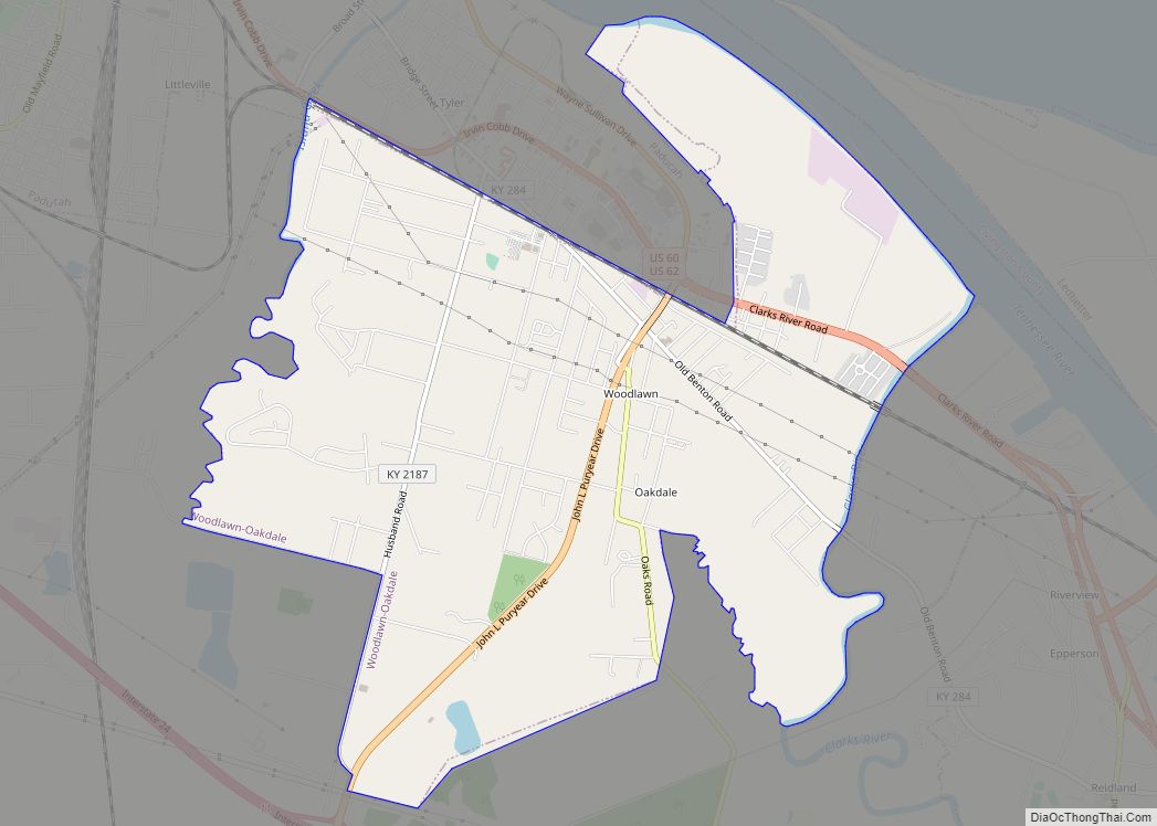
Farley is a census-designated place (CDP) in McCracken County, Kentucky, United States. The population was 4,374 as of the 2020 census, down from 4,701 in 2010. It is part of the Paducah, KY-IL Micropolitan Statistical Area. The area was listed by the U.S. Census Bureau as Woodlawn-Oakdale starting with the 1980 census and as Farley starting with the 2010 census.
| Name: | Farley CDP |
|---|---|
| LSAD Code: | 57 |
| LSAD Description: | CDP (suffix) |
| State: | Kentucky |
| County: | McCracken County |
| Elevation: | 343 ft (105 m) |
| Total Area: | 6.05 sq mi (15.68 km²) |
| Land Area: | 5.94 sq mi (15.39 km²) |
| Water Area: | 0.11 sq mi (0.29 km²) |
| Total Population: | 4,374 |
| Population Density: | 735.99/sq mi (284.16/km²) |
| ZIP code: | 42003 (Paducah) |
| Area code: | 270 & 364 |
| FIPS code: | 2126528 |
Online Interactive Map
Click on ![]() to view map in "full screen" mode.
to view map in "full screen" mode.
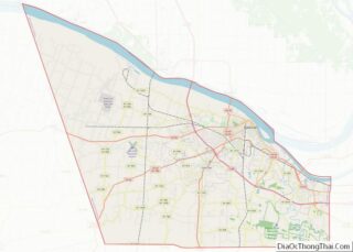
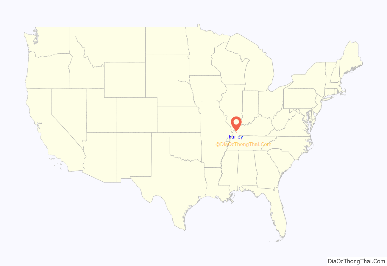
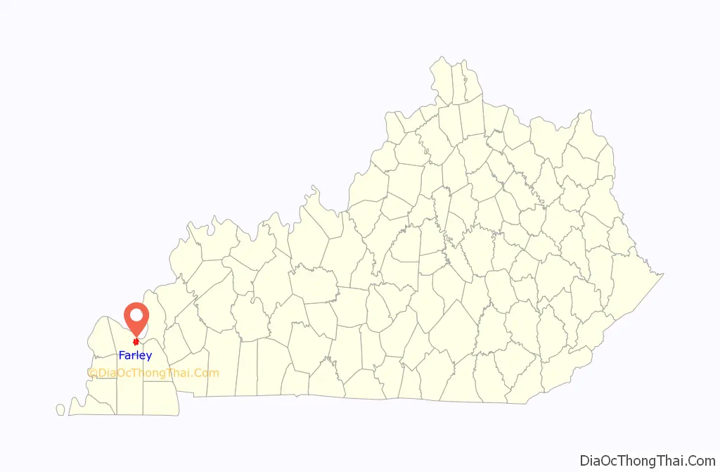
Farley location map. Where is Farley CDP?
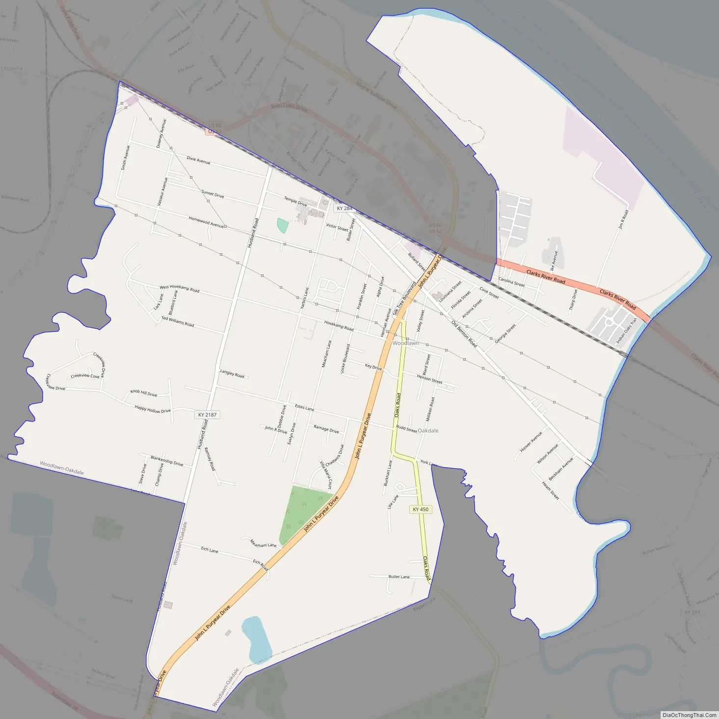
Farley Road Map
Farley city Satellite Map
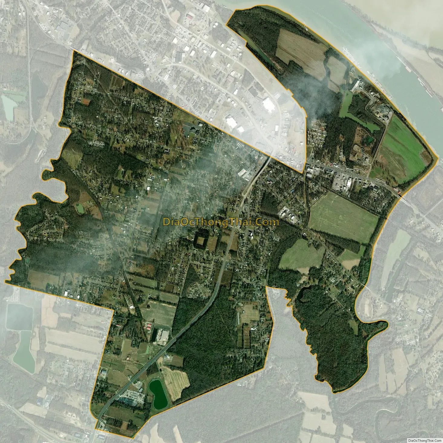
Geography
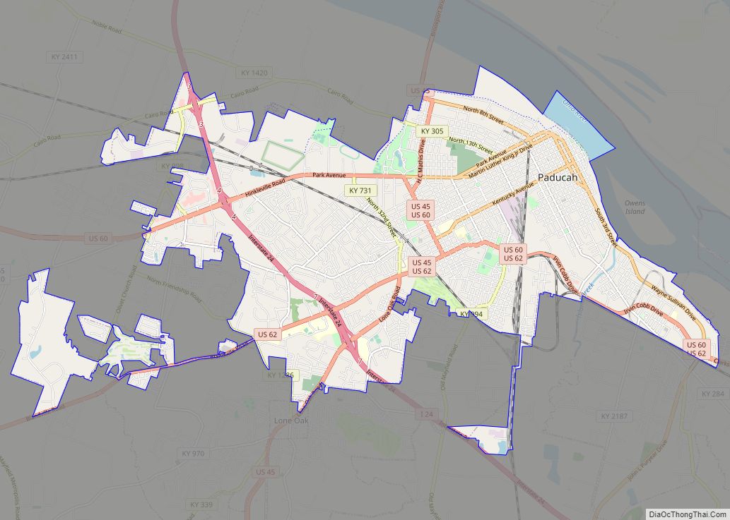
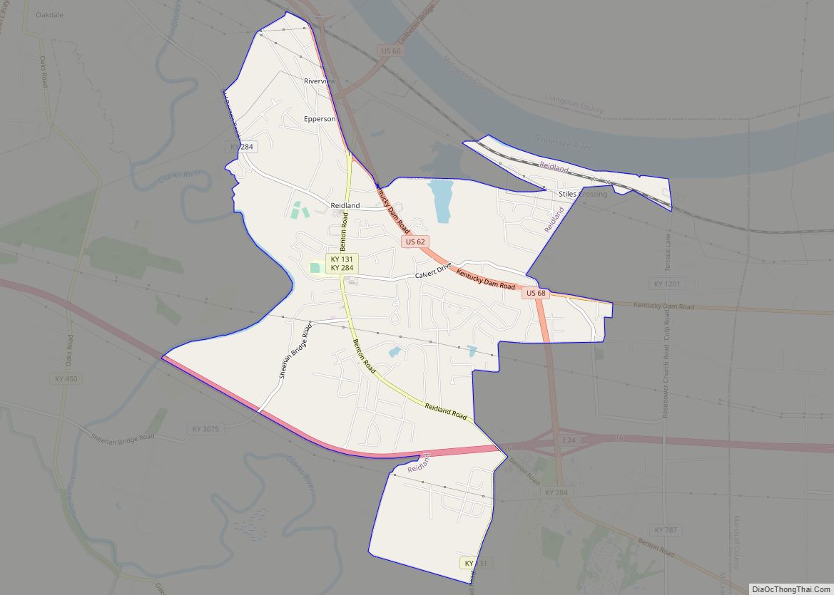
Farley is located in eastern McCracken County at 37°2′38″N 88°34′16″W / 37.04389°N 88.57111°W / 37.04389; -88.57111 (37.043786, −88.571223). It is bordered to the northwest by the city of Paducah and to the northeast by the Tennessee River, less than one mile south of where it joins the Ohio River. The Farley CDP includes the unincorporated communities of Woodlawn and Oakdale.
U.S. Routes 60 and 62 (Clarks River Road) cross the northeast part of Farley together. Both highways lead northwest into Paducah, while US 62 leads southeast 3 miles (5 km) to Reidland and US 60 leads east across the Tennessee River 6 miles (10 km) to Ledbetter.
According to the United States Census Bureau, the Farley CDP has a total area of 6.05 square miles (15.7 km), of which 5.91 square miles (15.3 km) are land and 0.14 square miles (0.36 km), or 2.35%, are water.
See also
Map of Kentucky State and its subdivision:- Adair
- Allen
- Anderson
- Ballard
- Barren
- Bath
- Bell
- Boone
- Bourbon
- Boyd
- Boyle
- Bracken
- Breathitt
- Breckinridge
- Bullitt
- Butler
- Caldwell
- Calloway
- Campbell
- Carlisle
- Carroll
- Carter
- Casey
- Christian
- Clark
- Clay
- Clinton
- Crittenden
- Cumberland
- Daviess
- Edmonson
- Elliott
- Estill
- Fayette
- Fleming
- Floyd
- Franklin
- Fulton
- Gallatin
- Garrard
- Grant
- Graves
- Grayson
- Green
- Greenup
- Hancock
- Hardin
- Harlan
- Harrison
- Hart
- Henderson
- Henry
- Hickman
- Hopkins
- Jackson
- Jefferson
- Jessamine
- Johnson
- Kenton
- Knott
- Knox
- Larue
- Laurel
- Lawrence
- Lee
- Leslie
- Letcher
- Lewis
- Lincoln
- Livingston
- Logan
- Lyon
- Madison
- Magoffin
- Marion
- Marshall
- Martin
- Mason
- McCracken
- McCreary
- McLean
- Meade
- Menifee
- Mercer
- Metcalfe
- Monroe
- Montgomery
- Morgan
- Muhlenberg
- Nelson
- Nicholas
- Ohio
- Oldham
- Owen
- Owsley
- Pendleton
- Perry
- Pike
- Powell
- Pulaski
- Robertson
- Rockcastle
- Rowan
- Russell
- Scott
- Shelby
- Simpson
- Spencer
- Taylor
- Todd
- Trigg
- Trimble
- Union
- Warren
- Washington
- Wayne
- Webster
- Whitley
- Wolfe
- Woodford
- Alabama
- Alaska
- Arizona
- Arkansas
- California
- Colorado
- Connecticut
- Delaware
- District of Columbia
- Florida
- Georgia
- Hawaii
- Idaho
- Illinois
- Indiana
- Iowa
- Kansas
- Kentucky
- Louisiana
- Maine
- Maryland
- Massachusetts
- Michigan
- Minnesota
- Mississippi
- Missouri
- Montana
- Nebraska
- Nevada
- New Hampshire
- New Jersey
- New Mexico
- New York
- North Carolina
- North Dakota
- Ohio
- Oklahoma
- Oregon
- Pennsylvania
- Rhode Island
- South Carolina
- South Dakota
- Tennessee
- Texas
- Utah
- Vermont
- Virginia
- Washington
- West Virginia
- Wisconsin
- Wyoming