Grayson is a home rule-class city in and the county seat of Carter County, Kentucky, United States, on US Route 60 and Interstate 64 in the state’s northeastern region. It is approximately 21 miles west of Ashland. Within the city limits, the population was 4,217 at the 2010 census. Along with Carter County, the city is closely associated with the nearby Huntington-Ashland, WV-KY-OH Metropolitan Statistical Area and is often erroneously included in the MSA being just 9 miles west of the M.S.A’s western boundary.
The city has grown in size substantially since the opening of Interstate 64 in 1975 through Carter County. Immediately afterwards, Grayson experienced several years of commercial sector growth, mainly to serve the Interstate 64 traffic. Since 1990, the city has also seen significant growth in the residential sector with the Interstate making for a faster trip to and from Ashland. Beginning in 1995, AA Highway terminates in Grayson making the city a gateway to the Huntington-Ashland urban area.
| Name: | Grayson city |
|---|---|
| LSAD Code: | 25 |
| LSAD Description: | city (suffix) |
| State: | Kentucky |
| County: | Carter County |
| Elevation: | 633 ft (193 m) |
| Total Area: | 2.83 sq mi (7.32 km²) |
| Land Area: | 2.77 sq mi (7.17 km²) |
| Water Area: | 0.06 sq mi (0.15 km²) |
| Total Population: | 3,834 |
| Population Density: | 1,384.12/sq mi (534.47/km²) |
| ZIP code: | 41143 |
| Area code: | 606 |
| FIPS code: | 2132572 |
| GNISfeature ID: | 0493221 |
| Website: | graysonky.net |
Online Interactive Map
Click on ![]() to view map in "full screen" mode.
to view map in "full screen" mode.
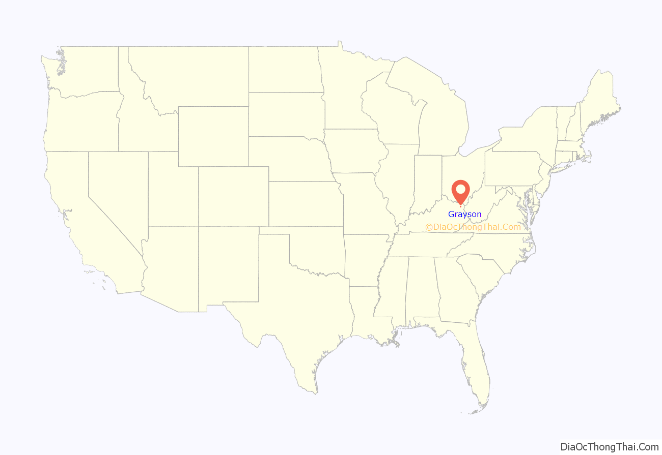
Grayson location map. Where is Grayson city?

History
After the Revolutionary War, George Washington’s aide-de-camp Col. William Grayson received a 70,000-acre (280 km) tract of land for his service during the war from the state of Virginia. By 1838, a small portion of this tract was set aside for the development of a town named for him. Although Grayson had only five streets and eighty lots, it was established by the General Assembly on February 6, 1844, and it was incorporated on February 22, 1860. Grayson, Kentucky was a stop on the Eastern Kentucky Railway.
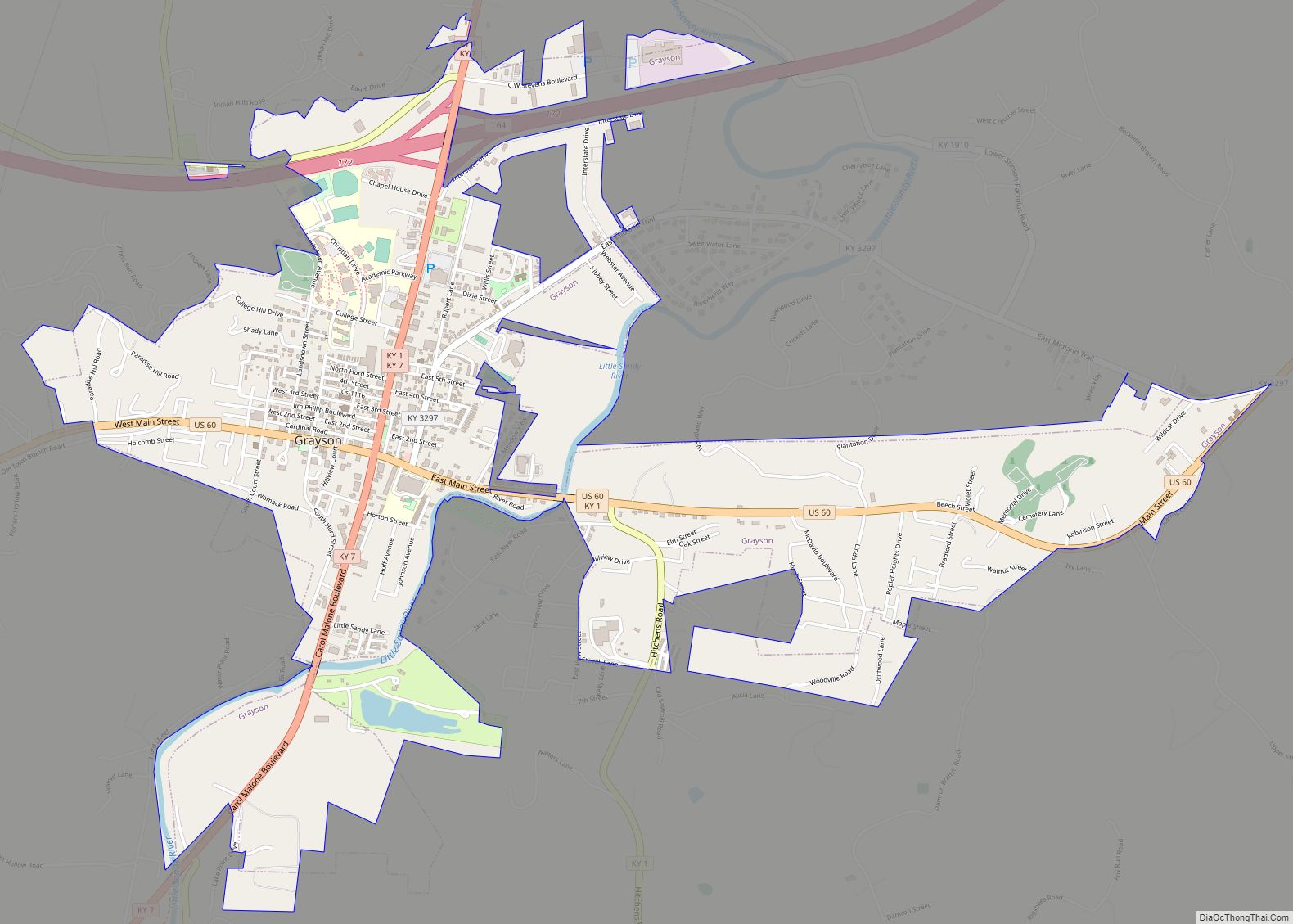
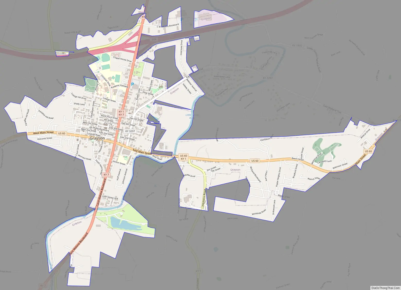
Grayson Road Map
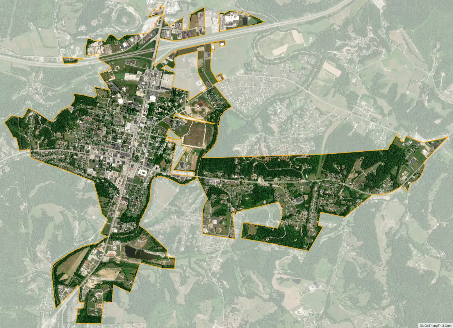
Grayson city Satellite Map
Geography
Grayson is located in east-central Carter County at 38°20′5″N 82°56′33″W / 38.33472°N 82.94250°W / 38.33472; -82.94250 (38.334738, -82.942368), along the Little Sandy River, a tributary of the Ohio River.
Route 60 passes through the city as Main Street and is intersected in downtown by Kentucky Routes 1 and 7 (Carol Malone Boulevard). Interstate 64 runs through the northern end of the city, with access to KY 7 at Exit 172. Kentucky Route 9, the AA Highway, begins from KY 1-and-7 just north of the city limits and runs 111 miles (179 km) to the Cincinnati area. Huntington, West Virginia, is 29 miles (47 km) east of Grayson via I-64, and Lexington is 96 miles (154 km) to the west.
According to the United States Census Bureau, Grayson has a total area of 2.9 square miles (7.5 km), of which 2.8 square miles (7.3 km) is land and 0.039 square miles (0.1 km), or 1.95%, is water.
Climate
The climate in this area is characterized by hot, humid summers and generally mild to cool winters. According to the Köppen Climate Classification system, Grayson has a humid subtropical climate, abbreviated “Cfa” on climate maps. Since 2002, nine different severe storms have struck Grayson, with each storm causing enough damage to warrant federal assistance for disaster recovery.
See also
Map of Kentucky State and its subdivision:- Adair
- Allen
- Anderson
- Ballard
- Barren
- Bath
- Bell
- Boone
- Bourbon
- Boyd
- Boyle
- Bracken
- Breathitt
- Breckinridge
- Bullitt
- Butler
- Caldwell
- Calloway
- Campbell
- Carlisle
- Carroll
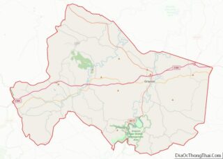
- Carter
- Casey
- Christian
- Clark
- Clay
- Clinton
- Crittenden
- Cumberland
- Daviess
- Edmonson
- Elliott
- Estill
- Fayette
- Fleming
- Floyd
- Franklin
- Fulton
- Gallatin
- Garrard
- Grant
- Graves
- Grayson
- Green
- Greenup
- Hancock
- Hardin
- Harlan
- Harrison
- Hart
- Henderson
- Henry
- Hickman
- Hopkins
- Jackson
- Jefferson
- Jessamine
- Johnson
- Kenton
- Knott
- Knox
- Larue
- Laurel
- Lawrence
- Lee
- Leslie
- Letcher
- Lewis
- Lincoln
- Livingston
- Logan
- Lyon
- Madison
- Magoffin
- Marion
- Marshall
- Martin
- Mason
- McCracken
- McCreary
- McLean
- Meade
- Menifee
- Mercer
- Metcalfe
- Monroe
- Montgomery
- Morgan
- Muhlenberg
- Nelson
- Nicholas
- Ohio
- Oldham
- Owen
- Owsley
- Pendleton
- Perry
- Pike
- Powell
- Pulaski
- Robertson
- Rockcastle
- Rowan
- Russell
- Scott
- Shelby
- Simpson
- Spencer
- Taylor
- Todd
- Trigg
- Trimble
- Union
- Warren
- Washington
- Wayne
- Webster
- Whitley
- Wolfe
- Woodford
- Alabama
- Alaska
- Arizona
- Arkansas
- California
- Colorado
- Connecticut
- Delaware
- District of Columbia
- Florida
- Georgia
- Hawaii
- Idaho
- Illinois
- Indiana
- Iowa
- Kansas
- Kentucky
- Louisiana
- Maine
- Maryland
- Massachusetts
- Michigan
- Minnesota
- Mississippi
- Missouri
- Montana
- Nebraska
- Nevada
- New Hampshire
- New Jersey
- New Mexico
- New York
- North Carolina
- North Dakota
- Ohio
- Oklahoma
- Oregon
- Pennsylvania
- Rhode Island
- South Carolina
- South Dakota
- Tennessee
- Texas
- Utah
- Vermont
- Virginia
- Washington
- West Virginia
- Wisconsin
- Wyoming