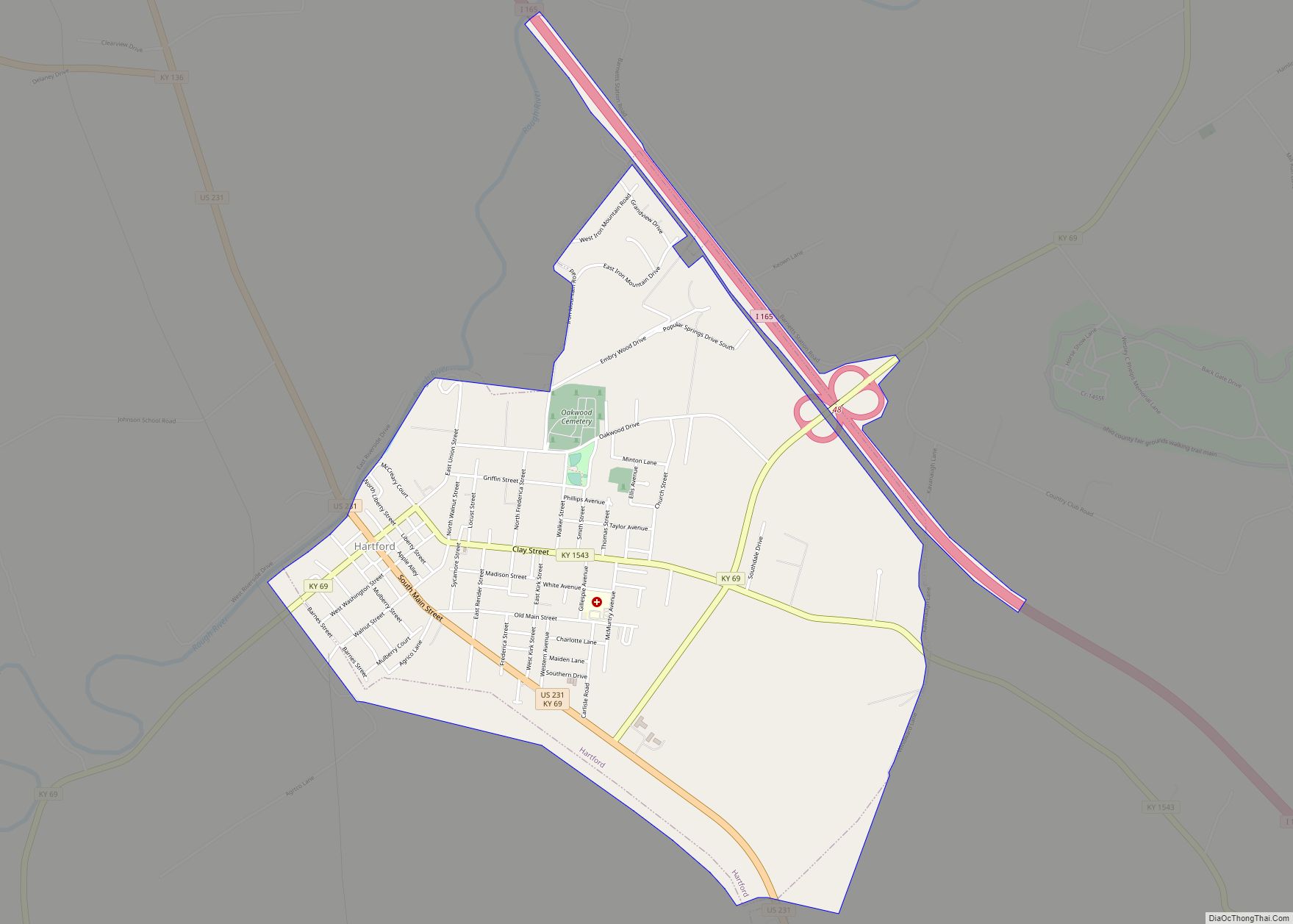
Hartford is a home rule-class city in Ohio County, Kentucky, in the United States. It is the seat of its county. The population was 2,668 at the 2020 census. The town slogan, “Home of 2,000 happy people and a few soreheads” welcomes visitors when entering the community. The Hartford, Kentucky website explains that ‘”soreheads’ are community-minded, progressive citizens who work to promote civic pride”.
| Name: | Hartford city |
|---|---|
| LSAD Code: | 25 |
| LSAD Description: | city (suffix) |
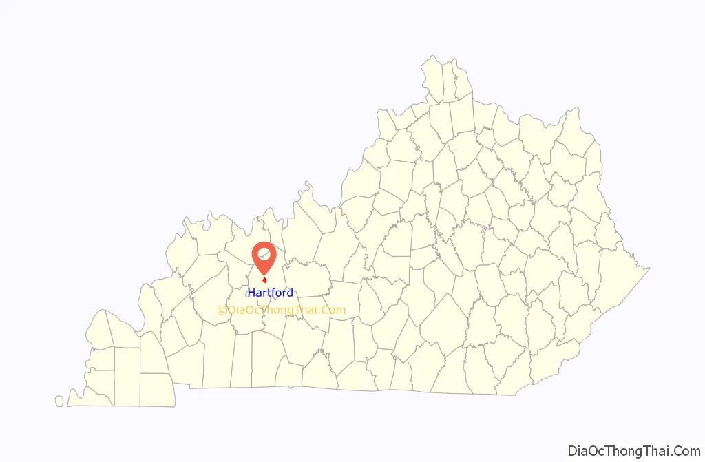
| State: | Kentucky |
| County: | Ohio County |
| Incorporated: | Hartford, 1808 |
| Elevation: | 417 ft (127 m) |
| Total Area: | 2.86 sq mi (7.40 km²) |
| Land Area: | 2.84 sq mi (7.35 km²) |
| Water Area: | 0.02 sq mi (0.05 km²) |
| Total Population: | 2,668 |
| Population Density: | 940.43/sq mi (363.10/km²) |
| ZIP code: | 42347 |
| Area code: | 270 & 364 |
| FIPS code: | 2135020 |
| GNISfeature ID: | 0493841 |
| Website: | https://hartfordky.org/ |
Online Interactive Map
Click on ![]() to view map in "full screen" mode.
to view map in "full screen" mode.
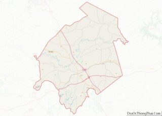
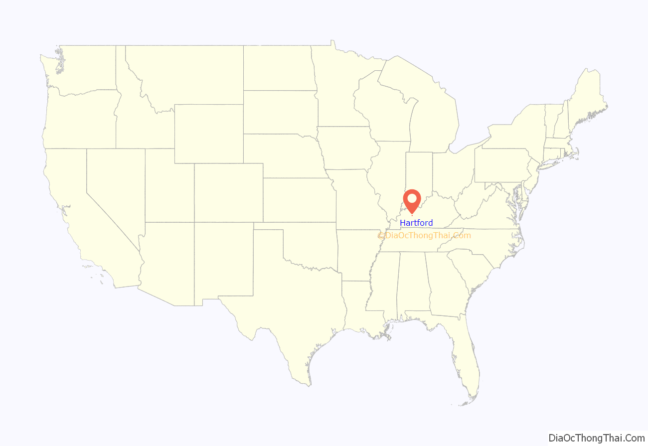
Hartford location map. Where is Hartford city?
History
The town was initially part of a 4000-acre grant from Virginia to Gabriel Madison. The area was surveyed in 1782 and settled before 1790. Fort Hartford (also known as Hartford Station) grew up around the head of navigation on the Rough River, which the bridge crossing that river is called the Fort Hartford Bridge. About the town, It initially faced Indian attacks but was named the seat of Ohio County the year after its formation in 1798 in exchange for a grant of land from Mr. Madison. The post office was established as Hartford Court House in 1801 and the settlement was formally incorporated by the state assembly in 1808.
An account written in the early 1800s by a William Smithers relates that he and several other settlers helped build “a fort at Hartford on Rough Creek” in 1782-83, which local tradition asserts was the first permanent settlement in Ohio County and the entire lower Green River Valley. It is believed to have consisted of a stockade and small log buildings on the bluff above the Rough River now occupied by Hartford’s water plant. Although many believe the town’s name refers to a ford on the Rough River (a large tributary of the Green River then known as Rough Creek), and an early settler who operated a ferry there, the name’s origin remains uncertain.
The town’s second courthouse was burned during the Civil War by Confederate Gen. Hylan B. Lyon on December 20, 1864.
The town was finally connected to the L&N network in 1909.
Downtown Historic District of Hartford
The Downtown Hartford Historic District consists of 18 locations occupying the courthouse square, approximately two blocks on Main St. and E. Union St. north of the square, and three properties immediately south and east of the courthouse. All except one location, a circa 1870 brick house, are commercial and institutional buildings representing three architecturally distinct periods: the late nineteenth to early twentieth century, 1920 to 1930, and the late 1930s to early 1940s. The earliest group of commercial buildings includes the district’s only two constructed of wood; in addition, four are of masonry construction, including two with cast iron fronts. Among the five buildings representing the decade ending in 1930, one dates to the late nineteenth century but had its main façade reconstructed in the 1920s. From the late Depression years, two buildings were private endeavors and three were the result of a federally sponsored public works program. Most of the buildings are two stories tall, although a few are a single story and the courthouse is two stories on a full raised basement.
Several elements of the Downtown Hartford Historic District, including the courthouse, jail and main block of the Hartford City Hall, remain virtually intact on the exterior. As in most downtowns, however, storefronts have suffered the greatest changes. Fortunately, most of the upper elevations of these buildings have been well preserved so that the district’s streetscape retains its historic character. Despite alterations, the district remains a visually distinct entity due to the extensively renovated older buildings and new construction that define its edges.
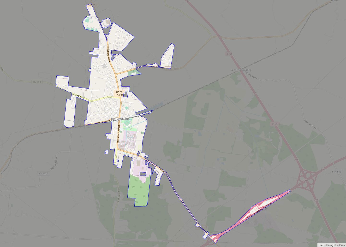
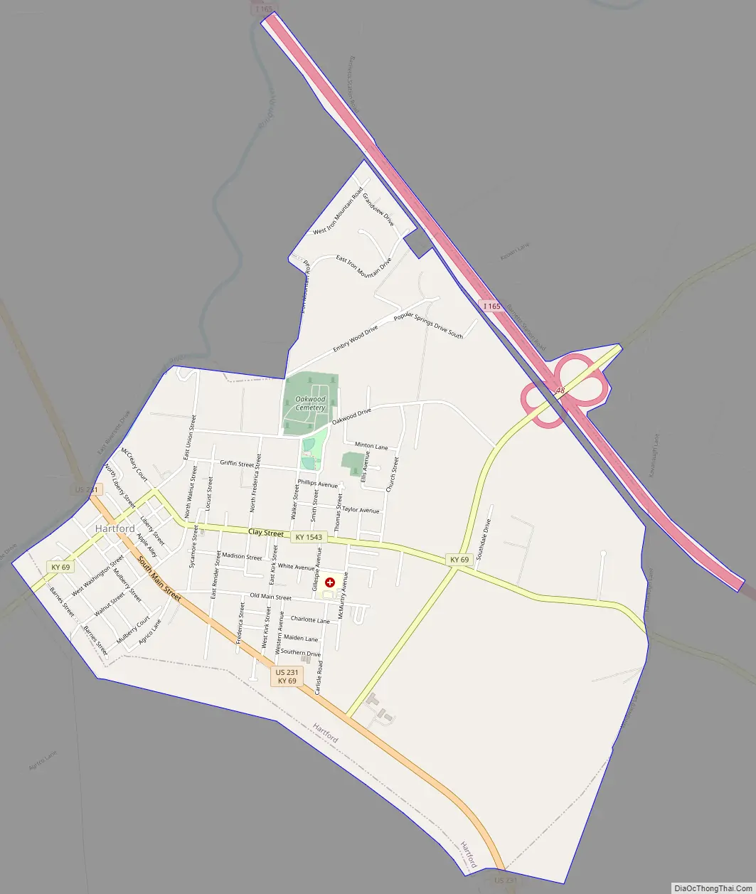
Hartford Road Map
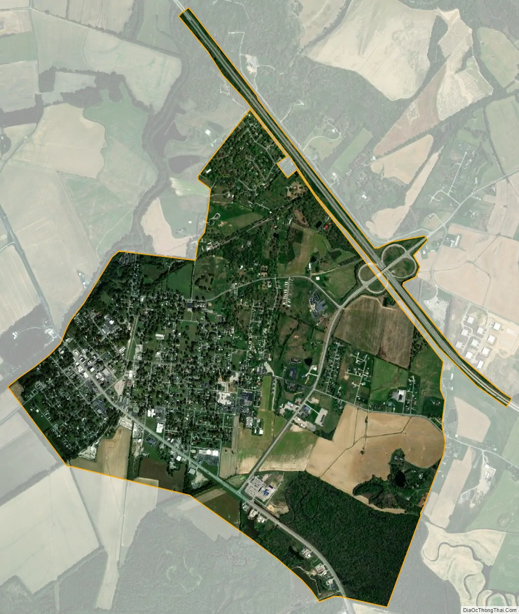
Hartford city Satellite Map
Geography
Hartford is located at 37°27′1″N 86°54′7″W / 37.45028°N 86.90194°W / 37.45028; -86.90194 (37.450415, -86.902026).
With a population of approximately 2,000, Hartford is the county seat of Ohio County, Kentucky, which is in the eastern end of Kentucky’s western coal fields and geographically one of the state’s largest counties. The town covers approximately 1.8 square miles on the southeast bank of the Rough River a few miles southwest of the center of the county. Its gently rolling terrain characteristic of the county overall is laid out primarily in a somewhat irregular grid interrupted by rural roads at its northern reaches and U.S. 231, the town’s major access, near its southern boundary. Hartford’s oldest and most densely developed portion is its western area along the Rough River which continues to display the town’s original early nineteenth-century plan in its grid of small square and larger rectangular blocks.
According to the United States Census Bureau, the city has a total area of 2.6 square miles (6.7 km), all land.
See also
Map of Kentucky State and its subdivision:- Adair
- Allen
- Anderson
- Ballard
- Barren
- Bath
- Bell
- Boone
- Bourbon
- Boyd
- Boyle
- Bracken
- Breathitt
- Breckinridge
- Bullitt
- Butler
- Caldwell
- Calloway
- Campbell
- Carlisle
- Carroll
- Carter
- Casey
- Christian
- Clark
- Clay
- Clinton
- Crittenden
- Cumberland
- Daviess
- Edmonson
- Elliott
- Estill
- Fayette
- Fleming
- Floyd
- Franklin
- Fulton
- Gallatin
- Garrard
- Grant
- Graves
- Grayson
- Green
- Greenup
- Hancock
- Hardin
- Harlan
- Harrison
- Hart
- Henderson
- Henry
- Hickman
- Hopkins
- Jackson
- Jefferson
- Jessamine
- Johnson
- Kenton
- Knott
- Knox
- Larue
- Laurel
- Lawrence
- Lee
- Leslie
- Letcher
- Lewis
- Lincoln
- Livingston
- Logan
- Lyon
- Madison
- Magoffin
- Marion
- Marshall
- Martin
- Mason
- McCracken
- McCreary
- McLean
- Meade
- Menifee
- Mercer
- Metcalfe
- Monroe
- Montgomery
- Morgan
- Muhlenberg
- Nelson
- Nicholas
- Ohio
- Oldham
- Owen
- Owsley
- Pendleton
- Perry
- Pike
- Powell
- Pulaski
- Robertson
- Rockcastle
- Rowan
- Russell
- Scott
- Shelby
- Simpson
- Spencer
- Taylor
- Todd
- Trigg
- Trimble
- Union
- Warren
- Washington
- Wayne
- Webster
- Whitley
- Wolfe
- Woodford
- Alabama
- Alaska
- Arizona
- Arkansas
- California
- Colorado
- Connecticut
- Delaware
- District of Columbia
- Florida
- Georgia
- Hawaii
- Idaho
- Illinois
- Indiana
- Iowa
- Kansas
- Kentucky
- Louisiana
- Maine
- Maryland
- Massachusetts
- Michigan
- Minnesota
- Mississippi
- Missouri
- Montana
- Nebraska
- Nevada
- New Hampshire
- New Jersey
- New Mexico
- New York
- North Carolina
- North Dakota
- Ohio
- Oklahoma
- Oregon
- Pennsylvania
- Rhode Island
- South Carolina
- South Dakota
- Tennessee
- Texas
- Utah
- Vermont
- Virginia
- Washington
- West Virginia
- Wisconsin
- Wyoming