Lawrenceburg is a home rule-class city in Anderson County, Kentucky, United States. The population was 10,505 at the 2010 census. It is the seat of its county. Lawrenceburg is part of the Frankfort, Kentucky, micropolitan statistical area.
| Name: | Lawrenceburg city |
|---|---|
| LSAD Code: | 25 |
| LSAD Description: | city (suffix) |
| State: | Kentucky |
| County: | Anderson County |
| Incorporated: | 1850 |
| Elevation: | 787 ft (240 m) |
| Total Area: | 6.05 sq mi (15.66 km²) |
| Land Area: | 6.02 sq mi (15.60 km²) |
| Water Area: | 0.03 sq mi (0.07 km²) |
| Total Population: | 11,728 |
| Population Density: | 1,947.53/sq mi (751.94/km²) |
| ZIP code: | 40342 |
| Area code: | 502 |
| FIPS code: | 2144146 |
| GNISfeature ID: | 496081 |
| Website: | www.lawrenceburgky.org |
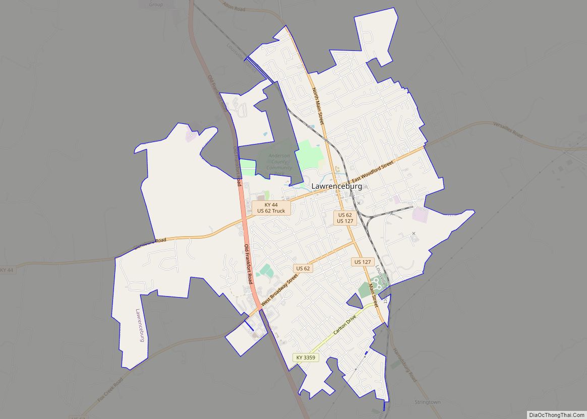
Online Interactive Map
Click on ![]() to view map in "full screen" mode.
to view map in "full screen" mode.
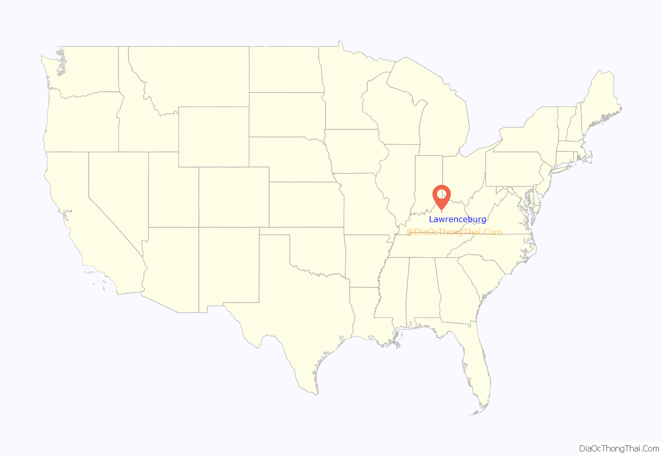
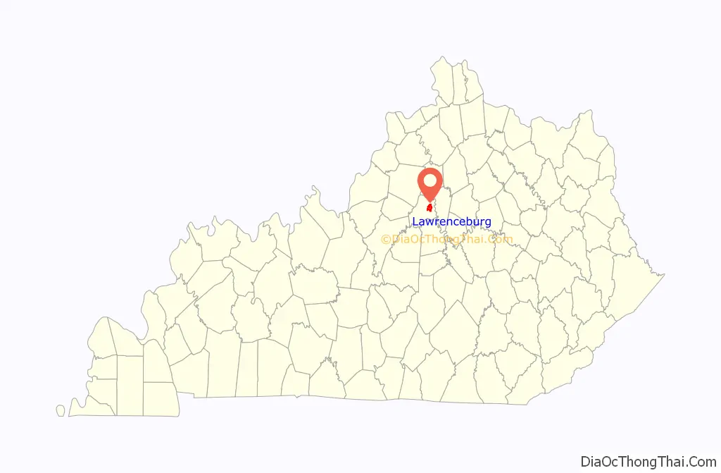
Lawrenceburg location map. Where is Lawrenceburg city?
History
The site of Lawrenceburg was settled in the early 1780s by a German immigrant named Jacob Kaufman and was first called Kaufman’s or Coffman’s Station. The post office was established as Lawrenceburgh on January 22, 1817, for William Lawrence, a local tavern owner. The community was incorporated as Lawrence in 1820 by the Court of Franklin County (of which it was then a part) but renamed Lawrenceburg in 1827. James Lawrence, a naval officer, is the namesake.
The city was formally incorporated by the state assembly in 1850.
The Four Roses distillery in Lawrenceburg was founded in 1888 and the physical distillery was built in 1910 in Spanish Mission-style architecture, and it is listed on the National Register of Historic Places. The Wild Turkey bourbon distillery is also located in Lawrenceburg.
Lawrenceburg Road Map
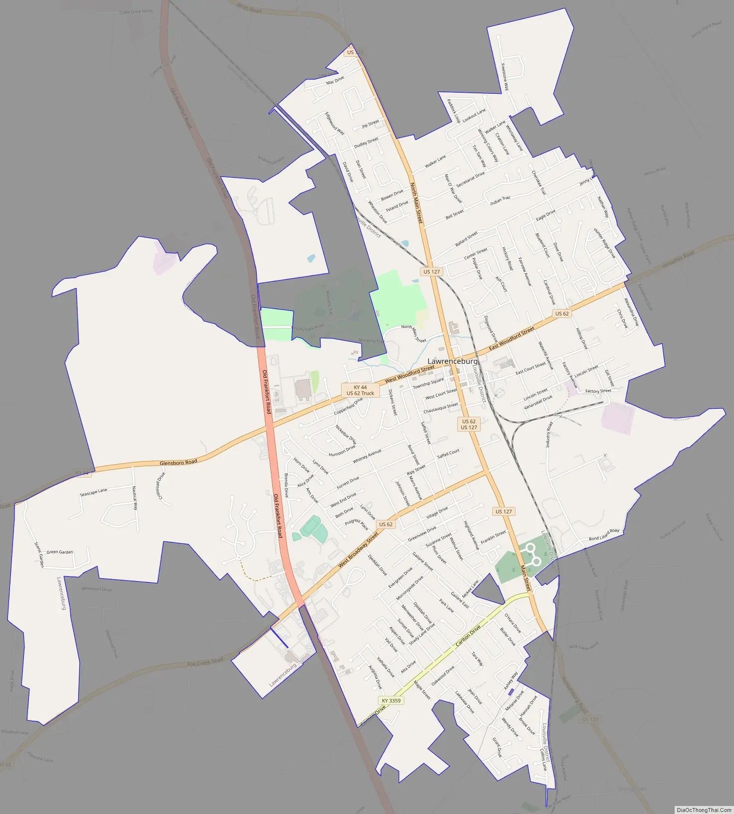
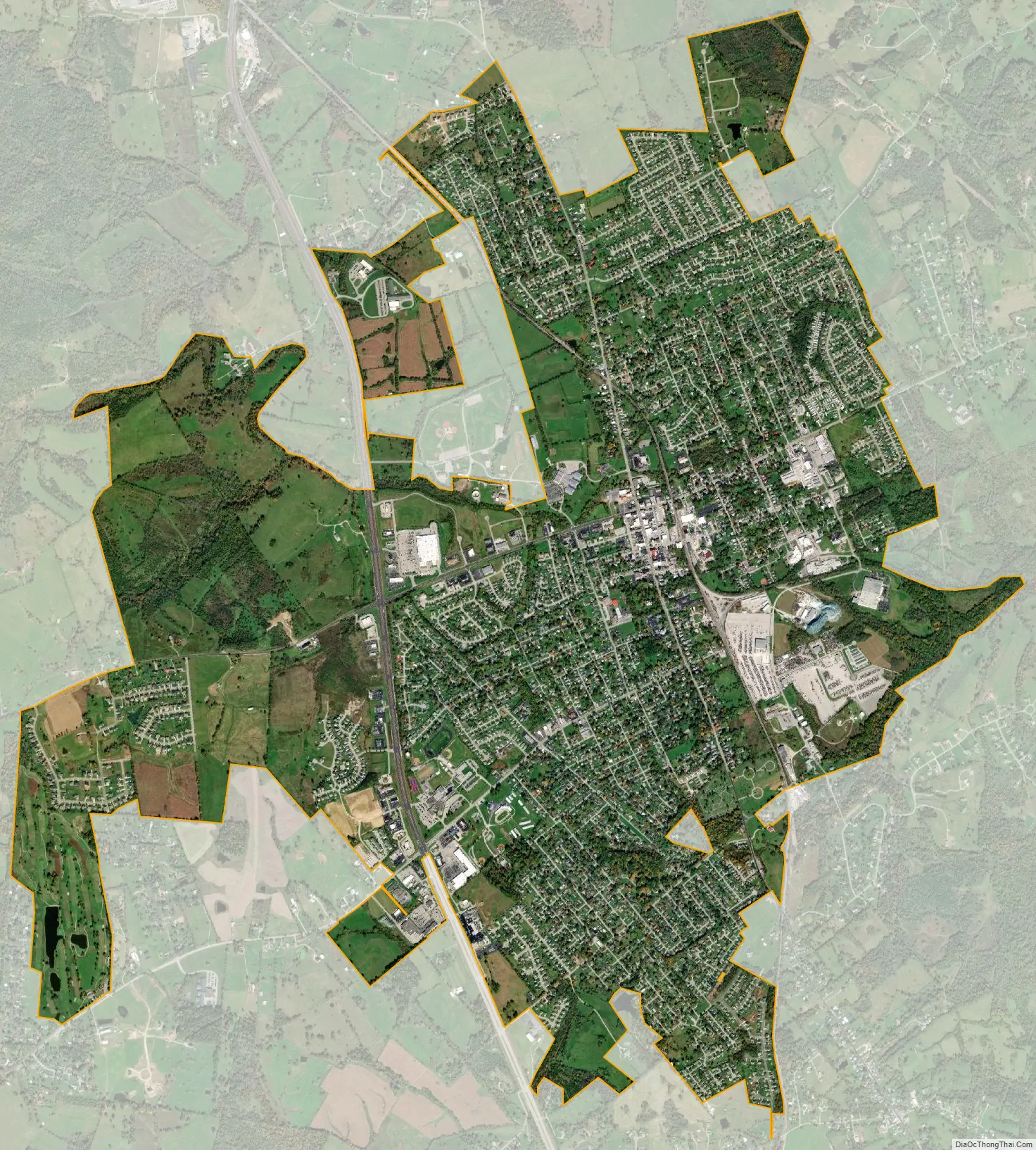
Lawrenceburg city Satellite Map
Geography
According to the United States Census Bureau, the city has a total area of 3.7 square miles (9.6 km), all land.
See also
Map of Kentucky State and its subdivision:- Adair
- Allen
- Anderson
- Ballard
- Barren
- Bath
- Bell
- Boone
- Bourbon
- Boyd
- Boyle
- Bracken
- Breathitt
- Breckinridge
- Bullitt
- Butler
- Caldwell
- Calloway
- Campbell
- Carlisle
- Carroll
- Carter
- Casey
- Christian
- Clark
- Clay
- Clinton
- Crittenden
- Cumberland
- Daviess
- Edmonson
- Elliott
- Estill
- Fayette
- Fleming
- Floyd
- Franklin
- Fulton
- Gallatin
- Garrard
- Grant
- Graves
- Grayson
- Green
- Greenup
- Hancock
- Hardin
- Harlan
- Harrison
- Hart
- Henderson
- Henry
- Hickman
- Hopkins
- Jackson
- Jefferson
- Jessamine
- Johnson
- Kenton
- Knott
- Knox
- Larue
- Laurel
- Lawrence
- Lee
- Leslie
- Letcher
- Lewis
- Lincoln
- Livingston
- Logan
- Lyon
- Madison
- Magoffin
- Marion
- Marshall
- Martin
- Mason
- McCracken
- McCreary
- McLean
- Meade
- Menifee
- Mercer
- Metcalfe
- Monroe
- Montgomery
- Morgan
- Muhlenberg
- Nelson
- Nicholas
- Ohio
- Oldham
- Owen
- Owsley
- Pendleton
- Perry
- Pike
- Powell
- Pulaski
- Robertson
- Rockcastle
- Rowan
- Russell
- Scott
- Shelby
- Simpson
- Spencer
- Taylor
- Todd
- Trigg
- Trimble
- Union
- Warren
- Washington
- Wayne
- Webster
- Whitley
- Wolfe
- Woodford
- Alabama
- Alaska
- Arizona
- Arkansas
- California
- Colorado
- Connecticut
- Delaware
- District of Columbia
- Florida
- Georgia
- Hawaii
- Idaho
- Illinois
- Indiana
- Iowa
- Kansas
- Kentucky
- Louisiana
- Maine
- Maryland
- Massachusetts
- Michigan
- Minnesota
- Mississippi
- Missouri
- Montana
- Nebraska
- Nevada
- New Hampshire
- New Jersey
- New Mexico
- New York
- North Carolina
- North Dakota
- Ohio
- Oklahoma
- Oregon
- Pennsylvania
- Rhode Island
- South Carolina
- South Dakota
- Tennessee
- Texas
- Utah
- Vermont
- Virginia
- Washington
- West Virginia
- Wisconsin
- Wyoming