Oak Grove is a home rule-class city adjacent to the Fort Campbell army base in Christian County, Kentucky, in the United States. The population was 7,489 as of the 2010 U.S. Census. It is part of the Clarksville, Tennessee metropolitan area.
| Name: | Oak Grove city |
|---|---|
| LSAD Code: | 25 |
| LSAD Description: | city (suffix) |
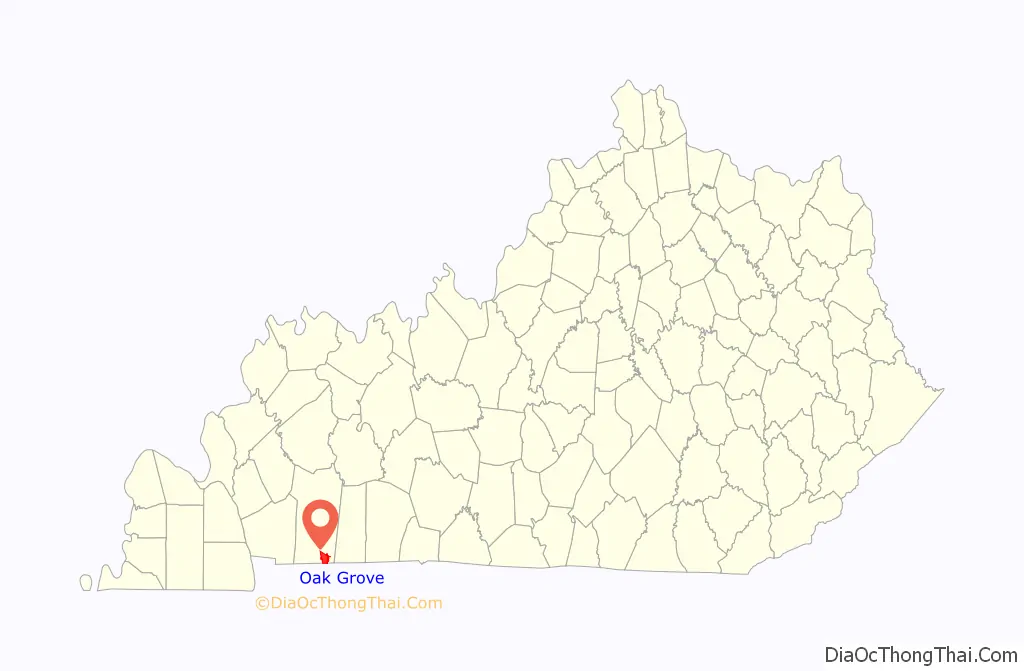
| State: | Kentucky |
| County: | Christian County |
| Incorporated: | 1974 |
| Elevation: | 541 ft (165 m) |
| Total Area: | 10.74 sq mi (27.82 km²) |
| Land Area: | 10.71 sq mi (27.74 km²) |
| Water Area: | 0.03 sq mi (0.08 km²) |
| Total Population: | 7,931 |
| Population Density: | 740.59/sq mi (285.94/km²) |
| ZIP code: | 42262 |
| Area code: | 270 & 364 |
| FIPS code: | 2157090 |
| GNISfeature ID: | 0499655 |
| Website: | www.oakgroveky.org |
Online Interactive Map
Click on ![]() to view map in "full screen" mode.
to view map in "full screen" mode.
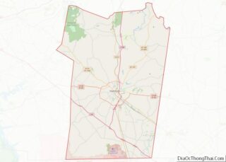
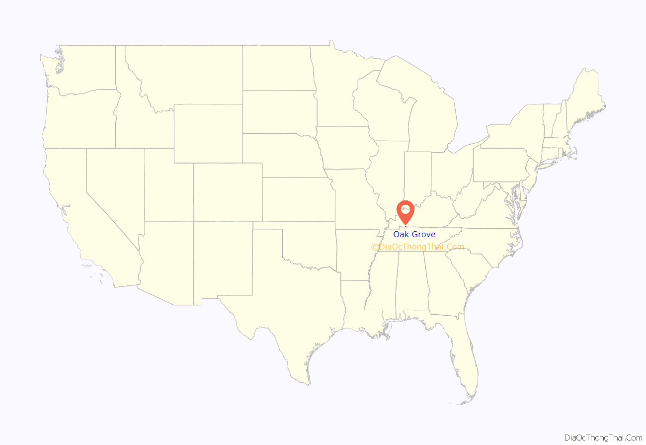
Oak Grove location map. Where is Oak Grove city?
History
The first post office in Oak Grove was established in 1828. The community was named for oak trees near the original town site. The Clarksville Railroad was extended to Oak Grove in the 19th century.
With construction of nearby Fort Campbell in the Second World War, Oak Grove’s population grew. The city was incorporated by the state legislature on September 24, 1974.
1994 New Life Massage Place murders
22 year old Candy Belt and 18 year old Gloria Ross were both massage therapist who secretly worked as prostitutes at the New Life Massage Place run by Tammy Papler. At 4am on September 20, 1994 the two women were found by other employees shot, stabbed and killed with their bodies placed in a storeroom where it was discovered by other employees. The employees complained of police harassment, attempts at blackmail and extortion, as well as police expecting services from the prostitutes. In 2013, 3 men were charged with the killings, 2 former police officers, and they were found guilty. In 2017, all 3 were acquitted.
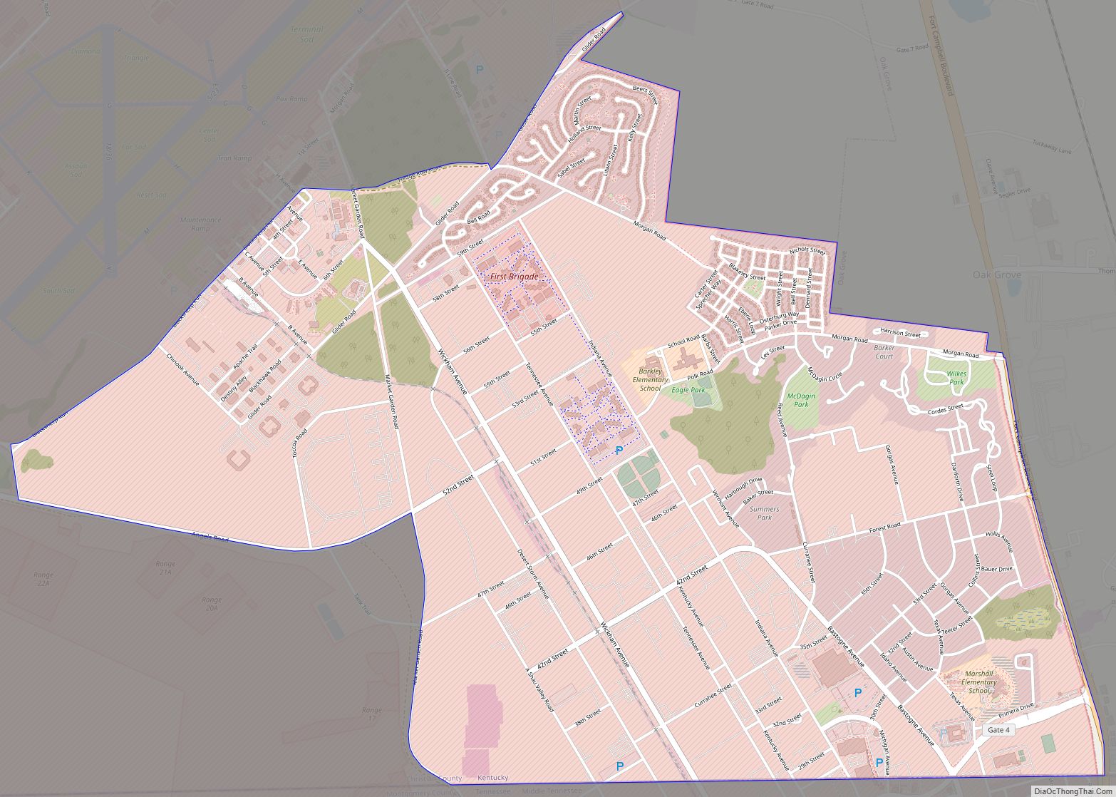
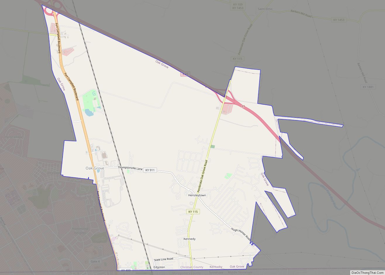
Oak Grove Road Map
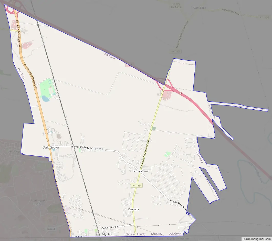
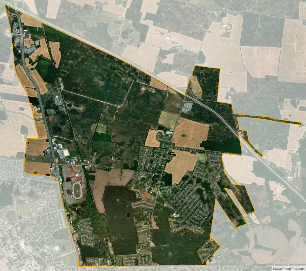
Oak Grove city Satellite Map
Geography
Oak Grove is located in southeastern Christian County at 36°39′30″N 87°25′10″W / 36.65833°N 87.41944°W / 36.65833; -87.41944 (36.658374, -87.419565). Its southern border is the Tennessee state line, and it is bordered to the west by Fort Campbell. Hopkinsville, the Christian County seat, touches the northwest corner of Oak Grove along Fort Campbell Boulevard (U.S. Route 41 Alternate). Interstate 24 forms the northeast boundary of Oak Grove, with access from exit 86 (US 41 Alt.) and exit 89 (Kentucky Route 115). The city of Clarksville, Tennessee, is along the southern boundary of Oak Grove.
According to the United States Census Bureau, Oak Grove has a total area of 10.8 square miles (27.9 km), of which 0.03 square miles (0.09 km), or 0.30%, is water.
See also
Map of Kentucky State and its subdivision:- Adair
- Allen
- Anderson
- Ballard
- Barren
- Bath
- Bell
- Boone
- Bourbon
- Boyd
- Boyle
- Bracken
- Breathitt
- Breckinridge
- Bullitt
- Butler
- Caldwell
- Calloway
- Campbell
- Carlisle
- Carroll
- Carter
- Casey
- Christian
- Clark
- Clay
- Clinton
- Crittenden
- Cumberland
- Daviess
- Edmonson
- Elliott
- Estill
- Fayette
- Fleming
- Floyd
- Franklin
- Fulton
- Gallatin
- Garrard
- Grant
- Graves
- Grayson
- Green
- Greenup
- Hancock
- Hardin
- Harlan
- Harrison
- Hart
- Henderson
- Henry
- Hickman
- Hopkins
- Jackson
- Jefferson
- Jessamine
- Johnson
- Kenton
- Knott
- Knox
- Larue
- Laurel
- Lawrence
- Lee
- Leslie
- Letcher
- Lewis
- Lincoln
- Livingston
- Logan
- Lyon
- Madison
- Magoffin
- Marion
- Marshall
- Martin
- Mason
- McCracken
- McCreary
- McLean
- Meade
- Menifee
- Mercer
- Metcalfe
- Monroe
- Montgomery
- Morgan
- Muhlenberg
- Nelson
- Nicholas
- Ohio
- Oldham
- Owen
- Owsley
- Pendleton
- Perry
- Pike
- Powell
- Pulaski
- Robertson
- Rockcastle
- Rowan
- Russell
- Scott
- Shelby
- Simpson
- Spencer
- Taylor
- Todd
- Trigg
- Trimble
- Union
- Warren
- Washington
- Wayne
- Webster
- Whitley
- Wolfe
- Woodford
- Alabama
- Alaska
- Arizona
- Arkansas
- California
- Colorado
- Connecticut
- Delaware
- District of Columbia
- Florida
- Georgia
- Hawaii
- Idaho
- Illinois
- Indiana
- Iowa
- Kansas
- Kentucky
- Louisiana
- Maine
- Maryland
- Massachusetts
- Michigan
- Minnesota
- Mississippi
- Missouri
- Montana
- Nebraska
- Nevada
- New Hampshire
- New Jersey
- New Mexico
- New York
- North Carolina
- North Dakota
- Ohio
- Oklahoma
- Oregon
- Pennsylvania
- Rhode Island
- South Carolina
- South Dakota
- Tennessee
- Texas
- Utah
- Vermont
- Virginia
- Washington
- West Virginia
- Wisconsin
- Wyoming