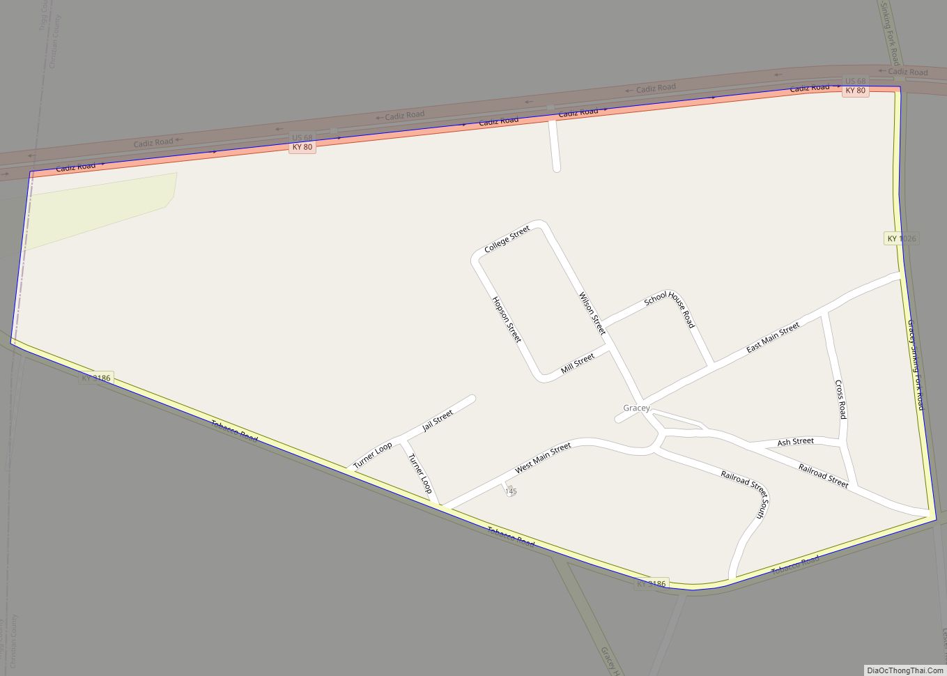
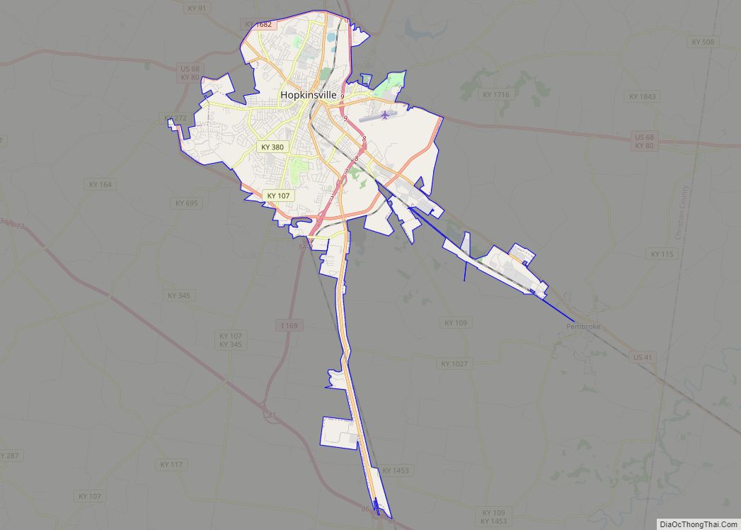
Hopkinsville is a home rule-class city in and the county seat of Christian County, Kentucky, United States. The population at the 2020 census was 31,180.
| Name: | Hopkinsville city |
|---|---|
| LSAD Code: | 25 |
| LSAD Description: | city (suffix) |
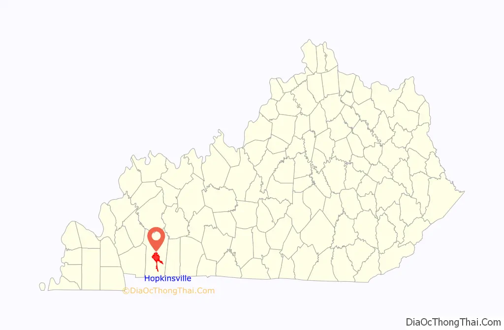
| State: | Kentucky |
| County: | Christian County |
| Incorporated: | 1853 |
| Elevation: | 528 ft (161 m) |
| Total Area: | 31.96 sq mi (82.79 km²) |
| Land Area: | 31.83 sq mi (82.44 km²) |
| Water Area: | 0.14 sq mi (0.35 km²) |
| Total Population: | 31,180 |
| Population Density: | 979.61/sq mi (378.23/km²) |
| ZIP code: | 42240 |
| Area code: | 270 & 364 |
| FIPS code: | 2137918 |
| GNISfeature ID: | 0494550 |
| Website: | www.hopkinsvilleky.us |
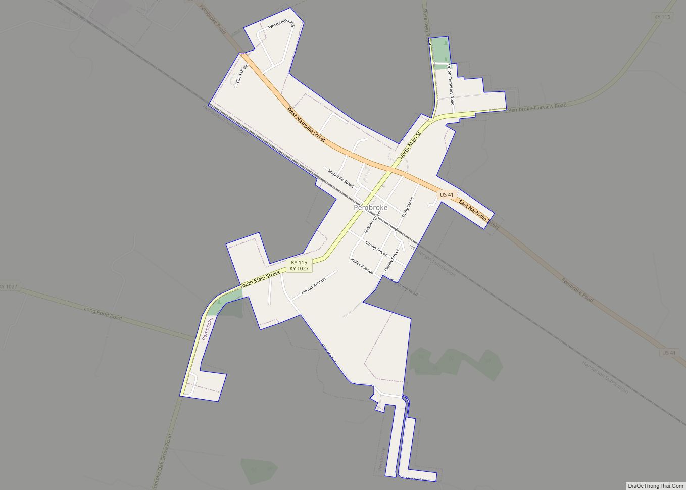
Online Interactive Map
Click on ![]() to view map in "full screen" mode.
to view map in "full screen" mode.
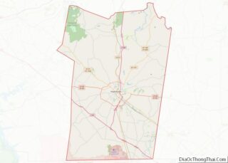
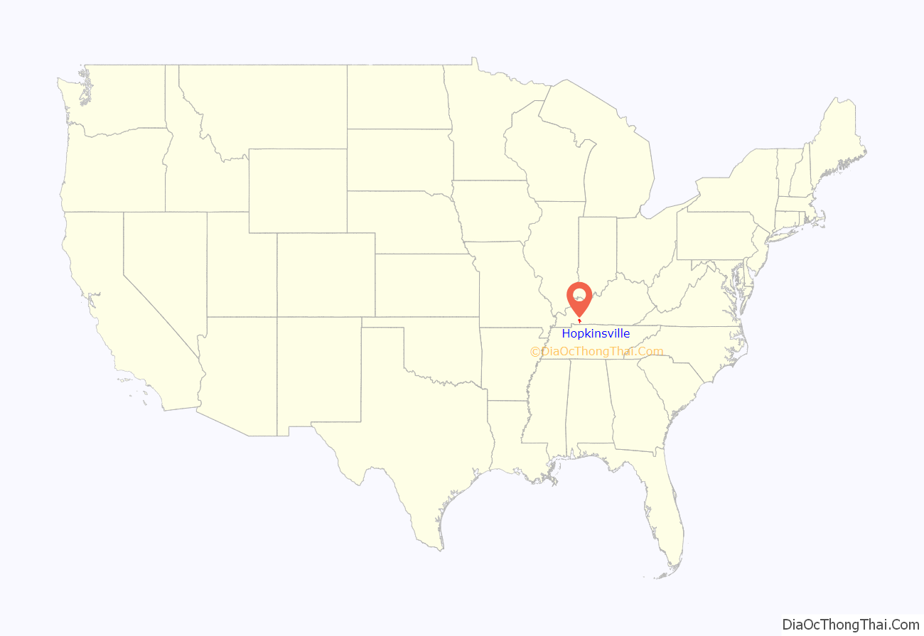
Hopkinsville location map. Where is Hopkinsville city?
History
Early years
The area of present-day Hopkinsville was initially claimed in 1796 by Bartholomew Wood as part of a 1,200-acre (5 km) grant for his service in the American Revolution. He and his wife Martha Ann moved from Jonesborough, Tennessee, first to a cabin near present-day W. Seventh and Bethel streets; then to a second cabin near present-day 9th and Virginia streets; and finally to a third home near 14th and Campbell.
Following the creation of Christian County the same year, the Woods donated 5 acres (20,000 m) of land and a half interest in their Old Rock Spring to form its seat of government in 1797. By 1798, a log courthouse, jail, and “stray pen” had been built; the next year, John Campbell and Samuel Means laid out the streets for “Christian Court House”. The community tried to rename itself “Elizabeth” after the Woods’ eldest daughter, but another town in Hardin County preëmpted the name, and the Kentucky Assembly established the town in 1804 as “Hopkinsville” after veteran and state representative Samuel Hopkins of Henderson County (later the namesake of Hopkins County as well and despite being in a neighboring county and having the same namesake, Hopkinsville was never the county seat of Hopkins County, despite Hopkins County being created from Christian and Henderson Counties).
Along with the rest of Kentucky, the town was late in establishing free lower education, but natives organized private schools, and the town was the home of South Kentucky College (est. 1849) and Bethel Female College (est. 1854).
Civil War
The Civil War generated major divisions in Christian County. Confederate support in Hopkinsville and Christian County was evident in the formation of the “Oak Grove Rangers” and the 28th Kentucky Cavalry. Christian County was the actual birthplace of Jefferson Davis, president of the Confederate States of America, though his birthplace is now part of Todd County, Kentucky. Several local businessmen and plantation owners contributed money and war supplies to the South. After Confederate forces retreated to Tennessee, however, Camp Joe Anderson was established by the Union to the northwest of Hopkinsville in 1862. Men who trained there became members of the 35th Kentucky Cavalry, the 25th Kentucky Infantry, and the 35th Kentucky Infantry. Gen. James S. Jackson had been a Hopkinsville attorney before the war and was killed in service to the Union at the Battle of Perryville in October 1862. Private citizens who supported the Union cause provided the army with mules, wagons, clothing, and food.
The occupation of Hopkinsville changed at least half a dozen times between the Confederate and Union forces. In December 1864, Confederate troops under Gen. Hylan B. Lyon captured the town and burned down the Christian County courthouse which was being used at that time by the Union army as a barracks. Another skirmish between Union and Confederate forces took place in the field opposite Western State Hospital near the end of the war.
Black Patch tobacco
The Evansville, Henderson, and Nashville Railroad was the first to connect Hopkinsville to surrounding cities in 1868. In 1879, it was purchased by the L&N. The Ohio Valley Railroad (later purchased by the Illinois Southern) reached the city in 1892, as did the Tennessee Central in 1903.
The tobacco from the Black Patch region was highly desired in Europe. In 1904, tobacco planters formed the Dark Tobacco District Planters’ Protective Association of Kentucky and Tennessee in opposition to a corporate monopoly by the American Tobacco Company (ATC) owned by James B. Duke. The ATC used their monopoly power to reduce the prices they paid to farmers; the planters’ association aimed to organize a boycott of sales to drive the price back up. Many farmers continued to sell independently or secretly, however, prompting the association to form a “Silent Brigade” to pressure such farmers into compliance. With societal pressure seeming to fail, the Silent Brigade (probably under Dr. David A. Amoss) organized the Night Riders (not to be confused with the Ku Klux Klan) to terrorize farmers into submission.
On December 7, 1907, 250 masked Night Riders seized Hopkinsville’s police station and cut off all outside contact. They pursued tobacco executives who bought tobacco from farmers who were not members of the Dark Tobacco District Planters’ Protective Association and city officials who aided them. Three warehouses were burned, one of whose sites became Peace Park. In April of the next year, a tobacco broker in Paducah named W.B. Kennedy wrote to associates in Rotterdam that “Out of all the mischief that has been done the law has not been able to convict and punish the night-riders. They do their mischief in the night, and wear masks, and they have taken a pledge to never tell anybody anything they know, and for this reason it is impossible to get sufficient evidence to convict them. They have gone on with their mischief making, until they have almost ruined the country.”
Tornadoes
On April 2, 2006, an F3 tornado swept through parts of Hopkinsville. In the storm, 200 homes were damaged and 28 people were injured. In addition, structural damage was reported to dozens of other businesses, along with countless trees, power lines, transmission towers and other structures, cutting electricity to the city of Hopkinsville. A gas line was also damaged, causing a gas leak. On January 1, 2022, an EF2 tornado struck Hopkinsville, removing the canopy from a gas station, and destroying the petrol pumps. A church lost parts of its roof, and trees were snapped and some uprooted along the path. This was the first confirmed tornado of 2022.
On March 31, 2023, the downtown area sustained noteworthy damage from straight-line winds of up to 90 mph, lifting off the upper floor of restaurant The Mixer in the former Young Hardware space, as well as damaging the city’s clock tower and the Woody Winfree Fire and Transportation Museum.
Hopkinsville Road Map
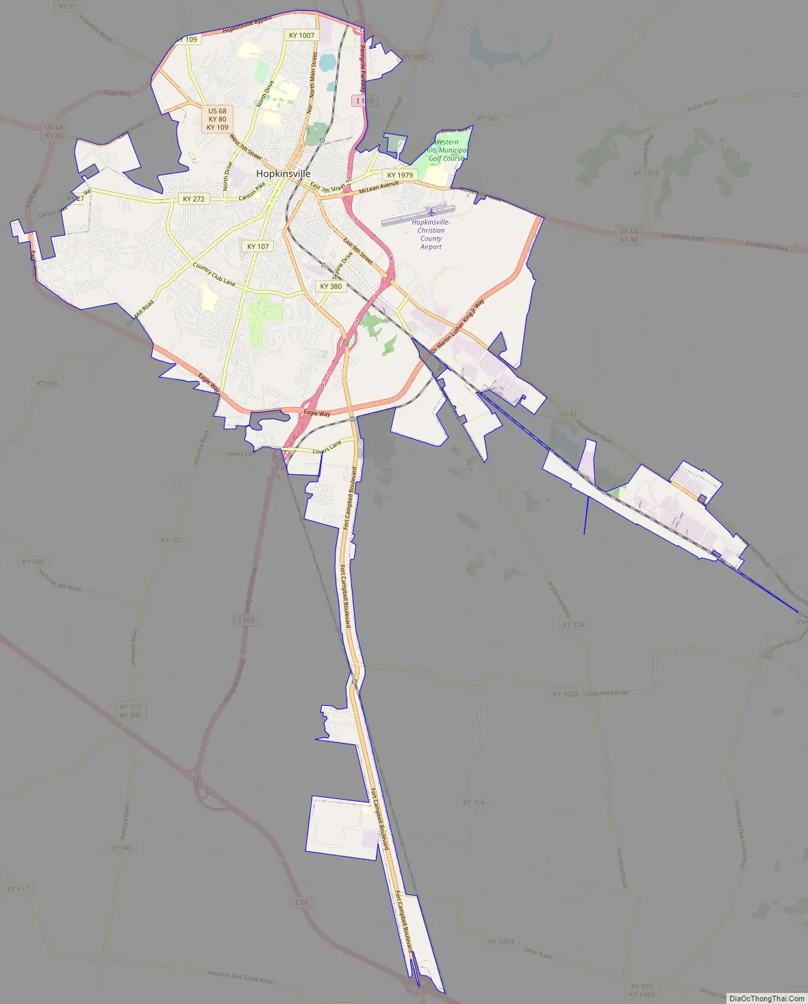
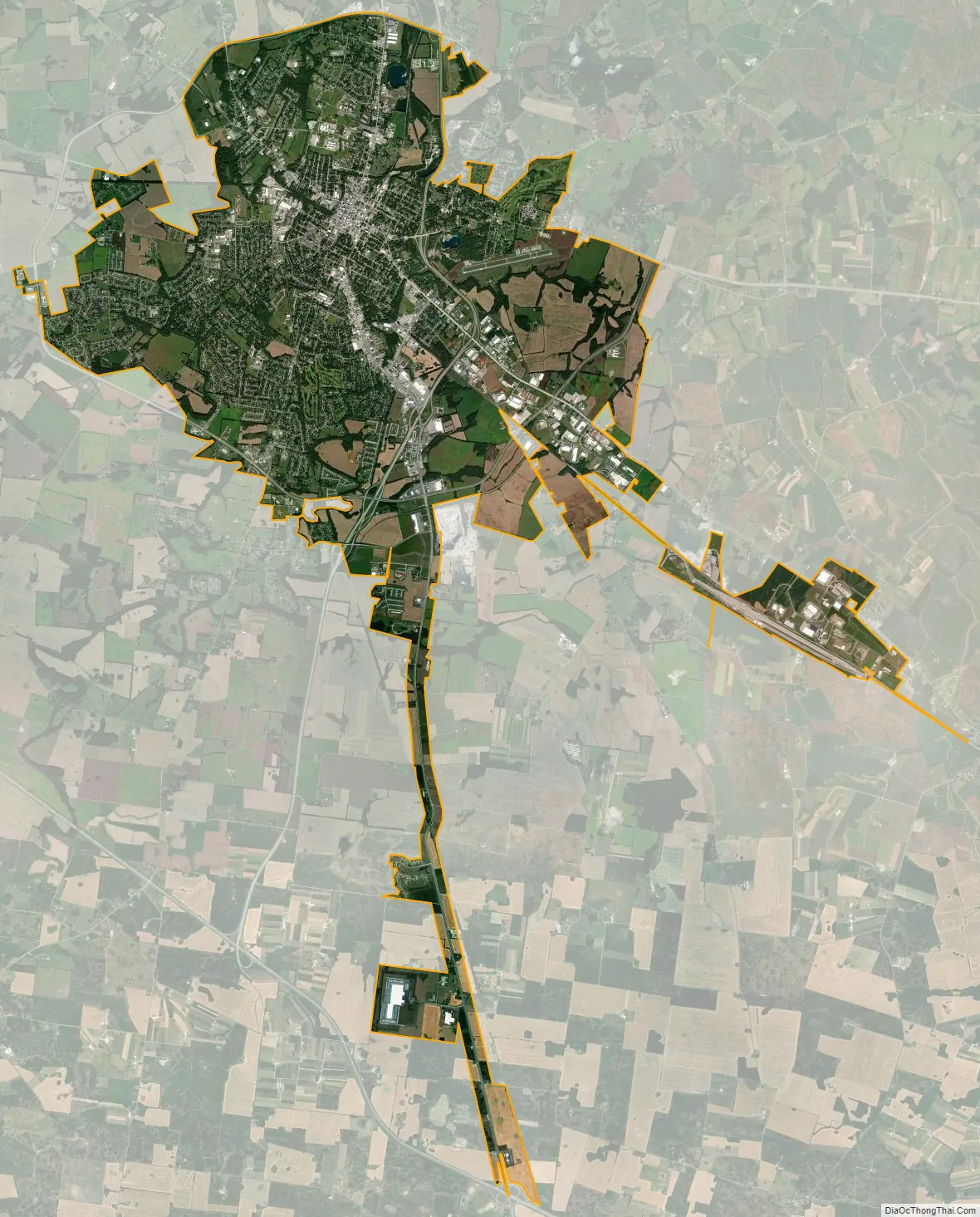
Hopkinsville city Satellite Map
Geography
Hopkinsville is located south of the center of Christian County at 36°51′17″N 87°29′20″W / 36.85472°N 87.48889°W / 36.85472; -87.48889 (36.854712, -87.488872). Madisonville is 35 miles (56 km) to the north, Russellville is 35 miles (56 km) to the east, Oak Grove is 15 miles to the south, and Clarksville, Tennessee, is 26 miles (42 km) to the south.
According to the United States Census Bureau, Hopkinsville has a total area of 30.8 square miles (79.8 km), of which 30.6 square miles (79.3 km) is land and 0.15 square miles (0.4 km), or 0.44%, is water.
Climate
Hopkinsville has a humid subtropical climate (Köppen Cfa), with hot, humid summers and cool winters. Precipitation is abundant and well-spread, with an average of 49.1 inches (1,250 mm). Snowfall is light and sporadic, with an average of 9.8 inches (25 cm).
The data below was accessed via the WRCC and was collected from 1896 until 2018.
See also
Map of Kentucky State and its subdivision:- Adair
- Allen
- Anderson
- Ballard
- Barren
- Bath
- Bell
- Boone
- Bourbon
- Boyd
- Boyle
- Bracken
- Breathitt
- Breckinridge
- Bullitt
- Butler
- Caldwell
- Calloway
- Campbell
- Carlisle
- Carroll
- Carter
- Casey
- Christian
- Clark
- Clay
- Clinton
- Crittenden
- Cumberland
- Daviess
- Edmonson
- Elliott
- Estill
- Fayette
- Fleming
- Floyd
- Franklin
- Fulton
- Gallatin
- Garrard
- Grant
- Graves
- Grayson
- Green
- Greenup
- Hancock
- Hardin
- Harlan
- Harrison
- Hart
- Henderson
- Henry
- Hickman
- Hopkins
- Jackson
- Jefferson
- Jessamine
- Johnson
- Kenton
- Knott
- Knox
- Larue
- Laurel
- Lawrence
- Lee
- Leslie
- Letcher
- Lewis
- Lincoln
- Livingston
- Logan
- Lyon
- Madison
- Magoffin
- Marion
- Marshall
- Martin
- Mason
- McCracken
- McCreary
- McLean
- Meade
- Menifee
- Mercer
- Metcalfe
- Monroe
- Montgomery
- Morgan
- Muhlenberg
- Nelson
- Nicholas
- Ohio
- Oldham
- Owen
- Owsley
- Pendleton
- Perry
- Pike
- Powell
- Pulaski
- Robertson
- Rockcastle
- Rowan
- Russell
- Scott
- Shelby
- Simpson
- Spencer
- Taylor
- Todd
- Trigg
- Trimble
- Union
- Warren
- Washington
- Wayne
- Webster
- Whitley
- Wolfe
- Woodford
- Alabama
- Alaska
- Arizona
- Arkansas
- California
- Colorado
- Connecticut
- Delaware
- District of Columbia
- Florida
- Georgia
- Hawaii
- Idaho
- Illinois
- Indiana
- Iowa
- Kansas
- Kentucky
- Louisiana
- Maine
- Maryland
- Massachusetts
- Michigan
- Minnesota
- Mississippi
- Missouri
- Montana
- Nebraska
- Nevada
- New Hampshire
- New Jersey
- New Mexico
- New York
- North Carolina
- North Dakota
- Ohio
- Oklahoma
- Oregon
- Pennsylvania
- Rhode Island
- South Carolina
- South Dakota
- Tennessee
- Texas
- Utah
- Vermont
- Virginia
- Washington
- West Virginia
- Wisconsin
- Wyoming