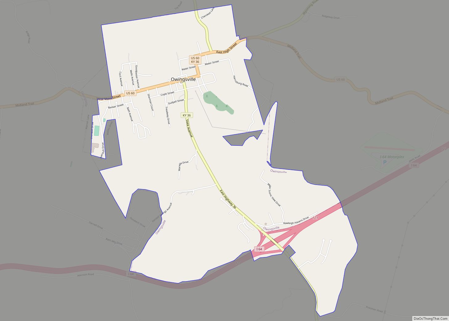
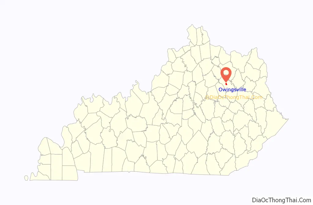
Owingsville is a home rule-class city in Bath County, Kentucky, in the United States. The population was 1,530 during the year 2010 U.S. Census. It is the county seat and is located roughly at the county’s center, at the junction of US 60 and Kentucky 36. It is part of the Mount Sterling micropolitan area.
| Name: | Owingsville city |
|---|---|
| LSAD Code: | 25 |
| LSAD Description: | city (suffix) |
| State: | Kentucky |
| County: | Bath County |
| Incorporated: | 1829 |
| Elevation: | 1,004 ft (306 m) |
| Total Area: | 2.53 sq mi (6.57 km²) |
| Land Area: | 2.51 sq mi (6.51 km²) |
| Water Area: | 0.02 sq mi (0.06 km²) |
| Total Population: | 1,593 |
| Population Density: | 634.16/sq mi (244.80/km²) |
| ZIP code: | 40360 |
| Area code: | 606 |
| FIPS code: | 2158710 |
| GNISfeature ID: | 0507358 |
Online Interactive Map
Click on ![]() to view map in "full screen" mode.
to view map in "full screen" mode.
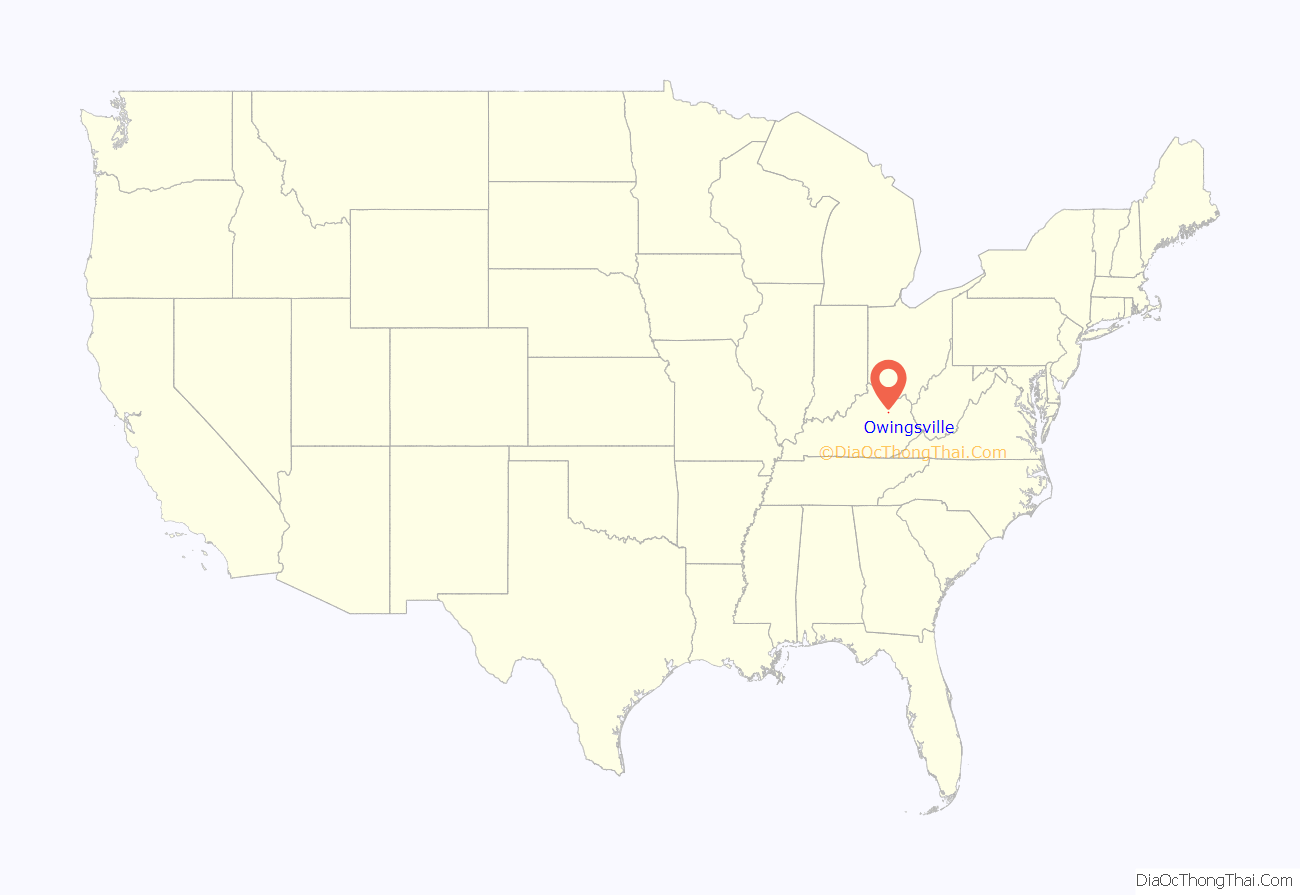
Owingsville location map. Where is Owingsville city?
History
In 1795, Colonel Thomas Dye Owings was sent from Maryland to Kentucky by his father to operate some of the first iron furnaces in the region. Within 15 years, Owings had amassed a good deal of wealth and land. Along with Colonel Richard H. Menefee, Owings founded the community that took his name, Owingsville.
Owings and Menefee each owned significant parcels of land in what would become Owingsville. To select whose name the community would take, the two men wagered that the man who built the finer home the quickest would be the namesake of the town. For the sum of $60,000, Owings won the contest. Owingsville was then founded in 1811.
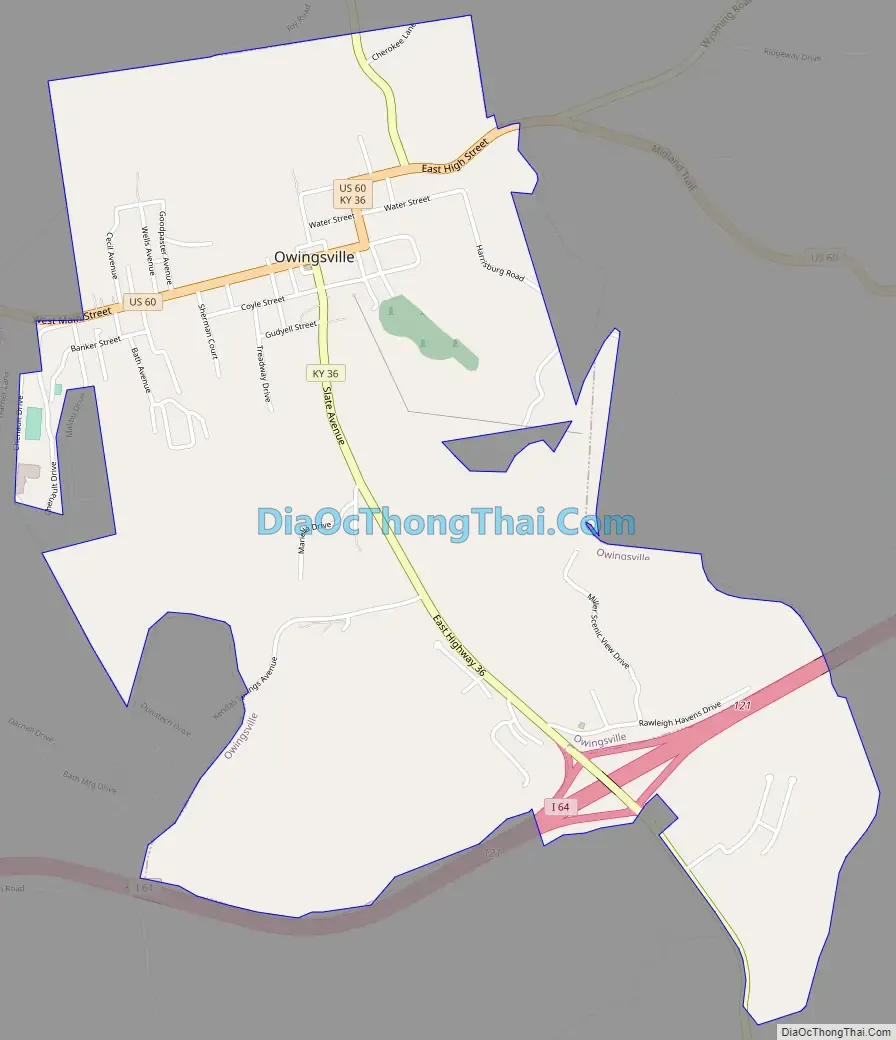
Owingsville Road Map
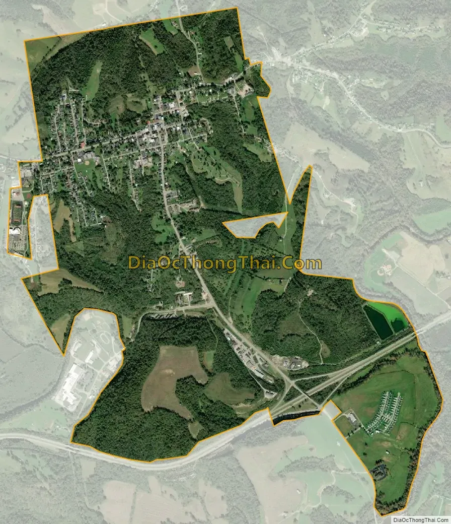
Owingsville city Satellite Map
Geography
Owingsville is located at 38°8′34″N 83°45′58″W / 38.14278°N 83.76611°W / 38.14278; -83.76611 (38.142694, -83.766135). According to the United States Census Bureau, the city has a total area of 2.4 square miles (6.2 km), of which 0.023 square miles (0.06 km), or 0.93%, is water.
See also
Map of Kentucky State and its subdivision:- Adair
- Allen
- Anderson
- Ballard
- Barren
- Bath
- Bell
- Boone
- Bourbon
- Boyd
- Boyle
- Bracken
- Breathitt
- Breckinridge
- Bullitt
- Butler
- Caldwell
- Calloway
- Campbell
- Carlisle
- Carroll
- Carter
- Casey
- Christian
- Clark
- Clay
- Clinton
- Crittenden
- Cumberland
- Daviess
- Edmonson
- Elliott
- Estill
- Fayette
- Fleming
- Floyd
- Franklin
- Fulton
- Gallatin
- Garrard
- Grant
- Graves
- Grayson
- Green
- Greenup
- Hancock
- Hardin
- Harlan
- Harrison
- Hart
- Henderson
- Henry
- Hickman
- Hopkins
- Jackson
- Jefferson
- Jessamine
- Johnson
- Kenton
- Knott
- Knox
- Larue
- Laurel
- Lawrence
- Lee
- Leslie
- Letcher
- Lewis
- Lincoln
- Livingston
- Logan
- Lyon
- Madison
- Magoffin
- Marion
- Marshall
- Martin
- Mason
- McCracken
- McCreary
- McLean
- Meade
- Menifee
- Mercer
- Metcalfe
- Monroe
- Montgomery
- Morgan
- Muhlenberg
- Nelson
- Nicholas
- Ohio
- Oldham
- Owen
- Owsley
- Pendleton
- Perry
- Pike
- Powell
- Pulaski
- Robertson
- Rockcastle
- Rowan
- Russell
- Scott
- Shelby
- Simpson
- Spencer
- Taylor
- Todd
- Trigg
- Trimble
- Union
- Warren
- Washington
- Wayne
- Webster
- Whitley
- Wolfe
- Woodford
- Alabama
- Alaska
- Arizona
- Arkansas
- California
- Colorado
- Connecticut
- Delaware
- District of Columbia
- Florida
- Georgia
- Hawaii
- Idaho
- Illinois
- Indiana
- Iowa
- Kansas
- Kentucky
- Louisiana
- Maine
- Maryland
- Massachusetts
- Michigan
- Minnesota
- Mississippi
- Missouri
- Montana
- Nebraska
- Nevada
- New Hampshire
- New Jersey
- New Mexico
- New York
- North Carolina
- North Dakota
- Ohio
- Oklahoma
- Oregon
- Pennsylvania
- Rhode Island
- South Carolina
- South Dakota
- Tennessee
- Texas
- Utah
- Vermont
- Virginia
- Washington
- West Virginia
- Wisconsin
- Wyoming