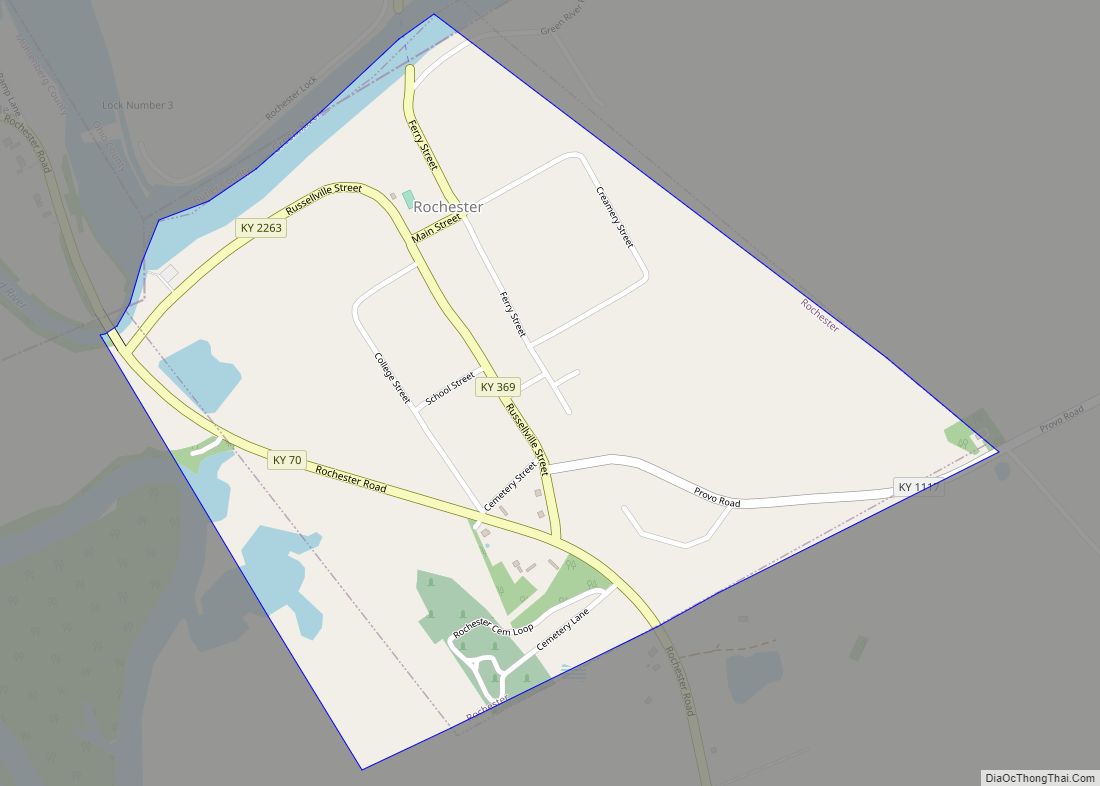
Rochester is a home rule-class city in Butler County, Kentucky, United States, at the confluence of the Green and Mud rivers. The population was 114 as of the 2020 Census
| Name: | Rochester city |
|---|---|
| LSAD Code: | 25 |
| LSAD Description: | city (suffix) |
| State: | Kentucky |
| County: | Butler County |
| Incorporated: | 1839; 184 years ago (1839) |
| Elevation: | 417 ft (127 m) |
| Total Area: | 0.49 sq mi (1.28 km²) |
| Land Area: | 0.47 sq mi (1.21 km²) |
| Water Area: | 0.03 sq mi (0.07 km²) 5.46% |
| Total Population: | 114 |
| Population Density: | 244.64/sq mi (94.54/km²) |
| ZIP code: | 42273 |
| Area code: | 270 & 364 |
| FIPS code: | 2165982 |
| GNISfeature ID: | 0502100 |
Online Interactive Map
Click on ![]() to view map in "full screen" mode.
to view map in "full screen" mode.
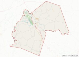
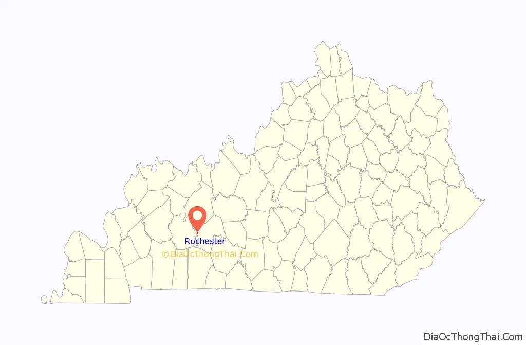
Rochester location map. Where is Rochester city?

History
Rochester is rooted in an early pioneer settlement known as “The Mouth” for its strategic location at the confluence of the Green and Mud rivers. In the early 19th century, an early settler named Thomas Riddick platted a town at this location known as “Suffolk” on his father’s Revolutionary War land grant, though the town was not successful. The city was established in the 1830s and incorporated in 1839. It is named for Rochester, New York. There is a connection to Rochester, New York, but it is not named “for” it. Documentation of the Rochester family, in a book “The House of Rochester in Kentucky” by Mrs. Agatha Rochester Strange published in/around 1889, indicates that Rochester, KY was settled by William Strother Lewis McDowell (b. Jun 24, 1819) thanks to the dedication and management from his mother, Nancy “Ann” Jordan Rochester (1797-1856).
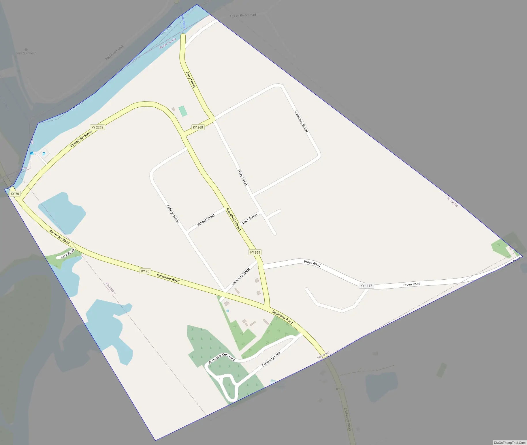
Rochester Road Map
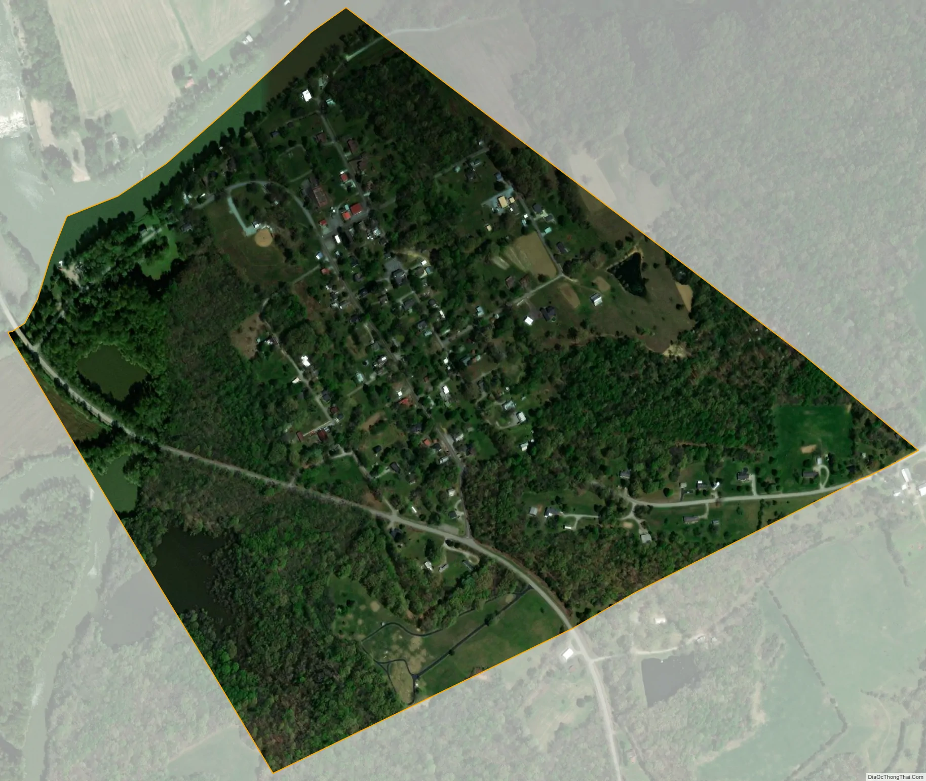
Rochester city Satellite Map
Geography
Rochester is located in western Butler County at 37°12′39″N 86°53′33″W / 37.21083°N 86.89250°W / 37.21083; -86.89250 (37.210712, -86.892483). Its northwestern boundary, the Green River, is the county boundary as well, with Ohio County on the opposite side of the river. A small portion of the western boundary of the city is formed by the Mud River, which is also the boundary with Muhlenberg County. Kentucky Route 70 (Rochester Road) passes through the city, leading east 14 miles (23 km) to Morgantown, the Butler County seat, and west 10 miles (16 km) to Drakesboro. Kentucky Route 369 leaves Rochester to the north, crossing the Green River by the Rochester Ferry and leading north 14 miles (23 km) to Beaver Dam.
Rochester Dam is located along the Green River just west of Rochester.
According to the United States Census Bureau, Rochester has a total area of 0.50 square miles (1.3 km), of which 0.027 square miles (0.07 km), or 5.46%, is water.
See also
Map of Kentucky State and its subdivision:- Adair
- Allen
- Anderson
- Ballard
- Barren
- Bath
- Bell
- Boone
- Bourbon
- Boyd
- Boyle
- Bracken
- Breathitt
- Breckinridge
- Bullitt
- Butler
- Caldwell
- Calloway
- Campbell
- Carlisle
- Carroll
- Carter
- Casey
- Christian
- Clark
- Clay
- Clinton
- Crittenden
- Cumberland
- Daviess
- Edmonson
- Elliott
- Estill
- Fayette
- Fleming
- Floyd
- Franklin
- Fulton
- Gallatin
- Garrard
- Grant
- Graves
- Grayson
- Green
- Greenup
- Hancock
- Hardin
- Harlan
- Harrison
- Hart
- Henderson
- Henry
- Hickman
- Hopkins
- Jackson
- Jefferson
- Jessamine
- Johnson
- Kenton
- Knott
- Knox
- Larue
- Laurel
- Lawrence
- Lee
- Leslie
- Letcher
- Lewis
- Lincoln
- Livingston
- Logan
- Lyon
- Madison
- Magoffin
- Marion
- Marshall
- Martin
- Mason
- McCracken
- McCreary
- McLean
- Meade
- Menifee
- Mercer
- Metcalfe
- Monroe
- Montgomery
- Morgan
- Muhlenberg
- Nelson
- Nicholas
- Ohio
- Oldham
- Owen
- Owsley
- Pendleton
- Perry
- Pike
- Powell
- Pulaski
- Robertson
- Rockcastle
- Rowan
- Russell
- Scott
- Shelby
- Simpson
- Spencer
- Taylor
- Todd
- Trigg
- Trimble
- Union
- Warren
- Washington
- Wayne
- Webster
- Whitley
- Wolfe
- Woodford
- Alabama
- Alaska
- Arizona
- Arkansas
- California
- Colorado
- Connecticut
- Delaware
- District of Columbia
- Florida
- Georgia
- Hawaii
- Idaho
- Illinois
- Indiana
- Iowa
- Kansas
- Kentucky
- Louisiana
- Maine
- Maryland
- Massachusetts
- Michigan
- Minnesota
- Mississippi
- Missouri
- Montana
- Nebraska
- Nevada
- New Hampshire
- New Jersey
- New Mexico
- New York
- North Carolina
- North Dakota
- Ohio
- Oklahoma
- Oregon
- Pennsylvania
- Rhode Island
- South Carolina
- South Dakota
- Tennessee
- Texas
- Utah
- Vermont
- Virginia
- Washington
- West Virginia
- Wisconsin
- Wyoming