Sanders is a home rule-class city in Carroll County, Kentucky, in the United States. The population was 238 as of the 2010 census.
| Name: | Sanders city |
|---|---|
| LSAD Code: | 25 |
| LSAD Description: | city (suffix) |
| State: | Kentucky |
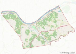
| County: | Carroll County |
| Incorporated: | 1871 |
| Elevation: | 486 ft (148 m) |
| Total Area: | 0.30 sq mi (0.77 km²) |
| Land Area: | 0.29 sq mi (0.76 km²) |
| Water Area: | 0.00 sq mi (0.01 km²) |
| Total Population: | 197 |
| Population Density: | 670.07/sq mi (258.90/km²) |
| ZIP code: | 41083 |
| Area code: | 502 |
| FIPS code: | 2168358 |
| GNISfeature ID: | 0502945 |
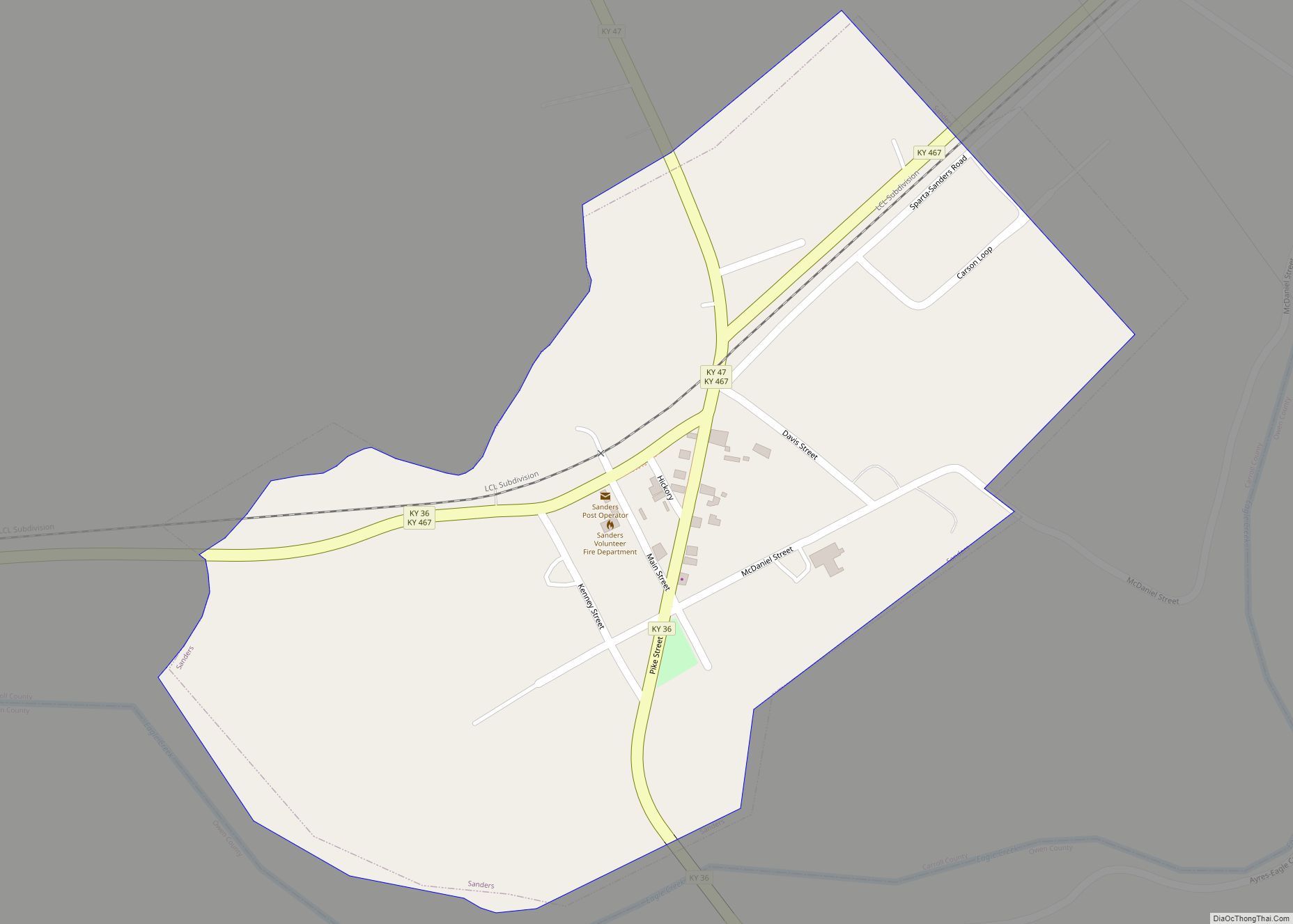
Online Interactive Map
Click on ![]() to view map in "full screen" mode.
to view map in "full screen" mode.
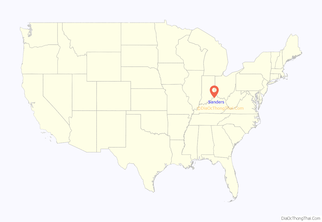
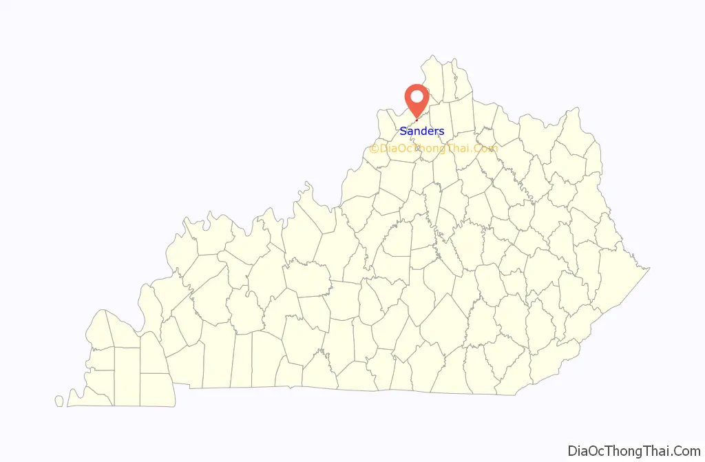
Sanders location map. Where is Sanders city?
History
The community was founded at a salt lick on the Buffalo Trace stretching from the Licking River to Drennon Springs. The community was first known as Rislerville for a local shopkeeper, but was known as Sanders’ Mill after the local miller Nathaniel Sanders opened a post office in 1816. His son George Washington Sanders continued to operate the mill after his death.
When the community was connected to the Louisville, Cincinnati and Lexington Railroad in 1867, the station was first named Dixie by the locals but then changed to Liberty Station by the railroad, owing to the importance of the station’s trade with nearby New Liberty. The name reverted to Sanders in 1874, according to local historian Anna Parker, owing to the influence of State Senator Larkin Sanders, who wanted to honor his father.
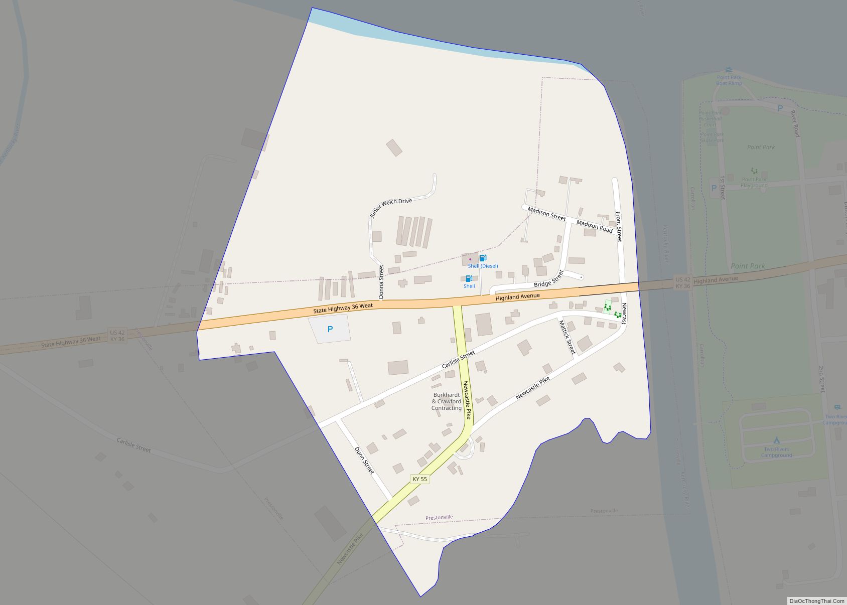
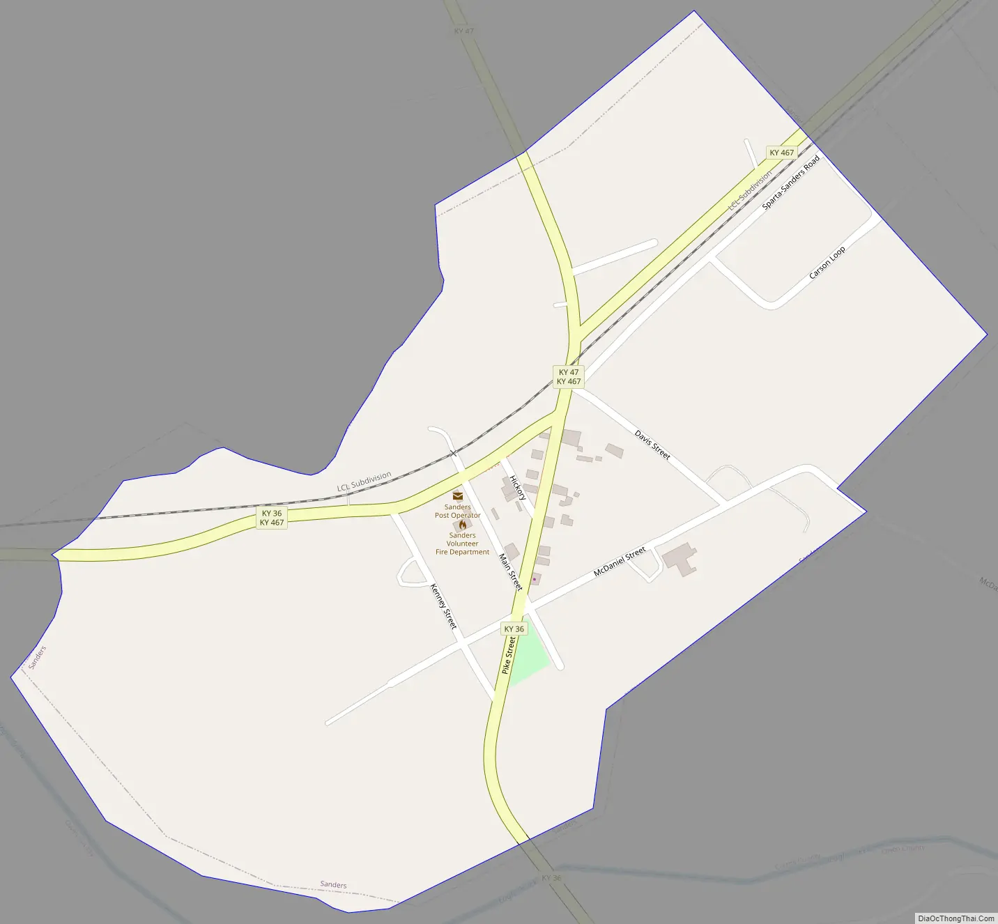
Sanders Road Map
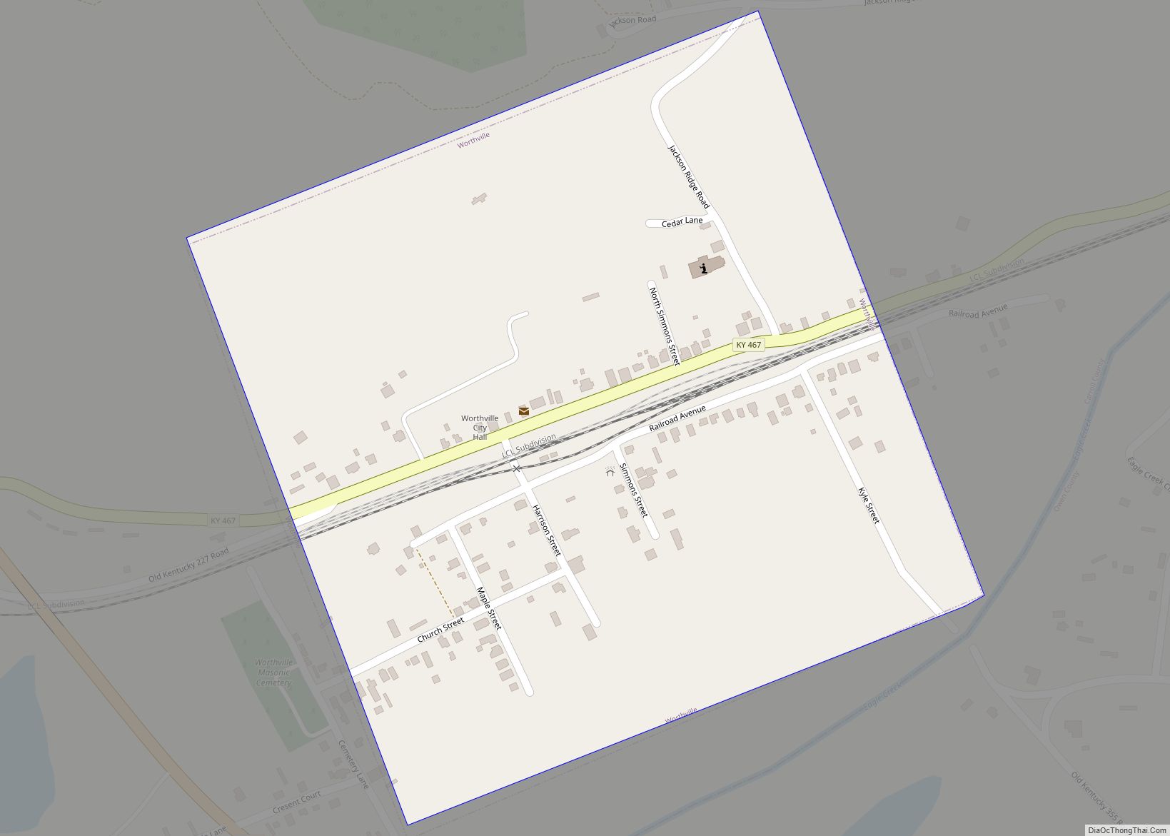
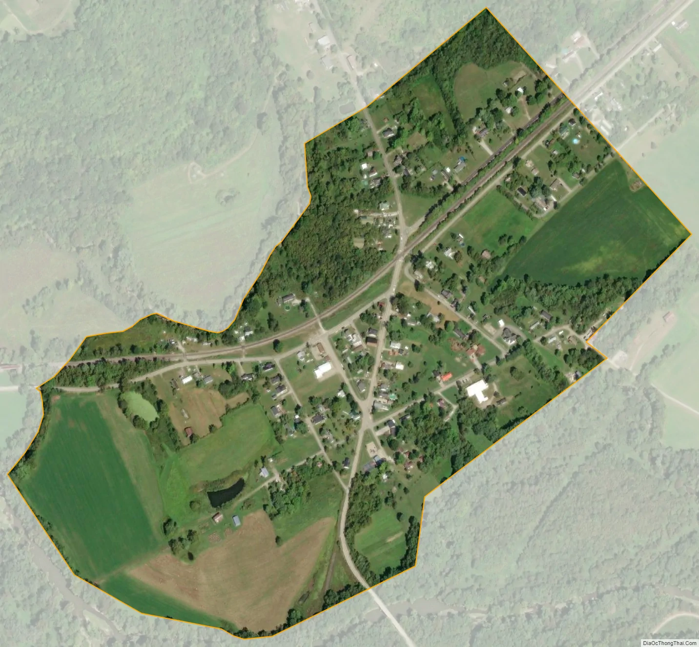
Sanders city Satellite Map
Geography
Sanders is located in the southeast corner of Carroll County at 38°39′19″N 84°56′47″W / 38.65528°N 84.94639°W / 38.65528; -84.94639 (38.655329, -84.946506), along Eagle Creek, a tributary of the Kentucky River. It is bordered to the south, across Eagle Creek, by Owen County, and Gallatin County begins less than 1 mile (1.6 km) to the east. Exit 55 on Interstate 71 is 4.5 miles (7.2 km) to the north.
According to the United States Census Bureau, the city has a total area of 0.30 square miles (0.77 km), of which 0.004 square miles (0.01 km), or 0.81%, is water.
See also
Map of Kentucky State and its subdivision:- Adair
- Allen
- Anderson
- Ballard
- Barren
- Bath
- Bell
- Boone
- Bourbon
- Boyd
- Boyle
- Bracken
- Breathitt
- Breckinridge
- Bullitt
- Butler
- Caldwell
- Calloway
- Campbell
- Carlisle
- Carroll
- Carter
- Casey
- Christian
- Clark
- Clay
- Clinton
- Crittenden
- Cumberland
- Daviess
- Edmonson
- Elliott
- Estill
- Fayette
- Fleming
- Floyd
- Franklin
- Fulton
- Gallatin
- Garrard
- Grant
- Graves
- Grayson
- Green
- Greenup
- Hancock
- Hardin
- Harlan
- Harrison
- Hart
- Henderson
- Henry
- Hickman
- Hopkins
- Jackson
- Jefferson
- Jessamine
- Johnson
- Kenton
- Knott
- Knox
- Larue
- Laurel
- Lawrence
- Lee
- Leslie
- Letcher
- Lewis
- Lincoln
- Livingston
- Logan
- Lyon
- Madison
- Magoffin
- Marion
- Marshall
- Martin
- Mason
- McCracken
- McCreary
- McLean
- Meade
- Menifee
- Mercer
- Metcalfe
- Monroe
- Montgomery
- Morgan
- Muhlenberg
- Nelson
- Nicholas
- Ohio
- Oldham
- Owen
- Owsley
- Pendleton
- Perry
- Pike
- Powell
- Pulaski
- Robertson
- Rockcastle
- Rowan
- Russell
- Scott
- Shelby
- Simpson
- Spencer
- Taylor
- Todd
- Trigg
- Trimble
- Union
- Warren
- Washington
- Wayne
- Webster
- Whitley
- Wolfe
- Woodford
- Alabama
- Alaska
- Arizona
- Arkansas
- California
- Colorado
- Connecticut
- Delaware
- District of Columbia
- Florida
- Georgia
- Hawaii
- Idaho
- Illinois
- Indiana
- Iowa
- Kansas
- Kentucky
- Louisiana
- Maine
- Maryland
- Massachusetts
- Michigan
- Minnesota
- Mississippi
- Missouri
- Montana
- Nebraska
- Nevada
- New Hampshire
- New Jersey
- New Mexico
- New York
- North Carolina
- North Dakota
- Ohio
- Oklahoma
- Oregon
- Pennsylvania
- Rhode Island
- South Carolina
- South Dakota
- Tennessee
- Texas
- Utah
- Vermont
- Virginia
- Washington
- West Virginia
- Wisconsin
- Wyoming