South Park View is a home rule-class city in Jefferson County, Kentucky, United States. The population was 0 at the 2020 census. The community was named for its location near South Park Hill, elevation 902 feet (275 m), the highest point in Jefferson County. It is the smallest incorporated city in the commonwealth of Kentucky and one of nine incorporated places in the U.S. that have no recorded population.
| Name: | South Park View city |
|---|---|
| LSAD Code: | 25 |
| LSAD Description: | city (suffix) |
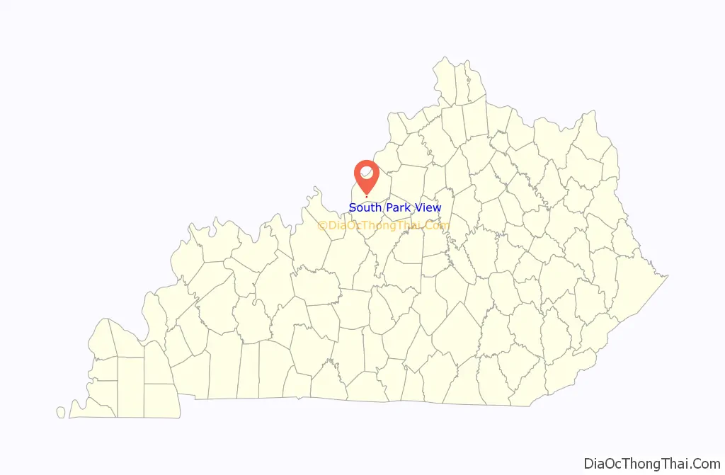
| State: | Kentucky |
| County: | Jefferson County |
| Elevation: | 479 ft (146 m) |
| Total Area: | 0.12 sq mi (0.32 km²) |
| Land Area: | 0.12 sq mi (0.32 km²) |
| Water Area: | 0.00 sq mi (0.00 km²) |
| Total Population: | 0 |
| Population Density: | 0.00/sq mi (0.00/km²) |
| ZIP code: | 40219 |
| FIPS code: | 2172138 |
| GNISfeature ID: | 0503967 |
Online Interactive Map
Click on ![]() to view map in "full screen" mode.
to view map in "full screen" mode.
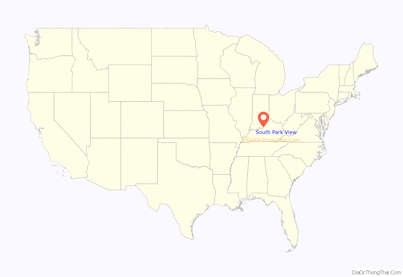
South Park View location map. Where is South Park View city?
History
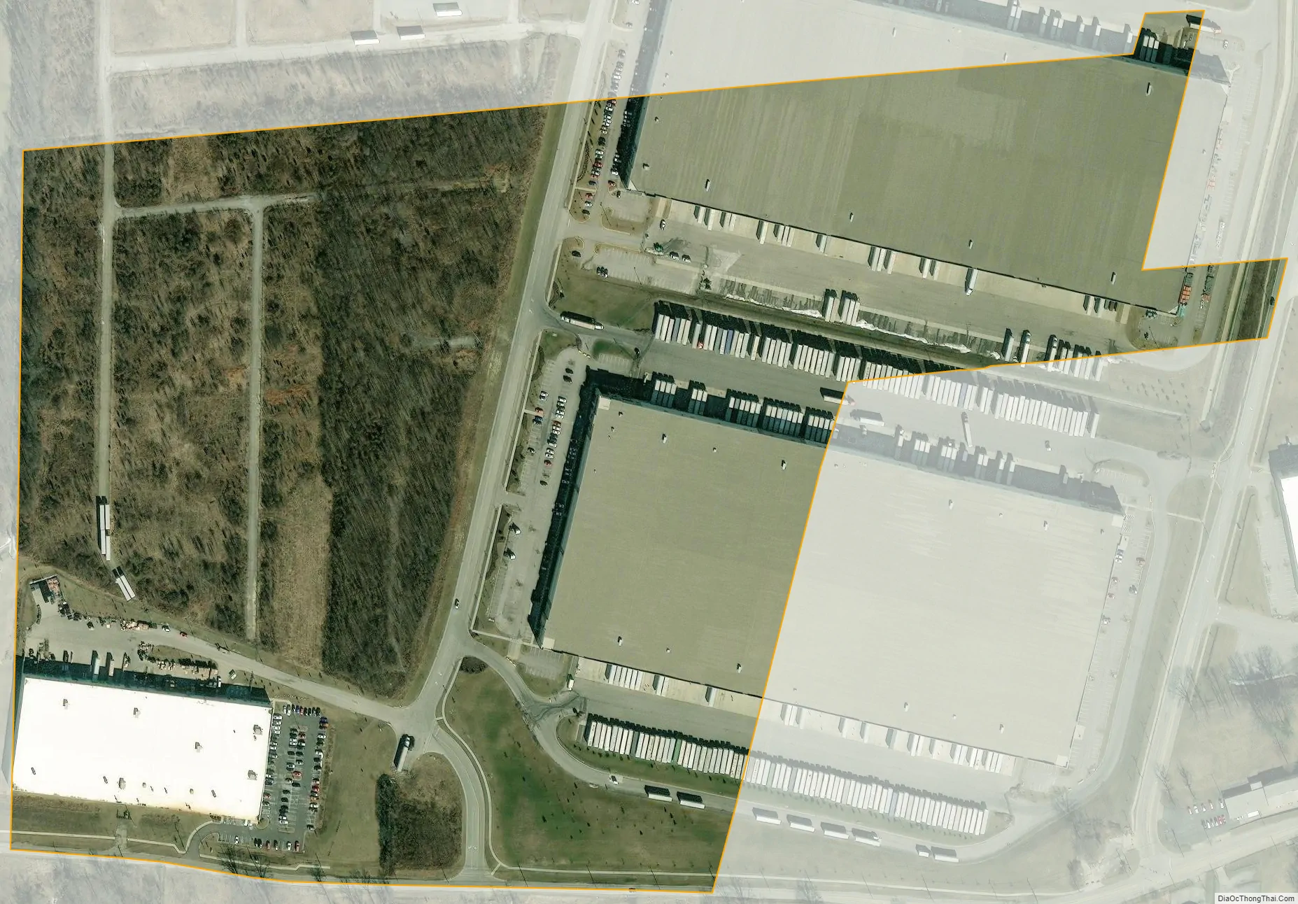
South Park View incorporated as a city of the 6th class in April 1961. The city was a residential suburb until the expansion of the Louisville International Airport realigned runways and created noise levels that the Federal Aviation Administration considered “significant.” During the 2000s, residents were relocated and an enterprise zone industrial park replaced much of the housing, resulting in a population loss for the city from 196 to 7 between the 2000 and 2010 censuses. The official population fell to 0 by the 2020 census.
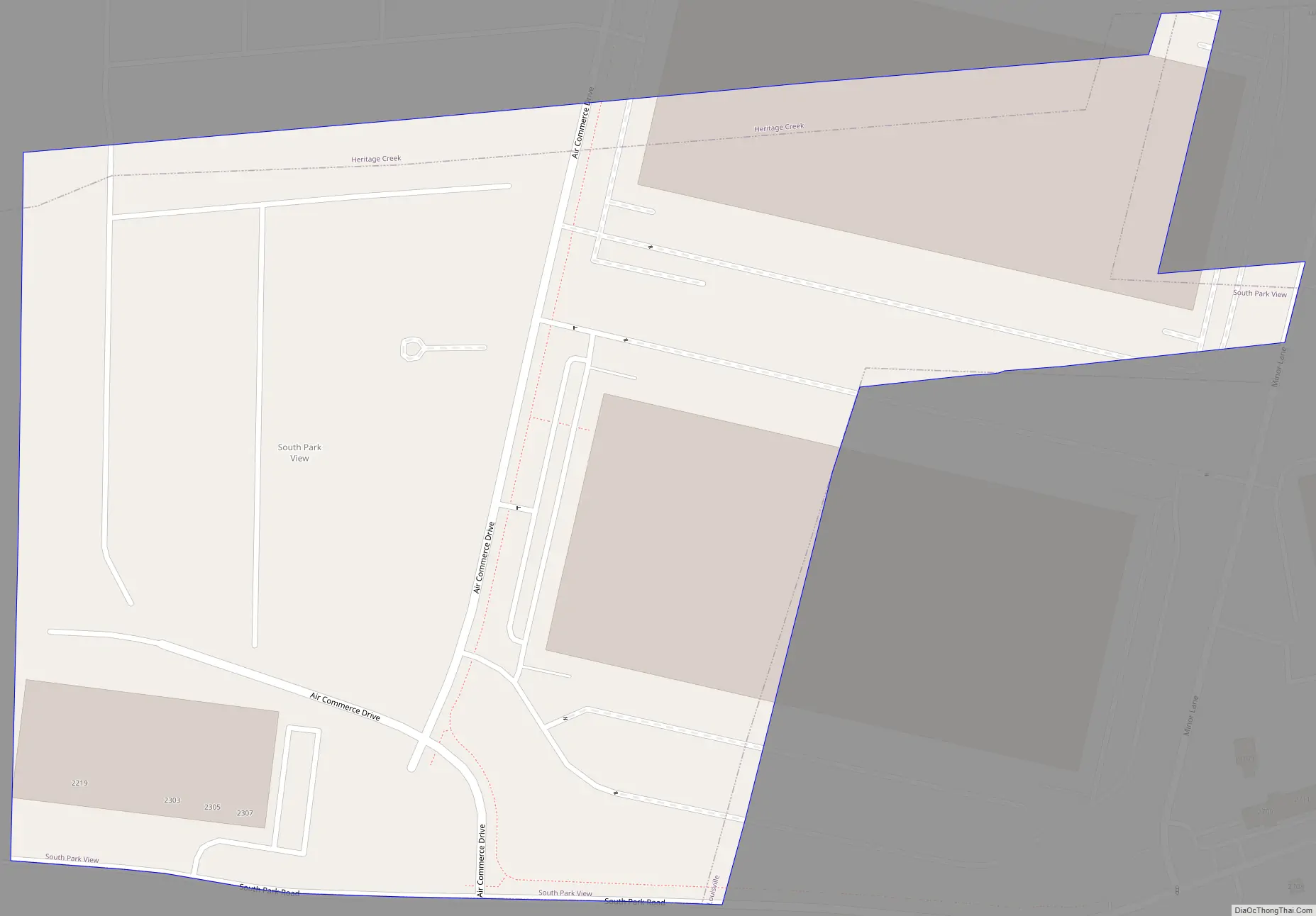
South Park View Road Map
South Park View city Satellite Map
Geography
South Park View is located in southern Jefferson County at 38°7′9″N 85°43′17″W / 38.11917°N 85.72139°W / 38.11917; -85.72139 (38.119050, -85.721448). It is 11 miles (18 km) south of downtown Louisville and 4 miles (6 km) south of Louisville International Airport.
According to the United States Census Bureau, South Park View has a total area of 0.1 square mile (0.3 km), all land.
See also
Map of Kentucky State and its subdivision:- Adair
- Allen
- Anderson
- Ballard
- Barren
- Bath
- Bell
- Boone
- Bourbon
- Boyd
- Boyle
- Bracken
- Breathitt
- Breckinridge
- Bullitt
- Butler
- Caldwell
- Calloway
- Campbell
- Carlisle
- Carroll
- Carter
- Casey
- Christian
- Clark
- Clay
- Clinton
- Crittenden
- Cumberland
- Daviess
- Edmonson
- Elliott
- Estill
- Fayette
- Fleming
- Floyd
- Franklin
- Fulton
- Gallatin
- Garrard
- Grant
- Graves
- Grayson
- Green
- Greenup
- Hancock
- Hardin
- Harlan
- Harrison
- Hart
- Henderson
- Henry
- Hickman
- Hopkins
- Jackson
- Jefferson
- Jessamine
- Johnson
- Kenton
- Knott
- Knox
- Larue
- Laurel
- Lawrence
- Lee
- Leslie
- Letcher
- Lewis
- Lincoln
- Livingston
- Logan
- Lyon
- Madison
- Magoffin
- Marion
- Marshall
- Martin
- Mason
- McCracken
- McCreary
- McLean
- Meade
- Menifee
- Mercer
- Metcalfe
- Monroe
- Montgomery
- Morgan
- Muhlenberg
- Nelson
- Nicholas
- Ohio
- Oldham
- Owen
- Owsley
- Pendleton
- Perry
- Pike
- Powell
- Pulaski
- Robertson
- Rockcastle
- Rowan
- Russell
- Scott
- Shelby
- Simpson
- Spencer
- Taylor
- Todd
- Trigg
- Trimble
- Union
- Warren
- Washington
- Wayne
- Webster
- Whitley
- Wolfe
- Woodford
- Alabama
- Alaska
- Arizona
- Arkansas
- California
- Colorado
- Connecticut
- Delaware
- District of Columbia
- Florida
- Georgia
- Hawaii
- Idaho
- Illinois
- Indiana
- Iowa
- Kansas
- Kentucky
- Louisiana
- Maine
- Maryland
- Massachusetts
- Michigan
- Minnesota
- Mississippi
- Missouri
- Montana
- Nebraska
- Nevada
- New Hampshire
- New Jersey
- New Mexico
- New York
- North Carolina
- North Dakota
- Ohio
- Oklahoma
- Oregon
- Pennsylvania
- Rhode Island
- South Carolina
- South Dakota
- Tennessee
- Texas
- Utah
- Vermont
- Virginia
- Washington
- West Virginia
- Wisconsin
- Wyoming


