Wilder is a home rule-class city in Campbell County, Kentucky, United States. The population was 3,035 at the 2010 census. It is part of the Cincinnati-Northern Kentucky metropolitan area.
| Name: | Wilder city |
|---|---|
| LSAD Code: | 25 |
| LSAD Description: | city (suffix) |
| State: | Kentucky |
| County: | Campbell County |
| Elevation: | 541 ft (165 m) |
| Total Area: | 3.75 sq mi (9.72 km²) |
| Land Area: | 3.63 sq mi (9.39 km²) |
| Water Area: | 0.13 sq mi (0.33 km²) |
| Total Population: | 3,176 |
| Population Density: | 876.14/sq mi (338.26/km²) |
| ZIP code: | 41071, 41076 |
| Area code: | 859 |
| FIPS code: | 2183172 |
| GNISfeature ID: | 1669492 |
| Website: | wilderky.gov |
Online Interactive Map
Click on ![]() to view map in "full screen" mode.
to view map in "full screen" mode.
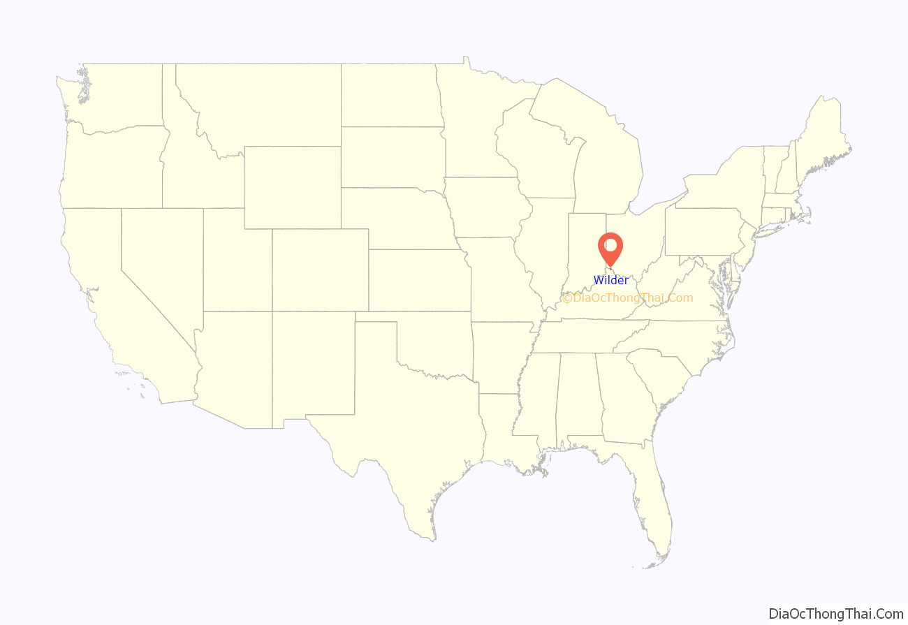
Wilder location map. Where is Wilder city?
History
Wilder was once known as Leitch’s Station. It was the first settlement in Campbell County. The name Wilder dates back to a railroad station built in the mid-19th century for the Louisville, Cincinnati and Lexington Railway named Wilder station. St. John the Baptist Roman Catholic Church was built in 1858 by German immigrants. “Wilder Station” is now located on property owned by Newport Steel. It is the home of supposed ghostly hauntings at the country music nightclub and honky tonk, Bobby Mackey’s Music World, which has been called “the most haunted nightclub in America”.
Wilder Road Map
Wilder city Satellite Map
Geography
Wilder is located at 39°2′50″N 84°28′39″W / 39.04722°N 84.47750°W / 39.04722; -84.47750 (39.047304, −84.477377).
According to the United States Census Bureau, the city has a total area of 3.8 square miles (9.8 km), of which 3.7 square miles (9.6 km) is land and 0.1 square miles (0.26 km) (2.89%) is water.
See also
Map of Kentucky State and its subdivision:- Adair
- Allen
- Anderson
- Ballard
- Barren
- Bath
- Bell
- Boone
- Bourbon
- Boyd
- Boyle
- Bracken
- Breathitt
- Breckinridge
- Bullitt
- Butler
- Caldwell
- Calloway
- Campbell
- Carlisle
- Carroll
- Carter
- Casey
- Christian
- Clark
- Clay
- Clinton
- Crittenden
- Cumberland
- Daviess
- Edmonson
- Elliott
- Estill
- Fayette
- Fleming
- Floyd
- Franklin
- Fulton
- Gallatin
- Garrard
- Grant
- Graves
- Grayson
- Green
- Greenup
- Hancock
- Hardin
- Harlan
- Harrison
- Hart
- Henderson
- Henry
- Hickman
- Hopkins
- Jackson
- Jefferson
- Jessamine
- Johnson
- Kenton
- Knott
- Knox
- Larue
- Laurel
- Lawrence
- Lee
- Leslie
- Letcher
- Lewis
- Lincoln
- Livingston
- Logan
- Lyon
- Madison
- Magoffin
- Marion
- Marshall
- Martin
- Mason
- McCracken
- McCreary
- McLean
- Meade
- Menifee
- Mercer
- Metcalfe
- Monroe
- Montgomery
- Morgan
- Muhlenberg
- Nelson
- Nicholas
- Ohio
- Oldham
- Owen
- Owsley
- Pendleton
- Perry
- Pike
- Powell
- Pulaski
- Robertson
- Rockcastle
- Rowan
- Russell
- Scott
- Shelby
- Simpson
- Spencer
- Taylor
- Todd
- Trigg
- Trimble
- Union
- Warren
- Washington
- Wayne
- Webster
- Whitley
- Wolfe
- Woodford
- Alabama
- Alaska
- Arizona
- Arkansas
- California
- Colorado
- Connecticut
- Delaware
- District of Columbia
- Florida
- Georgia
- Hawaii
- Idaho
- Illinois
- Indiana
- Iowa
- Kansas
- Kentucky
- Louisiana
- Maine
- Maryland
- Massachusetts
- Michigan
- Minnesota
- Mississippi
- Missouri
- Montana
- Nebraska
- Nevada
- New Hampshire
- New Jersey
- New Mexico
- New York
- North Carolina
- North Dakota
- Ohio
- Oklahoma
- Oregon
- Pennsylvania
- Rhode Island
- South Carolina
- South Dakota
- Tennessee
- Texas
- Utah
- Vermont
- Virginia
- Washington
- West Virginia
- Wisconsin
- Wyoming
