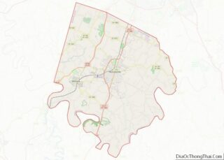
Wilmore is a home rule-class city in Jessamine County, Kentucky, United States. The population was 5,999 at the 2020 census. It is part of the Lexington–Fayette Metropolitan Statistical Area. According to the United States Census Bureau, the city has a total area of 2.6 square miles (6.7 km), all of it land.
| Name: | Wilmore city |
|---|---|
| LSAD Code: | 25 |
| LSAD Description: | city (suffix) |
| State: | Kentucky |
| County: | Jessamine County |
| Elevation: | 883 ft (269 m) |
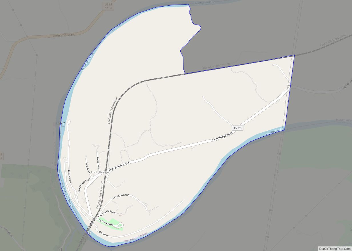
| Total Area: | 4.09 sq mi (10.60 km²) |
| Land Area: | 4.06 sq mi (10.51 km²) |
| Water Area: | 0.03 sq mi (0.09 km²) |
| Total Population: | 5,999 |
| Population Density: | 1,478.31/sq mi (570.81/km²) |
| ZIP code: | 40390 |
| Area code: | 859 |
| FIPS code: | 2183550 |
| GNISfeature ID: | 506874 |
| Website: | http://www.wilmore.org/ |
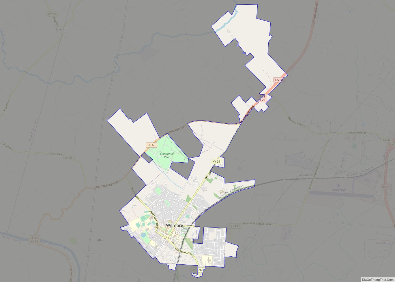
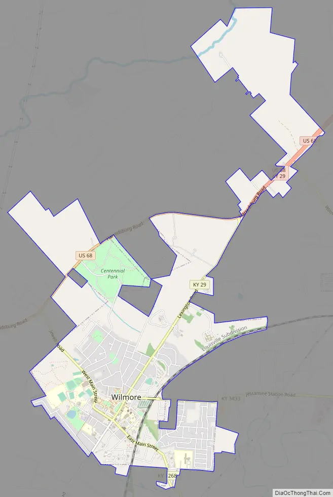
Online Interactive Map
Click on ![]() to view map in "full screen" mode.
to view map in "full screen" mode.
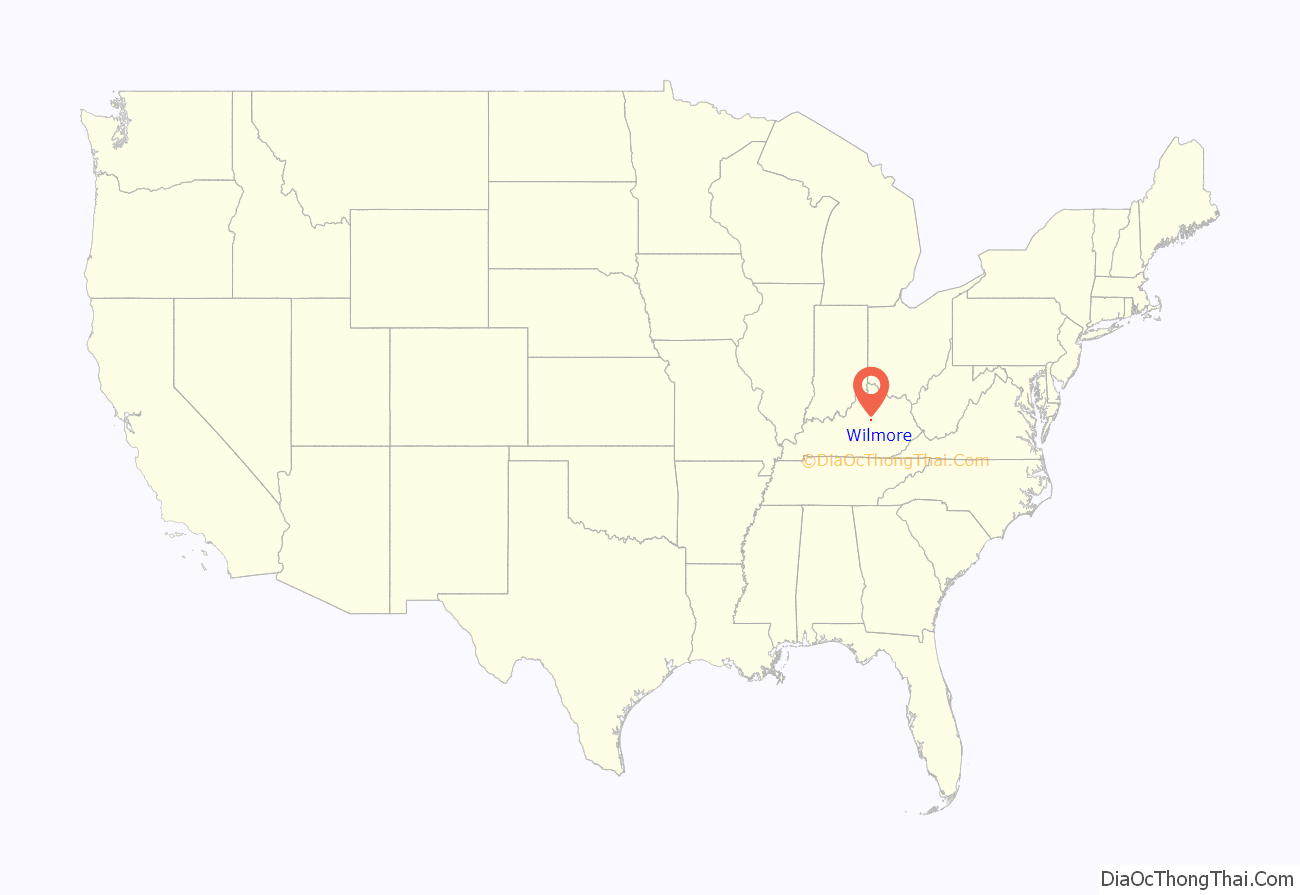
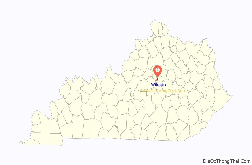
Wilmore location map. Where is Wilmore city?
History
A post office called “Wilmore” was established in 1877. It was named for John R. Wilmore, a local landowner and former slave owner.
In 1882, the Southern Railway established a line through the county and located a flag stop at Wilmore which was briefly called “Scott’s Station”. It was named for John D. Scott, the owner of the site. The station’s name was soon changed to Wilmore.
By the 1890s, Wilmore was a prosperous settlement with a population of about 600. Wilmore was an important shipping point for cattle, hogs, grain and other produce, and the settlement had a blacksmith, carriage repair shops, two drug stores, three doctors, three large stores, a hardware store, two butcher shops, a livery stable, a school, several churches, a glass mill, and a grist mill. Asbury University (formerly Asbury College) was founded in 1890.
Wilmore was incorporated in 1918.
From 1970 to 2012, Wilmore was the original location of the Ichthus Music Festival, a gathering of Christian musical artists and speakers; upon its revival in 2021 it returned to Wilmore. The city is home to the Highbridge Film Festival, a showcase for locally produced films.
Several locations in Wilmore are listed on the National Register of Historic Places, including the Asbury University Administration Building (renamed the Hager Administration Building), the East Main Street Historic District, the Kenyon Avenue Historic District, the Lexington and Main Historic District, the Morrison-Kenyon Library, and the North Lexington Avenue Historic District.
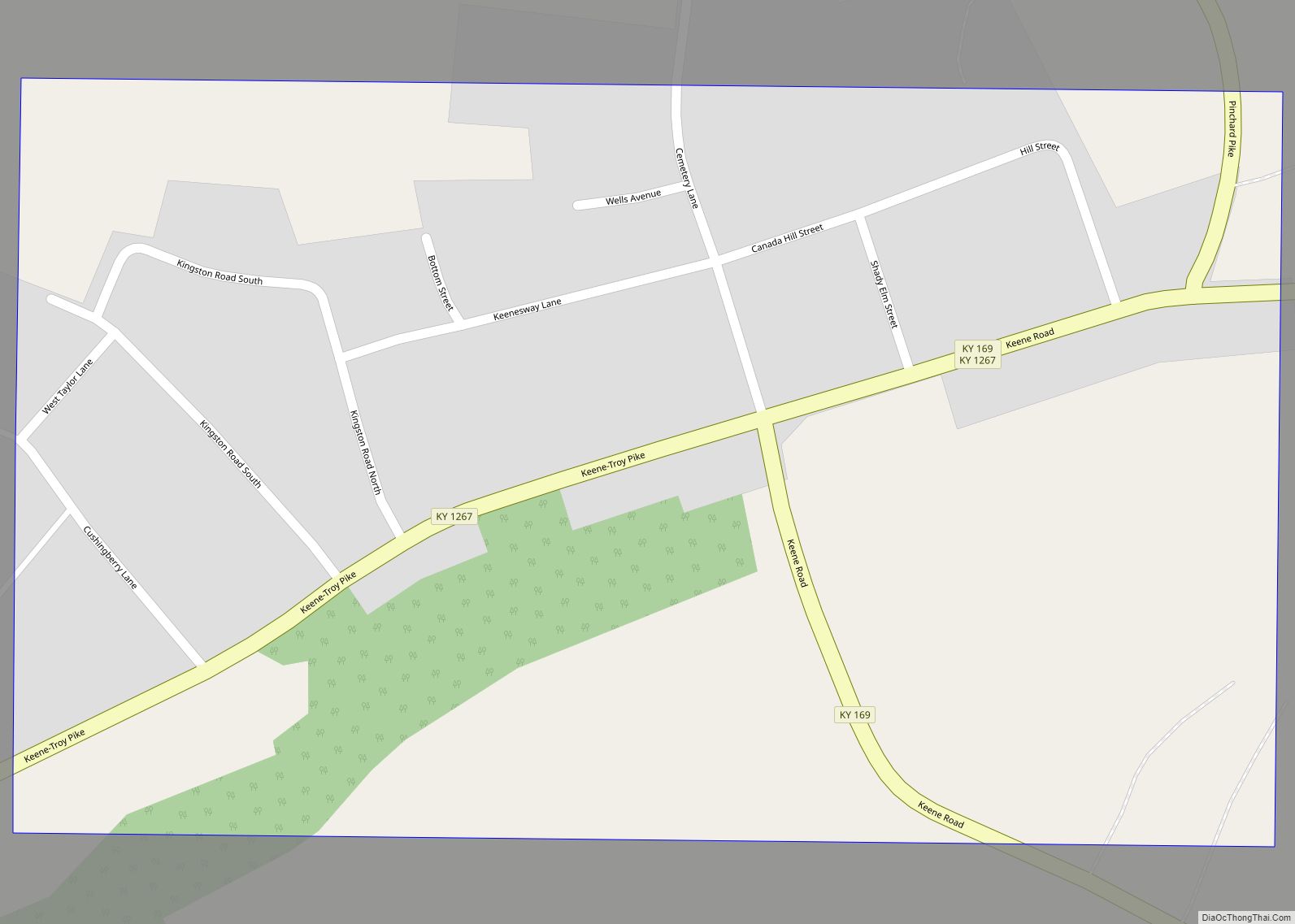
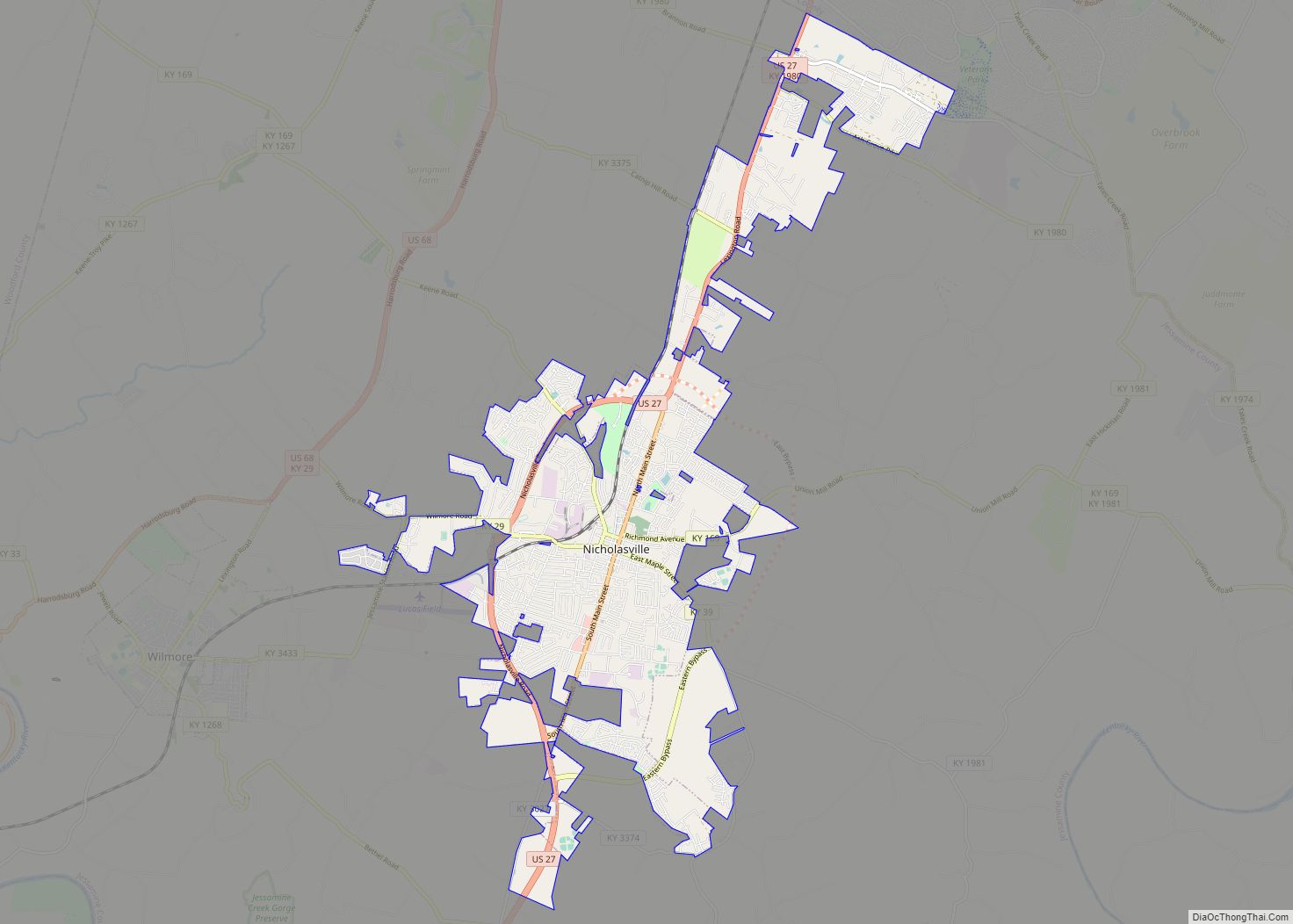
Wilmore Road Map
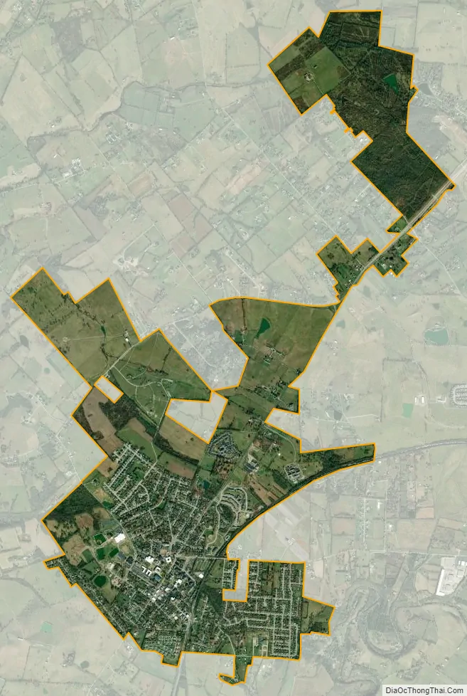
Wilmore city Satellite Map
See also
Map of Kentucky State and its subdivision:- Adair
- Allen
- Anderson
- Ballard
- Barren
- Bath
- Bell
- Boone
- Bourbon
- Boyd
- Boyle
- Bracken
- Breathitt
- Breckinridge
- Bullitt
- Butler
- Caldwell
- Calloway
- Campbell
- Carlisle
- Carroll
- Carter
- Casey
- Christian
- Clark
- Clay
- Clinton
- Crittenden
- Cumberland
- Daviess
- Edmonson
- Elliott
- Estill
- Fayette
- Fleming
- Floyd
- Franklin
- Fulton
- Gallatin
- Garrard
- Grant
- Graves
- Grayson
- Green
- Greenup
- Hancock
- Hardin
- Harlan
- Harrison
- Hart
- Henderson
- Henry
- Hickman
- Hopkins
- Jackson
- Jefferson
- Jessamine
- Johnson
- Kenton
- Knott
- Knox
- Larue
- Laurel
- Lawrence
- Lee
- Leslie
- Letcher
- Lewis
- Lincoln
- Livingston
- Logan
- Lyon
- Madison
- Magoffin
- Marion
- Marshall
- Martin
- Mason
- McCracken
- McCreary
- McLean
- Meade
- Menifee
- Mercer
- Metcalfe
- Monroe
- Montgomery
- Morgan
- Muhlenberg
- Nelson
- Nicholas
- Ohio
- Oldham
- Owen
- Owsley
- Pendleton
- Perry
- Pike
- Powell
- Pulaski
- Robertson
- Rockcastle
- Rowan
- Russell
- Scott
- Shelby
- Simpson
- Spencer
- Taylor
- Todd
- Trigg
- Trimble
- Union
- Warren
- Washington
- Wayne
- Webster
- Whitley
- Wolfe
- Woodford
- Alabama
- Alaska
- Arizona
- Arkansas
- California
- Colorado
- Connecticut
- Delaware
- District of Columbia
- Florida
- Georgia
- Hawaii
- Idaho
- Illinois
- Indiana
- Iowa
- Kansas
- Kentucky
- Louisiana
- Maine
- Maryland
- Massachusetts
- Michigan
- Minnesota
- Mississippi
- Missouri
- Montana
- Nebraska
- Nevada
- New Hampshire
- New Jersey
- New Mexico
- New York
- North Carolina
- North Dakota
- Ohio
- Oklahoma
- Oregon
- Pennsylvania
- Rhode Island
- South Carolina
- South Dakota
- Tennessee
- Texas
- Utah
- Vermont
- Virginia
- Washington
- West Virginia
- Wisconsin
- Wyoming