Lavonia is a city in Franklin and Hart Counties, Georgia, United States. The population was 2,156 at the 2010 census, up from 1,827 at the 2000 census.
| Name: | Lavonia city |
|---|---|
| LSAD Code: | 25 |
| LSAD Description: | city (suffix) |
| State: | Georgia |
| County: | Franklin County, Hart County |
| Elevation: | 853 ft (260 m) |
| Total Area: | 4.53 sq mi (11.73 km²) |
| Land Area: | 4.51 sq mi (11.67 km²) |
| Water Area: | 0.02 sq mi (0.06 km²) |
| Total Population: | 2,143 |
| Population Density: | 475.59/sq mi (183.61/km²) |
| ZIP code: | 30553 |
| Area code: | 706 |
| FIPS code: | 1345460 |
| GNISfeature ID: | 0316687 |
| Website: | www.lavoniaga.gov |
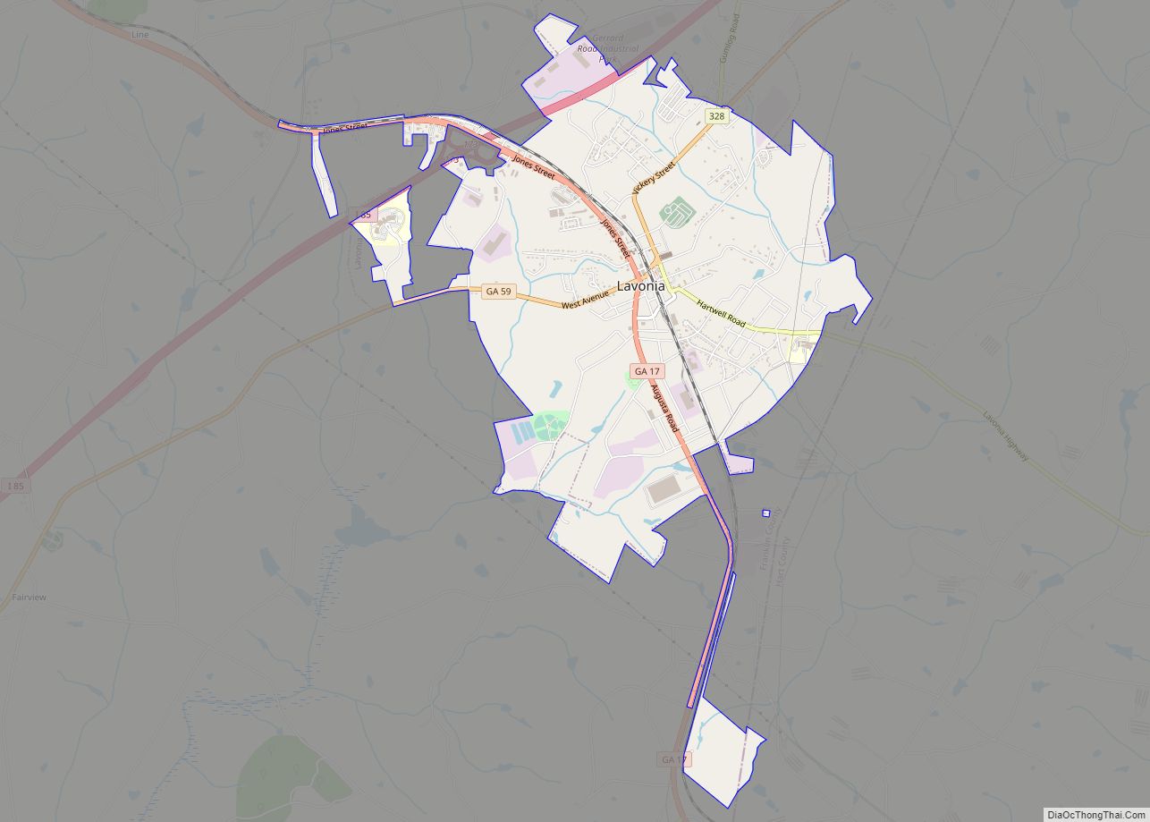
Online Interactive Map
Click on ![]() to view map in "full screen" mode.
to view map in "full screen" mode.
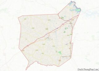
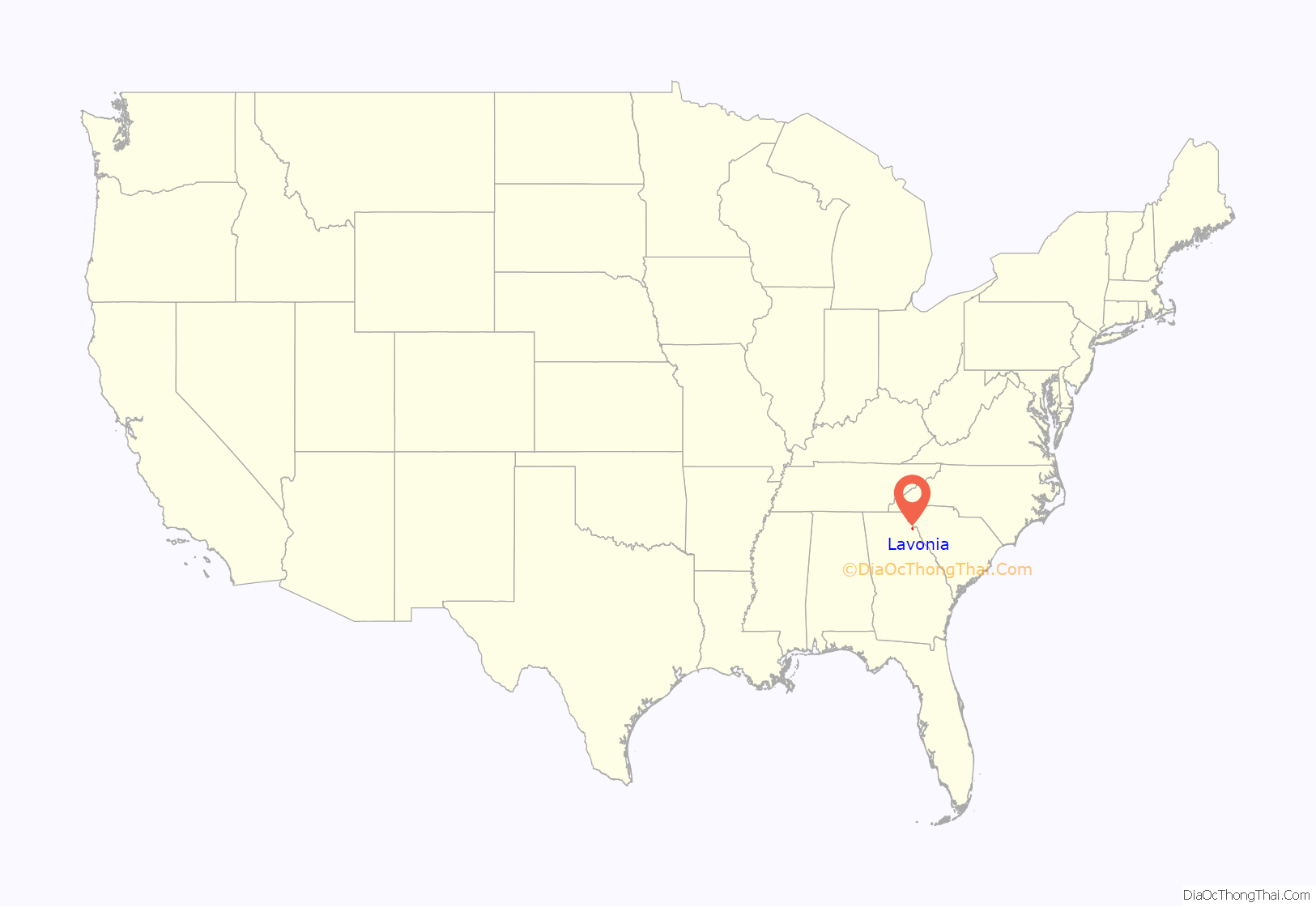
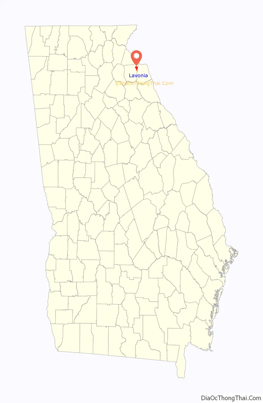
Lavonia location map. Where is Lavonia city?
History
The Cherokee people were indigenous to the area in which Lavonia is located. A sophisticated tribe that typically dwelled in cabins by the 18th century, the Cherokee joined with the British during the American Revolution. When the American colonists prevailed, their land was issued as bounty land to those who had fought in the revolution. As a result, people of European ancestry began to move into the Lavonia area during the 1780s.
The founding of the town of Lavonia came as the result of the expansion of the railroad in northeast Georgia. A railroad line known as the Elberton-Airline Railroad desired another station further to the north. In a move typical for the time, businessmen in the area determined to build a town around the new railroad station. Upon division of the area into town lots and completion of all necessary legal procedures, the town of Lavonia was incorporated in 1880. The community was named after Lavonia Hammond Jones, the wife of a railroad official.
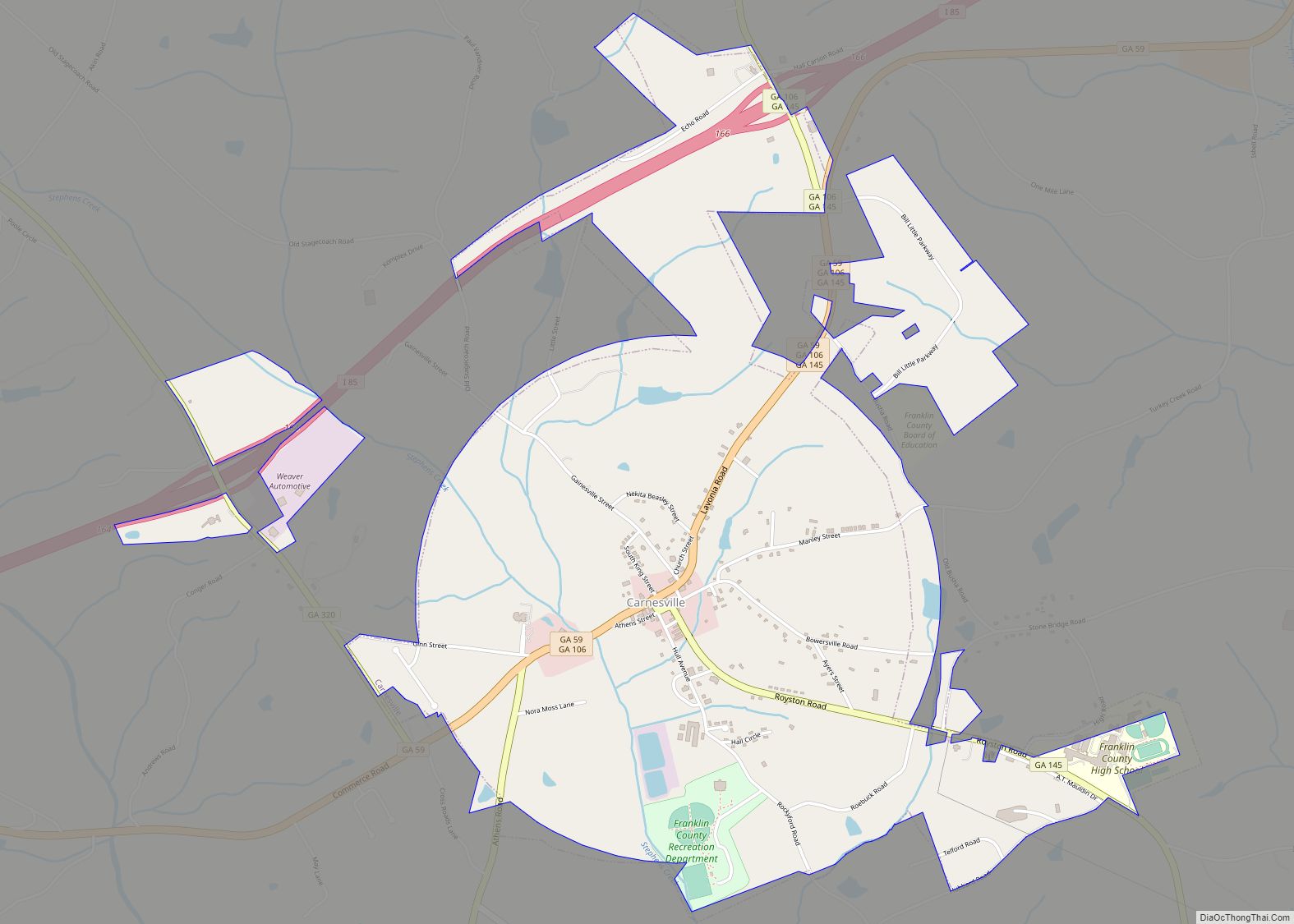
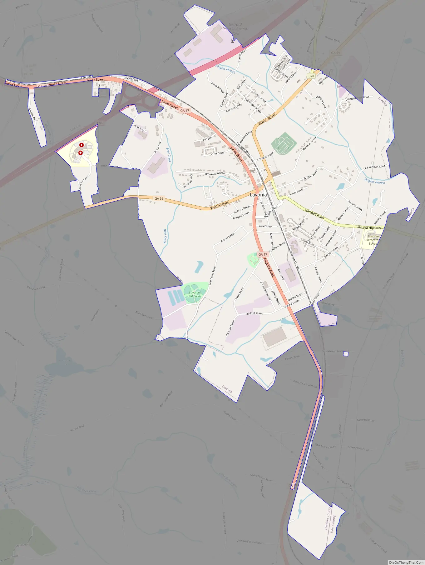
Lavonia Road Map
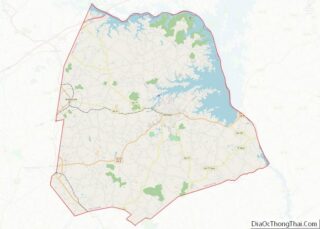
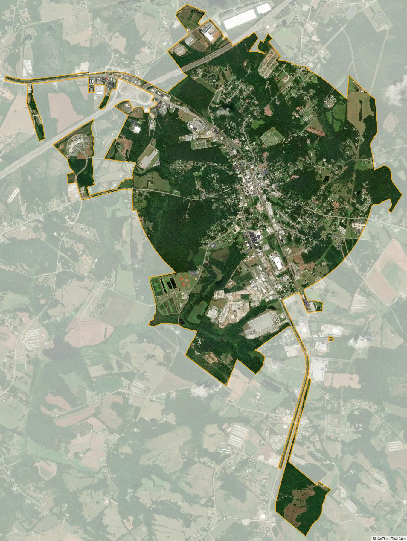
Lavonia city Satellite Map
Geography
Lavonia is located in northeastern Franklin County at 34°26′10″N 83°6′23″W / 34.43611°N 83.10639°W / 34.43611; -83.10639 (34.436055, -83.106270). A small portion of the town extends southeast into Hart County.
According to the United States Census Bureau, the city has a total area of 4.6 square miles (11.9 km), of which 0.02 square miles (0.06 km), or 0.53%, is covered by water.
The city lies along Interstate 85, 53 miles (85 km) southwest of Greenville, South Carolina, and 94 miles (151 km) northeast of Atlanta.
See also
Map of Georgia State and its subdivision:- Appling
- Atkinson
- Bacon
- Baker
- Baldwin
- Banks
- Barrow
- Bartow
- Ben Hill
- Berrien
- Bibb
- Bleckley
- Brantley
- Brooks
- Bryan
- Bulloch
- Burke
- Butts
- Calhoun
- Camden
- Candler
- Carroll
- Catoosa
- Charlton
- Chatham
- Chattahoochee
- Chattooga
- Cherokee
- Clarke
- Clay
- Clayton
- Clinch
- Cobb
- Coffee
- Colquitt
- Columbia
- Cook
- Coweta
- Crawford
- Crisp
- Dade
- Dawson
- Decatur
- DeKalb
- Dodge
- Dooly
- Dougherty
- Douglas
- Early
- Echols
- Effingham
- Elbert
- Emanuel
- Evans
- Fannin
- Fayette
- Floyd
- Forsyth
- Franklin
- Fulton
- Gilmer
- Glascock
- Glynn
- Gordon
- Grady
- Greene
- Gwinnett
- Habersham
- Hall
- Hancock
- Haralson
- Harris
- Hart
- Heard
- Henry
- Houston
- Irwin
- Jackson
- Jasper
- Jeff Davis
- Jefferson
- Jenkins
- Johnson
- Jones
- Lamar
- Lanier
- Laurens
- Lee
- Liberty
- Lincoln
- Long
- Lowndes
- Lumpkin
- Macon
- Madison
- Marion
- McDuffie
- McIntosh
- Meriwether
- Miller
- Mitchell
- Monroe
- Montgomery
- Morgan
- Murray
- Muscogee
- Newton
- Oconee
- Oglethorpe
- Paulding
- Peach
- Pickens
- Pierce
- Pike
- Polk
- Pulaski
- Putnam
- Quitman
- Rabun
- Randolph
- Richmond
- Rockdale
- Schley
- Screven
- Seminole
- Spalding
- Stephens
- Stewart
- Sumter
- Talbot
- Taliaferro
- Tattnall
- Taylor
- Telfair
- Terrell
- Thomas
- Tift
- Toombs
- Towns
- Treutlen
- Troup
- Turner
- Twiggs
- Union
- Upson
- Walker
- Walton
- Ware
- Warren
- Washington
- Wayne
- Webster
- Wheeler
- White
- Whitfield
- Wilcox
- Wilkes
- Wilkinson
- Worth
- Alabama
- Alaska
- Arizona
- Arkansas
- California
- Colorado
- Connecticut
- Delaware
- District of Columbia
- Florida
- Georgia
- Hawaii
- Idaho
- Illinois
- Indiana
- Iowa
- Kansas
- Kentucky
- Louisiana
- Maine
- Maryland
- Massachusetts
- Michigan
- Minnesota
- Mississippi
- Missouri
- Montana
- Nebraska
- Nevada
- New Hampshire
- New Jersey
- New Mexico
- New York
- North Carolina
- North Dakota
- Ohio
- Oklahoma
- Oregon
- Pennsylvania
- Rhode Island
- South Carolina
- South Dakota
- Tennessee
- Texas
- Utah
- Vermont
- Virginia
- Washington
- West Virginia
- Wisconsin
- Wyoming