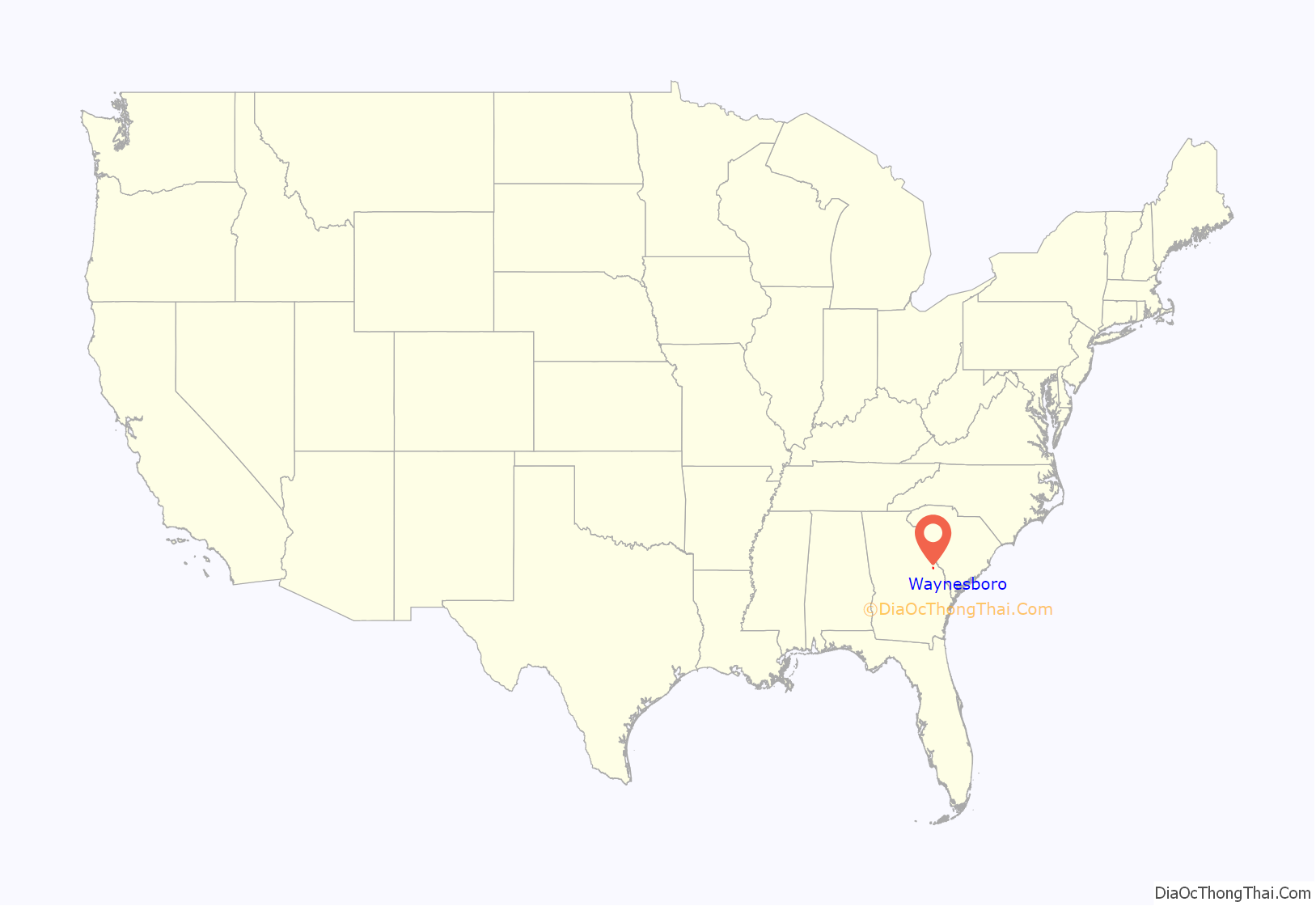
Waynesboro is a city in Burke County, Georgia, United States. The population was 5,766 at the 2010 census. The city is the county seat of Burke County. It is part of the Augusta, Georgia metropolitan area.
Waynesboro is known as “The Bird Dog Capital of the World”. The Waynesboro Commercial Historic District is listed on the National Register of Historic Places.
| Name: | Waynesboro city |
|---|---|
| LSAD Code: | 25 |
| LSAD Description: | city (suffix) |
| State: | Georgia |
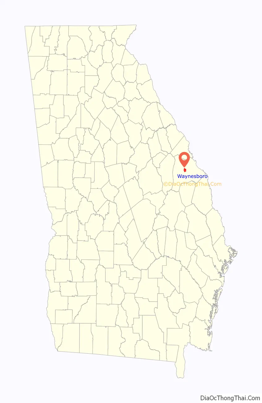
| County: | Burke County |
| Elevation: | 295 ft (90 m) |
| Total Area: | 5.53 sq mi (14.31 km²) |
| Land Area: | 5.47 sq mi (14.17 km²) |
| Water Area: | 0.05 sq mi (0.14 km²) |
| Total Population: | 5,799 |
| Population Density: | 1,059.76/sq mi (409.15/km²) |
| ZIP code: | 30830 |
| Area code: | 706 |
| FIPS code: | 1380984 |
| GNISfeature ID: | 0347180 |
| Website: | www.waynesboroga.com |
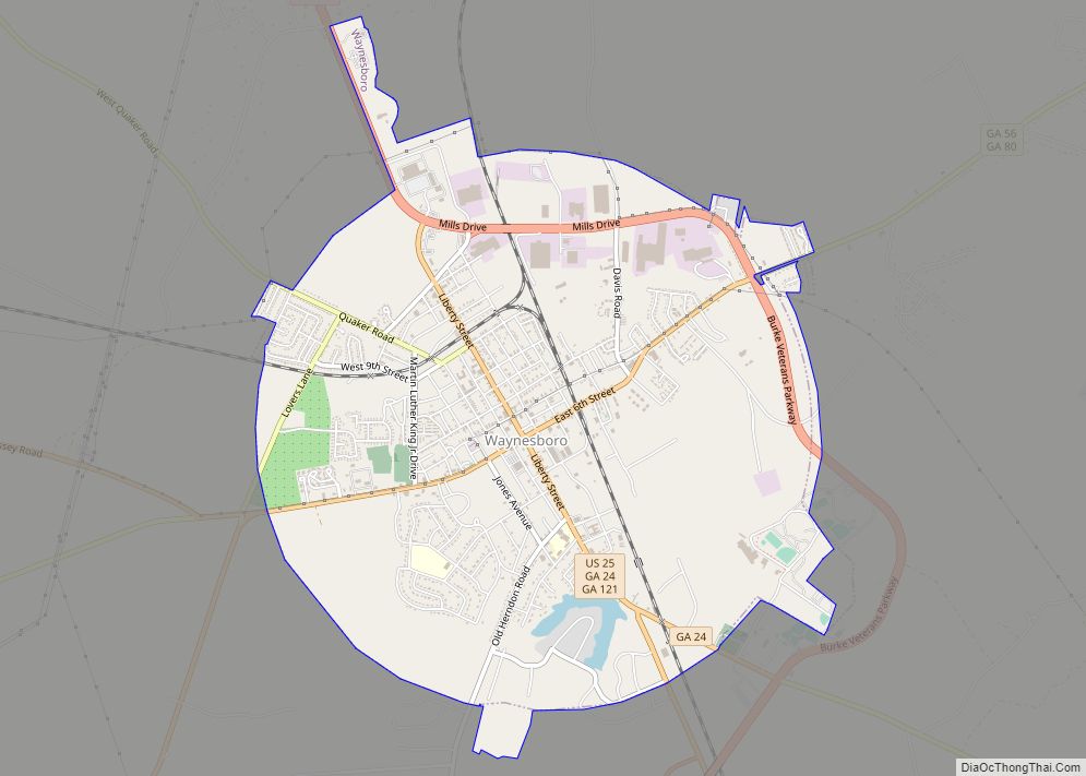
Online Interactive Map
Click on ![]() to view map in "full screen" mode.
to view map in "full screen" mode.
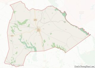
Waynesboro location map. Where is Waynesboro city?
History
Waynesboro is located in Burke County, one of the eight original counties of Georgia. The city was named after General Anthony Wayne, whose daring efforts during the Revolutionary War earned him the nickname “Mad Anthony Wayne”.
Although European Americans lived in the area before the Revolutionary War, the town was not laid out until 1783. The city was officially incorporated in 1883 as Waynesborough. The name was changed to Waynesboro sometime after. It developed as the trading and government center of the county, and is the site of the county courthouse and jail.
President George Washington spent the night of May 17, 1791, in Waynesboro. A stone monument on Liberty Street marks the historical site; it stands in front of the Golden Pantry (formerly Kwik Stop).
On December 4, 1864, the Civil War Battle of Waynesboro was fought just south of the town. Forces under Union General Judson Kilpatrick prevented troops led by Confederate General Joseph Wheeler from interfering with Union General William T. Sherman’s campaign to destroy a wide swathe of the South on his march to Savannah, Georgia, and the Atlantic Ocean.
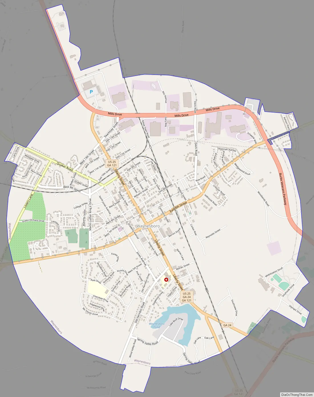
Waynesboro Road Map
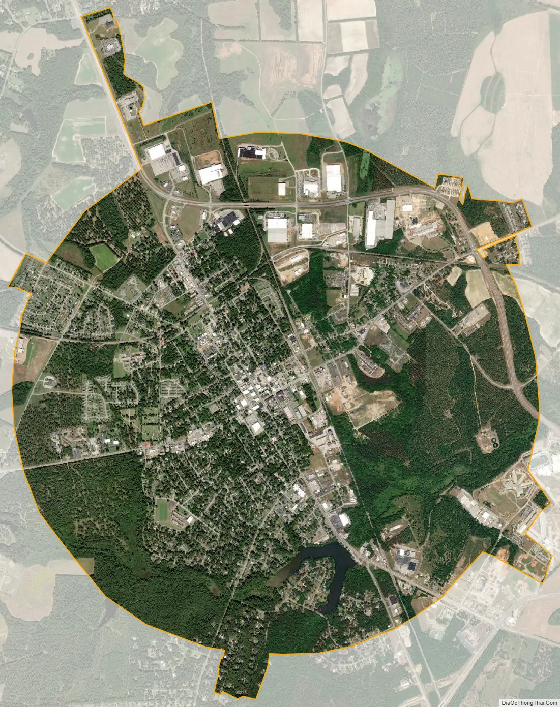
Waynesboro city Satellite Map
Geography
Waynesboro is located in the center of Burke County at 33°5′26″N 82°0′55″W / 33.09056°N 82.01528°W / 33.09056; -82.01528 (33.090482, -82.015404). U.S. Route 25 bypasses the city on the east side, while State Route 121 passes through the center as Liberty Street. To the north it is 28 miles (45 km) to downtown Augusta, and to the south it is 49 miles (79 km) to Statesboro.
According to the United States Census Bureau, Waynesboro has a total area of 5.5 square miles (14.2 km), of which 5.4 square miles (14.0 km) is land and 0.039 square miles (0.1 km), or 0.96%, is water. The city’s elevation is 295 feet (90 m) above sea level. Pine, oak, dogwood, and other trees found in the South are in Waynesboro.
See also
Map of Georgia State and its subdivision:- Appling
- Atkinson
- Bacon
- Baker
- Baldwin
- Banks
- Barrow
- Bartow
- Ben Hill
- Berrien
- Bibb
- Bleckley
- Brantley
- Brooks
- Bryan
- Bulloch
- Burke
- Butts
- Calhoun
- Camden
- Candler
- Carroll
- Catoosa
- Charlton
- Chatham
- Chattahoochee
- Chattooga
- Cherokee
- Clarke
- Clay
- Clayton
- Clinch
- Cobb
- Coffee
- Colquitt
- Columbia
- Cook
- Coweta
- Crawford
- Crisp
- Dade
- Dawson
- Decatur
- DeKalb
- Dodge
- Dooly
- Dougherty
- Douglas
- Early
- Echols
- Effingham
- Elbert
- Emanuel
- Evans
- Fannin
- Fayette
- Floyd
- Forsyth
- Franklin
- Fulton
- Gilmer
- Glascock
- Glynn
- Gordon
- Grady
- Greene
- Gwinnett
- Habersham
- Hall
- Hancock
- Haralson
- Harris
- Hart
- Heard
- Henry
- Houston
- Irwin
- Jackson
- Jasper
- Jeff Davis
- Jefferson
- Jenkins
- Johnson
- Jones
- Lamar
- Lanier
- Laurens
- Lee
- Liberty
- Lincoln
- Long
- Lowndes
- Lumpkin
- Macon
- Madison
- Marion
- McDuffie
- McIntosh
- Meriwether
- Miller
- Mitchell
- Monroe
- Montgomery
- Morgan
- Murray
- Muscogee
- Newton
- Oconee
- Oglethorpe
- Paulding
- Peach
- Pickens
- Pierce
- Pike
- Polk
- Pulaski
- Putnam
- Quitman
- Rabun
- Randolph
- Richmond
- Rockdale
- Schley
- Screven
- Seminole
- Spalding
- Stephens
- Stewart
- Sumter
- Talbot
- Taliaferro
- Tattnall
- Taylor
- Telfair
- Terrell
- Thomas
- Tift
- Toombs
- Towns
- Treutlen
- Troup
- Turner
- Twiggs
- Union
- Upson
- Walker
- Walton
- Ware
- Warren
- Washington
- Wayne
- Webster
- Wheeler
- White
- Whitfield
- Wilcox
- Wilkes
- Wilkinson
- Worth
- Alabama
- Alaska
- Arizona
- Arkansas
- California
- Colorado
- Connecticut
- Delaware
- District of Columbia
- Florida
- Georgia
- Hawaii
- Idaho
- Illinois
- Indiana
- Iowa
- Kansas
- Kentucky
- Louisiana
- Maine
- Maryland
- Massachusetts
- Michigan
- Minnesota
- Mississippi
- Missouri
- Montana
- Nebraska
- Nevada
- New Hampshire
- New Jersey
- New Mexico
- New York
- North Carolina
- North Dakota
- Ohio
- Oklahoma
- Oregon
- Pennsylvania
- Rhode Island
- South Carolina
- South Dakota
- Tennessee
- Texas
- Utah
- Vermont
- Virginia
- Washington
- West Virginia
- Wisconsin
- Wyoming