Statesboro is the largest city and county seat of Bulloch County, Georgia, United States. Located in the southeastern part of the state, its population was 33,438 at the 2020 census. It is the principal city of the Statesboro micropolitan area, which had 81,099 residents, and is part of the Savannah–Hinesville–Statesboro combined statistical area.
The city was chartered in 1803, starting as a small trading community providing basic essentials for surrounding cotton plantations. This drove the economy throughout the 19th century, both before and after the American Civil War. In 1906, Statesboro was selected as the home of the First District A&M School, a land grant college that eventually developed into Georgia Southern University. Statesboro inspired the blues song “Statesboro Blues”, written by Blind Willie McTell in the 1920s, and covered in a well-known version by the Allman Brothers Band. In 2017, Statesboro was selected in the top three of the national America’s Best Communities competition and was named one of nine Georgia “live, work, play” cities by the Georgia Municipal Association.
| Name: | Statesboro city |
|---|---|
| LSAD Code: | 25 |
| LSAD Description: | city (suffix) |
| State: | Georgia |
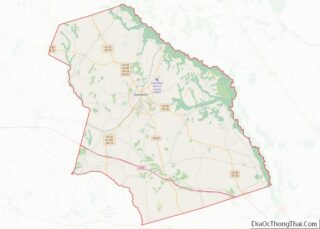
| County: | Bulloch County |
| Elevation: | 253 ft (77 m) |
| Land Area: | 14.99 sq mi (38.84 km²) |
| Water Area: | 0.31 sq mi (0.81 km²) |
| Population Density: | 2,229.94/sq mi (860.97/km²) |
| ZIP code: | 30458-30461 |
| Area code: | 912 |
| FIPS code: | 1373256 |
| GNISfeature ID: | 0323541 |
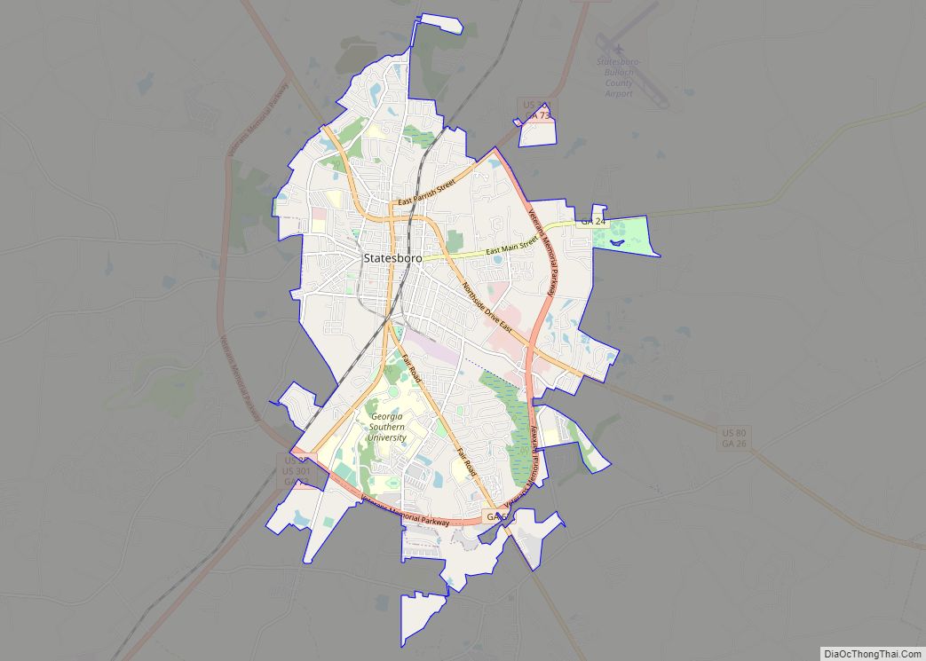
Online Interactive Map
Click on ![]() to view map in "full screen" mode.
to view map in "full screen" mode.
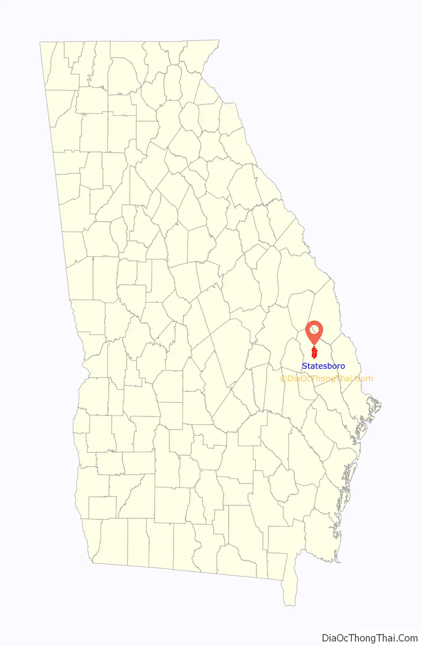
Statesboro location map. Where is Statesboro city?

History
In 1801, George Sibbald of Augusta donated a 9,301-acre (37.64 km) tract for a centrally located county seat for the growing agricultural community of Bulloch County. The area was developed by white planters largely for cotton plantations that were worked by black slave labor. In December 1803, the Georgia legislature created the town of Statesborough. The community most likely was named after the notion of states’ rights, an issue central in the 1800 United States presidential election. In 1866 the state legislature granted a permanent charter to the city, changing the spelling of its name to the present “Statesboro.”
During the Civil War and General William T. Sherman’s famous March to the Sea through Georgia, a Union officer asked a saloon proprietor for directions to Statesboro. The proprietor replied, “You are standing in the middle of town,” indicating its small size. The soldiers destroyed the courthouse, a log structure that doubled as a barn when court was not in session. After the Civil War, the small town began to grow, and Statesboro has developed as a major town in southeastern Georgia. Many freedmen stayed in the area, working on plantations as sharecroppers and tenant farmers.
Following the Reconstruction era, racial violence of whites against blacks increased. In the era from 1880 to 1930, Georgia had the highest rate of lynchings of any state in the nation. Among them were three black men who were lynched and burned to death on August 16, 1904, near Statesboro. A fourth man was lynched later in the month in Bulloch County. After a white farm family was killed, the white community spread unfounded rumors of black clergy urging blacks to violence against whites, and more than twelve black men were arrested in this case.
Paul Reed and Will Cato were convicted of the Hodge family murders by an all-white jury and sentenced to death on August 16, 1904, but they were abducted that day from the courthouse by a lynch mob and brutally burned to death. Handy Bell, another suspect, was lynched and burned by a mob that night. White violence against blacks did not end; both men and women were physically attacked on the streets. Area newspaper coverage of the trial and lynching had been sensationalized, arousing anger, and two more black men were lynched in August 1904: Sebastian McBride in Portal, another town in Bulloch County, and A.L. Scott in Wilcox County.
To escape oppression and violence, many African Americans left Statesboro and Bulloch County altogether, causing local businessmen to worry about labor shortages in the cotton and turpentine industries. African Americans made a Great Migration from the rural South to northern cities in the first half of the 20th century. Local effects can be seen in the drop in Statesboro population growth from 1910 to 1930 on the census tables below in the “Demographics” section.
Around the turn of the century, new businesses in Statesboro included stores and banks built along North, East, South, and West Main streets. In 1908, Statesboro led the world in sales of long-staple Sea Island Cotton, a specialty of the Low Country. Mechanization of agriculture decreased the need for some farm labor. After the boll weevil destroyed the cotton crop in the 1930s, farmers shifted to tobacco. The insect had invaded the South from the west, disrupting cotton cultivation throughout the region. By 1953, however, more than 20 million pounds of tobacco passed through warehouses in Statesboro, then the largest market of the “Bright Tobacco Belt” spanning Georgia and Florida.
The 1906 First District Agricultural & Mechanical School at Statesboro was developed as a land grant college, initiated by federal legislation to support education. Its mission shifted in the 1920s to teacher training; and in 1924 it was renamed as the Georgia Normal School. With expansion of the curriculum to a 4-year program, it was renamed as the South Georgia Teachers College in 1929. Other name changes were to Georgia Teachers College in 1939, and Georgia Southern College in 1959. After this period, it became racially integrated and with development of graduate programs and research in numerous fields, since 1990 it has had university status as Georgia Southern University.
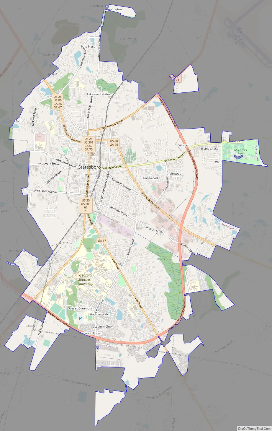
Statesboro Road Map
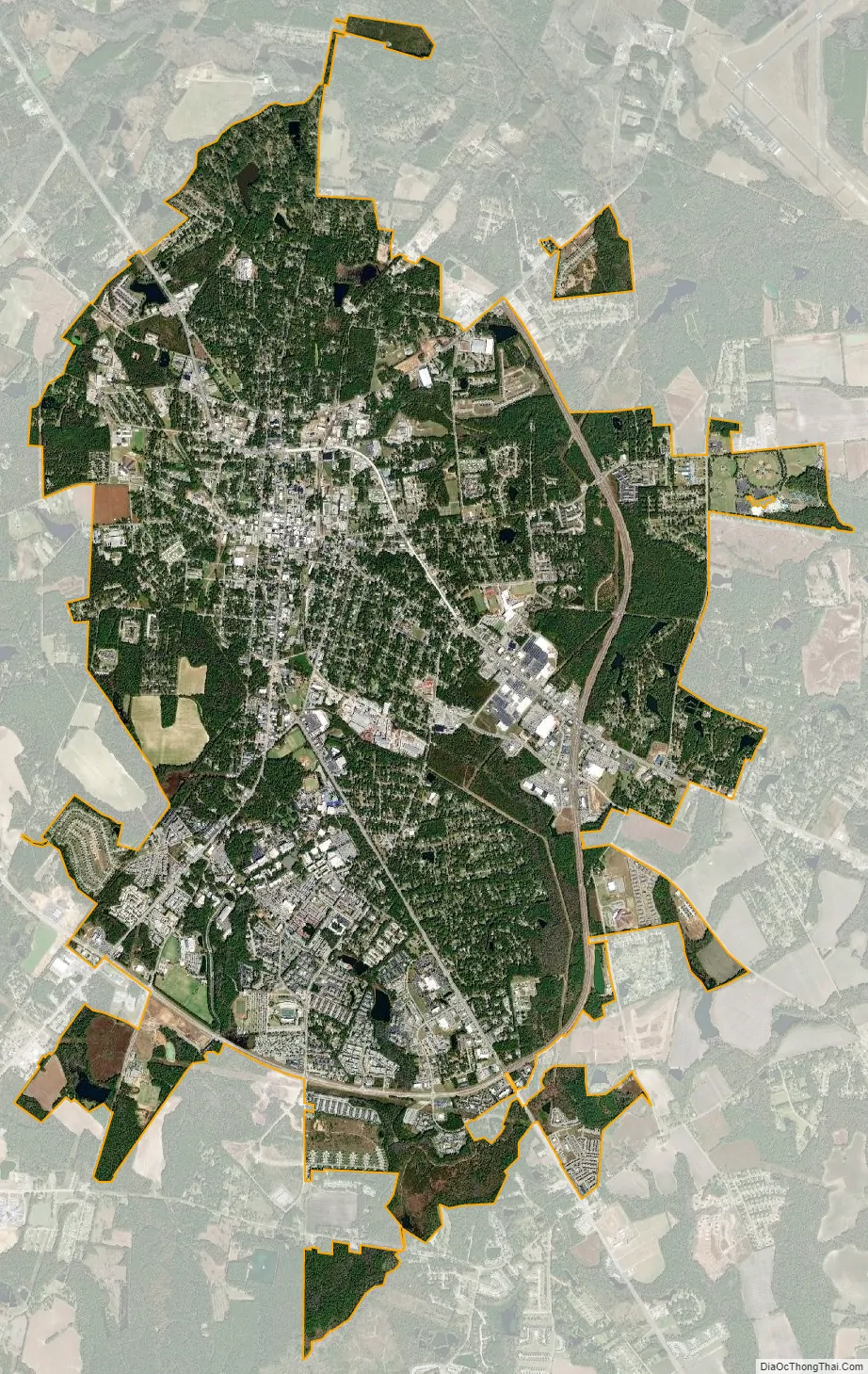
Statesboro city Satellite Map
Geography
Statesboro is located at 32°26′43″N 81°46′45″W / 32.44528°N 81.77917°W / 32.44528; -81.77917 (32.445147, -81.779234). The city is located in southeastern Georgia along U.S. Routes 80, 25, and 301. US 80 runs northwest to southeast through the city, leading southeast 58 mi (93 km) to Savannah and west-northwest 37 mi (60 km) to Swainsboro. US 25 and 301 run concurrently through the center of town and split upon their junction with US 80, leading south 12 mi (19 km) to Interstate 16 at exit 116. US 25 leads north 29 mi (47 km) to Millen and US 301 north 24 mi (39 km) to Sylvania.
According to the United States Census Bureau, the city has a total area of 13.9 square miles (35.9 km), of which 13.5 square miles (35.0 km) is land and 0.35 square miles (0.9 km), or 2.60%, is water. The city is in the coastal plain region, or Low Country, of Georgia, so it is mainly flat with a few small hills. With an elevation of 250 feet (76 m), the downtown area is one of the highest places in Bulloch County. Pine, oak, magnolia, dogwood, palm, sweetgum, and a variety of other trees can be found in the area.
Climate
Statesboro has a humid subtropical climate, according to the Köppen classification. The city experiences very hot and humid summers with average July highs of about 91 degrees and lows around 70. Afternoon thunderstorms associated with the summer heat and humidity can spawn from time to time. Winters are mild with average January highs of 58 degrees and lows of 36 degrees. Winter storms are rare, but they happen periodically, the most recent being an ice storm in January 2018. On February 12, 2010, approximately two inches of snow fell on the city.
See also
Map of Georgia State and its subdivision:- Appling
- Atkinson
- Bacon
- Baker
- Baldwin
- Banks
- Barrow
- Bartow
- Ben Hill
- Berrien
- Bibb
- Bleckley
- Brantley
- Brooks
- Bryan
- Bulloch
- Burke
- Butts
- Calhoun
- Camden
- Candler
- Carroll
- Catoosa
- Charlton
- Chatham
- Chattahoochee
- Chattooga
- Cherokee
- Clarke
- Clay
- Clayton
- Clinch
- Cobb
- Coffee
- Colquitt
- Columbia
- Cook
- Coweta
- Crawford
- Crisp
- Dade
- Dawson
- Decatur
- DeKalb
- Dodge
- Dooly
- Dougherty
- Douglas
- Early
- Echols
- Effingham
- Elbert
- Emanuel
- Evans
- Fannin
- Fayette
- Floyd
- Forsyth
- Franklin
- Fulton
- Gilmer
- Glascock
- Glynn
- Gordon
- Grady
- Greene
- Gwinnett
- Habersham
- Hall
- Hancock
- Haralson
- Harris
- Hart
- Heard
- Henry
- Houston
- Irwin
- Jackson
- Jasper
- Jeff Davis
- Jefferson
- Jenkins
- Johnson
- Jones
- Lamar
- Lanier
- Laurens
- Lee
- Liberty
- Lincoln
- Long
- Lowndes
- Lumpkin
- Macon
- Madison
- Marion
- McDuffie
- McIntosh
- Meriwether
- Miller
- Mitchell
- Monroe
- Montgomery
- Morgan
- Murray
- Muscogee
- Newton
- Oconee
- Oglethorpe
- Paulding
- Peach
- Pickens
- Pierce
- Pike
- Polk
- Pulaski
- Putnam
- Quitman
- Rabun
- Randolph
- Richmond
- Rockdale
- Schley
- Screven
- Seminole
- Spalding
- Stephens
- Stewart
- Sumter
- Talbot
- Taliaferro
- Tattnall
- Taylor
- Telfair
- Terrell
- Thomas
- Tift
- Toombs
- Towns
- Treutlen
- Troup
- Turner
- Twiggs
- Union
- Upson
- Walker
- Walton
- Ware
- Warren
- Washington
- Wayne
- Webster
- Wheeler
- White
- Whitfield
- Wilcox
- Wilkes
- Wilkinson
- Worth
- Alabama
- Alaska
- Arizona
- Arkansas
- California
- Colorado
- Connecticut
- Delaware
- District of Columbia
- Florida
- Georgia
- Hawaii
- Idaho
- Illinois
- Indiana
- Iowa
- Kansas
- Kentucky
- Louisiana
- Maine
- Maryland
- Massachusetts
- Michigan
- Minnesota
- Mississippi
- Missouri
- Montana
- Nebraska
- Nevada
- New Hampshire
- New Jersey
- New Mexico
- New York
- North Carolina
- North Dakota
- Ohio
- Oklahoma
- Oregon
- Pennsylvania
- Rhode Island
- South Carolina
- South Dakota
- Tennessee
- Texas
- Utah
- Vermont
- Virginia
- Washington
- West Virginia
- Wisconsin
- Wyoming