Leavenworth is a town in Jennings Township, Crawford County, Indiana, along the Ohio River. The 2010 US Census recorded a population of 238 persons.
| Name: | Leavenworth town |
|---|---|
| LSAD Code: | 43 |
| LSAD Description: | town (suffix) |
| State: | Indiana |
| County: | Crawford County |
| Elevation: | 659 ft (201 m) |
| Total Area: | 0.92 sq mi (2.39 km²) |
| Land Area: | 0.88 sq mi (2.27 km²) |
| Water Area: | 0.05 sq mi (0.12 km²) |
| Total Population: | 289 |
| Population Density: | 329.16/sq mi (127.11/km²) |
| ZIP code: | 47137 |
| Area code: | 812 |
| FIPS code: | 1842606 |
| GNISfeature ID: | 0437716 |
Online Interactive Map
Click on ![]() to view map in "full screen" mode.
to view map in "full screen" mode.
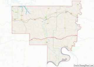
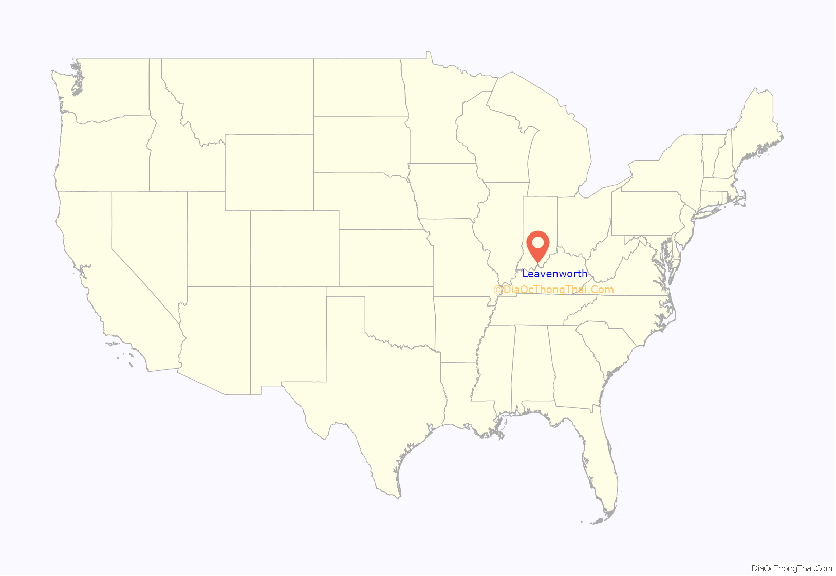
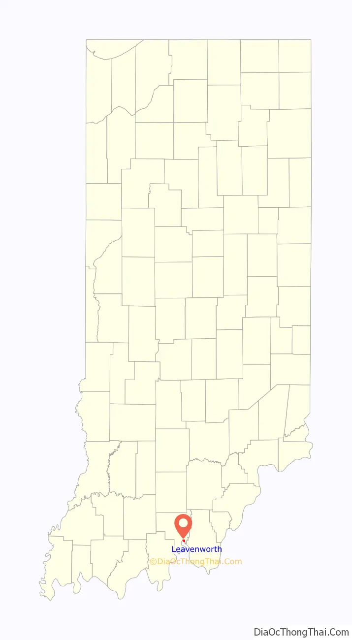
Leavenworth location map. Where is Leavenworth town?
History
Foundation and early settlement
Leavenworth was laid out in 1818 in an oxbow of the Ohio River, directly under a large bluff called Mt. Eden. The bluff forms part of the Indiana Ridge and faces directly across the river toward Kentucky. “Old Leavenworth” (the original town, now practically abandoned) was almost completely wiped out by the huge 1937 Ohio River flood, as it was built directly on the floodplain.
The town was founded by Zebulon Leavenworth and his brother Seth, natives of Connecticut.
In 1824, a wood yard was established in the town to provide fuel to steamboats, and David Lyon had a boatbuilding industry here in 1830. The Whitcomb brickyard was also a flourishing industry.
The Crisis, Crawford County’s first newspaper, was begun in Leavenworth in 1839.
In 1835, Zebulon started a stage line from Leavenworth to the new state capitol in Indianapolis, a route intended primarily for students going to the new State College in Bloomington (later Indiana University) and for boatmen returning from downriver.
Riverboat men returning from New Orleans were thought to be carriers of the yellow fever and cholera epidemics that often devastated the Ohio Valley frontier. Seth Leavenworth advocated the construction of a marine hospital for the purpose of quarantine and medical treatment, which he hoped to build somewhere near the town of Leavenworth. The bill he put before the Indiana legislature was never enacted.
In 1843, Leavenworth supplanted Fredonia as the county seat. Leavenworth remained the county seat until 1896, when the county records were stolen by a mob in a notorious armed “courthouse war” against the town of English.
Seth Leavenworth eventually left Indiana and moved to Missouri, where he died in 1854. His son Zebulon, named after the boy’s uncle in Indiana, became a famous riverboat pilot on the Mississippi River and was a friend of Mark Twain before Twain became a writer. Together, they piloted the steamboat Nebraska past Memphis at the outbreak of the Civil War, receiving gunshots across their bow as a warning to halt.
The Hines Raid, 1863
In June 1863, a 25-year-old Confederate spy from Kentucky, Thomas Hines, was sent by General John Hunt Morgan to ride north into Indiana and reconnoiter with Southern sympathizers there, whose dedication to the Southern cause Morgan drastically overestimated. Hines and his party of nearly a hundred men stole uniforms from a Union supply depot in Brownsville, Kentucky, then robbed a train in Elizabethtown to acquire Union currency. Dressed as Federal troops, they crossed the Ohio River on horseback a few miles downstream from Leavenworth, then struck out for Paoli, pretending to be in pursuit of Union deserters.
In French Lick, they met with the local Copperhead leader, Doctor William A. Bowles, who headed the Confederate-leaning Democratic party in southern Indiana and was a supporter of slavery. Bowles told them he was unable to help them. Indiana Home Guards were then in pursuit of the Confederates. Hines hired a Leavenworth local to guide them to a safe ford over the river where they could escape into Kentucky, but the local was actually a Union supporter and betrayed them. Residents of Leavenworth carried ammunition to Union troops, who gunned several of the horsemen down as they tried to get across the river at Little Blue Island. Three Confederate soldiers were killed and a large number were taken prisoner and kept in the Methodist Church in Leavenworth. The spy, Hines, escaped.
Between the Civil War and the 1937 Ohio River Flood
At the end of the Civil War, Leavenworth was a thriving town, a regular stop for steamboats on the Ohio River.
Button-making was an important industry, relying on shell banks in the river. The industry declined in the 1920s, when shell banks were exhausted. A total of 700 people lived in the town in 1910 and three button factories employed twenty-four families. Other industries included boat-making, freight hauling, and barrel production.
Quarries opened up in the 1880s and lime was shipped out on flatboats. In October 1890, a fire destroyed about one-third of Leavenworth. The population at this time was over five hundred.
The 1937 Ohio River Flood
The river’s waters began to rise in January 1937. Record rainfalls by late January resulted in a huge flood, the most destructive in the Ohio Valley’s history. Of 145 houses in Leavenworth, twenty floated away and sixty-five were lifted off their foundations. Four hundred of the town’s population of 418 were forced to evacuate.
Laborers enlisted by Franklin Roosevelt’s Works Progress Administration (WPA) salvaged what they could, but when the waters receded, it was decided to move what was left of Leavenworth uphill. Under the direction of Indiana Work Relief Administrator John K. Jennings, the town decided to relocate to the top of the bluff, rendering “Old” Leavenworth a ghost town. Rebuilding was complete by December 1938. Leavenworth was then the only completely rebuilt community in Indiana, though in the 1950s and 1990s, English was ravaged by floods on the Blue River and eventually relocated to higher ground in the mid 1990s, the second largest relocation of a town in U.S. history.
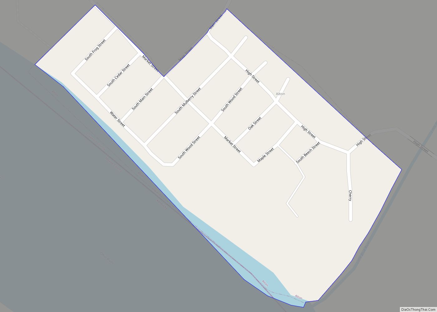
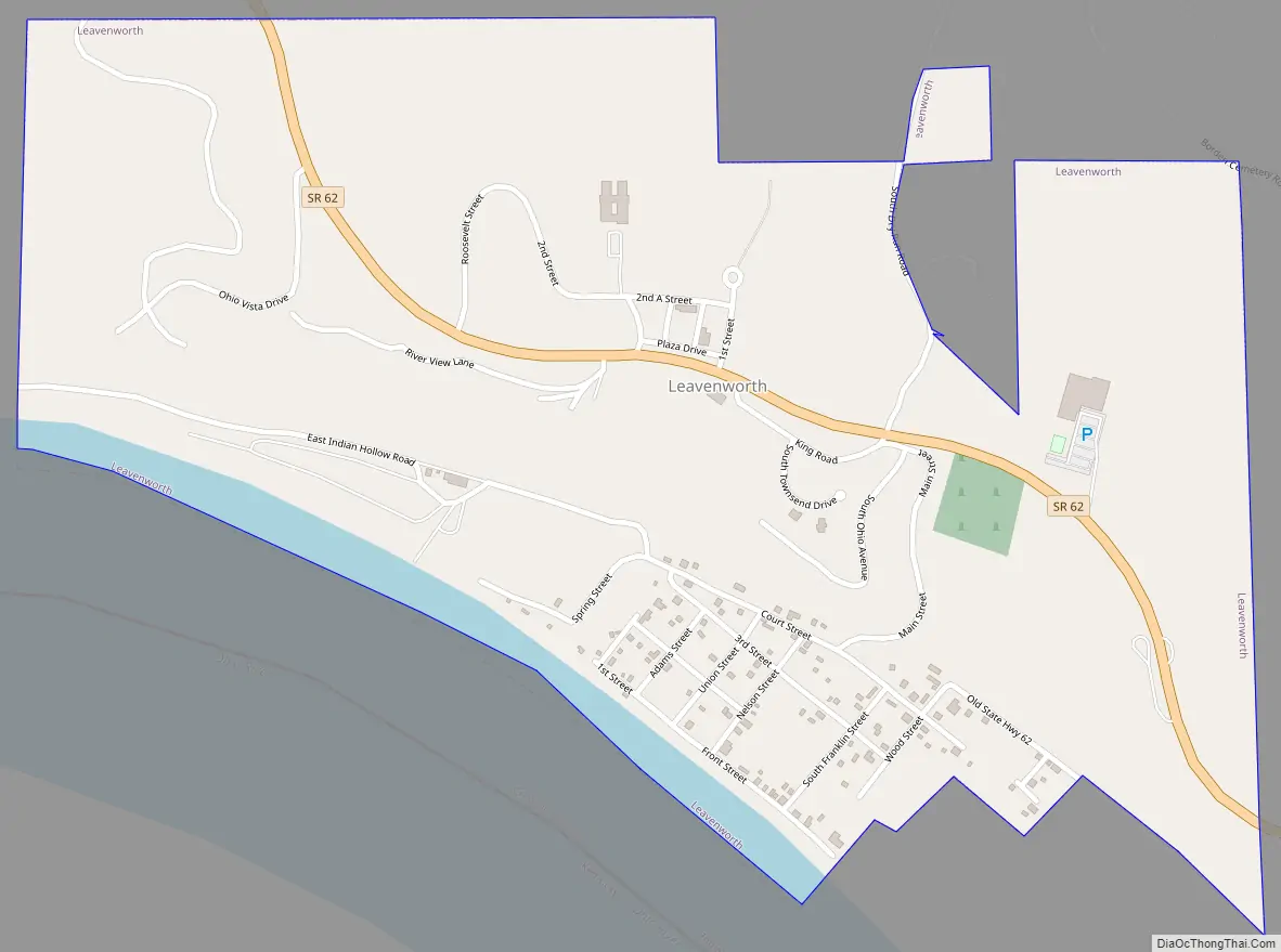
Leavenworth Road Map
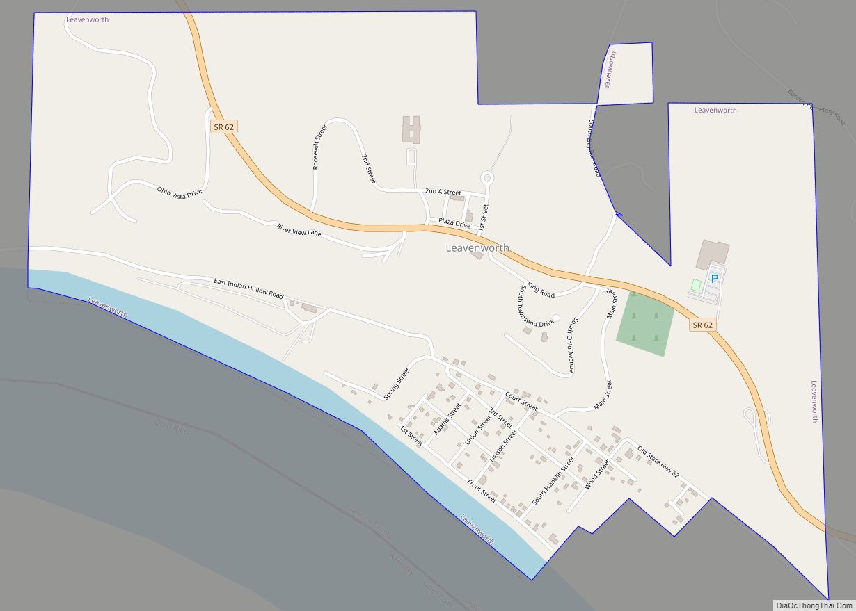
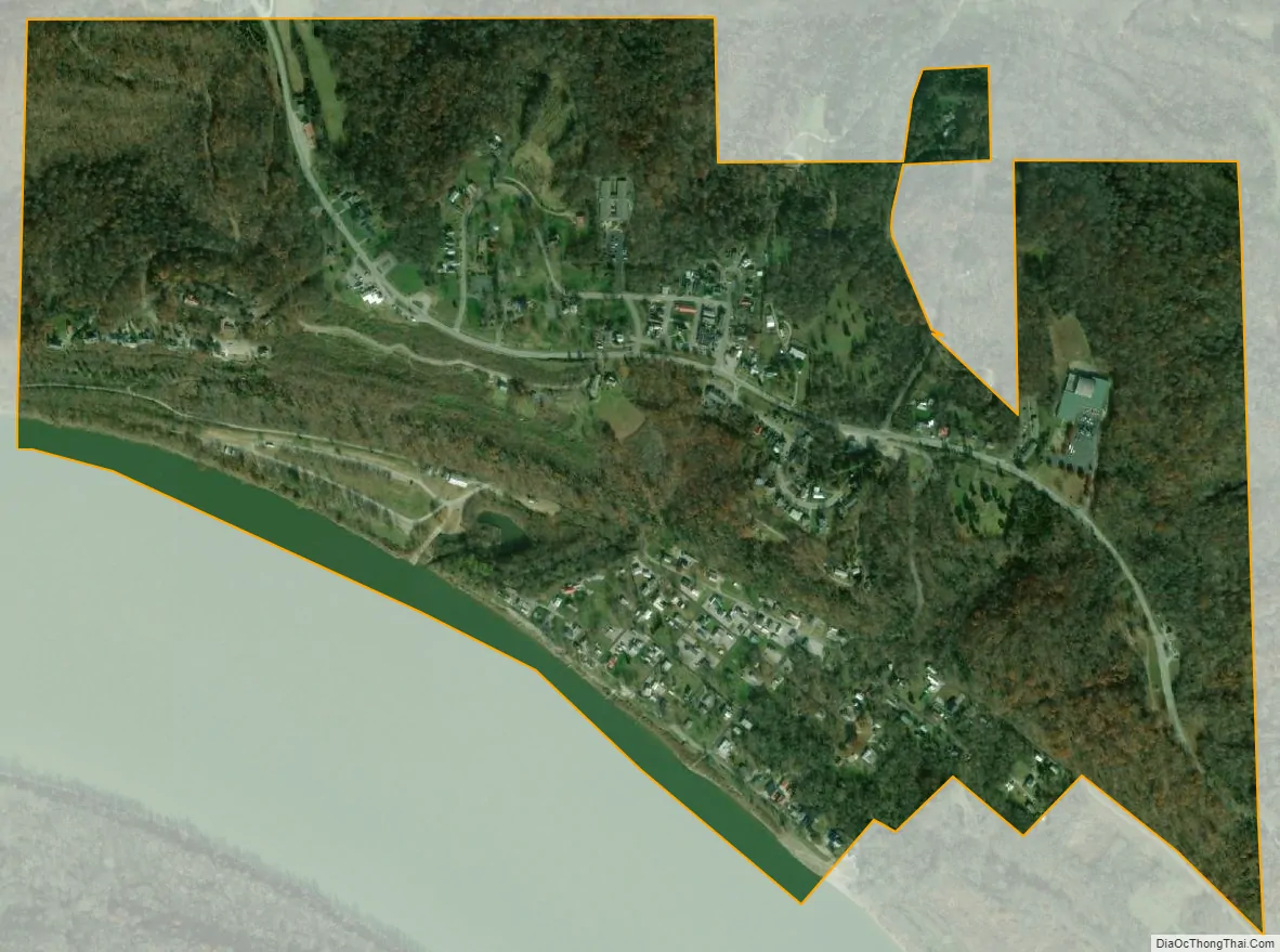
Leavenworth city Satellite Map
Geography
Leavenworth is located at 38°11′57″N 86°20′32″W / 38.19917°N 86.34222°W / 38.19917; -86.34222 (38.199061, -86.342334).
According to the 2010 census, Leavenworth has a total area of 0.87 square miles (2.25 km), of which 0.82 square miles (2.12 km) (or 94.25%) is land and 0.05 square miles (0.13 km) (or 5.75%) is water.
Climate
The climate in this area is characterized by hot, humid summers and generally mild to cool winters. According to the Köppen Climate Classification system, Leavenworth has a humid subtropical climate, abbreviated “Cfa” on climate maps.
See also
Map of Indiana State and its subdivision:- Adams
- Allen
- Bartholomew
- Benton
- Blackford
- Boone
- Brown
- Carroll
- Cass
- Clark
- Clay
- Clinton
- Crawford
- Daviess
- De Kalb
- Dearborn
- Decatur
- Delaware
- Dubois
- Elkhart
- Fayette
- Floyd
- Fountain
- Franklin
- Fulton
- Gibson
- Grant
- Greene
- Hamilton
- Hancock
- Harrison
- Hendricks
- Henry
- Howard
- Huntington
- Jackson
- Jasper
- Jay
- Jefferson
- Jennings
- Johnson
- Knox
- Kosciusko
- LaGrange
- Lake
- Lake Michigan
- LaPorte
- Lawrence
- Madison
- Marion
- Marshall
- Martin
- Miami
- Monroe
- Montgomery
- Morgan
- Newton
- Noble
- Ohio
- Orange
- Owen
- Parke
- Perry
- Pike
- Porter
- Posey
- Pulaski
- Putnam
- Randolph
- Ripley
- Rush
- Saint Joseph
- Scott
- Shelby
- Spencer
- Starke
- Steuben
- Sullivan
- Switzerland
- Tippecanoe
- Tipton
- Union
- Vanderburgh
- Vermillion
- Vigo
- Wabash
- Warren
- Warrick
- Washington
- Wayne
- Wells
- White
- Whitley
- Alabama
- Alaska
- Arizona
- Arkansas
- California
- Colorado
- Connecticut
- Delaware
- District of Columbia
- Florida
- Georgia
- Hawaii
- Idaho
- Illinois
- Indiana
- Iowa
- Kansas
- Kentucky
- Louisiana
- Maine
- Maryland
- Massachusetts
- Michigan
- Minnesota
- Mississippi
- Missouri
- Montana
- Nebraska
- Nevada
- New Hampshire
- New Jersey
- New Mexico
- New York
- North Carolina
- North Dakota
- Ohio
- Oklahoma
- Oregon
- Pennsylvania
- Rhode Island
- South Carolina
- South Dakota
- Tennessee
- Texas
- Utah
- Vermont
- Virginia
- Washington
- West Virginia
- Wisconsin
- Wyoming