Annville is an unincorporated community, a census-designated place (CDP), and the largest community in Jackson County, KY. As of the 2020 census, the population was 1,102. The community was established in 1878 and named for local resident Nancy Ann Johnson. The community offers a few services such as a post office, grocery store, gas station, medical clinic, nursing home, restaurants, and other locally owned businesses.
| Name: | Annville CDP |
|---|---|
| LSAD Code: | 57 |
| LSAD Description: | CDP (suffix) |
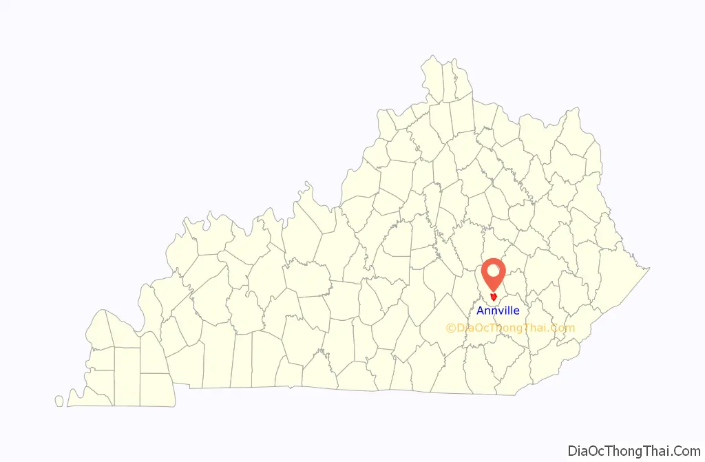
| State: | Kentucky |
| County: | Jackson County |
| Elevation: | 1,102 ft (336 m) |
| Total Area: | 8.05 sq mi (20.85 km²) |
| Land Area: | 8.01 sq mi (20.73 km²) |
| Water Area: | 0.04 sq mi (0.11 km²) |
| Total Population: | 1,102 |
| Population Density: | 137.66/sq mi (53.15/km²) |
| ZIP code: | 40402 |
| Area code: | 606 |
| FIPS code: | 2101648 |
Online Interactive Map
Click on ![]() to view map in "full screen" mode.
to view map in "full screen" mode.
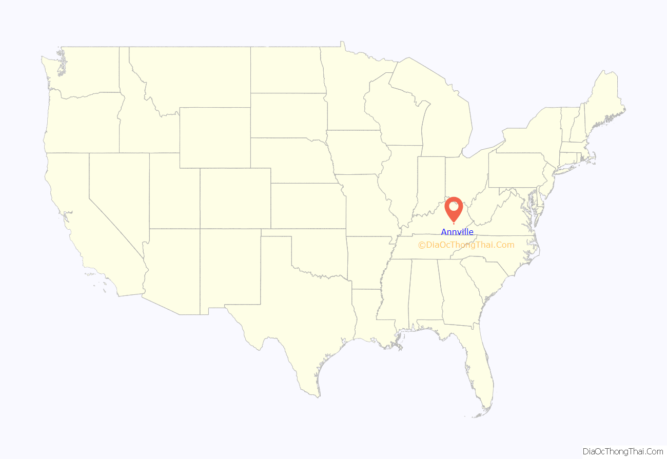
Annville location map. Where is Annville CDP?
History
Establishment
The town’s first post office was opened in 1878, named Chinquapin Rough, for the numerous chinquapin and dwarf chestnut trees found along Pond Creek. In 1886 the post office was renamed Annville for resident Nancy Ann Johnson. Annville was incorporated in 1988 and dissolved in 2000.
Annville Institute
In 1909, Rev. William Worthington decided to locate a Reformed Church College in Jackson County, KY. His vision was for some sort of technical school to help promote his vision of “complete living for the mountain people.” The beautiful property with its rolling hills and large meadows was purchased and the Annville Institute started that Fall and has served the community in multiple facets ever since. Although the Annville Institute no longer operates as a school, it still benefits the community through its numerous outreach program and facilities.
Lincoln Hall
Lincoln Hall served as the main classroom for the Annville Institute. The original Lincoln Hall was destroyed by fire in 1921. The present building was built in 1922 and 1923 on the foundation of the original building. After the Institute ceased its educational operations in 1978, the building has primarily served as a community center, with no true purpose.
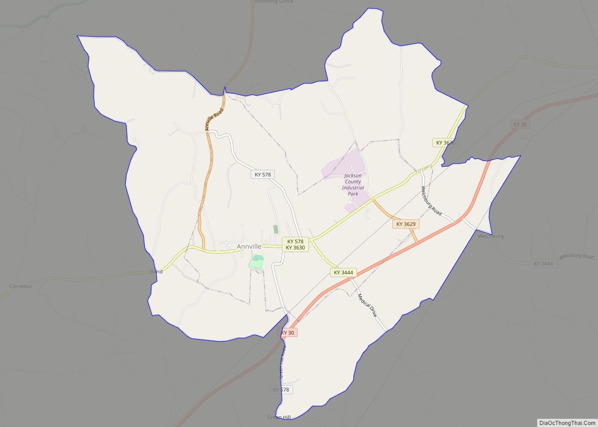
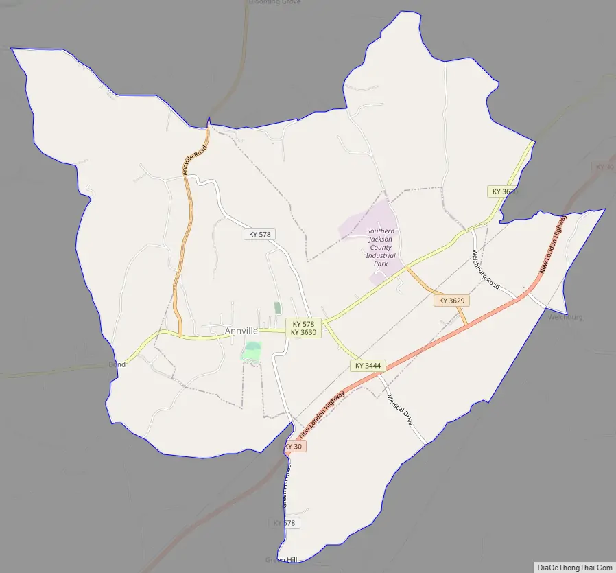
Annville Road Map
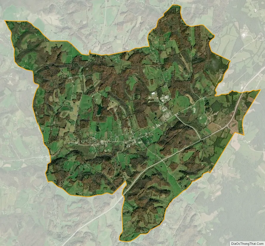
Annville city Satellite Map
Geography
Annville is located in southern Jackson County, along KY Route 3630.
According to the United States Census Bureau, the Annville CDP has a total area of 8.0 square miles, of which 0.4 square miles, or 0.55%, are water. Pond Creek flows through the southern part of the community, running southwest to the South Fork of the Rockcastle River, part of the Cumberland River watershed.
Public parks
- Worthington Park
Major routes
- KY Route 3630
- KY Route 30
- KY Route 290
Kentucky Route 3630 is the main road through the community. Kentucky Route 290 goes north from town 9 miles to McKee, the county’s seat. South of community is Kentucky Route 30 which bypasses the community as a recently constructed highway and acts as the county’s main east-west corridor, connecting the community to London, 15 miles to the southwest.
See also
Map of Kentucky State and its subdivision:- Adair
- Allen
- Anderson
- Ballard
- Barren
- Bath
- Bell
- Boone
- Bourbon
- Boyd
- Boyle
- Bracken
- Breathitt
- Breckinridge
- Bullitt
- Butler
- Caldwell
- Calloway
- Campbell
- Carlisle
- Carroll
- Carter
- Casey
- Christian
- Clark
- Clay
- Clinton
- Crittenden
- Cumberland
- Daviess
- Edmonson
- Elliott
- Estill
- Fayette
- Fleming
- Floyd
- Franklin
- Fulton
- Gallatin
- Garrard
- Grant
- Graves
- Grayson
- Green
- Greenup
- Hancock
- Hardin
- Harlan
- Harrison
- Hart
- Henderson
- Henry
- Hickman
- Hopkins
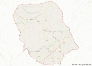
- Jackson
- Jefferson
- Jessamine
- Johnson
- Kenton
- Knott
- Knox
- Larue
- Laurel
- Lawrence
- Lee
- Leslie
- Letcher
- Lewis
- Lincoln
- Livingston
- Logan
- Lyon
- Madison
- Magoffin
- Marion
- Marshall
- Martin
- Mason
- McCracken
- McCreary
- McLean
- Meade
- Menifee
- Mercer
- Metcalfe
- Monroe
- Montgomery
- Morgan
- Muhlenberg
- Nelson
- Nicholas
- Ohio
- Oldham
- Owen
- Owsley
- Pendleton
- Perry
- Pike
- Powell
- Pulaski
- Robertson
- Rockcastle
- Rowan
- Russell
- Scott
- Shelby
- Simpson
- Spencer
- Taylor
- Todd
- Trigg
- Trimble
- Union
- Warren
- Washington
- Wayne
- Webster
- Whitley
- Wolfe
- Woodford
- Alabama
- Alaska
- Arizona
- Arkansas
- California
- Colorado
- Connecticut
- Delaware
- District of Columbia
- Florida
- Georgia
- Hawaii
- Idaho
- Illinois
- Indiana
- Iowa
- Kansas
- Kentucky
- Louisiana
- Maine
- Maryland
- Massachusetts
- Michigan
- Minnesota
- Mississippi
- Missouri
- Montana
- Nebraska
- Nevada
- New Hampshire
- New Jersey
- New Mexico
- New York
- North Carolina
- North Dakota
- Ohio
- Oklahoma
- Oregon
- Pennsylvania
- Rhode Island
- South Carolina
- South Dakota
- Tennessee
- Texas
- Utah
- Vermont
- Virginia
- Washington
- West Virginia
- Wisconsin
- Wyoming