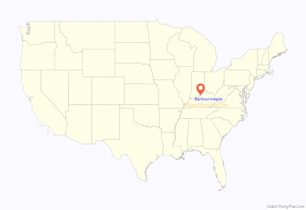
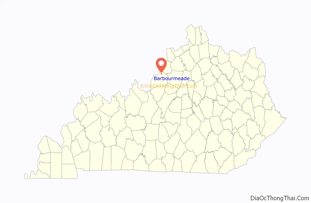
Barbourmeade is a home rule-class city in Jefferson County, Kentucky, United States. It was formally incorporated by the state assembly in 1962. The population was 1,218 at the 2010 census.
The community derives its name from Thomas and Richard Barbour, early settlers for whom Barbour Lane is named. Barbourmeade incorporated as a city in October 1962, with a population of 150.
| Name: | Barbourmeade city |
|---|---|
| LSAD Code: | 25 |
| LSAD Description: | city (suffix) |
| State: | Kentucky |
| County: | Jefferson County |
| Elevation: | 630 ft (192 m) |
| Total Area: | 0.40 sq mi (1.02 km²) |
| Land Area: | 0.40 sq mi (1.02 km²) |
| Water Area: | 0.00 sq mi (0.00 km²) |
| Total Population: | 1,216 |
| Population Density: | 3,078.48/sq mi (1,188.16/km²) |
| ZIP code: | 40241 |
| Area code: | 502 |
| FIPS code: | 2103556 |
| GNISfeature ID: | 0486328 |
| Website: | barbourmeade.org |
Online Interactive Map
Click on ![]() to view map in "full screen" mode.
to view map in "full screen" mode.
Barbourmeade location map. Where is Barbourmeade city?
History
Present-day Barbourmeade is part of the loosely defined historic community known as Springdale, after the farm that stood on the south side of Brownsboro Road beginning in 1830. Though it is not a formally recognized neighborhood or district within Louisville, nor does it have official boundaries, older businesses in the community still retain the Springdale name.
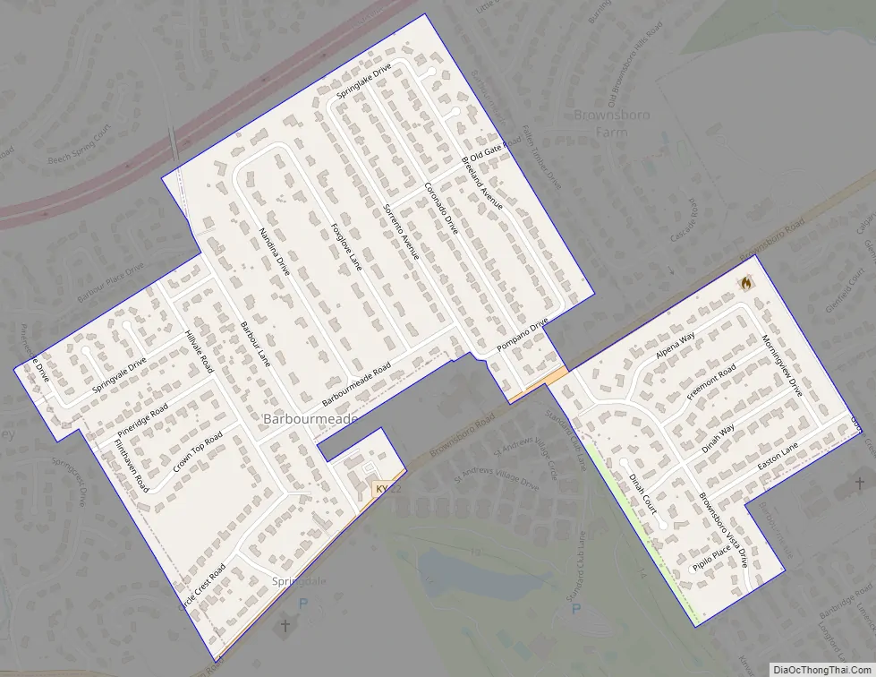
Barbour Lane, which runs through the middle of the community, was originally the entry drive to the Barbour house, which sat on the Barbour family’s 500-acre tract of land between Brownsboro Road and River Road. The original Barbour house was destroyed in the 1974 tornado, which terminated near Barbour Lane.
The intersection of present-day Barbour Lane and Brownsboro Road, then a toll road known as the Louisville-Brownsboro Turnpike, was home to a gristmill, grocery and blacksmith shop as far back as 1879, as well as a tavern known as the Seven Mile House for its location from downtown Louisville. This intersection remains a commercial hub for the immediate community, serviced by a convenience store and gas station (a Convenient Food Mart, a Dairy Mart and currently a Circle K), dry cleaner, animal hospital and automotive shop. A series of liquor stores have also been located at the intersection since 1978, when Steve Watson’s Beverage Shoppe opened amidst considerable protest from members of the community. Springdale Presbyterian Church was established in 1882, with much of its present-day structure constructed in 1964.
Beginning in the late 19th century until it was subdivided in the 1950s, much of present-day Barbourmeade and the surrounding portions of Louisville’s East End were occupied by potato farms. Farmers from the area were instrumental in organizing the St. Matthews Produce Exchange, the second-largest potato shipper in the country, located in nearby St. Matthews, known locally as “the potato capital of the world.” Among these farmers was John “The Potato King” Stutzenberger Sr., said at the time to be “one of Jefferson County’s best known-farmers,” and whose family farm occupied a large portion of present-day Barbourmeade. The area was described in 1941 as home to “Jefferson County‘s most fertile land and least experienced farmers,” owing to the influx of wealthy hobby farmers from the city. A farmhouse facing Brownsboro Road built by the Schneider family, who operated a truck farm on the site, is one of the few pre-World War II buildings remaining in Barbourmeade.
After World War II, potato production in the area declined and farm acreages in Springdale and along Brownsboro Road were reduced or sold off. In 1953, Stutzenberger himself blamed the decline in American potato consumption on “diet propaganda.” That year, an Oldham County developer named Joe Wilhoyte purchased a 45-acre tract of farmland at Brownsboro Road and Barbour Lane from Albert D. Stutzenberger and his sister Anna Hahn, two children of John Stutzenberger Sr. Albert Stutzenberger was an amateur farmer, languages and music instructor at the Kentucky Military Institute, and an authority on collecting souvenir spoons.
The Barbourmeade subdivision was platted that year from the farmland Wilhoyte had purchased. As with many suburban developments of the era, the street names are a mix of Italian and Spanish language-derived place names (Sorrento, Coronado, Pompano), plants and animals (Nandina, Foxglove, Pipilo), former place markers and geographic features of the land (Pine Ridge, Old Gate) and names of the developers’ family and colleagues (Breeland, Dinah). The suffix “-meade” derives from a poetic variation on the Old English word “mead,” referring to a meadow or pasture. The first new single-family home constructions went on the market in 1953. The housing stock consists of a variety of popular postwar styles, including Colonial Revival, ranch-style, split-levels and Cape Cods. Along with nearby Plantation, Barbourmeade was one of the earliest residential developments in the area.
To accommodate the growing population in the area, Jefferson County Public Schools opened Norton Elementary School in 1967. The school is named for WAVE founder and president George Norton Jr. and philanthropist and artist Jane Norton, who lived on nearby Wolf Pen Branch Road.
In 1988, the city commission disbanded the Barbourmeade police department for budgetary reasons. The Barbourmeade police department also provided police services for Brownsboro Farm, Ten Broeck, Langdon Place and Rolling Hills. Barbourmeade has been served by the Graymoor-Devondale Police Department since 2011.
In 1999, Barbourmeade annexed the neighboring community of Brownsboro Gardens after a protracted legal battle with Louisville-Jefferson County relating to a metro-wide ban on annexations.
Barbourmeade Road Map
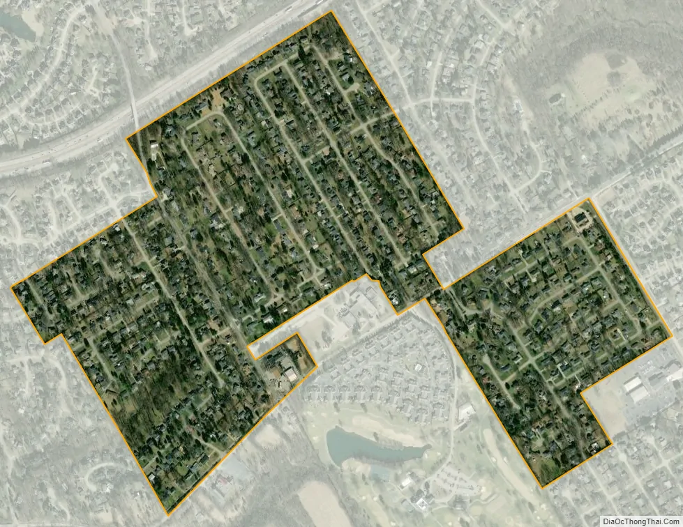
Barbourmeade city Satellite Map
Geography
Barbourmeade is located in northeastern Jefferson County at 38°18′1″N 85°35′59″W / 38.30028°N 85.59972°W / 38.30028; -85.59972 (38.300219, -85.599695). It is bordered to the northeast by Brownsboro Farm, to the southeast by Manor Creek, Broeck Pointe and Goose Creek, to the west by Spring Valley, and to the north, east, and south by Louisville. Interstate 71 runs along the northern border of Barbourmeade (but with no direct access), and Kentucky Route 22 (Brownsboro Road) forms part of the southern border. Downtown Louisville is 10 miles (16 km) to the southwest, and Crestwood is 8 miles (13 km) to the northeast up Route 22.
According to the United States Census Bureau, Barbourmeade has a total area of 0.39 square miles (1.02 km), all land.
Barbourmeade is informally separated into three sections. The Hillvale section, located southwest of Barbour Lane, is named for the road. The Norton section, located on the northeast side of Barbour Lane, is named for the elementary school. The Brownsboro Vista section is on the southeastern side of Highway 22, and is named for the road. The Brownsboro Vista section is the former Brownsboro Gardens subdivision, annexed in 1999.
See also
Map of Kentucky State and its subdivision:- Adair
- Allen
- Anderson
- Ballard
- Barren
- Bath
- Bell
- Boone
- Bourbon
- Boyd
- Boyle
- Bracken
- Breathitt
- Breckinridge
- Bullitt
- Butler
- Caldwell
- Calloway
- Campbell
- Carlisle
- Carroll
- Carter
- Casey
- Christian
- Clark
- Clay
- Clinton
- Crittenden
- Cumberland
- Daviess
- Edmonson
- Elliott
- Estill
- Fayette
- Fleming
- Floyd
- Franklin
- Fulton
- Gallatin
- Garrard
- Grant
- Graves
- Grayson
- Green
- Greenup
- Hancock
- Hardin
- Harlan
- Harrison
- Hart
- Henderson
- Henry
- Hickman
- Hopkins
- Jackson
- Jefferson
- Jessamine
- Johnson
- Kenton
- Knott
- Knox
- Larue
- Laurel
- Lawrence
- Lee
- Leslie
- Letcher
- Lewis
- Lincoln
- Livingston
- Logan
- Lyon
- Madison
- Magoffin
- Marion
- Marshall
- Martin
- Mason
- McCracken
- McCreary
- McLean
- Meade
- Menifee
- Mercer
- Metcalfe
- Monroe
- Montgomery
- Morgan
- Muhlenberg
- Nelson
- Nicholas
- Ohio
- Oldham
- Owen
- Owsley
- Pendleton
- Perry
- Pike
- Powell
- Pulaski
- Robertson
- Rockcastle
- Rowan
- Russell
- Scott
- Shelby
- Simpson
- Spencer
- Taylor
- Todd
- Trigg
- Trimble
- Union
- Warren
- Washington
- Wayne
- Webster
- Whitley
- Wolfe
- Woodford
- Alabama
- Alaska
- Arizona
- Arkansas
- California
- Colorado
- Connecticut
- Delaware
- District of Columbia
- Florida
- Georgia
- Hawaii
- Idaho
- Illinois
- Indiana
- Iowa
- Kansas
- Kentucky
- Louisiana
- Maine
- Maryland
- Massachusetts
- Michigan
- Minnesota
- Mississippi
- Missouri
- Montana
- Nebraska
- Nevada
- New Hampshire
- New Jersey
- New Mexico
- New York
- North Carolina
- North Dakota
- Ohio
- Oklahoma
- Oregon
- Pennsylvania
- Rhode Island
- South Carolina
- South Dakota
- Tennessee
- Texas
- Utah
- Vermont
- Virginia
- Washington
- West Virginia
- Wisconsin
- Wyoming


