Bardstown is a home rule-class city in Nelson County, Kentucky, United States. The population was 13,567 in the 2020 census. It is the county seat of Nelson County.
Bardstown is named for the pioneering Bard brothers. David Bard obtained a 1,000-acre (400 ha) land grant in 1785 in what was then Jefferson County, Virginia. William Bard surveyed and platted the town. It was originally chartered as Baird’s Town in 1788, and has been known as Beardstown, and Beards Town. The production of bourbon whiskey is a major industry.
| Name: | Bardstown city |
|---|---|
| LSAD Code: | 25 |
| LSAD Description: | city (suffix) |
| State: | Kentucky |
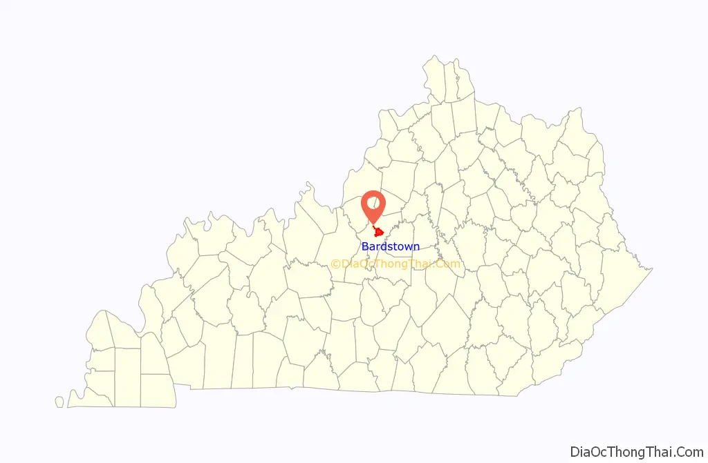
| County: | Nelson County |
| Incorporated: | Bardstown, 1790 |
| Elevation: | 646 ft (197 m) |
| Total Area: | 12.19 sq mi (31.57 km²) |
| Land Area: | 12.11 sq mi (31.36 km²) |
| Water Area: | 0.08 sq mi (0.21 km²) |
| Total Population: | 13,567 |
| Population Density: | 1,120.59/sq mi (432.67/km²) |
| ZIP code: | 40004 |
| Area code: | 502 |
| FIPS code: | 2103628 |
| GNISfeature ID: | 0486333 |
| Website: | cityofbardstown.org |
Online Interactive Map
Click on ![]() to view map in "full screen" mode.
to view map in "full screen" mode.
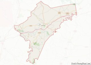
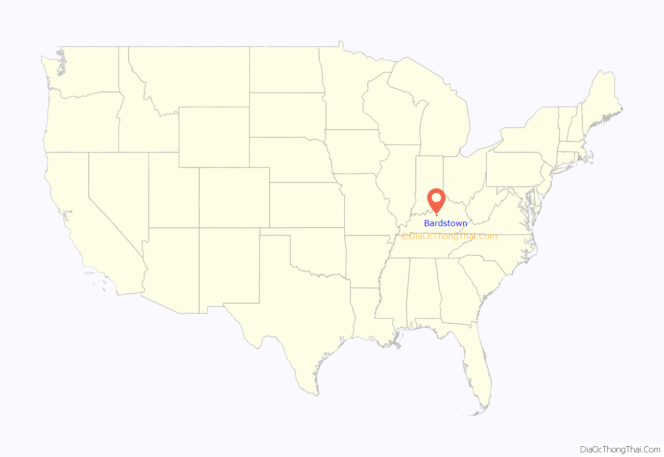
Bardstown location map. Where is Bardstown city?
History
First settled by European Americans in 1780, Bardstown is among the oldest cities in Kentucky. Named county seat of the newly created Nelson County, Virginia (now Kentucky) in 1784, the town was formally established in 1788. It was incorporated by the state assembly in 1838.
Reflecting the westward migration of Americans over the Blue Ridge Mountains after the Revolutionary War, Bardstown was also the first center of Catholicism west of the Appalachian Mountains in the original western frontier territories of the United States. The Diocese of Bardstown was established on February 8, 1808, to serve all Catholics between the Appalachians and the Mississippi River. This divided the previous all-encompassing Diocese of Baltimore, established in 1789. In 1841, the seat of the diocese was transferred to nearby Louisville, Kentucky. The Bardstown cathedral is the Basilica of Saint Joseph Proto-Cathedral, and the city has a Roman Catholic parochial high school, Bethlehem High School.
In 2008, videos showing sewage and storm water spewing from the sewer systems in multiple locations around the city lead to the state of Kentucky to order the city fix the problem. The sewer system was fixed in 2016.
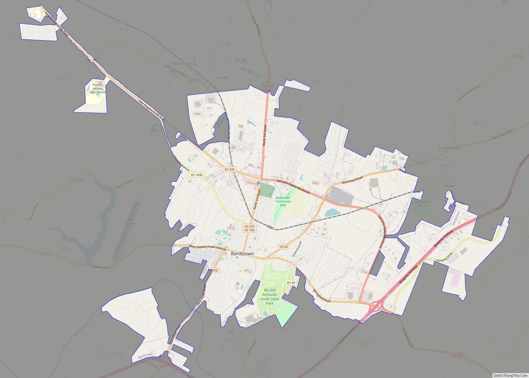
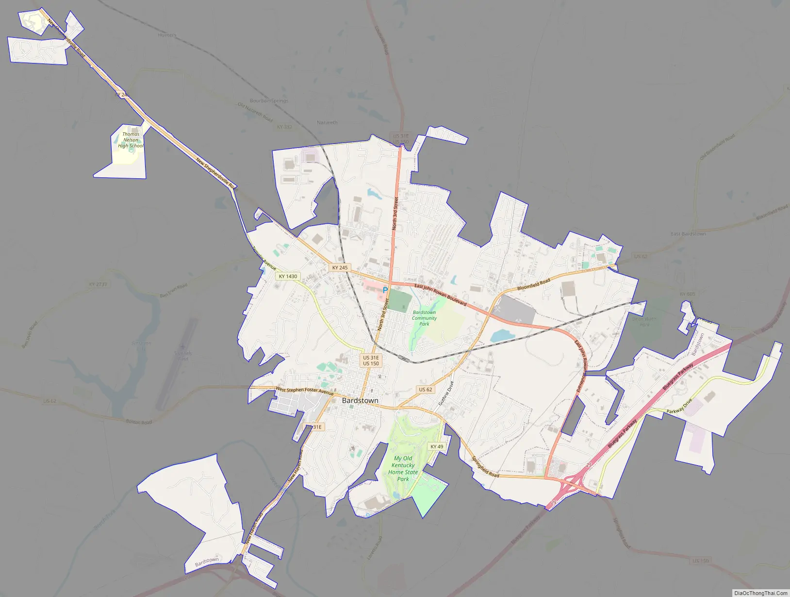
Bardstown Road Map
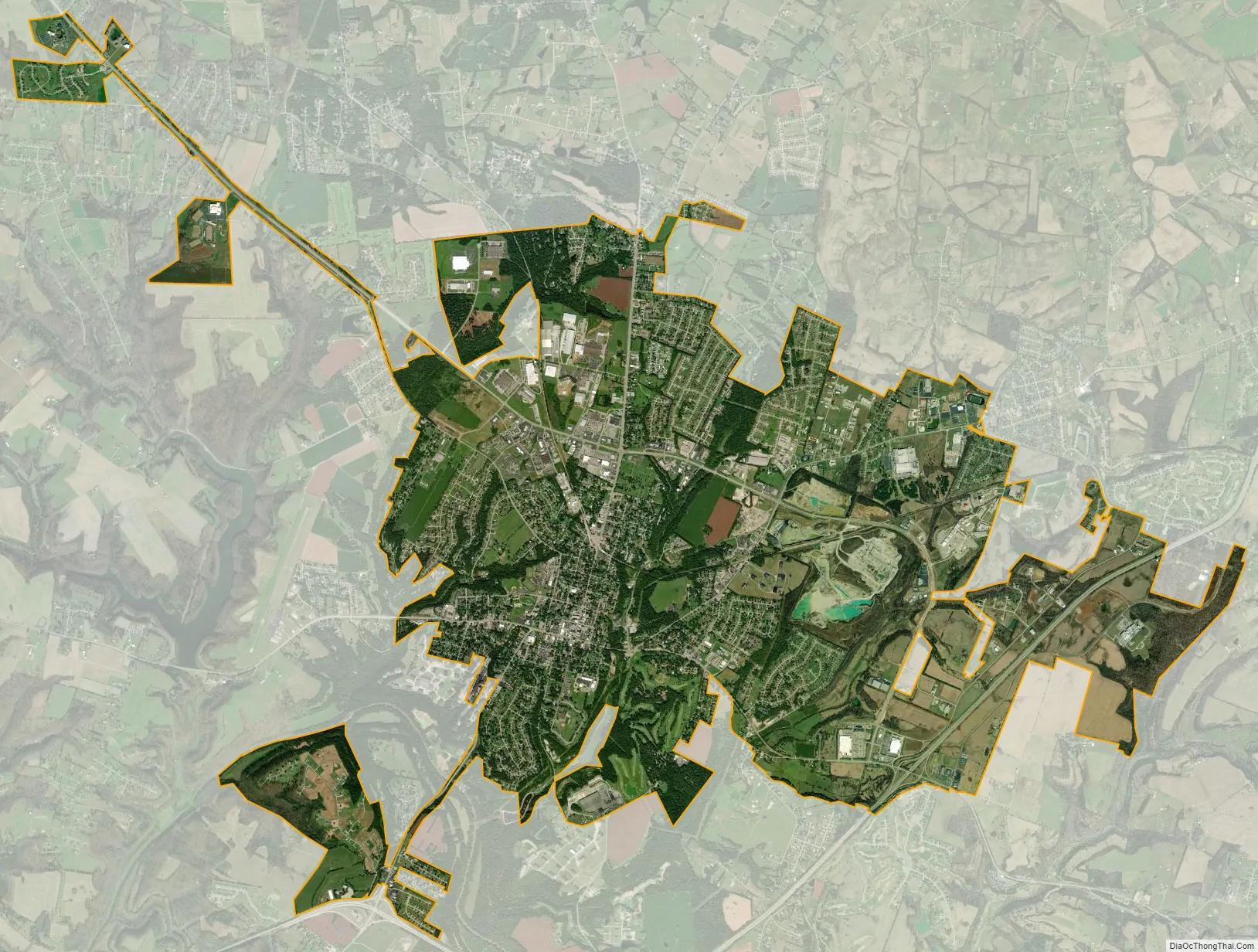
Bardstown city Satellite Map
Geography
Bardstown is located in north central Nelson County. It is at the intersection of US routes 31E, 62 and 150. The Bluegrass Parkway passes to the southeast.
According to the United States Census Bureau, the city has a total area of 7.4 square miles (19.2 km), all but 0.1 square miles (0.3 km) of which is land.
Climate
The climate in this area is characterized by hot, humid summers and generally mild to cool winters. According to the Köppen Climate Classification system, Bardstown has a humid subtropical climate, abbreviated “Cfa” on climate maps.
See also
Map of Kentucky State and its subdivision:- Adair
- Allen
- Anderson
- Ballard
- Barren
- Bath
- Bell
- Boone
- Bourbon
- Boyd
- Boyle
- Bracken
- Breathitt
- Breckinridge
- Bullitt
- Butler
- Caldwell
- Calloway
- Campbell
- Carlisle
- Carroll
- Carter
- Casey
- Christian
- Clark
- Clay
- Clinton
- Crittenden
- Cumberland
- Daviess
- Edmonson
- Elliott
- Estill
- Fayette
- Fleming
- Floyd
- Franklin
- Fulton
- Gallatin
- Garrard
- Grant
- Graves
- Grayson
- Green
- Greenup
- Hancock
- Hardin
- Harlan
- Harrison
- Hart
- Henderson
- Henry
- Hickman
- Hopkins
- Jackson
- Jefferson
- Jessamine
- Johnson
- Kenton
- Knott
- Knox
- Larue
- Laurel
- Lawrence
- Lee
- Leslie
- Letcher
- Lewis
- Lincoln
- Livingston
- Logan
- Lyon
- Madison
- Magoffin
- Marion
- Marshall
- Martin
- Mason
- McCracken
- McCreary
- McLean
- Meade
- Menifee
- Mercer
- Metcalfe
- Monroe
- Montgomery
- Morgan
- Muhlenberg
- Nelson
- Nicholas
- Ohio
- Oldham
- Owen
- Owsley
- Pendleton
- Perry
- Pike
- Powell
- Pulaski
- Robertson
- Rockcastle
- Rowan
- Russell
- Scott
- Shelby
- Simpson
- Spencer
- Taylor
- Todd
- Trigg
- Trimble
- Union
- Warren
- Washington
- Wayne
- Webster
- Whitley
- Wolfe
- Woodford
- Alabama
- Alaska
- Arizona
- Arkansas
- California
- Colorado
- Connecticut
- Delaware
- District of Columbia
- Florida
- Georgia
- Hawaii
- Idaho
- Illinois
- Indiana
- Iowa
- Kansas
- Kentucky
- Louisiana
- Maine
- Maryland
- Massachusetts
- Michigan
- Minnesota
- Mississippi
- Missouri
- Montana
- Nebraska
- Nevada
- New Hampshire
- New Jersey
- New Mexico
- New York
- North Carolina
- North Dakota
- Ohio
- Oklahoma
- Oregon
- Pennsylvania
- Rhode Island
- South Carolina
- South Dakota
- Tennessee
- Texas
- Utah
- Vermont
- Virginia
- Washington
- West Virginia
- Wisconsin
- Wyoming