Bonnieville is a home rule-class city in Hart County, Kentucky, in the United States. The population was 255 at the 2010 census.
| Name: | Bonnieville city |
|---|---|
| LSAD Code: | 25 |
| LSAD Description: | city (suffix) |
| State: | Kentucky |
| County: | Hart County |
| Elevation: | 650 ft (198 m) |
| Total Area: | 0.58 sq mi (1.49 km²) |
| Land Area: | 0.57 sq mi (1.49 km²) |
| Water Area: | 0.00 sq mi (0.00 km²) |
| Total Population: | 269 |
| Population Density: | 467.83/sq mi (180.73/km²) |
| ZIP code: | 42713 |
| FIPS code: | 2108488 |
| GNISfeature ID: | 0487671 |
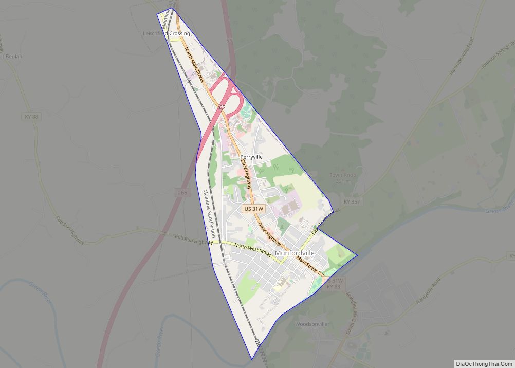
Online Interactive Map
Click on ![]() to view map in "full screen" mode.
to view map in "full screen" mode.
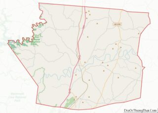
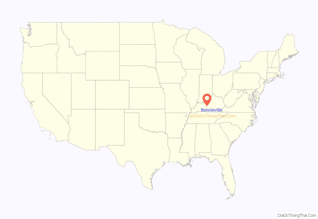
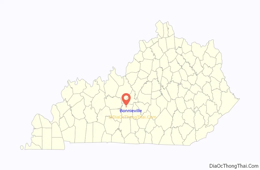
Bonnieville location map. Where is Bonnieville city?
History
Founded in 1849, the town was originally known as Bacon Creek, for the stream that runs through the city. It is rumored that the name was changed to Bonnieville because of the popularity of the song “My Bonnie Lies over the Ocean”.
On December 26, 1862, the Confederate John Hunt Morgan sent a detachment from Upton to the bridge over Bacon Creek in Bonnieville. A brief firefight with a detachment of the 2nd Michigan Volunteer Cavalry Regiment resulted with the destruction of the bridge for a third time and the wounding of 23. The railroad remained closed for six weeks until the tracks could be repaired and reopened on February 1.
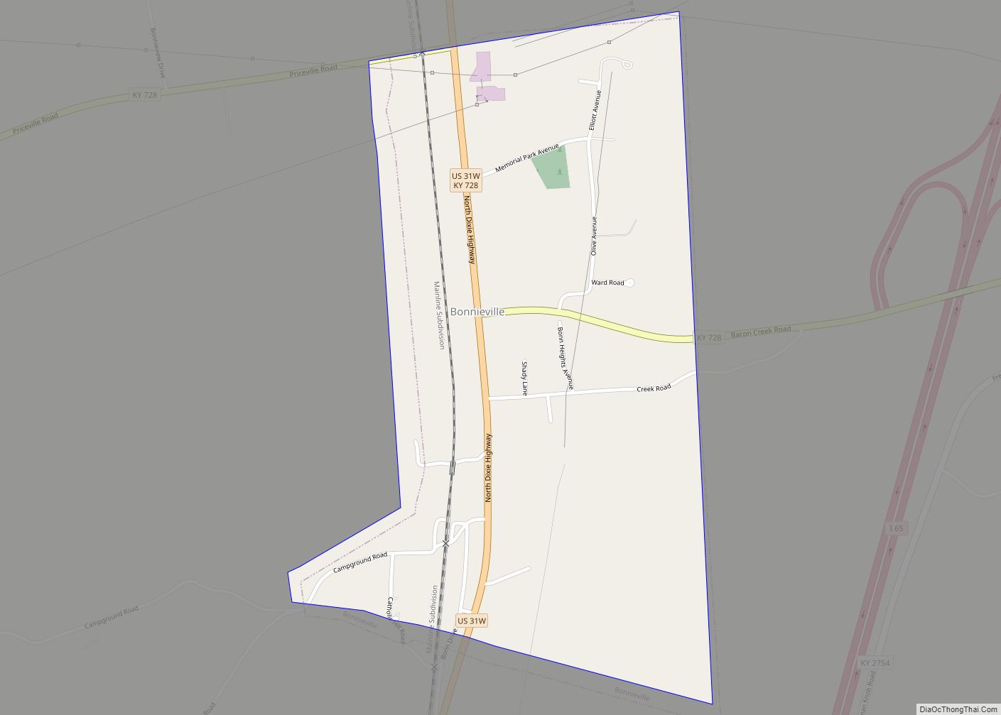
Bonnieville Road Map
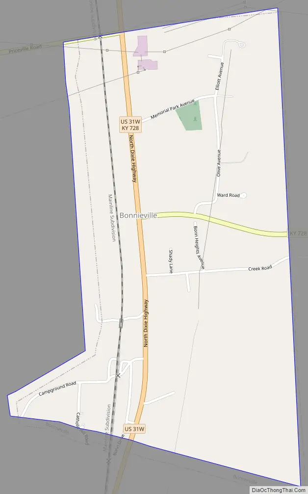
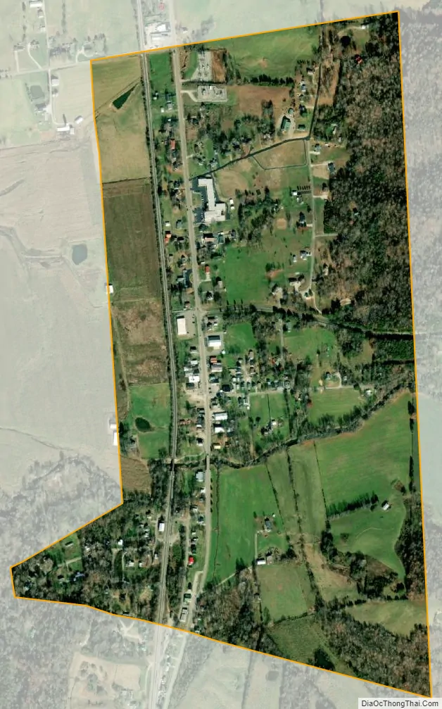
Bonnieville city Satellite Map
Geography
Bonnieville is located at 37°22′29″N 85°54′12″W / 37.37472°N 85.90333°W / 37.37472; -85.90333 (37.374850, -85.903429).
According to the United States Census Bureau, the city has a total area of 0.6 square miles (1.6 km), all land. U.S. Route 31W passes through the middle of Bonnieville, with most of the city concentrated around this highway’s two intersections with Kentucky Route 728. Bonnieville is accessible from Exit 71 on Interstate 65. Part of the original main line of the historic Louisville and Nashville Railroad (now CSX) passes through the city. Bacon Creek, a tributary of the Nolin River, bisects the city.
See also
Map of Kentucky State and its subdivision:- Adair
- Allen
- Anderson
- Ballard
- Barren
- Bath
- Bell
- Boone
- Bourbon
- Boyd
- Boyle
- Bracken
- Breathitt
- Breckinridge
- Bullitt
- Butler
- Caldwell
- Calloway
- Campbell
- Carlisle
- Carroll
- Carter
- Casey
- Christian
- Clark
- Clay
- Clinton
- Crittenden
- Cumberland
- Daviess
- Edmonson
- Elliott
- Estill
- Fayette
- Fleming
- Floyd
- Franklin
- Fulton
- Gallatin
- Garrard
- Grant
- Graves
- Grayson
- Green
- Greenup
- Hancock
- Hardin
- Harlan
- Harrison
- Hart
- Henderson
- Henry
- Hickman
- Hopkins
- Jackson
- Jefferson
- Jessamine
- Johnson
- Kenton
- Knott
- Knox
- Larue
- Laurel
- Lawrence
- Lee
- Leslie
- Letcher
- Lewis
- Lincoln
- Livingston
- Logan
- Lyon
- Madison
- Magoffin
- Marion
- Marshall
- Martin
- Mason
- McCracken
- McCreary
- McLean
- Meade
- Menifee
- Mercer
- Metcalfe
- Monroe
- Montgomery
- Morgan
- Muhlenberg
- Nelson
- Nicholas
- Ohio
- Oldham
- Owen
- Owsley
- Pendleton
- Perry
- Pike
- Powell
- Pulaski
- Robertson
- Rockcastle
- Rowan
- Russell
- Scott
- Shelby
- Simpson
- Spencer
- Taylor
- Todd
- Trigg
- Trimble
- Union
- Warren
- Washington
- Wayne
- Webster
- Whitley
- Wolfe
- Woodford
- Alabama
- Alaska
- Arizona
- Arkansas
- California
- Colorado
- Connecticut
- Delaware
- District of Columbia
- Florida
- Georgia
- Hawaii
- Idaho
- Illinois
- Indiana
- Iowa
- Kansas
- Kentucky
- Louisiana
- Maine
- Maryland
- Massachusetts
- Michigan
- Minnesota
- Mississippi
- Missouri
- Montana
- Nebraska
- Nevada
- New Hampshire
- New Jersey
- New Mexico
- New York
- North Carolina
- North Dakota
- Ohio
- Oklahoma
- Oregon
- Pennsylvania
- Rhode Island
- South Carolina
- South Dakota
- Tennessee
- Texas
- Utah
- Vermont
- Virginia
- Washington
- West Virginia
- Wisconsin
- Wyoming