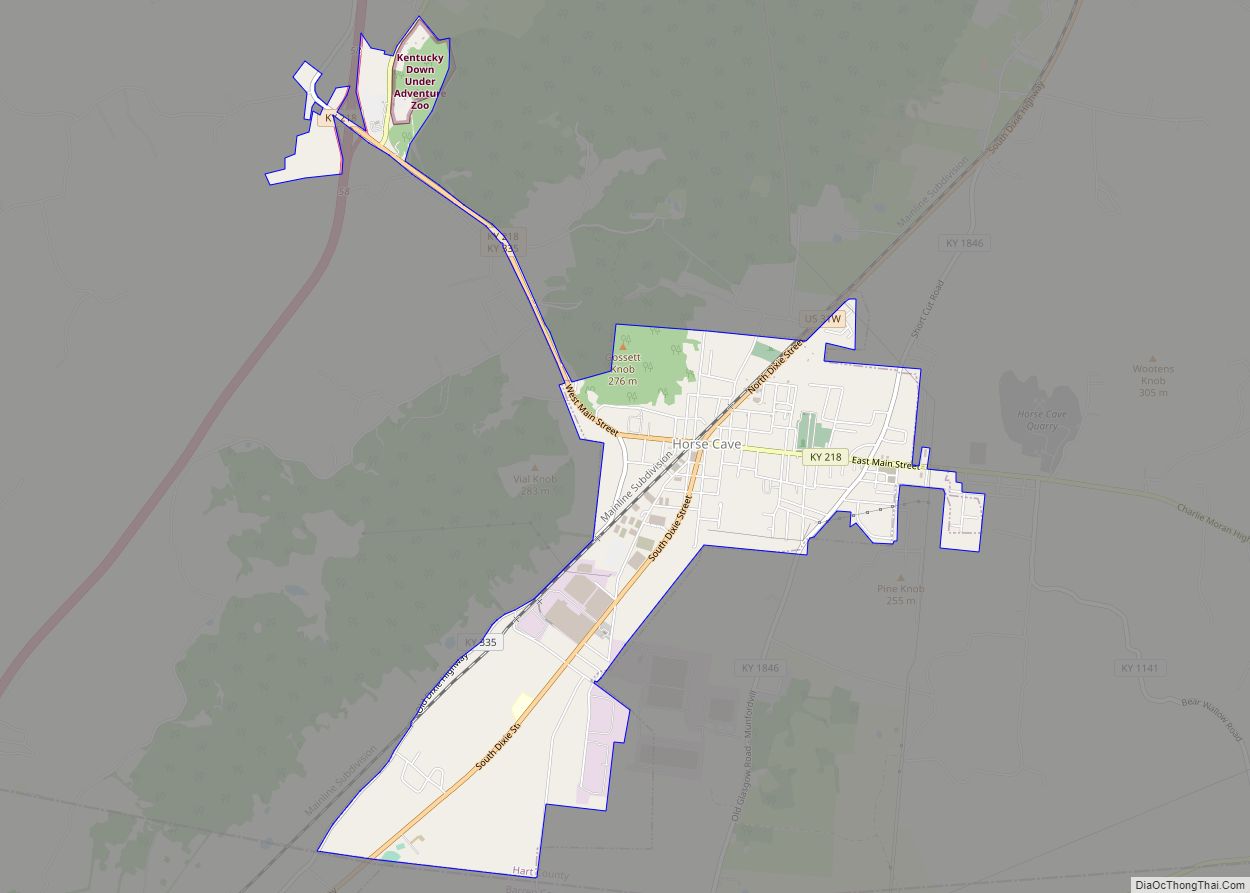
Horse Cave is a home rule-class city in Hart County, Kentucky, United States. Randall Curry currently serves as mayor of the city and is assisted by a city council that is composed of six members. As of the 2010 census, the population of Horse Cave was 2,311, making it the most populous community in the county.
| Name: | Horse Cave city |
|---|---|
| LSAD Code: | 25 |
| LSAD Description: | city (suffix) |
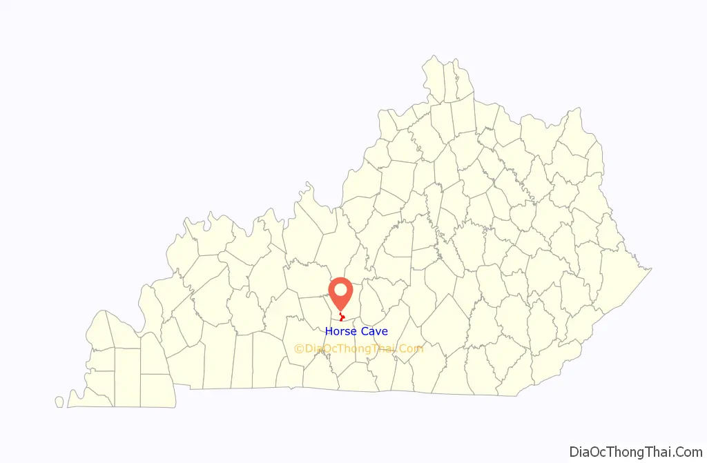
| State: | Kentucky |
| County: | Hart County |
| Elevation: | 633 ft (193 m) |
| Total Area: | 3.16 sq mi (8.20 km²) |
| Land Area: | 3.15 sq mi (8.15 km²) |
| Water Area: | 0.02 sq mi (0.05 km²) |
| Total Population: | 2,212 |
| Population Density: | 703.34/sq mi (271.52/km²) |
| ZIP code: | 42749 |
| Area code: | 270 & 364 |
| FIPS code: | 2138008 |
| GNISfeature ID: | 0494572 |
| Website: | www.horsecaveky.com |
Online Interactive Map
Click on ![]() to view map in "full screen" mode.
to view map in "full screen" mode.
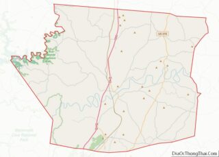
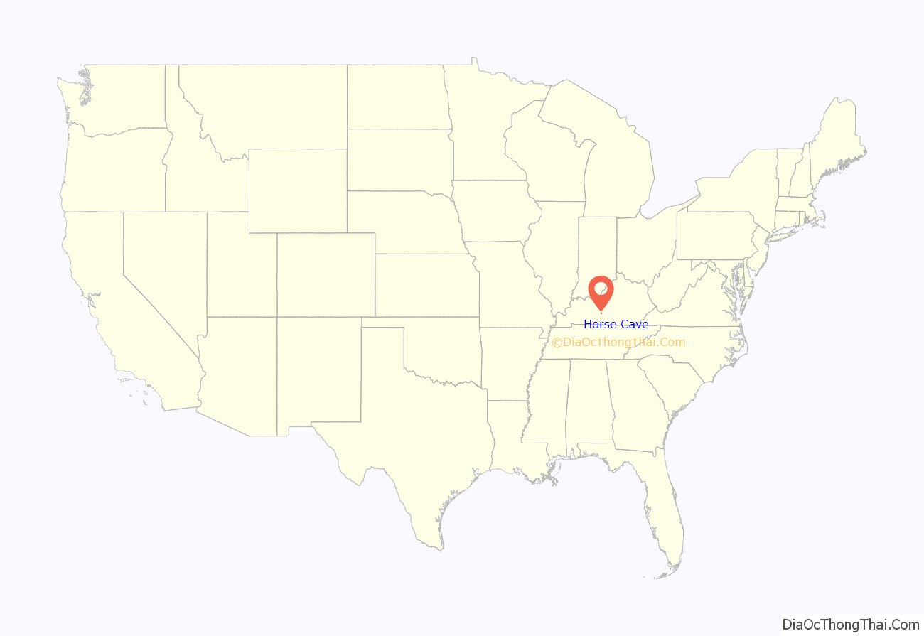
Horse Cave location map. Where is Horse Cave city?
History
The town was settled by Major Albert Anderson in the 1840s. The landowner donated land for a Louisville and Nashville Railroad station in 1858 on the provision that it be named after nearby Horse Cave. The community around the station developed quickly, so that a post office was erected in 1860, and the city was formally incorporated by the state assembly in 1864.
The cave for which the city is named is located on the south side of Main Street. Various explanations are given for its unusual name. One is that Native Americans or outlaws hid horses in the cave; another is that an early carriage may have lost a horse when it fell into the opening by accident; a third reason involves the 19th-century use of “horse” as slang for anything big or huge, related to a similar use of the Swedish hoss. The cave has also been known as “Hidden River Cave”, for an underground stream located inside. That stream was used to power a dynamo, and for a while in the late 19th century Horse Cave was the only city in Kentucky apart from Louisville and Ashland to have electric lights. Around World War I, the only air-conditioned tennis courts in the world were located near the entrance of the cave. The stream also provided the town’s water supply, but mistaken development caused raw sewage to seep into the water and forced the closure of the cave for fifty years. The stench was so bad in the 1960s that pedestrians typically crossed to the other side of Main Street rather than walk near the entrance and birds would sometimes fall from the sky. The problem has been largely solved in recent years.
The town changed its name to “Caverna” in 1869 but the inability to change the name of the railroad station prompted the community to reconsider and restore the name “Horse Cave” in 1879. Owing to its early rail connection, Horse Cave was a major center of agricultural commerce for Hart, Metcalfe, Green, and Barren counties since the 1870s. Tobacco warehouses provided the majority of the income.
Since the 1970s, some factories have relocated to the area, including Dart Container Corporation, T Marzetti Company, and Sister Schubert’s Bakery. Tourist attractions include Kentucky Down Under/Kentucky Caverns, Hidden River Cave/American Cave Museum, and the nearby Mammoth Cave National Park. Civil War Days are an annual tourist event, during which time parades down Main Street and reenactments of the Battle of Rowlett’s Station between Horse Cave and Munfordville are staged. A local theatre formerly known as the Horse Cave Theatre and/or the Kentucky Repertory Theatre once operated in Horse Cave but is no longer in business. Horse Cave serves as filming location for several films, including “Runaway Romance” and “Never Forgive.”
Artist Joseph Dudley Downing (1925-2007) was born and grew up in Horse Cave, where he graduated valedictorian of his class. In 1980, an exhibition of 150 of his paintings was held in the People’s Loose Leaf Tobacco Warehouse No. 2.
Horse Cave Road Map
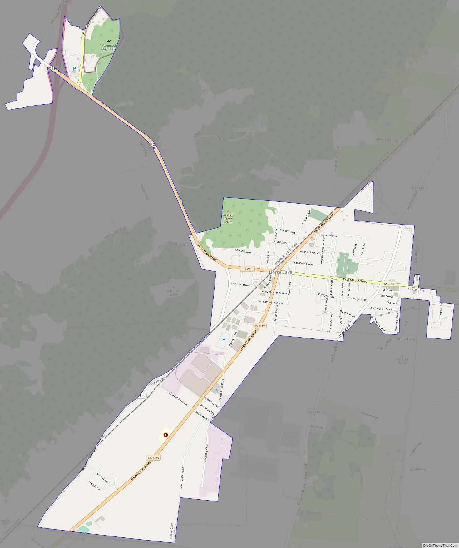
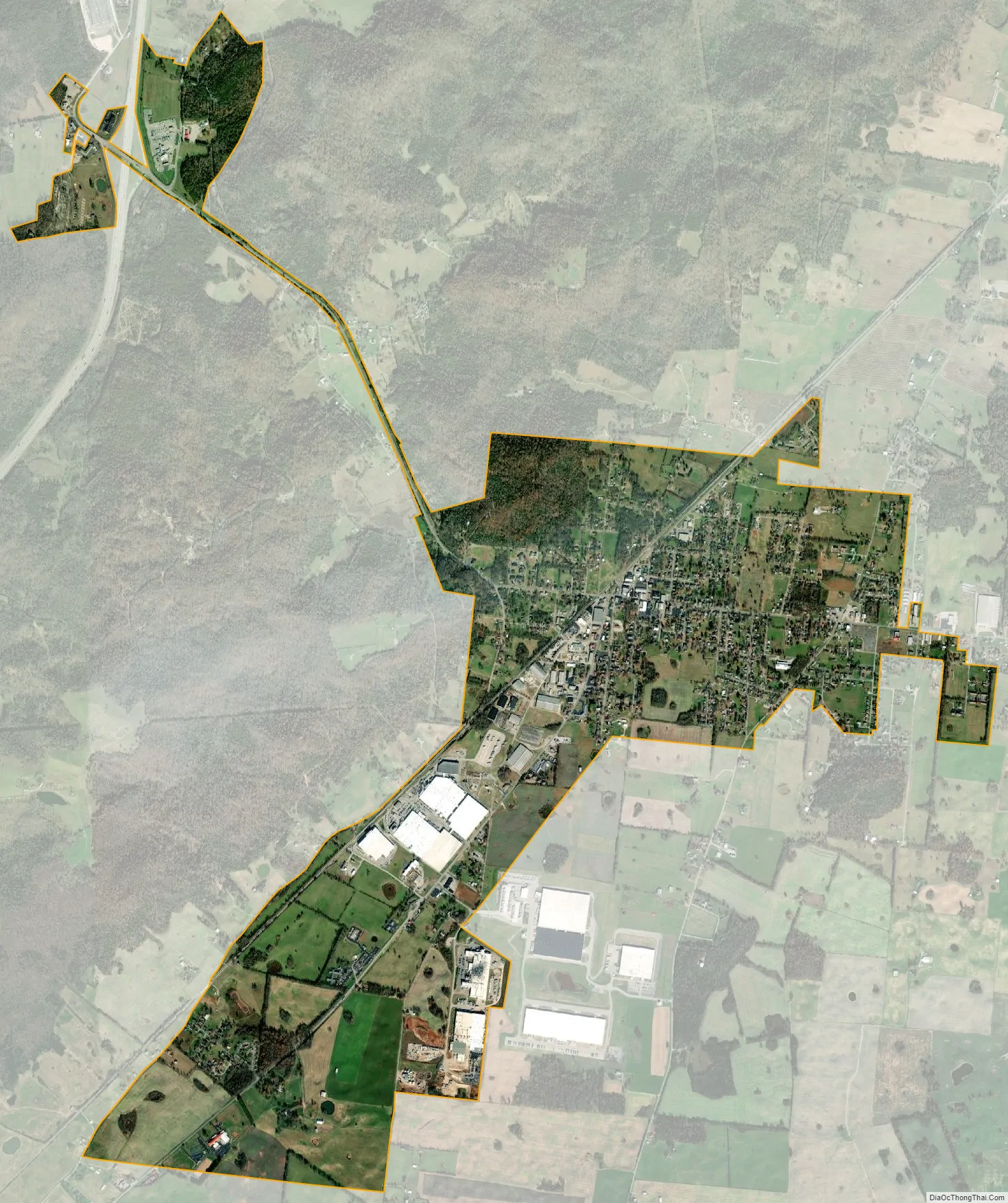
Horse Cave city Satellite Map
Geography
Horse Cave’s southern border is the Barren County line and the border of Cave City. U.S. Route 31W (Dixie Street) is the main road through Horse Cave, leading north 8 miles (13 km) to Munfordville and southwest through Cave City 10 miles (16 km) to Park City near the entrance to Mammoth Cave National Park. Interstate 65 passes 2 miles (3 km) west of Horse Cave, with access from Exit 58. I-65 leads north 78 miles (126 km) to Louisville and southwest 97 miles (156 km) to Nashville, Tennessee.
According to the United States Census Bureau, the city of Horse Cave has a total area of 2.7 square miles (6.9 km), of which 0.02 square miles (0.05 km), or 0.74%, are water.
See also
Map of Kentucky State and its subdivision:- Adair
- Allen
- Anderson
- Ballard
- Barren
- Bath
- Bell
- Boone
- Bourbon
- Boyd
- Boyle
- Bracken
- Breathitt
- Breckinridge
- Bullitt
- Butler
- Caldwell
- Calloway
- Campbell
- Carlisle
- Carroll
- Carter
- Casey
- Christian
- Clark
- Clay
- Clinton
- Crittenden
- Cumberland
- Daviess
- Edmonson
- Elliott
- Estill
- Fayette
- Fleming
- Floyd
- Franklin
- Fulton
- Gallatin
- Garrard
- Grant
- Graves
- Grayson
- Green
- Greenup
- Hancock
- Hardin
- Harlan
- Harrison
- Hart
- Henderson
- Henry
- Hickman
- Hopkins
- Jackson
- Jefferson
- Jessamine
- Johnson
- Kenton
- Knott
- Knox
- Larue
- Laurel
- Lawrence
- Lee
- Leslie
- Letcher
- Lewis
- Lincoln
- Livingston
- Logan
- Lyon
- Madison
- Magoffin
- Marion
- Marshall
- Martin
- Mason
- McCracken
- McCreary
- McLean
- Meade
- Menifee
- Mercer
- Metcalfe
- Monroe
- Montgomery
- Morgan
- Muhlenberg
- Nelson
- Nicholas
- Ohio
- Oldham
- Owen
- Owsley
- Pendleton
- Perry
- Pike
- Powell
- Pulaski
- Robertson
- Rockcastle
- Rowan
- Russell
- Scott
- Shelby
- Simpson
- Spencer
- Taylor
- Todd
- Trigg
- Trimble
- Union
- Warren
- Washington
- Wayne
- Webster
- Whitley
- Wolfe
- Woodford
- Alabama
- Alaska
- Arizona
- Arkansas
- California
- Colorado
- Connecticut
- Delaware
- District of Columbia
- Florida
- Georgia
- Hawaii
- Idaho
- Illinois
- Indiana
- Iowa
- Kansas
- Kentucky
- Louisiana
- Maine
- Maryland
- Massachusetts
- Michigan
- Minnesota
- Mississippi
- Missouri
- Montana
- Nebraska
- Nevada
- New Hampshire
- New Jersey
- New Mexico
- New York
- North Carolina
- North Dakota
- Ohio
- Oklahoma
- Oregon
- Pennsylvania
- Rhode Island
- South Carolina
- South Dakota
- Tennessee
- Texas
- Utah
- Vermont
- Virginia
- Washington
- West Virginia
- Wisconsin
- Wyoming