Bromley is a home rule-class city in Kenton County, Kentucky, United States, along the Ohio River. The population was 724 at the 2020 census. It is part of the Cincinnati metropolitan area.
| Name: | Bromley city |
|---|---|
| LSAD Code: | 25 |
| LSAD Description: | city (suffix) |
| State: | Kentucky |
| County: | Kenton County |
| Elevation: | 509 ft (155 m) |
| Total Area: | 0.51 sq mi (1.31 km²) |
| Land Area: | 0.38 sq mi (0.97 km²) |
| Water Area: | 0.13 sq mi (0.34 km²) |
| Total Population: | 724 |
| Population Density: | 1,930.67/sq mi (745.92/km²) |
| ZIP code: | 41016-41017 |
| Area code: | 859 |
| FIPS code: | 2109856 |
| GNISfeature ID: | 0487948 |
| Website: | www.cityofbromley.com |
Online Interactive Map
Click on ![]() to view map in "full screen" mode.
to view map in "full screen" mode.
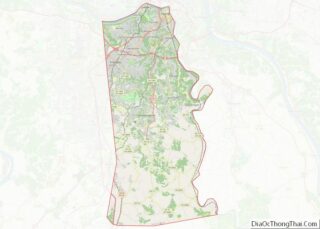
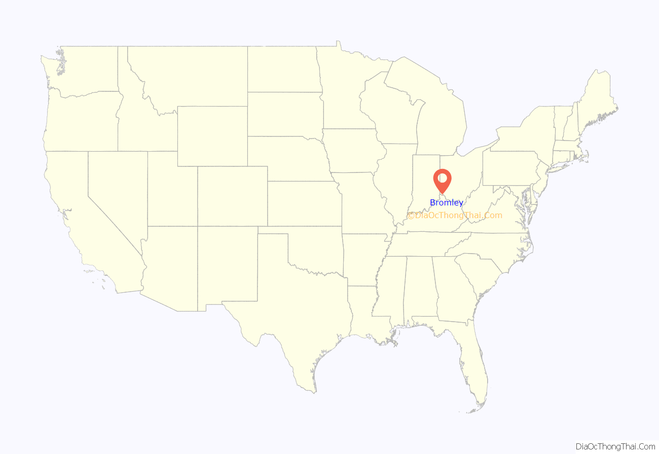
Bromley location map. Where is Bromley city?
History
The settlement of Bromley can be traced to 1784, when Prettyman Merry received a land grant from the United States government of 2,000 acres (8.1 km). Soon thereafter, the Merry family began constructing a home on the property. This home still stands today on Shelby Street.
The Commonwealth of Kentucky officially approved the incorporation of the city of Bromley on May 23, 1890.
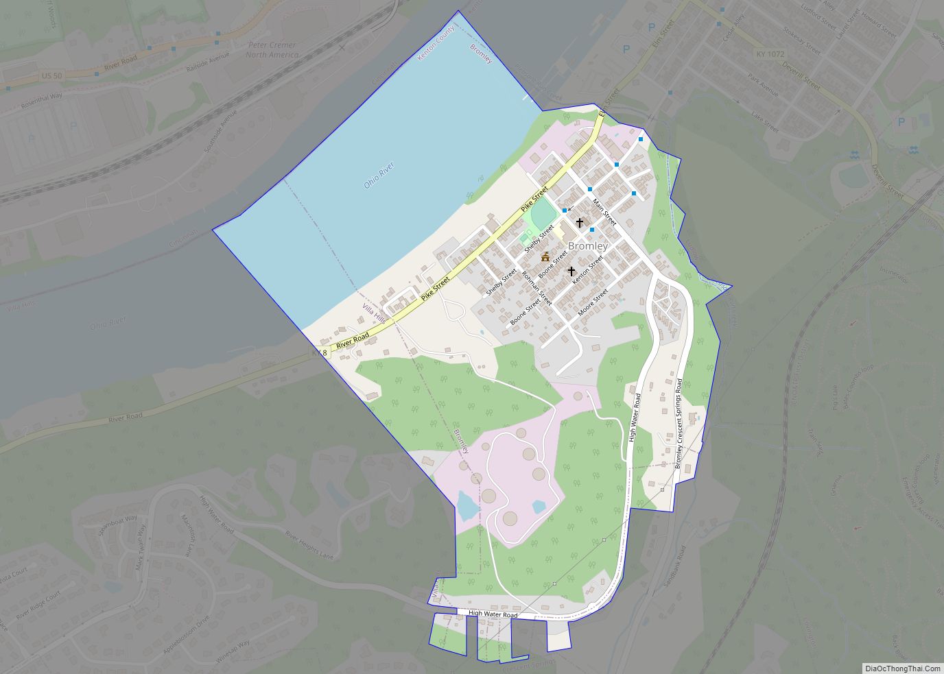
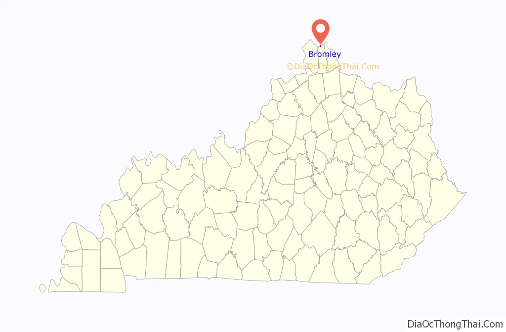
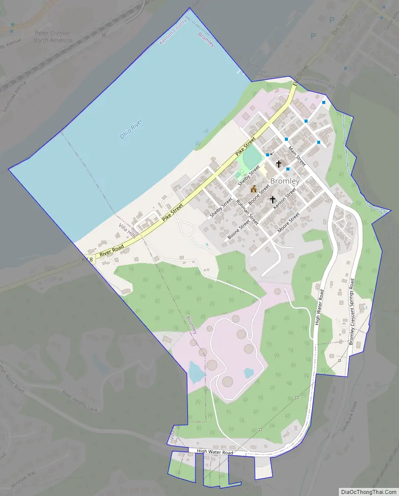
Bromley Road Map
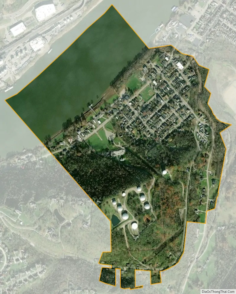
Bromley city Satellite Map
Geography
Bromley is located on the northern edge of Kenton County at 39°4′57″N 84°33′36″W / 39.08250°N 84.56000°W / 39.08250; -84.56000 (39.082610, -84.560088). It sits on the south bank of the Ohio River and is bordered to the northeast (upstream) by the city of Ludlow and to the southwest (downstream) by the city of Villa Hills. To the south is Crescent Springs, and to the north, across the river in Ohio, is the city of Cincinnati. The nearest river crossing is the Brent Spence Bridge 3 miles (5 km) to the east, carrying Interstates 71 and 75.
Kentucky Route 8 passes through the center of Bromley, leading northeast into Ludlow and Covington and west along the river through Villa Hills to Taylorsport.
According to the United States Census Bureau, Bromley has a total area of 0.44 square miles (1.13 km), of which 0.34 square miles (0.87 km) are land and 0.10 square miles (0.26 km), or 22.75%, are water.
Several Bromley streets bear the names of prominent Kentucky historical figures, including Shelby Street (Isaac Shelby), Boone Street (Daniel Boone) and Kenton Street (Simon Kenton).
See also
Map of Kentucky State and its subdivision:- Adair
- Allen
- Anderson
- Ballard
- Barren
- Bath
- Bell
- Boone
- Bourbon
- Boyd
- Boyle
- Bracken
- Breathitt
- Breckinridge
- Bullitt
- Butler
- Caldwell
- Calloway
- Campbell
- Carlisle
- Carroll
- Carter
- Casey
- Christian
- Clark
- Clay
- Clinton
- Crittenden
- Cumberland
- Daviess
- Edmonson
- Elliott
- Estill
- Fayette
- Fleming
- Floyd
- Franklin
- Fulton
- Gallatin
- Garrard
- Grant
- Graves
- Grayson
- Green
- Greenup
- Hancock
- Hardin
- Harlan
- Harrison
- Hart
- Henderson
- Henry
- Hickman
- Hopkins
- Jackson
- Jefferson
- Jessamine
- Johnson
- Kenton
- Knott
- Knox
- Larue
- Laurel
- Lawrence
- Lee
- Leslie
- Letcher
- Lewis
- Lincoln
- Livingston
- Logan
- Lyon
- Madison
- Magoffin
- Marion
- Marshall
- Martin
- Mason
- McCracken
- McCreary
- McLean
- Meade
- Menifee
- Mercer
- Metcalfe
- Monroe
- Montgomery
- Morgan
- Muhlenberg
- Nelson
- Nicholas
- Ohio
- Oldham
- Owen
- Owsley
- Pendleton
- Perry
- Pike
- Powell
- Pulaski
- Robertson
- Rockcastle
- Rowan
- Russell
- Scott
- Shelby
- Simpson
- Spencer
- Taylor
- Todd
- Trigg
- Trimble
- Union
- Warren
- Washington
- Wayne
- Webster
- Whitley
- Wolfe
- Woodford
- Alabama
- Alaska
- Arizona
- Arkansas
- California
- Colorado
- Connecticut
- Delaware
- District of Columbia
- Florida
- Georgia
- Hawaii
- Idaho
- Illinois
- Indiana
- Iowa
- Kansas
- Kentucky
- Louisiana
- Maine
- Maryland
- Massachusetts
- Michigan
- Minnesota
- Mississippi
- Missouri
- Montana
- Nebraska
- Nevada
- New Hampshire
- New Jersey
- New Mexico
- New York
- North Carolina
- North Dakota
- Ohio
- Oklahoma
- Oregon
- Pennsylvania
- Rhode Island
- South Carolina
- South Dakota
- Tennessee
- Texas
- Utah
- Vermont
- Virginia
- Washington
- West Virginia
- Wisconsin
- Wyoming