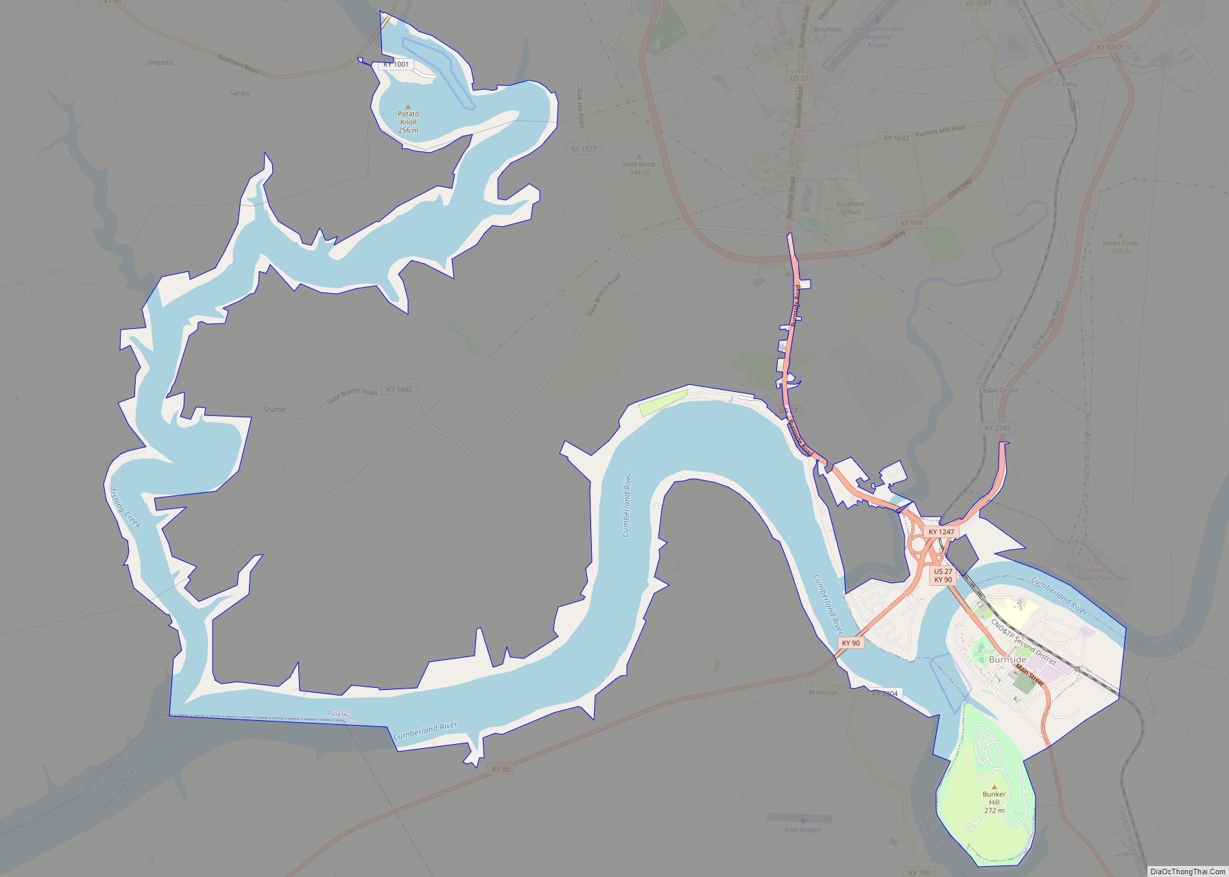
Burnside is a home rule-class city in Pulaski County, Kentucky, in the United States. The population was 611 at the 2010 census. In 2004, Burnside became the only town in Pulaski County or any adjoining county to allow the sale of alcoholic beverages in qualified establishments. Since then, Burnside has annexed about eight miles of shoreline along Lake Cumberland in order to include Lee’s Ford Marina on Fishing Creek, allowing it to sell alcohol.
On August 28, 2007, Burnside voters again approved the sale of alcoholic beverages in restaurants that seat at least 100 people and derive at least 70% of their gross receipts from the sale of food, by a vote of 227–104. The petition for the election was started by two Pulaski County clergymen in an attempt to reverse Burnside’s “moist” status.
On October 15, 2013 the City of Burnside voted to go fully “wet” by a count of 123–39.
| Name: | Burnside city |
|---|---|
| LSAD Code: | 25 |
| LSAD Description: | city (suffix) |
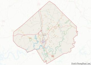
| State: | Kentucky |
| County: | Pulaski County |
| Elevation: | 860 ft (260 m) |
| Total Area: | 9.00 sq mi (23.30 km²) |
| Land Area: | 3.79 sq mi (9.82 km²) |
| Water Area: | 5.21 sq mi (13.48 km²) |
| Total Population: | 694 |
| Population Density: | 183.07/sq mi (70.69/km²) |
| ZIP code: | 42519 |
| Area code: | 606 |
| FIPS code: | 2111278 |
| GNISfeature ID: | 0511083 |
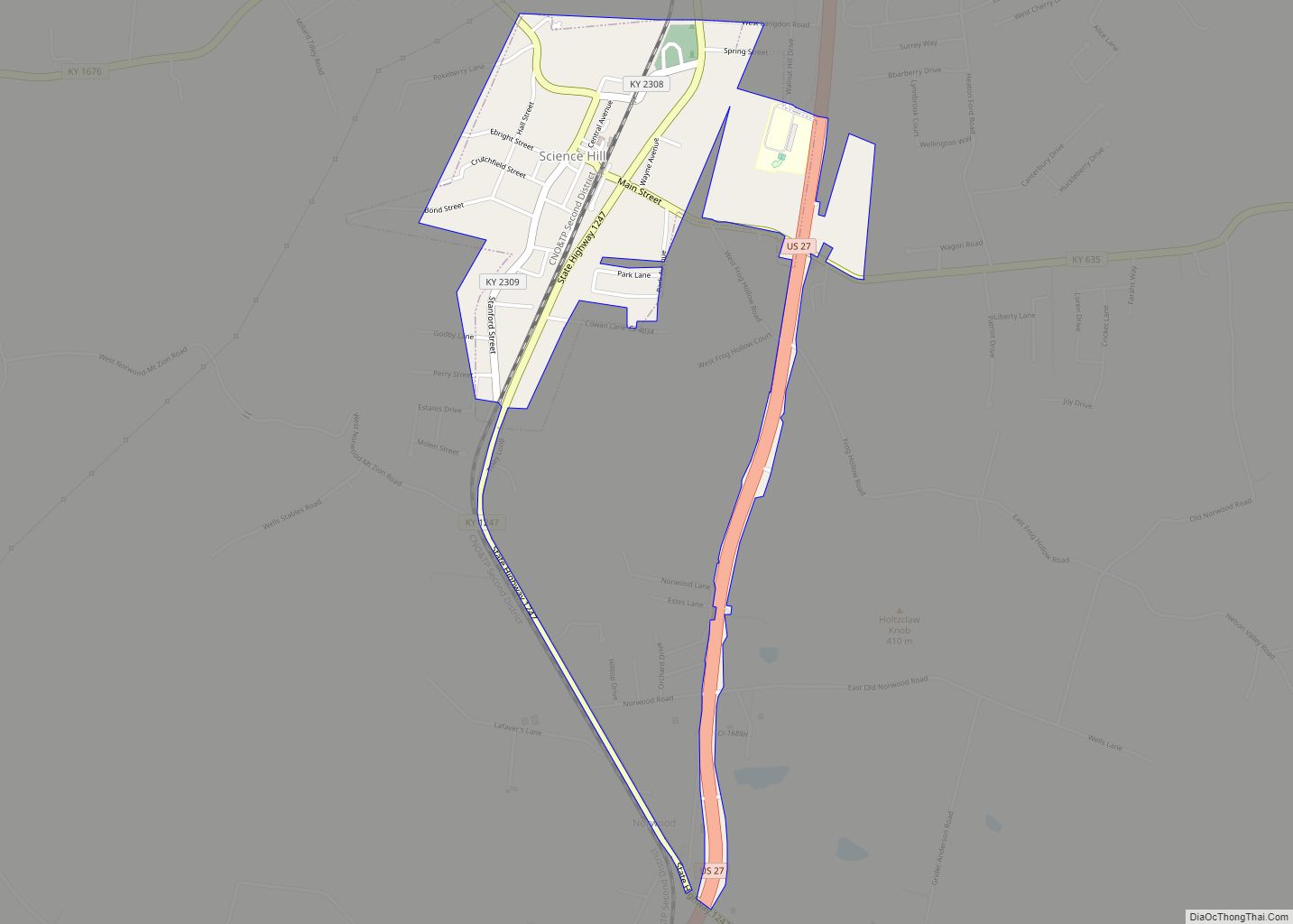
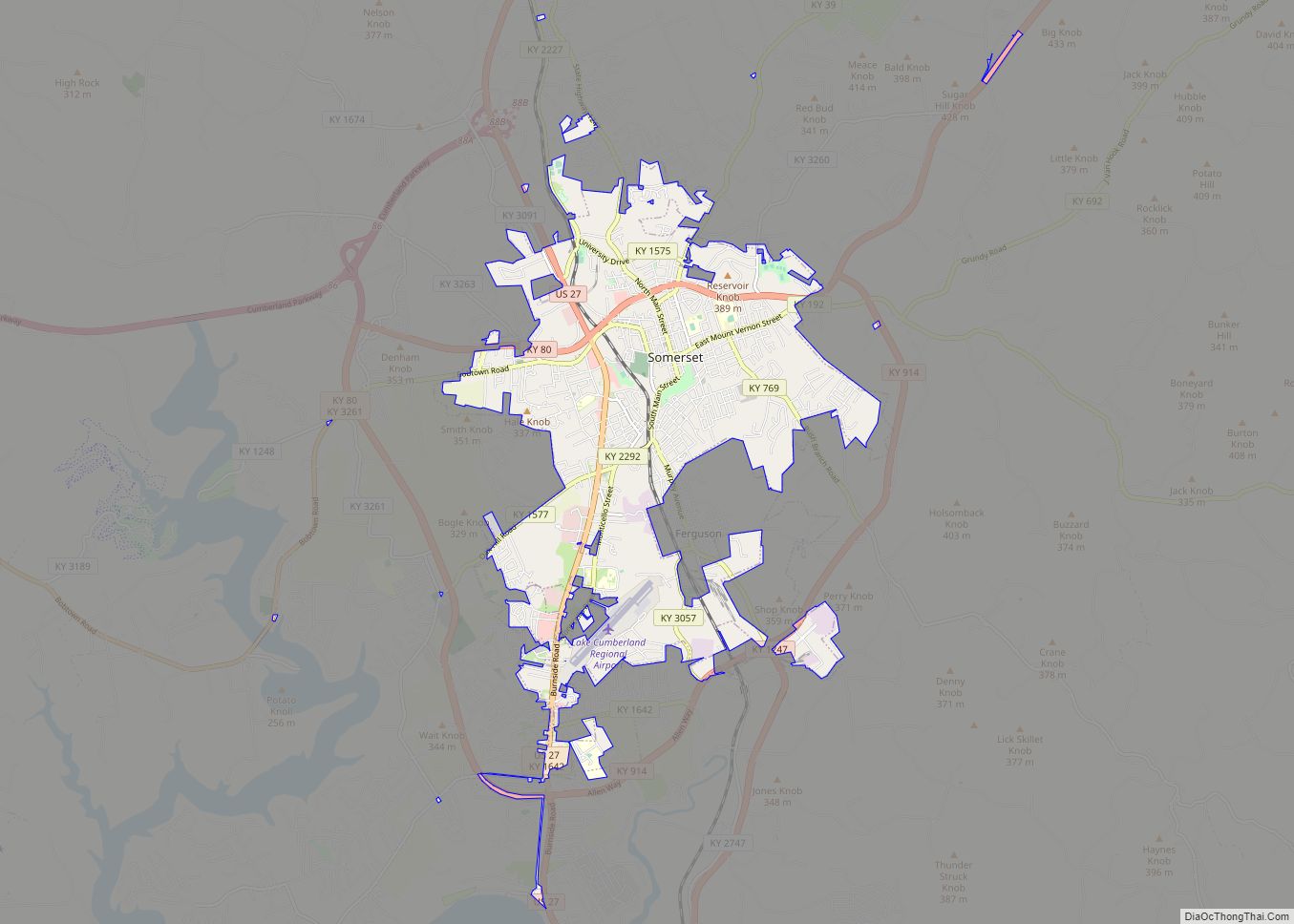
Online Interactive Map
Click on ![]() to view map in "full screen" mode.
to view map in "full screen" mode.
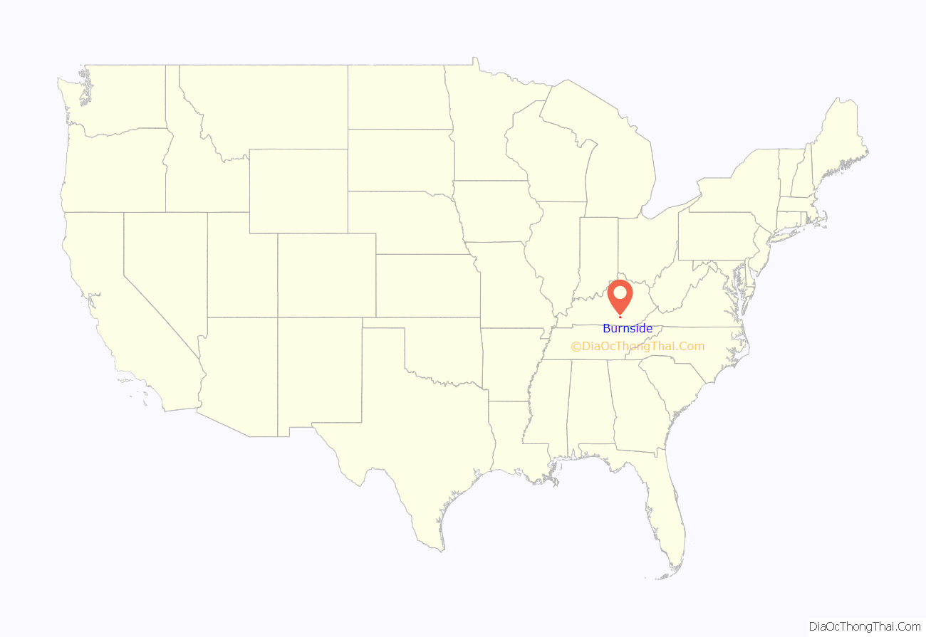
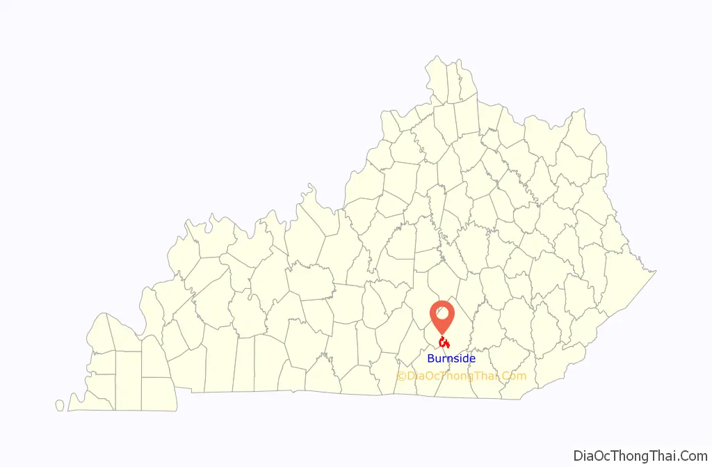
Burnside location map. Where is Burnside city?
History
The community was originally settled at the juncture of the Cumberland River and its South Fork. It was called Point Isabel, allegedly for a woman who jumped off a nearby cliff after breaking off a relationship. In 1890, the town was renamed for Civil War General Ambrose Burnside, who established a camp there during the war.
Burnside was a center for shipping by rail and steamboat packet. Its lumber mills sent products around the world. The town boasted retail stores, saloons, a post office, restaurants, churches, a bank, hotels, and even Burnside Academy – the first Wesleyan preparatory school in the state.
In the early 1950s, the entire town was relocated to higher ground due to the impounding of Lake Cumberland. The town had once been a thriving community. American author Harriette Simpson Arnow who was known for her book The Dollmaker lived in Burnside as a child.
Burnside is one of several places that lay claim to be home to the first Boy Scout troop in the United States. In 1908, two years before the Boy Scouts of America was officially organized, Mrs. Myra Greeno Bass organized a local troop of 15 boys, using official Boy Scout materials she had acquired from England. A sign at the edge of town declares Burnside “Birthplace of Boy Scouts in America”, and an official state historical society marker commemorates the troop.
Burnside Road Map
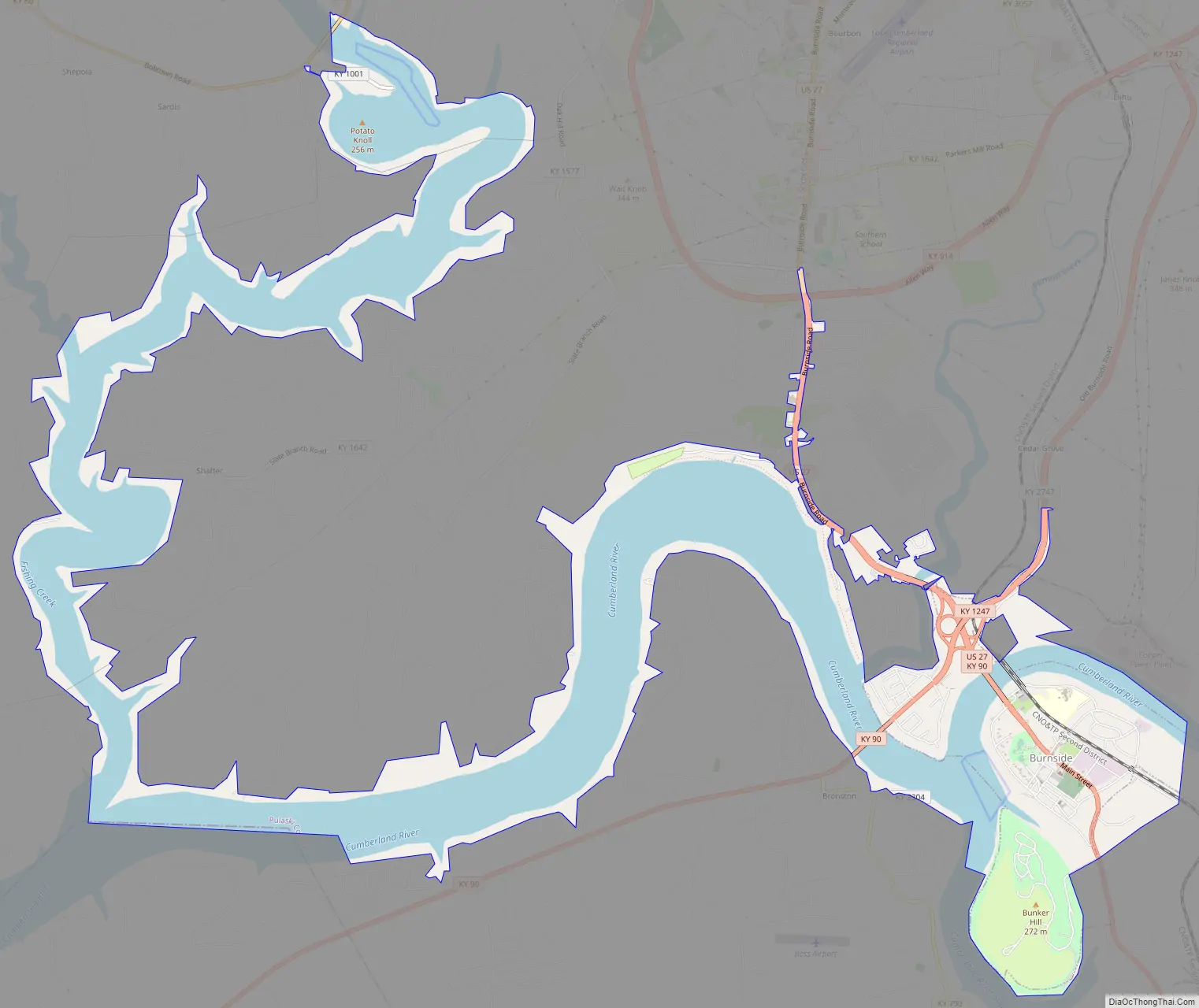
Burnside city Satellite Map
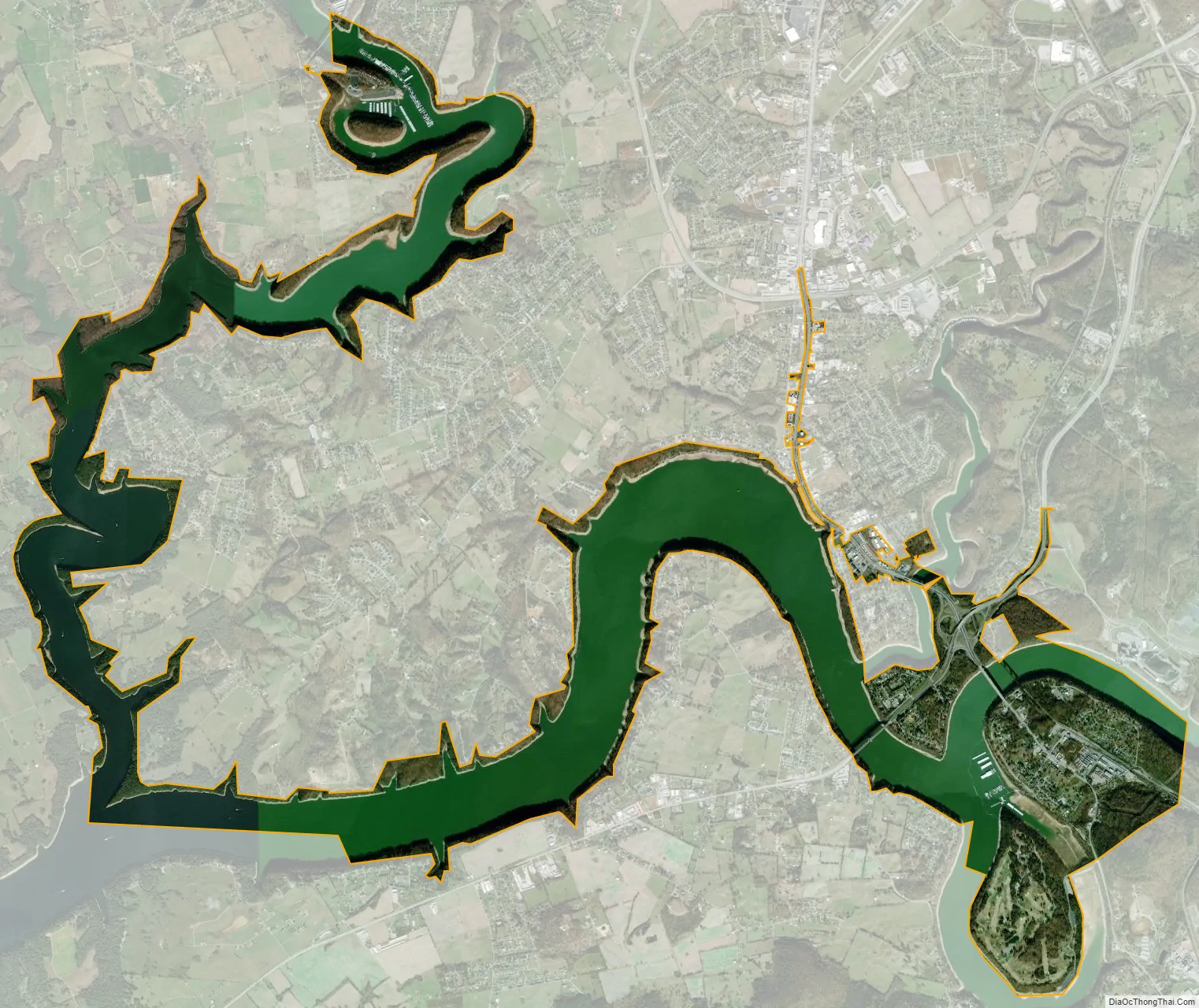
Geography
Burnside is located at 36°59′24″N 84°36′13″W / 36.99000°N 84.60361°W / 36.99000; -84.60361 (36.990039, -84.603486).
According to the United States Census Bureau, the city has a total area of 2.1 square miles (5.4 km), of which, 1.7 square miles (4.4 km) of it is land and 0.4 square miles (1.0 km) of it (18.75%) is water.
See also
Map of Kentucky State and its subdivision:- Adair
- Allen
- Anderson
- Ballard
- Barren
- Bath
- Bell
- Boone
- Bourbon
- Boyd
- Boyle
- Bracken
- Breathitt
- Breckinridge
- Bullitt
- Butler
- Caldwell
- Calloway
- Campbell
- Carlisle
- Carroll
- Carter
- Casey
- Christian
- Clark
- Clay
- Clinton
- Crittenden
- Cumberland
- Daviess
- Edmonson
- Elliott
- Estill
- Fayette
- Fleming
- Floyd
- Franklin
- Fulton
- Gallatin
- Garrard
- Grant
- Graves
- Grayson
- Green
- Greenup
- Hancock
- Hardin
- Harlan
- Harrison
- Hart
- Henderson
- Henry
- Hickman
- Hopkins
- Jackson
- Jefferson
- Jessamine
- Johnson
- Kenton
- Knott
- Knox
- Larue
- Laurel
- Lawrence
- Lee
- Leslie
- Letcher
- Lewis
- Lincoln
- Livingston
- Logan
- Lyon
- Madison
- Magoffin
- Marion
- Marshall
- Martin
- Mason
- McCracken
- McCreary
- McLean
- Meade
- Menifee
- Mercer
- Metcalfe
- Monroe
- Montgomery
- Morgan
- Muhlenberg
- Nelson
- Nicholas
- Ohio
- Oldham
- Owen
- Owsley
- Pendleton
- Perry
- Pike
- Powell
- Pulaski
- Robertson
- Rockcastle
- Rowan
- Russell
- Scott
- Shelby
- Simpson
- Spencer
- Taylor
- Todd
- Trigg
- Trimble
- Union
- Warren
- Washington
- Wayne
- Webster
- Whitley
- Wolfe
- Woodford
- Alabama
- Alaska
- Arizona
- Arkansas
- California
- Colorado
- Connecticut
- Delaware
- District of Columbia
- Florida
- Georgia
- Hawaii
- Idaho
- Illinois
- Indiana
- Iowa
- Kansas
- Kentucky
- Louisiana
- Maine
- Maryland
- Massachusetts
- Michigan
- Minnesota
- Mississippi
- Missouri
- Montana
- Nebraska
- Nevada
- New Hampshire
- New Jersey
- New Mexico
- New York
- North Carolina
- North Dakota
- Ohio
- Oklahoma
- Oregon
- Pennsylvania
- Rhode Island
- South Carolina
- South Dakota
- Tennessee
- Texas
- Utah
- Vermont
- Virginia
- Washington
- West Virginia
- Wisconsin
- Wyoming