Campbellsville is a city in central Kentucky founded in 1817 by Andrew Campbell. It is known for Campbellsville University, Taylor Regional Hospital health care system, its historic downtown, and the proximity to Green River Lake State Park. Campbellsville is the county seat of Taylor County, with a geographic boundary shaped like a heart. Campbellsville celebrated its bicentennial on July 4, 2017.
| Name: | Campbellsville city |
|---|---|
| LSAD Code: | 25 |
| LSAD Description: | city (suffix) |
| State: | Kentucky |
| County: | Taylor County |
| Elevation: | 814 ft (248 m) |
| Total Area: | 7.67 sq mi (19.86 km²) |
| Land Area: | 7.54 sq mi (19.52 km²) |
| Water Area: | 0.13 sq mi (0.34 km²) |
| Total Population: | 11,426 |
| Population Density: | 1,516.39/sq mi (585.47/km²) |
| ZIP code: | 42718-42719 |
| Area code: | 270 & 364 |
| FIPS code: | 2112160 |
| GNISfeature ID: | 0488742 |
| Website: | www.campbellsville.us |
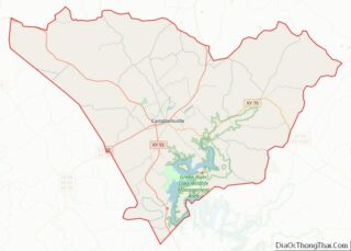
Online Interactive Map
Click on ![]() to view map in "full screen" mode.
to view map in "full screen" mode.
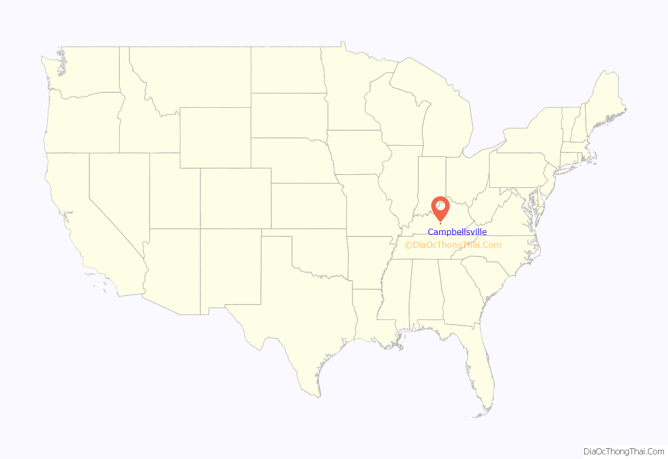
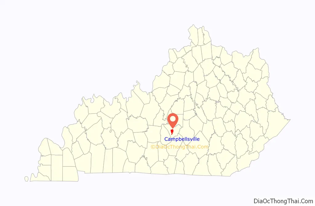
Campbellsville location map. Where is Campbellsville city?
History
Founding
The city was founded in 1817 and laid out by Andrew Campbell, who had moved from Augusta County, Virginia. Campbell owned a gristmill and a tavern and began selling lots in Campbellsville in 1814. Campbellsville was designated by the state legislature as the county seat in 1848 after Taylor County was separated from Green County. The city agreed to sell the public square to the county for one dollar so that a courthouse could be built.
Historic sites
Campbellsville has several historic sites as listed under Taylor County in the National Register of Historic Places listings in Kentucky.
The Campbellsville Historic Commercial District includes several blocks of Main Street. The historic First Street Brewery one street over dates back to the prohibition. Which is due to open in 2021 for the first time since the 1930s. The most notable structure in this district is Merchant Tower (formally Merchants Hotel) which has Romanesque architecture. It has been listed individually on the National Register of Historic Places since 1980.
The city’s first courthouse was burned by Confederate cavalry in 1864 because the Union Army was using it for barracks. After the war, a second courthouse was built on the same site. The third courthouse was built in 1965 on a property adjoining the “old courthouse” (on the aptly named Court Street). A fourth courthouse referred to as the Justice Center building was built on Main Street (along with a new adjoining county jail) in 2008. The project removed several old commercial buildings from the 300 block of East Main Street.
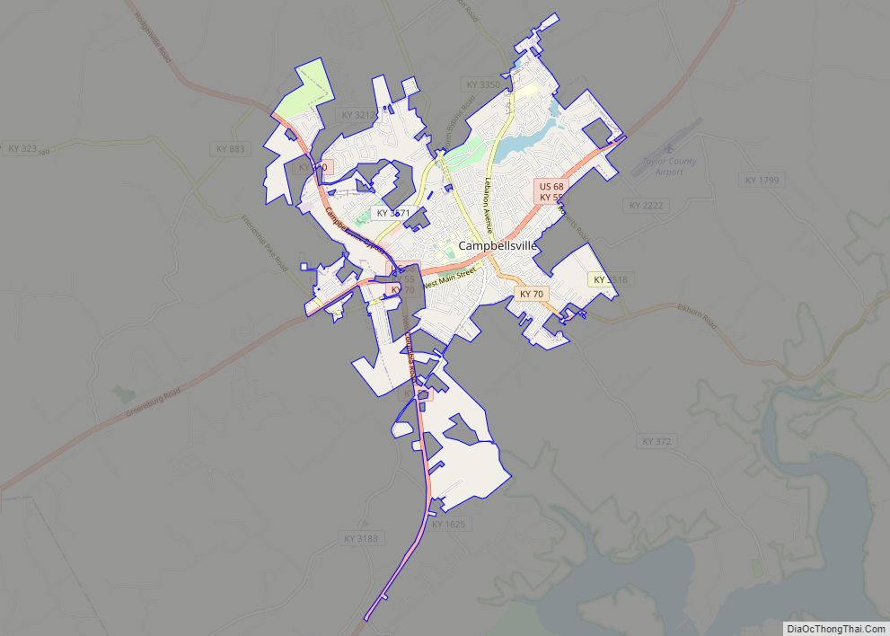
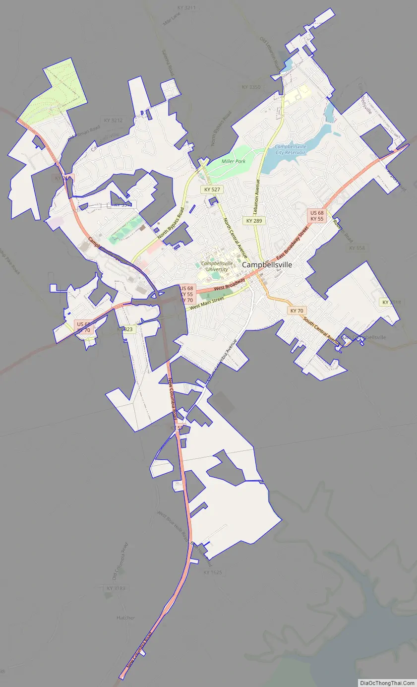
Campbellsville Road Map
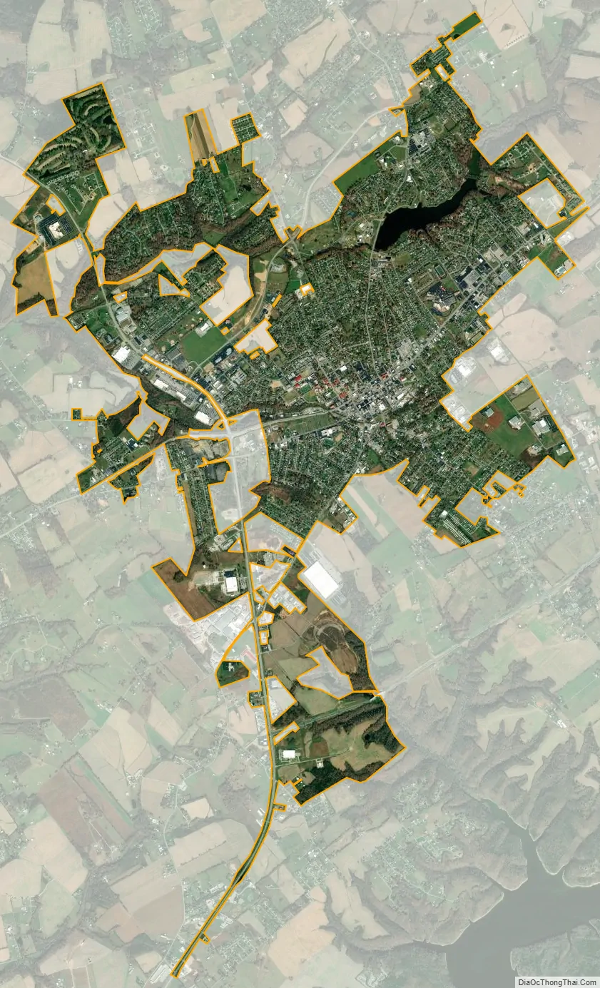
Campbellsville city Satellite Map
Geography
According to the United States Census Bureau, the city has a total area of 6.1 square miles (16 km), of which 6.0 square miles (16 km) is land and 0.1 square miles (0.26 km) (1.65%) is covered by water.
US 68, KY 55, KY 210, and KY 70 pass through Campbellsville.
Climate
The climate is characterized by hot, humid summers and generally mild to cool winters. According to the Köppen climate classification system, Campbellsville has a humid subtropical climate, Cfa on climate maps.
Parks
Miller Park is the main recreational park with softball fields, tennis courts, swimming pool, playgrounds, walking track gardens, and open space. It surrounds the Pitman Creek that flows through the park. About one mile to the west, Osborne Park (named after former Mayor Paul E. Osborne) is mostly open space and soccer fields. These two recreation parks are joined by the nature trail, the Pitman Creek Trail (a Trail Town project).
See also
Map of Kentucky State and its subdivision:- Adair
- Allen
- Anderson
- Ballard
- Barren
- Bath
- Bell
- Boone
- Bourbon
- Boyd
- Boyle
- Bracken
- Breathitt
- Breckinridge
- Bullitt
- Butler
- Caldwell
- Calloway
- Campbell
- Carlisle
- Carroll
- Carter
- Casey
- Christian
- Clark
- Clay
- Clinton
- Crittenden
- Cumberland
- Daviess
- Edmonson
- Elliott
- Estill
- Fayette
- Fleming
- Floyd
- Franklin
- Fulton
- Gallatin
- Garrard
- Grant
- Graves
- Grayson
- Green
- Greenup
- Hancock
- Hardin
- Harlan
- Harrison
- Hart
- Henderson
- Henry
- Hickman
- Hopkins
- Jackson
- Jefferson
- Jessamine
- Johnson
- Kenton
- Knott
- Knox
- Larue
- Laurel
- Lawrence
- Lee
- Leslie
- Letcher
- Lewis
- Lincoln
- Livingston
- Logan
- Lyon
- Madison
- Magoffin
- Marion
- Marshall
- Martin
- Mason
- McCracken
- McCreary
- McLean
- Meade
- Menifee
- Mercer
- Metcalfe
- Monroe
- Montgomery
- Morgan
- Muhlenberg
- Nelson
- Nicholas
- Ohio
- Oldham
- Owen
- Owsley
- Pendleton
- Perry
- Pike
- Powell
- Pulaski
- Robertson
- Rockcastle
- Rowan
- Russell
- Scott
- Shelby
- Simpson
- Spencer
- Taylor
- Todd
- Trigg
- Trimble
- Union
- Warren
- Washington
- Wayne
- Webster
- Whitley
- Wolfe
- Woodford
- Alabama
- Alaska
- Arizona
- Arkansas
- California
- Colorado
- Connecticut
- Delaware
- District of Columbia
- Florida
- Georgia
- Hawaii
- Idaho
- Illinois
- Indiana
- Iowa
- Kansas
- Kentucky
- Louisiana
- Maine
- Maryland
- Massachusetts
- Michigan
- Minnesota
- Mississippi
- Missouri
- Montana
- Nebraska
- Nevada
- New Hampshire
- New Jersey
- New Mexico
- New York
- North Carolina
- North Dakota
- Ohio
- Oklahoma
- Oregon
- Pennsylvania
- Rhode Island
- South Carolina
- South Dakota
- Tennessee
- Texas
- Utah
- Vermont
- Virginia
- Washington
- West Virginia
- Wisconsin
- Wyoming