Carrsville is a home rule-class city beside the Ohio River in Livingston County, Kentucky, in the United States. The population was 50 at the 2010 census, declining from 64 as of 2000. It is part of the Paducah, KY-IL Micropolitan Statistical Area. It is situated just west of the junction of where Buck Creek empties into the Ohio River.
| Name: | Carrsville city |
|---|---|
| LSAD Code: | 25 |
| LSAD Description: | city (suffix) |
| State: | Kentucky |
| County: | Livingston County |
| Elevation: | 371 ft (113 m) |
| Total Area: | 0.07 sq mi (0.17 km²) |
| Land Area: | 0.07 sq mi (0.17 km²) |
| Water Area: | 0.00 sq mi (0.00 km²) |
| Total Population: | 48 |
| Population Density: | 738.46/sq mi (284.57/km²) |
| ZIP code: | 42081 |
| Area code: | 270 & 364 |
| FIPS code: | 2113060 |
| GNISfeature ID: | 2404001 |
Online Interactive Map
Click on ![]() to view map in "full screen" mode.
to view map in "full screen" mode.
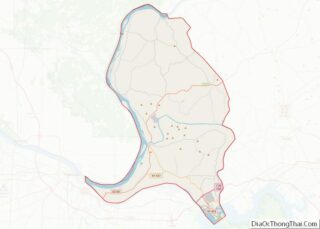
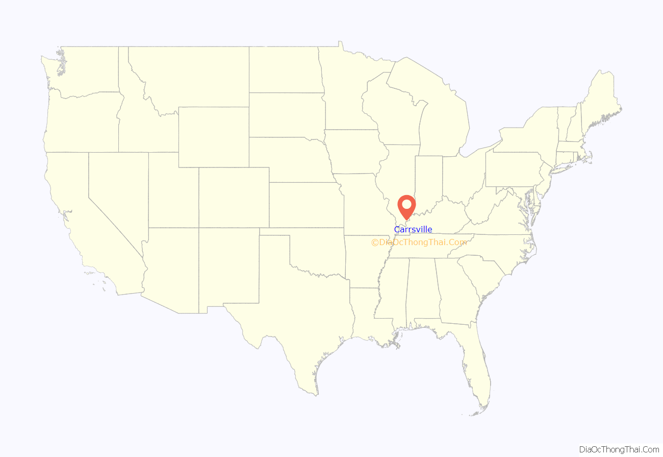
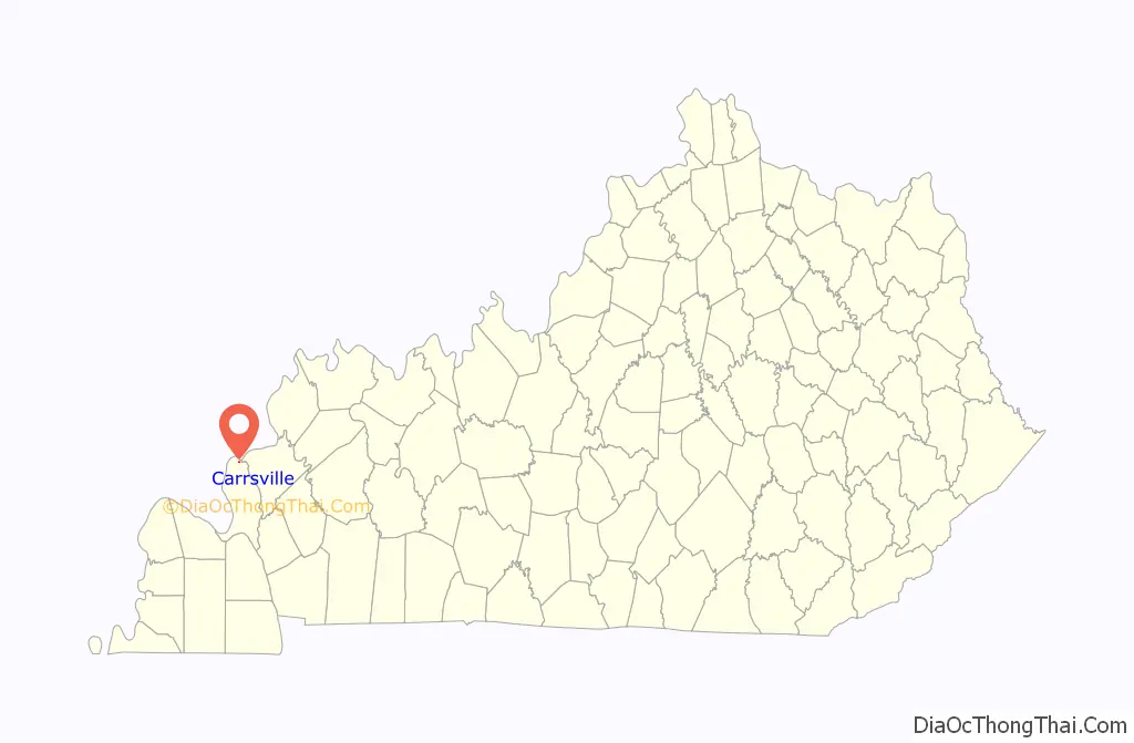
Carrsville location map. Where is Carrsville city?
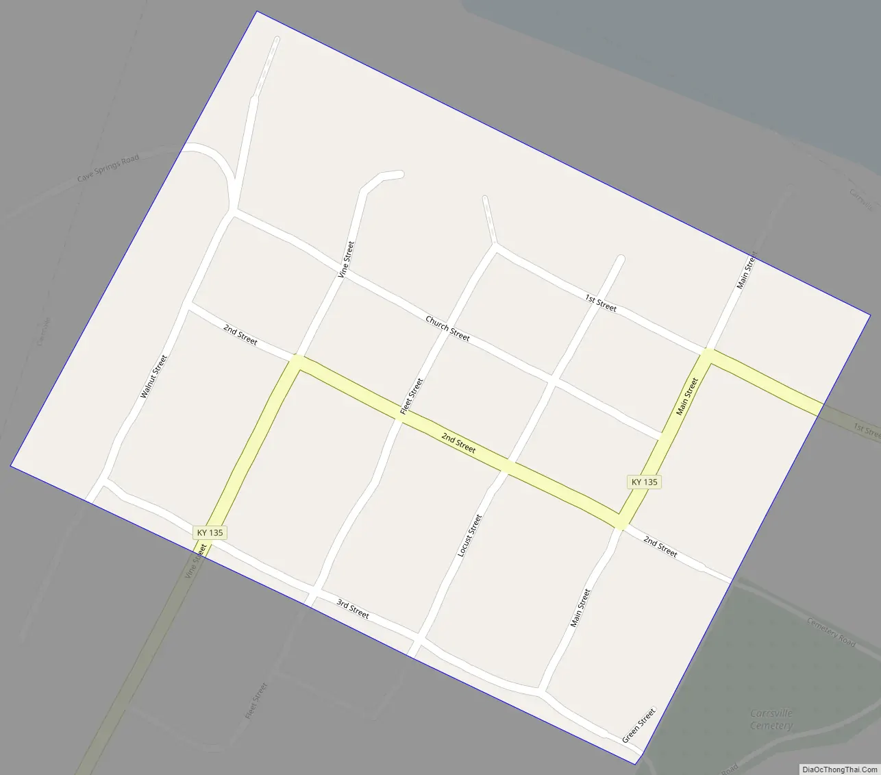
Carrsville Road Map
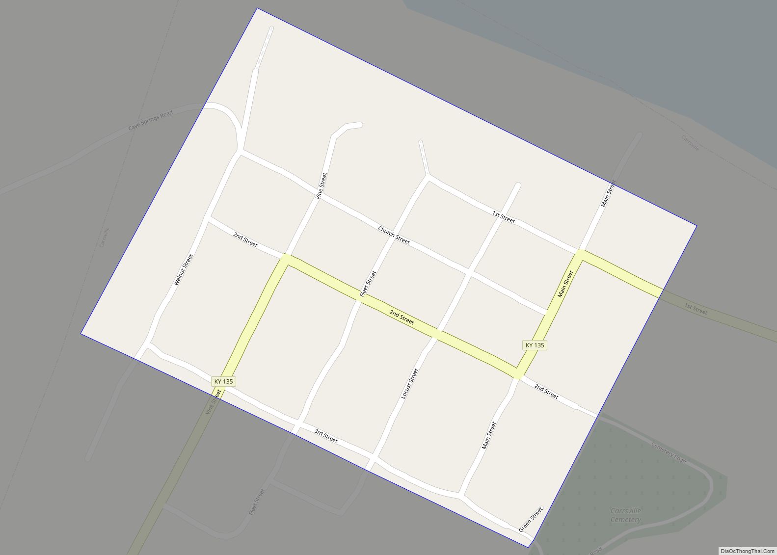
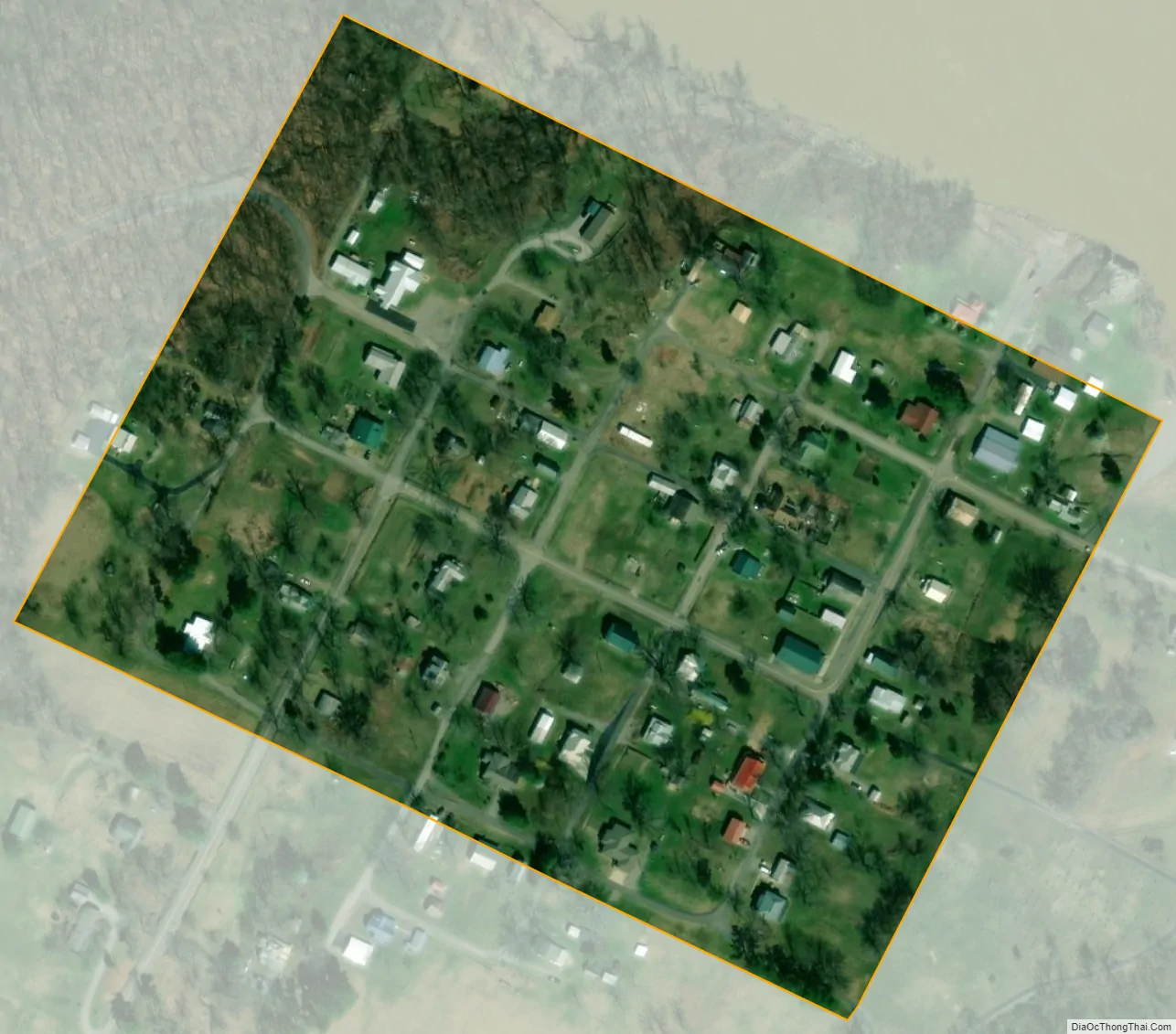
Carrsville city Satellite Map
Geography
Carrsville is located in northern Livingston County at 37°23′53″N 88°22′30″W / 37.39806°N 88.37500°W / 37.39806; -88.37500 (37.398063, -88.375113). To the north, across the Ohio River, is Hardin County, Illinois. The nearest river crossing is the Cave-In-Rock Ferry 13 miles (21 km) upstream (east). The nearest bridges over the Ohio are the Shawneetown Bridge 36 miles (58 km) upriver at Old Shawneetown, Illinois, and the Brookport Bridge 43 miles (69 km) downriver at Paducah.
Kentucky Route 135 passes through Carrsville, leading east 14 miles (23 km) to Kentucky Route 91 near the Cave-In-Rock Ferry, and south 12 miles (19 km) to U.S. Route 60 at Burna.
According to the United States Census Bureau, Carrsville has a total area of 0.07 square miles (0.17 km), all land.
See also
Map of Kentucky State and its subdivision:- Adair
- Allen
- Anderson
- Ballard
- Barren
- Bath
- Bell
- Boone
- Bourbon
- Boyd
- Boyle
- Bracken
- Breathitt
- Breckinridge
- Bullitt
- Butler
- Caldwell
- Calloway
- Campbell
- Carlisle
- Carroll
- Carter
- Casey
- Christian
- Clark
- Clay
- Clinton
- Crittenden
- Cumberland
- Daviess
- Edmonson
- Elliott
- Estill
- Fayette
- Fleming
- Floyd
- Franklin
- Fulton
- Gallatin
- Garrard
- Grant
- Graves
- Grayson
- Green
- Greenup
- Hancock
- Hardin
- Harlan
- Harrison
- Hart
- Henderson
- Henry
- Hickman
- Hopkins
- Jackson
- Jefferson
- Jessamine
- Johnson
- Kenton
- Knott
- Knox
- Larue
- Laurel
- Lawrence
- Lee
- Leslie
- Letcher
- Lewis
- Lincoln
- Livingston
- Logan
- Lyon
- Madison
- Magoffin
- Marion
- Marshall
- Martin
- Mason
- McCracken
- McCreary
- McLean
- Meade
- Menifee
- Mercer
- Metcalfe
- Monroe
- Montgomery
- Morgan
- Muhlenberg
- Nelson
- Nicholas
- Ohio
- Oldham
- Owen
- Owsley
- Pendleton
- Perry
- Pike
- Powell
- Pulaski
- Robertson
- Rockcastle
- Rowan
- Russell
- Scott
- Shelby
- Simpson
- Spencer
- Taylor
- Todd
- Trigg
- Trimble
- Union
- Warren
- Washington
- Wayne
- Webster
- Whitley
- Wolfe
- Woodford
- Alabama
- Alaska
- Arizona
- Arkansas
- California
- Colorado
- Connecticut
- Delaware
- District of Columbia
- Florida
- Georgia
- Hawaii
- Idaho
- Illinois
- Indiana
- Iowa
- Kansas
- Kentucky
- Louisiana
- Maine
- Maryland
- Massachusetts
- Michigan
- Minnesota
- Mississippi
- Missouri
- Montana
- Nebraska
- Nevada
- New Hampshire
- New Jersey
- New Mexico
- New York
- North Carolina
- North Dakota
- Ohio
- Oklahoma
- Oregon
- Pennsylvania
- Rhode Island
- South Carolina
- South Dakota
- Tennessee
- Texas
- Utah
- Vermont
- Virginia
- Washington
- West Virginia
- Wisconsin
- Wyoming