Central City is a home rule-class city in Muhlenberg County, Kentucky, in the United States. The population was 5,978 at the 2010 census. It is also the largest city in the county and the principal community in the Central City Micropolitan Statistical Area, which includes all of Muhlenberg County.
| Name: | Central City city |
|---|---|
| LSAD Code: | 25 |
| LSAD Description: | city (suffix) |
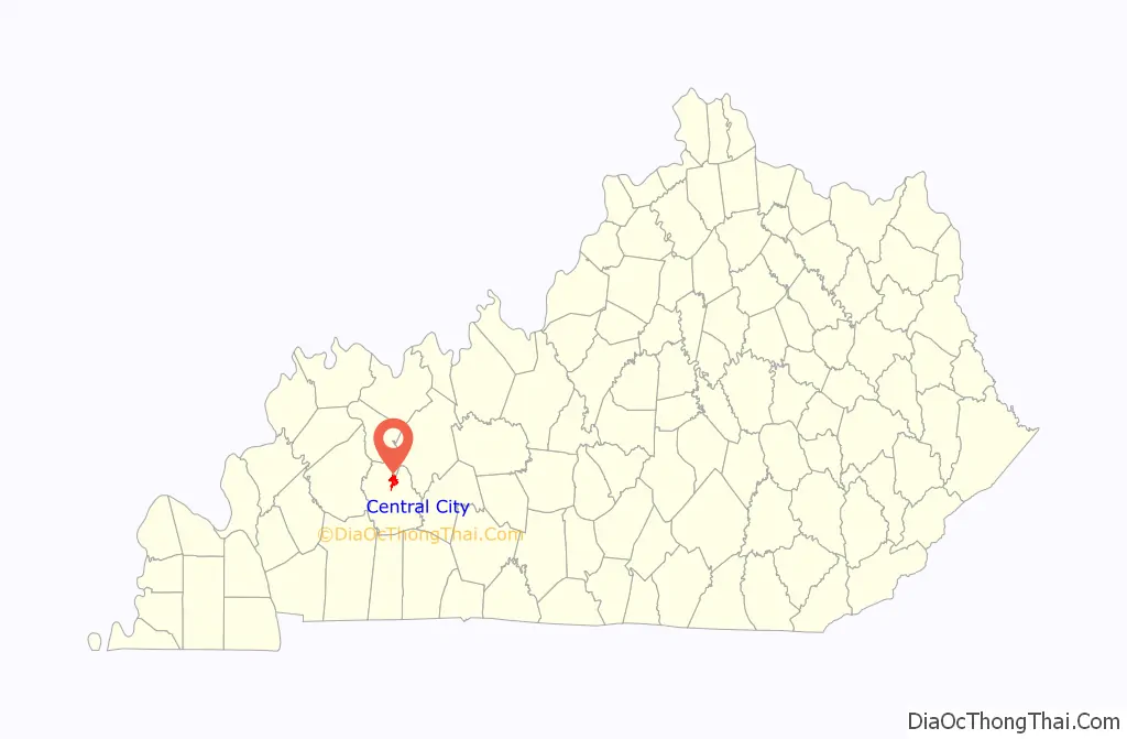
| State: | Kentucky |
| County: | Muhlenberg County |
| Incorporated: | Stroud City, 1873 |
| Elevation: | 436 ft (133 m) |
| Total Area: | 5.25 sq mi (13.59 km²) |
| Land Area: | 5.24 sq mi (13.56 km²) |
| Water Area: | 0.01 sq mi (0.03 km²) |
| Population Density: | 1,111.13/sq mi (429.05/km²) |
| ZIP code: | 42330 |
| Area code: | 270 & 364 |
| FIPS code: | 2113978 |
| GNISfeature ID: | 0489282 |
| Website: | cityofcentralcity.com |
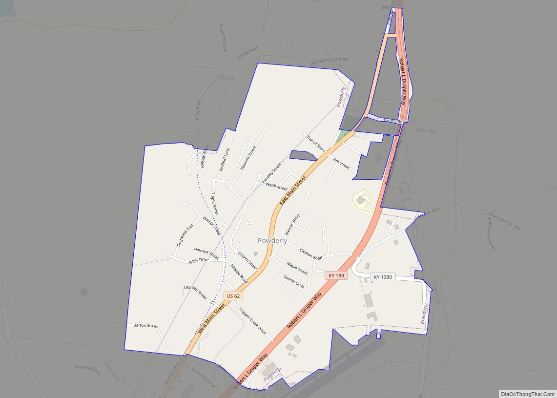
Online Interactive Map
Click on ![]() to view map in "full screen" mode.
to view map in "full screen" mode.
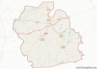
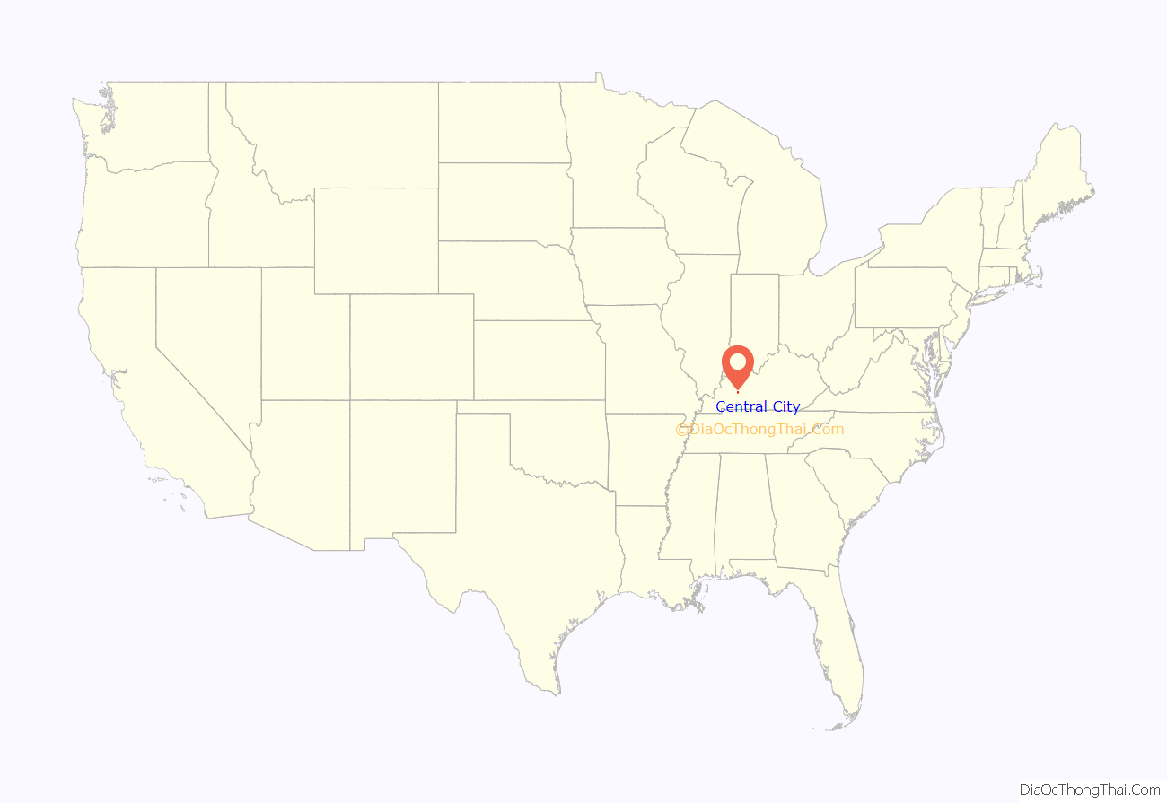
Central City location map. Where is Central City city?
History
The site of present-day Central City was originally known as Morehead’s Horse Mill after local resident Charles S. Morehead’s steam-powered gristmill. A larger community began to develop after the 1870 advent of the Elizabethtown and Paducah Railroad. A post office was constructed the next year in 1871 and called Owensboro Junction after the projected 1872 completion of the Owensboro and Russellville Railroad. By 1873, the settlement was large enough to be incorporated by the state legislature as Stroud City, after local landowner John Stroud.
The same year, however, the du Pont’s Central Coal and Iron Company began operation in the area and became so vital to the local economy that the city was reïncorporated in 1882 as Central City. Recessions replaced the E&P and the O&R with a procession of different companies, including the Owensboro and Nashville Railway, but the two rights of way always remained in separate hands, keeping Central City an important regional hub for the Illinois Central and the L&N, with train yards, roundhouses, and even an elevated rail station. Coal was mined from nearby fields, prompting explosions such as one in 1912 that killed 5 workers.
The expansion of automotive traffic in the early 20th century reduced some of Central City’s importance, but it continues to service mainline freight traffic on the Paducah and Louisville Railway and trunk-line service for CSX from Madisonville to the Paradise Combined Cycle Plant, minutes south of the city.
Central City is the only city in Muhlenberg County that allows liquor to be sold by package stores and by the drink in restaurants seating at least 100 persons. Muhlenberg County is dry.
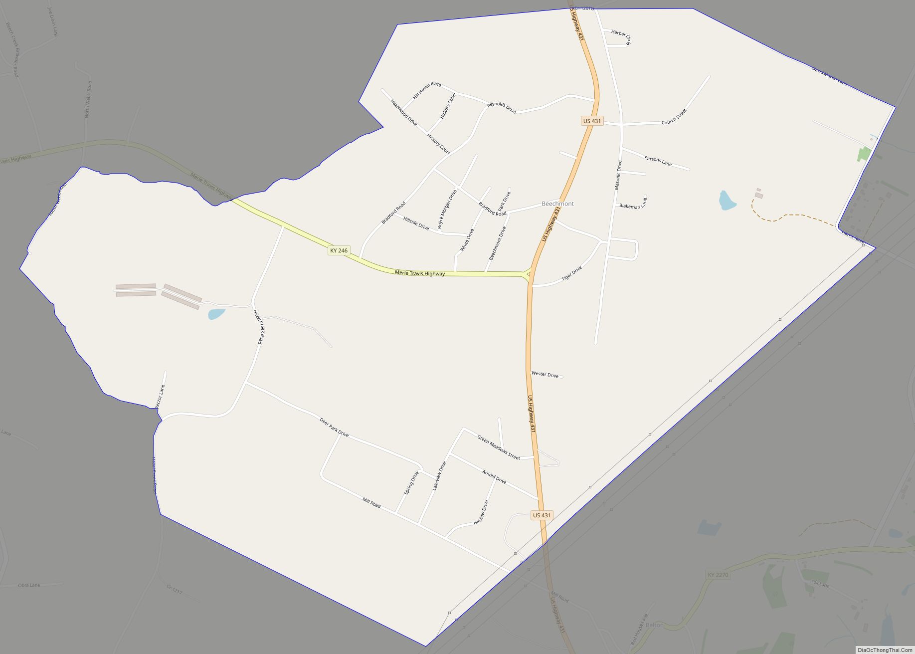
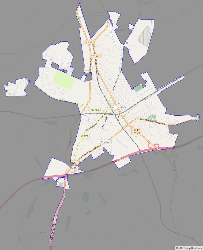
Central City Road Map
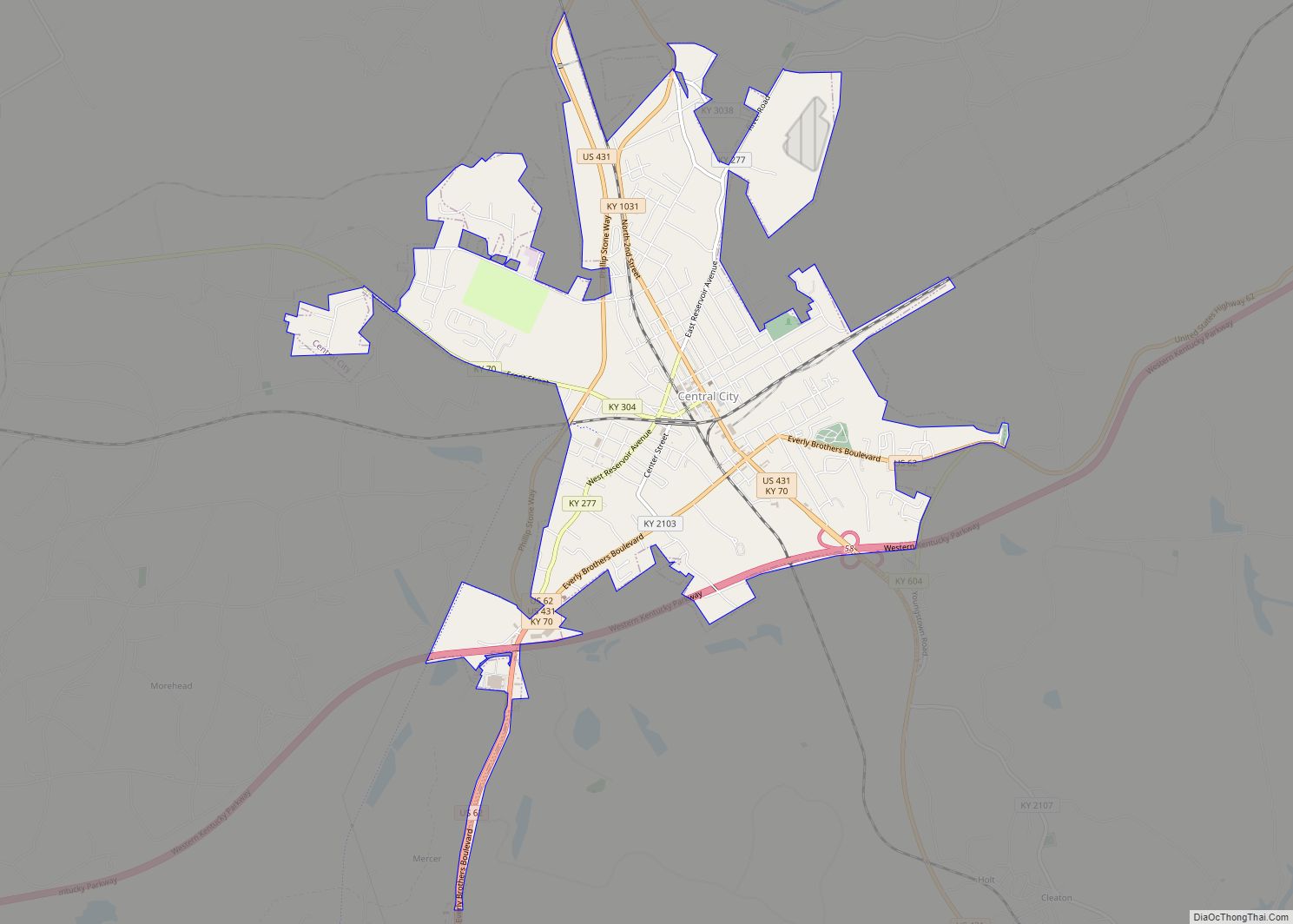
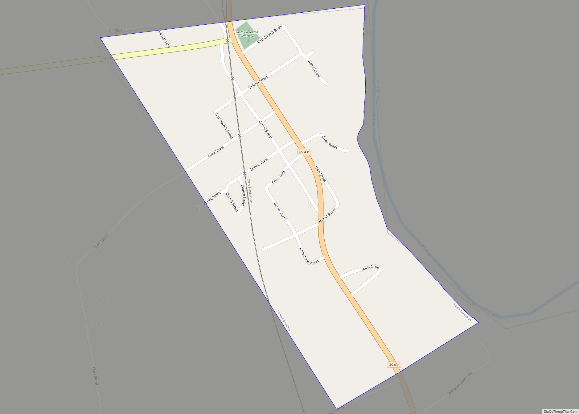
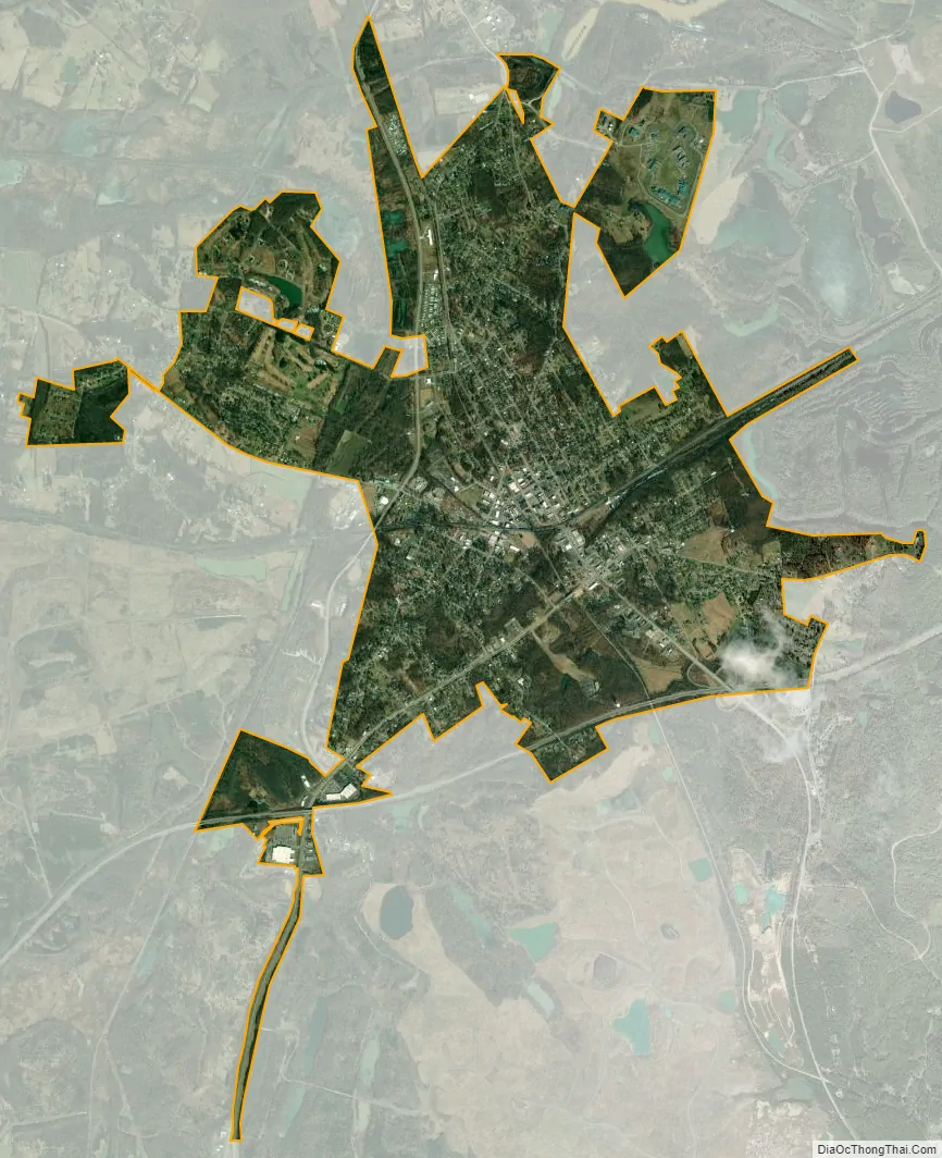
Central City city Satellite Map
Geography
Central City is located at 37°17′42″N 87°07′43″W / 37.294989°N 87.128622°W / 37.294989; -87.128622 (37.294989, -87.128622).
According to the United States Census Bureau, the city has a total area of 5.2 square miles (13 km), all land.
Terrain in Central City is rolling hills to steep bluffs along the northern boundaries of the city along the Green River. The city, along its northwestern border, is known for its swamps and lowland area that remain at or near the water table year-round.
Most of Central City has a sandstone bedrock with #9 bituminous coal underlying the bedrock. Central City has a number of old underground coal mine shafts that still crisscross the city. Most of these old shafts date back to the early 1900s. The majority of terrain around the city limits is reclaimed land where surface mining has taken place.
See also
Map of Kentucky State and its subdivision:- Adair
- Allen
- Anderson
- Ballard
- Barren
- Bath
- Bell
- Boone
- Bourbon
- Boyd
- Boyle
- Bracken
- Breathitt
- Breckinridge
- Bullitt
- Butler
- Caldwell
- Calloway
- Campbell
- Carlisle
- Carroll
- Carter
- Casey
- Christian
- Clark
- Clay
- Clinton
- Crittenden
- Cumberland
- Daviess
- Edmonson
- Elliott
- Estill
- Fayette
- Fleming
- Floyd
- Franklin
- Fulton
- Gallatin
- Garrard
- Grant
- Graves
- Grayson
- Green
- Greenup
- Hancock
- Hardin
- Harlan
- Harrison
- Hart
- Henderson
- Henry
- Hickman
- Hopkins
- Jackson
- Jefferson
- Jessamine
- Johnson
- Kenton
- Knott
- Knox
- Larue
- Laurel
- Lawrence
- Lee
- Leslie
- Letcher
- Lewis
- Lincoln
- Livingston
- Logan
- Lyon
- Madison
- Magoffin
- Marion
- Marshall
- Martin
- Mason
- McCracken
- McCreary
- McLean
- Meade
- Menifee
- Mercer
- Metcalfe
- Monroe
- Montgomery
- Morgan
- Muhlenberg
- Nelson
- Nicholas
- Ohio
- Oldham
- Owen
- Owsley
- Pendleton
- Perry
- Pike
- Powell
- Pulaski
- Robertson
- Rockcastle
- Rowan
- Russell
- Scott
- Shelby
- Simpson
- Spencer
- Taylor
- Todd
- Trigg
- Trimble
- Union
- Warren
- Washington
- Wayne
- Webster
- Whitley
- Wolfe
- Woodford
- Alabama
- Alaska
- Arizona
- Arkansas
- California
- Colorado
- Connecticut
- Delaware
- District of Columbia
- Florida
- Georgia
- Hawaii
- Idaho
- Illinois
- Indiana
- Iowa
- Kansas
- Kentucky
- Louisiana
- Maine
- Maryland
- Massachusetts
- Michigan
- Minnesota
- Mississippi
- Missouri
- Montana
- Nebraska
- Nevada
- New Hampshire
- New Jersey
- New Mexico
- New York
- North Carolina
- North Dakota
- Ohio
- Oklahoma
- Oregon
- Pennsylvania
- Rhode Island
- South Carolina
- South Dakota
- Tennessee
- Texas
- Utah
- Vermont
- Virginia
- Washington
- West Virginia
- Wisconsin
- Wyoming