Madisonville is a home rule-class city in and the county seat of Hopkins County, Kentucky, United States, located along Interstate 69 in the state’s Western Coal Fields region. The population was 19,591 at the 2010 census. Madisonville is a commercial center of the region and is home to Madisonville Community College.
| Name: | Madisonville city |
|---|---|
| LSAD Code: | 25 |
| LSAD Description: | city (suffix) |
| State: | Kentucky |
| County: | Hopkins County |
| Incorporated: | 1807 |
| Elevation: | 470 ft (144 m) |
| Total Area: | 18.66 sq mi (48.33 km²) |
| Land Area: | 17.87 sq mi (46.27 km²) |
| Water Area: | 0.80 sq mi (2.06 km²) |
| Total Population: | 19,542 |
| Population Density: | 1,093.81/sq mi (422.32/km²) |
| ZIP code: | 42431 |
| Area code: | 270 & 364 270 |
| FIPS code: | 2149368 |
| GNISfeature ID: | 0497441 |
| Website: | madisonvilleliving.com |
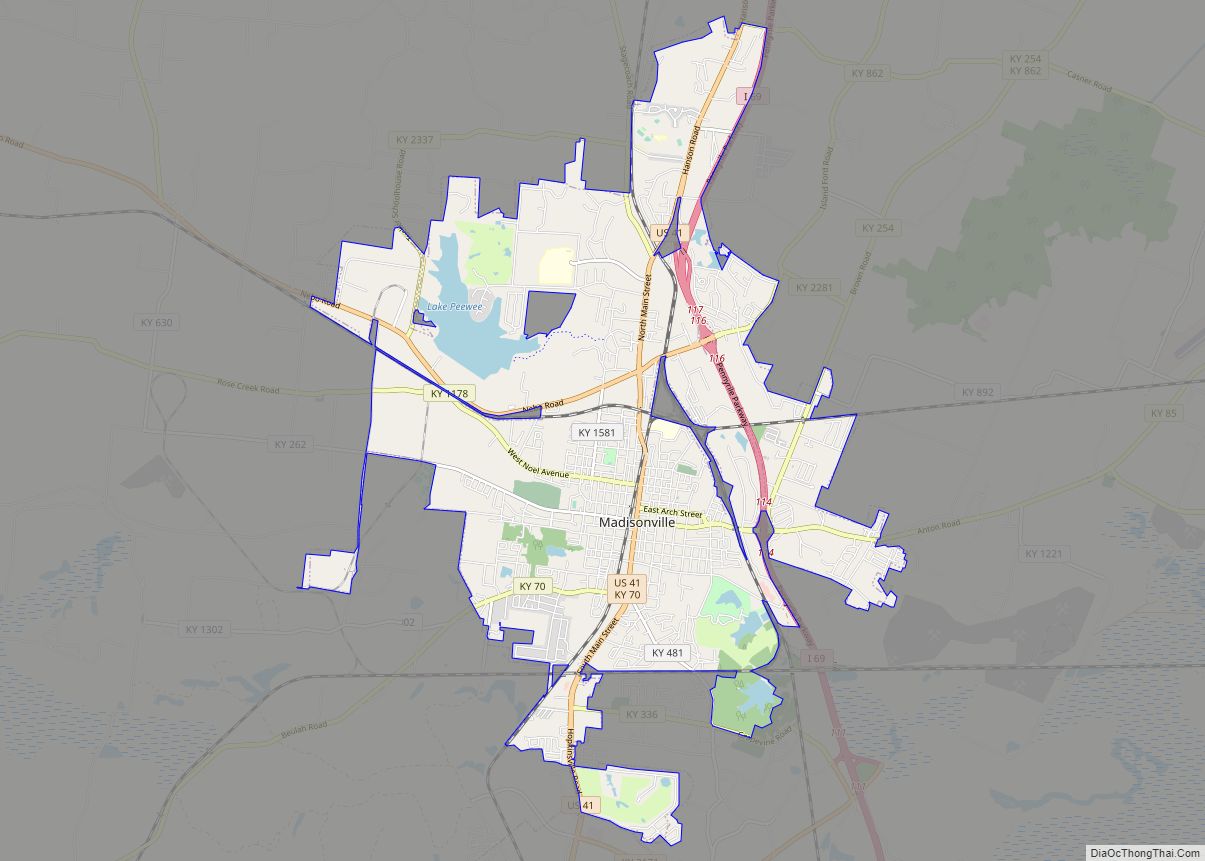
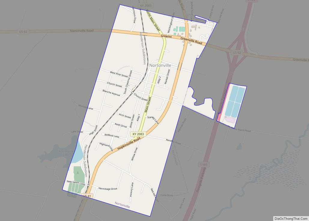
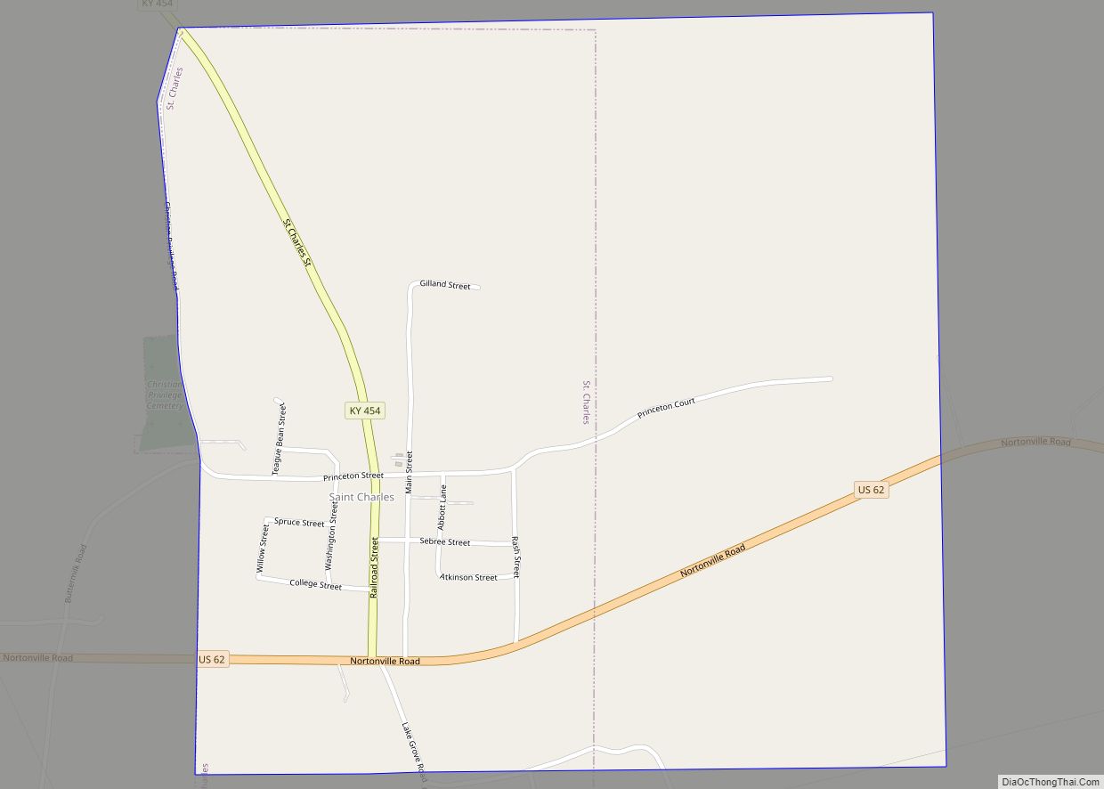
Online Interactive Map
Click on ![]() to view map in "full screen" mode.
to view map in "full screen" mode.
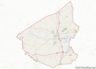
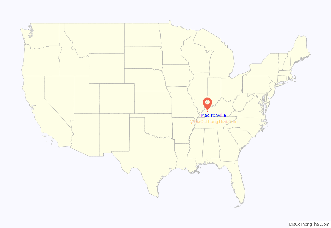
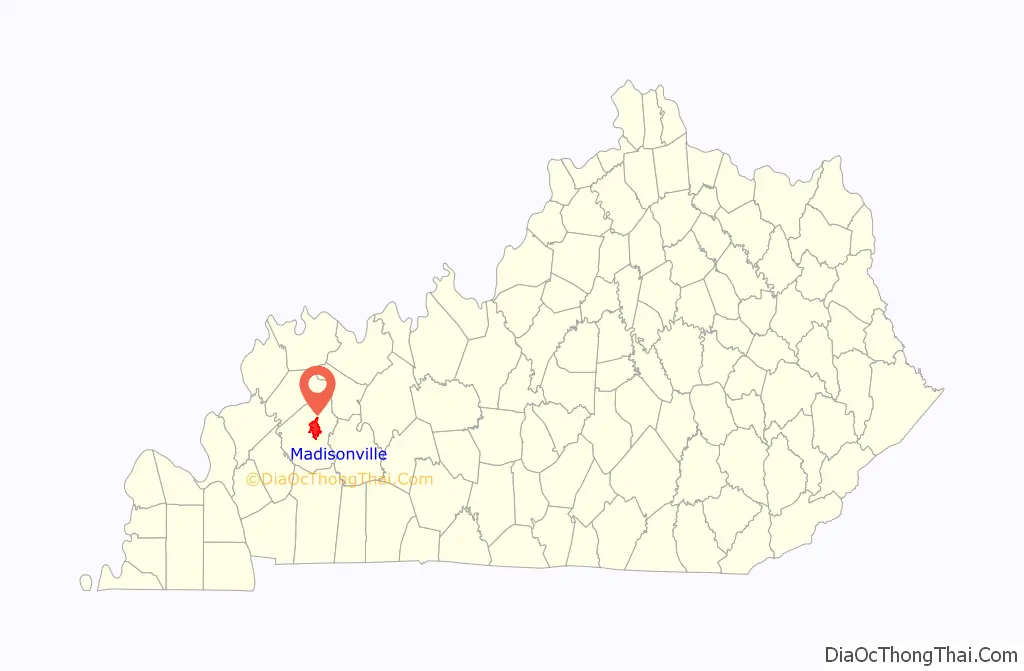
Madisonville location map. Where is Madisonville city?
History
Madisonville was founded in 1807 and named for then-Secretary of State James Madison. It was named the seat of Hopkins County in 1808 and formally incorporated in 1810.
Hopkins County and Madisonville were divided by the Civil War. Union supporters joined a regiment recruited locally by James Shackleford; Al Fowler recruited Confederate troops. The courthouse in Madisonville was burned by Confederates led by Gen. Hylan B. Lyon on December 17, 1864, as they passed through western Kentucky. While Kentucky remained a Union state, the policies imposed by Union armies in the area caused resentment and sparked sympathy for the Confederate cause.
Farming was the major occupation in Hopkins County for most of the 1800s, with tobacco the leading crop. Around 1837 an outcropping of coal was discovered, and the first coal mine in the county opened in 1869. Mining did not become a major industry until the Louisville & Nashville Railroad pushed its line southward from Henderson through Madisonville and toward Nashville in 1870. By the early 1900s, Madisonville was a rail hub, coal mining center, and had a large tobacco market. This continued until the 1960s when manufacturing and service industries came to the area.
On November 15, 2005, a tornado ripped through the city, destroying some parts of it. The tornado began to form around 3:00 PM. The neighborhood near the Madisonville Country Club was greatly affected by the storm. The home of Madisonville resident and former Boston Celtics star Frank Ramsey was destroyed in the storm. Mayor Karen Cunningham ordered a curfew in parts of the city and declared a state of emergency.
In January 2009, a severe ice storm hit Madisonville. Hopkins County and much of the rest of state of Kentucky were affected. Madisonville was placed under a curfew for the safety of the citizens. The storm was responsible for widespread power outages and damage to homes as well as trees. Many residents were without power for weeks, and tree limb clean-up took months to complete. Many out-of-state power companies assisted the local power companies to speed up the process of re-powering the town.
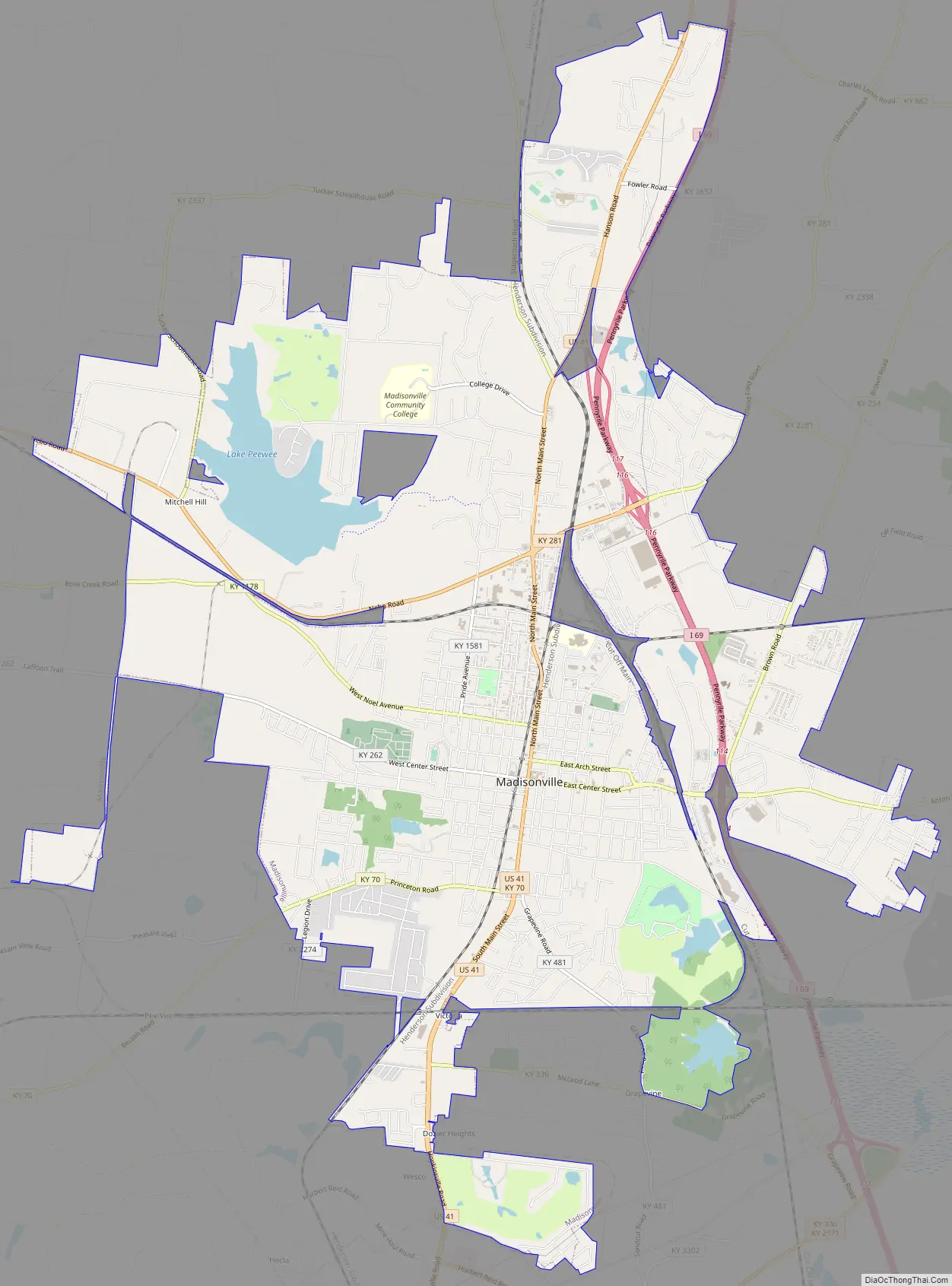
Madisonville Road Map
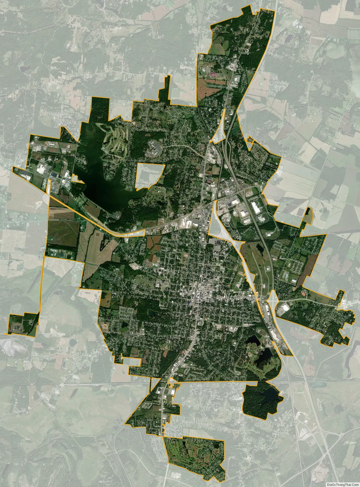
Madisonville city Satellite Map
Geography
Madisonville is located about 50 miles (80 km) south of Evansville, Indiana. Interstate 69 (formerly the Pennyrile Parkway) passes through the eastern side of the city, with access from exits 111, 114, and 117. U.S. Route 41 passes through the center of town as Main Street, running generally parallel to I-69. The highways lead north 38 miles (61 km) to Henderson and south 35 miles (56 km) to Hopkinsville.
According to the United States Census Bureau, Madisonville has a total area of 18.7 square miles (48.4 km), of which 17.9 square miles (46.3 km) are land and 0.81 square miles (2.1 km), or 4.42%, are water.
See also
Map of Kentucky State and its subdivision:- Adair
- Allen
- Anderson
- Ballard
- Barren
- Bath
- Bell
- Boone
- Bourbon
- Boyd
- Boyle
- Bracken
- Breathitt
- Breckinridge
- Bullitt
- Butler
- Caldwell
- Calloway
- Campbell
- Carlisle
- Carroll
- Carter
- Casey
- Christian
- Clark
- Clay
- Clinton
- Crittenden
- Cumberland
- Daviess
- Edmonson
- Elliott
- Estill
- Fayette
- Fleming
- Floyd
- Franklin
- Fulton
- Gallatin
- Garrard
- Grant
- Graves
- Grayson
- Green
- Greenup
- Hancock
- Hardin
- Harlan
- Harrison
- Hart
- Henderson
- Henry
- Hickman
- Hopkins
- Jackson
- Jefferson
- Jessamine
- Johnson
- Kenton
- Knott
- Knox
- Larue
- Laurel
- Lawrence
- Lee
- Leslie
- Letcher
- Lewis
- Lincoln
- Livingston
- Logan
- Lyon
- Madison
- Magoffin
- Marion
- Marshall
- Martin
- Mason
- McCracken
- McCreary
- McLean
- Meade
- Menifee
- Mercer
- Metcalfe
- Monroe
- Montgomery
- Morgan
- Muhlenberg
- Nelson
- Nicholas
- Ohio
- Oldham
- Owen
- Owsley
- Pendleton
- Perry
- Pike
- Powell
- Pulaski
- Robertson
- Rockcastle
- Rowan
- Russell
- Scott
- Shelby
- Simpson
- Spencer
- Taylor
- Todd
- Trigg
- Trimble
- Union
- Warren
- Washington
- Wayne
- Webster
- Whitley
- Wolfe
- Woodford
- Alabama
- Alaska
- Arizona
- Arkansas
- California
- Colorado
- Connecticut
- Delaware
- District of Columbia
- Florida
- Georgia
- Hawaii
- Idaho
- Illinois
- Indiana
- Iowa
- Kansas
- Kentucky
- Louisiana
- Maine
- Maryland
- Massachusetts
- Michigan
- Minnesota
- Mississippi
- Missouri
- Montana
- Nebraska
- Nevada
- New Hampshire
- New Jersey
- New Mexico
- New York
- North Carolina
- North Dakota
- Ohio
- Oklahoma
- Oregon
- Pennsylvania
- Rhode Island
- South Carolina
- South Dakota
- Tennessee
- Texas
- Utah
- Vermont
- Virginia
- Washington
- West Virginia
- Wisconsin
- Wyoming