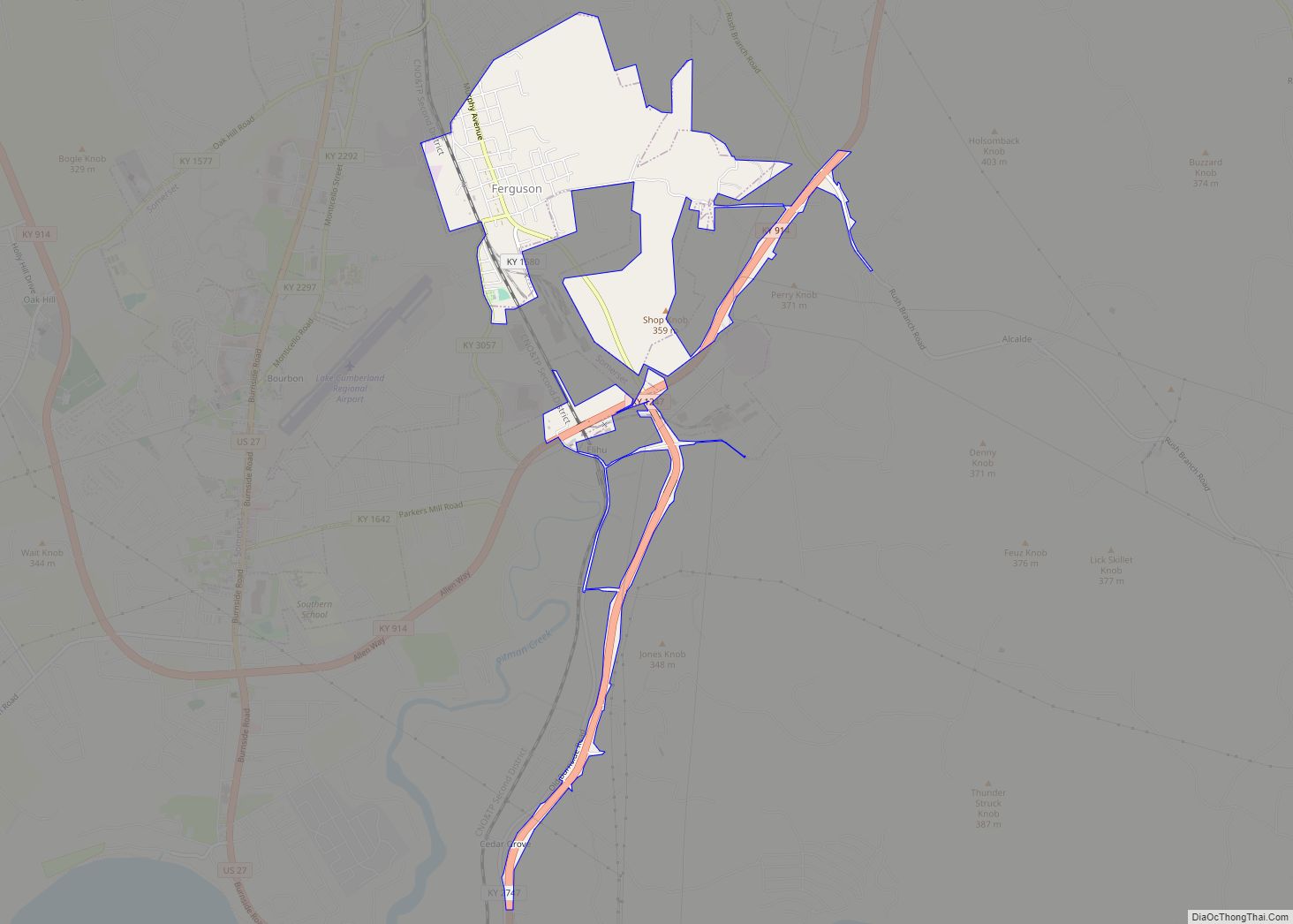
Ferguson is a home rule-class city just south of downtown Somerset in Pulaski County, Kentucky, United States. It had a population of 924 as of the 2010 census, up from 881 in 2000.
| Name: | Ferguson city |
|---|---|
| LSAD Code: | 25 |
| LSAD Description: | city (suffix) |
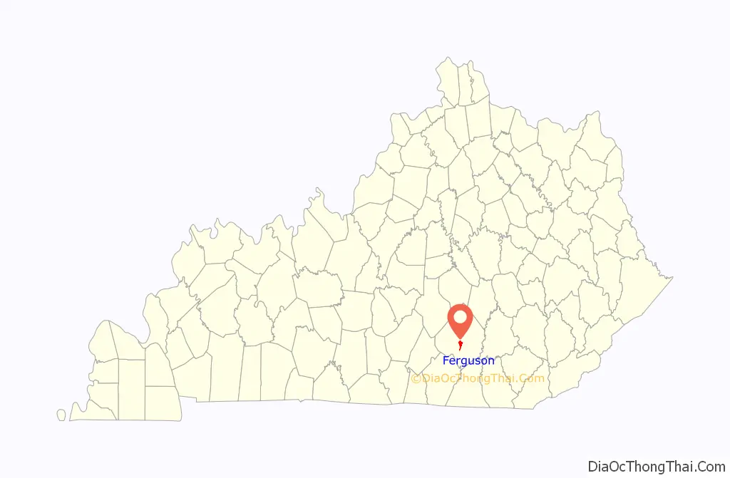
| State: | Kentucky |
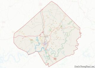
| County: | Pulaski County |
| Elevation: | 935 ft (285 m) |
| Total Area: | 2.01 sq mi (5.21 km²) |
| Land Area: | 2.01 sq mi (5.21 km²) |
| Water Area: | 0.00 sq mi (0.01 km²) |
| Total Population: | 886 |
| Population Density: | 440.58/sq mi (170.15/km²) |
| ZIP code: | 42533 |
| Area code: | 606 |
| FIPS code: | 2127010 |
| GNISfeature ID: | 0492026 |
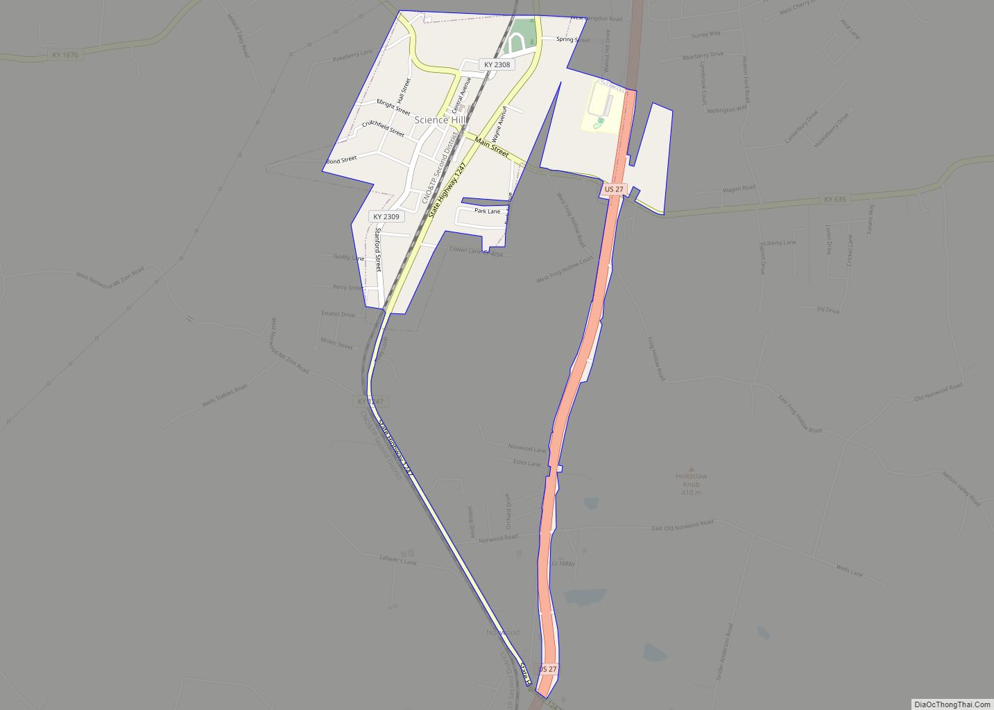
Online Interactive Map
Click on ![]() to view map in "full screen" mode.
to view map in "full screen" mode.
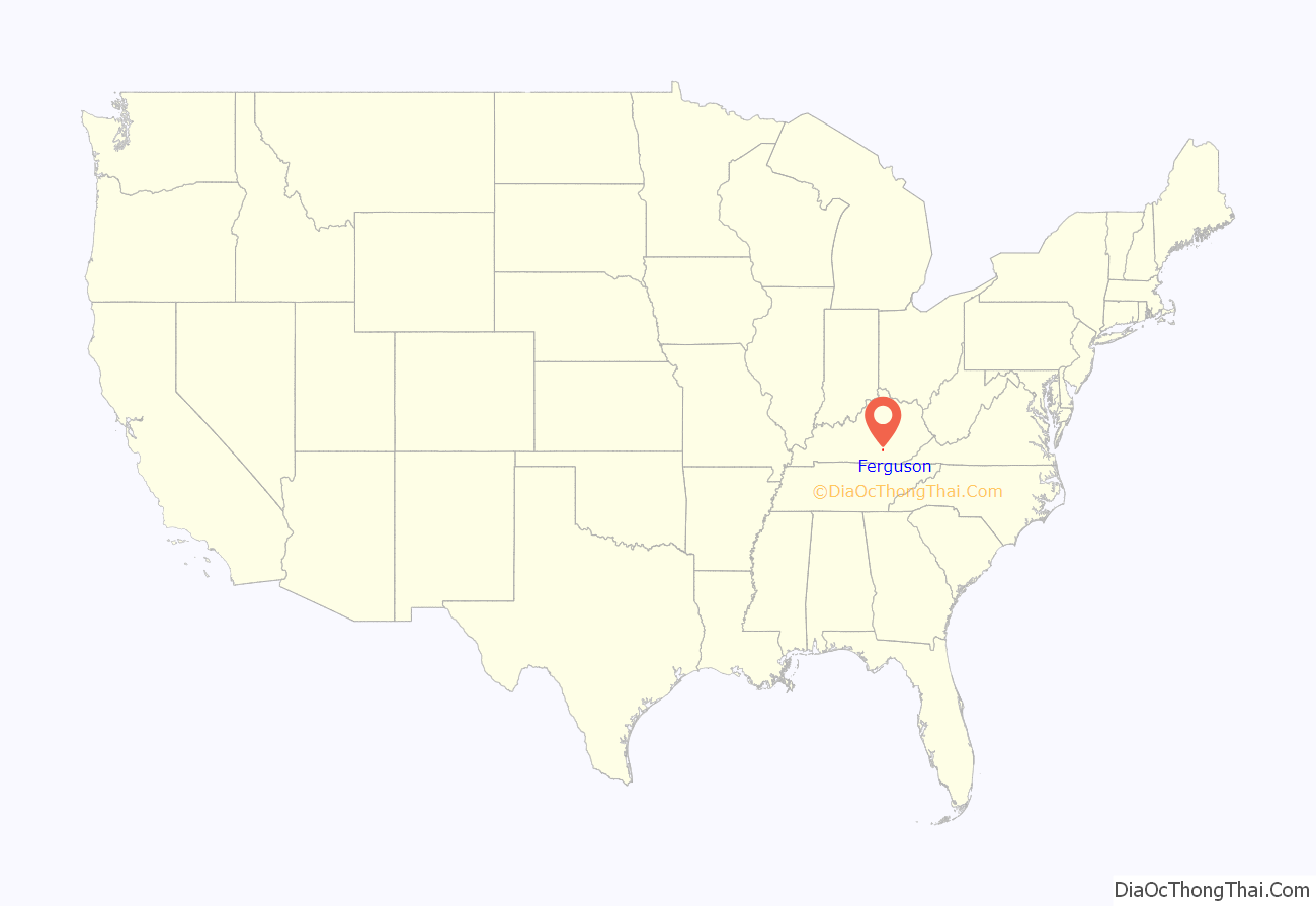
Ferguson location map. Where is Ferguson city?
History
The city was originally constructed just north of the Cincinnati Southern Railroad’s engine repair shops as a residential community for its workers. It was incorporated by the state assembly in 1906. It was likely named for the Cincinnati attorney Edward A. Ferguson who helped found the railroad in 1869.
Because another community in Logan County already possessed a post office named Ferguson, the city long employed the name Luretha for mail delivery after the daughter of its first postmaster George Wynn. In 1950, the Logan Co. post office was closed and the Board on Geographic Names approved the use of Ferguson for the Pulaski community’s mail.
The railroad shops were specialized for work with steam engines and were shuttered after trains began using diesel locomotives in the mid-20th century.
Ferguson School
Ferguson School opened in 1910 for grades 1-12 to serve the children of the town and the rural area just south and east. The high school fluctuated in enrollment from 100 to 150. The high school closed in 1968 and the elementary school in 1978. The property of the former school grounds is now the Ferguson Park, and the buildings house community center offices and recreational facilities. Ferguson students now attend Southwestern-Pulaski County High School.
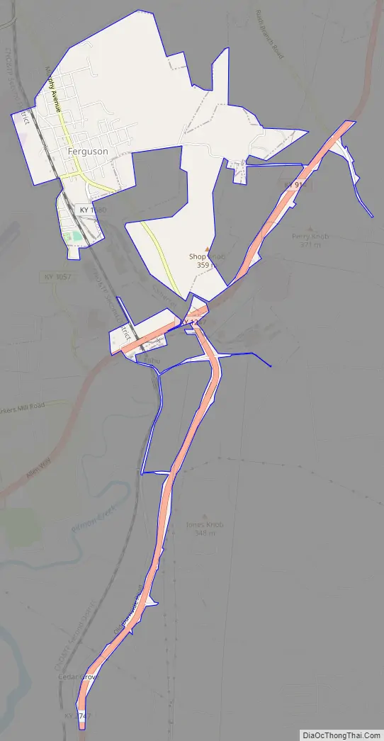
Ferguson Road Map
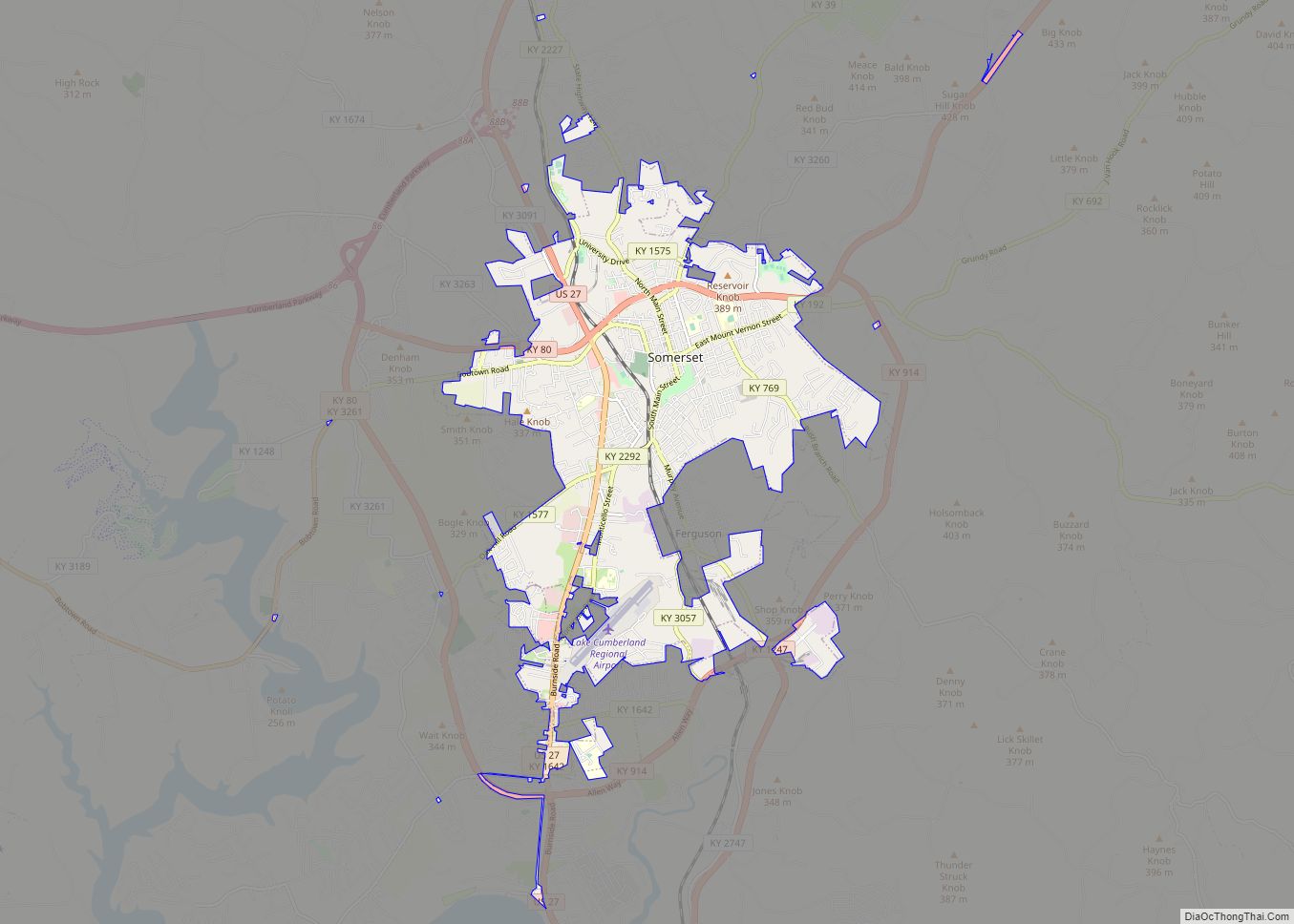
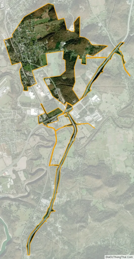
Ferguson city Satellite Map
Geography
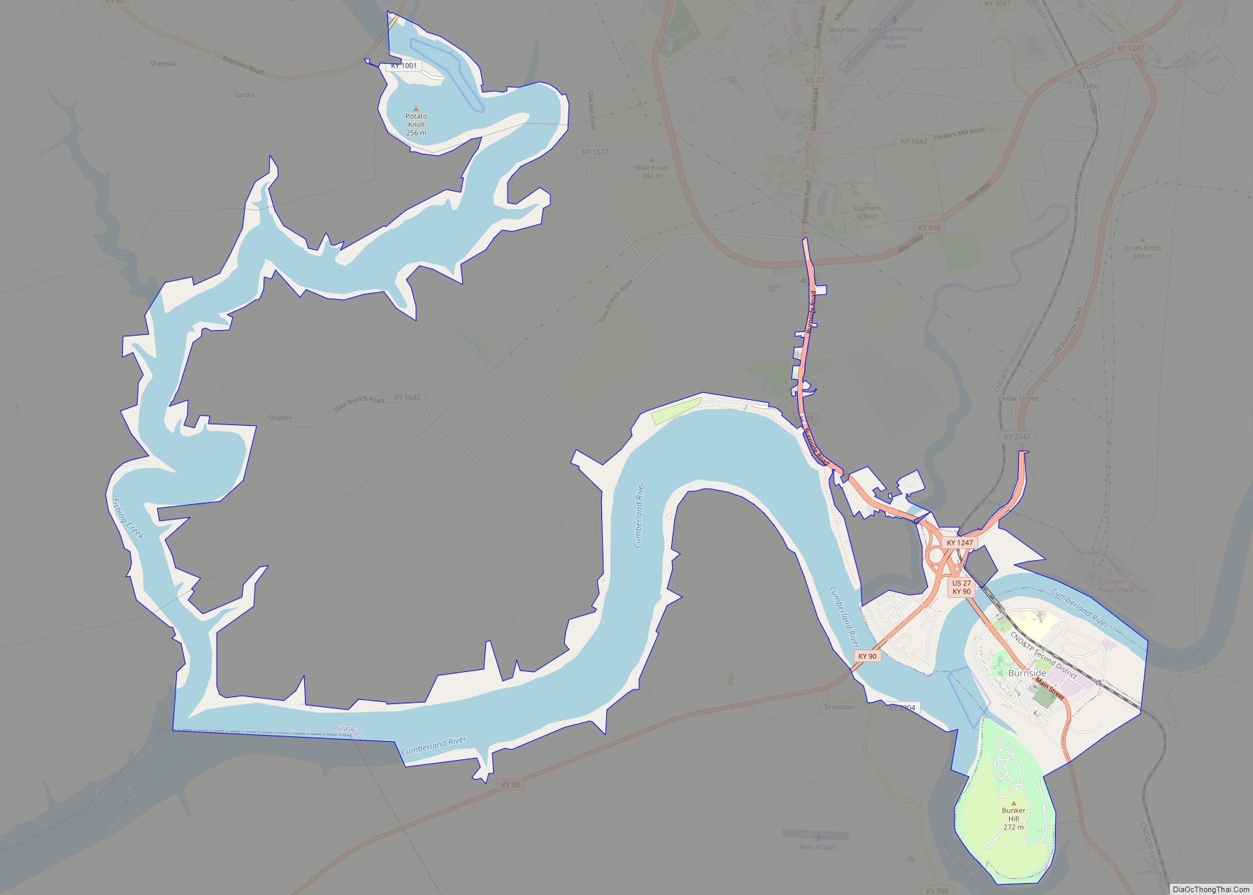
Ferguson is located at 37°4′1″N 84°36′0″W / 37.06694°N 84.60000°W / 37.06694; -84.60000 (37.066845, -84.599953). The city is concentrated along Kentucky Route 1247 (Murphy Avenue), and stretches southward toward Kentucky Route 914. Ferguson is surrounded on the north, west, and south by the municipal boundaries of Somerset. The Cumberland River (Lake Cumberland) passes to the southwest.
According to the United States Census Bureau, the city has a total area of 1.8 square miles (4.7 km), all land.
See also
Map of Kentucky State and its subdivision:- Adair
- Allen
- Anderson
- Ballard
- Barren
- Bath
- Bell
- Boone
- Bourbon
- Boyd
- Boyle
- Bracken
- Breathitt
- Breckinridge
- Bullitt
- Butler
- Caldwell
- Calloway
- Campbell
- Carlisle
- Carroll
- Carter
- Casey
- Christian
- Clark
- Clay
- Clinton
- Crittenden
- Cumberland
- Daviess
- Edmonson
- Elliott
- Estill
- Fayette
- Fleming
- Floyd
- Franklin
- Fulton
- Gallatin
- Garrard
- Grant
- Graves
- Grayson
- Green
- Greenup
- Hancock
- Hardin
- Harlan
- Harrison
- Hart
- Henderson
- Henry
- Hickman
- Hopkins
- Jackson
- Jefferson
- Jessamine
- Johnson
- Kenton
- Knott
- Knox
- Larue
- Laurel
- Lawrence
- Lee
- Leslie
- Letcher
- Lewis
- Lincoln
- Livingston
- Logan
- Lyon
- Madison
- Magoffin
- Marion
- Marshall
- Martin
- Mason
- McCracken
- McCreary
- McLean
- Meade
- Menifee
- Mercer
- Metcalfe
- Monroe
- Montgomery
- Morgan
- Muhlenberg
- Nelson
- Nicholas
- Ohio
- Oldham
- Owen
- Owsley
- Pendleton
- Perry
- Pike
- Powell
- Pulaski
- Robertson
- Rockcastle
- Rowan
- Russell
- Scott
- Shelby
- Simpson
- Spencer
- Taylor
- Todd
- Trigg
- Trimble
- Union
- Warren
- Washington
- Wayne
- Webster
- Whitley
- Wolfe
- Woodford
- Alabama
- Alaska
- Arizona
- Arkansas
- California
- Colorado
- Connecticut
- Delaware
- District of Columbia
- Florida
- Georgia
- Hawaii
- Idaho
- Illinois
- Indiana
- Iowa
- Kansas
- Kentucky
- Louisiana
- Maine
- Maryland
- Massachusetts
- Michigan
- Minnesota
- Mississippi
- Missouri
- Montana
- Nebraska
- Nevada
- New Hampshire
- New Jersey
- New Mexico
- New York
- North Carolina
- North Dakota
- Ohio
- Oklahoma
- Oregon
- Pennsylvania
- Rhode Island
- South Carolina
- South Dakota
- Tennessee
- Texas
- Utah
- Vermont
- Virginia
- Washington
- West Virginia
- Wisconsin
- Wyoming