Glenview is a 6th-class city along the southern bank of the Ohio River in northeastern Jefferson County, Kentucky, United States The population was 531 at the 2010 census.
Glenview has the 2nd-highest per capita income within Kentucky and the 74th-highest in the United States. The city is known for its old estate homes on high bluffs overlooking the Ohio River.
| Name: | Glenview city |
|---|---|
| LSAD Code: | 25 |
| LSAD Description: | city (suffix) |
| State: | Kentucky |
| County: | Jefferson County |
| Elevation: | 449 ft (137 m) |
| Total Area: | 1.43 sq mi (3.71 km²) |
| Land Area: | 1.43 sq mi (3.69 km²) |
| Water Area: | 0.01 sq mi (0.02 km²) |
| Total Population: | 596 |
| Population Density: | 418.25/sq mi (161.50/km²) |
| ZIP code: | 40025 |
| Area code: | 502 |
| FIPS code: | 2131348 |
| GNISfeature ID: | 0508100 |
| Website: | www.glenviewky.gov |
Online Interactive Map
Click on ![]() to view map in "full screen" mode.
to view map in "full screen" mode.
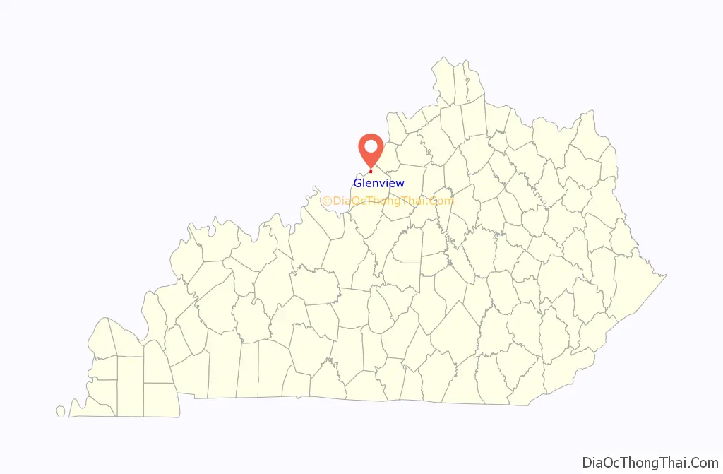
Glenview location map. Where is Glenview city?

History
5,000 acres (20 km) of the surrounding land were originally owned by James Smalley Bate and named “Berry Hill” for his former Virginia home. The estate was purchased in 1868 by meat packer James C. McFerran. McFerran’s horse farm was named “Glen View”. After his death in 1885, John E. Green acquired the farm and renamed it “Glenview Stock Farm”. The community received its post office on May 11, 1893.
In the late 19th century, wealthy families from Louisville began moving east to build summer homes in communities such as Anchorage. Some of these eventually became full-time residences. Early residents of Glenview cooperated with other communities to open the Louisville, Harrods Creek and Westport Railroad in 1877, a commuter rail line in use until its abandonment in the 1950s. Some of Louisville’s most influential families, including the Binghams, the Ballards, and the Belknaps, moved into the area after the opening of the railroad.
Many houses are part of the Glenview Historic District. Several buildings are individually listed on the National Register of Historic Places including the Ballard School, Boxhill and Lincliff.
Some developers have played off Glenview’s reputation, establishing similarly-named communities at Glenview Manor and Glenview Hills in the 1960s and 70s. Louisville attempted to annex Glenview in 1983, which prompted its residents to seek a separate incorporation from the state legislature. This was granted in 1985. Many of the houses are part of the Glenview Historic District, which is on the National Register of Historic Places.
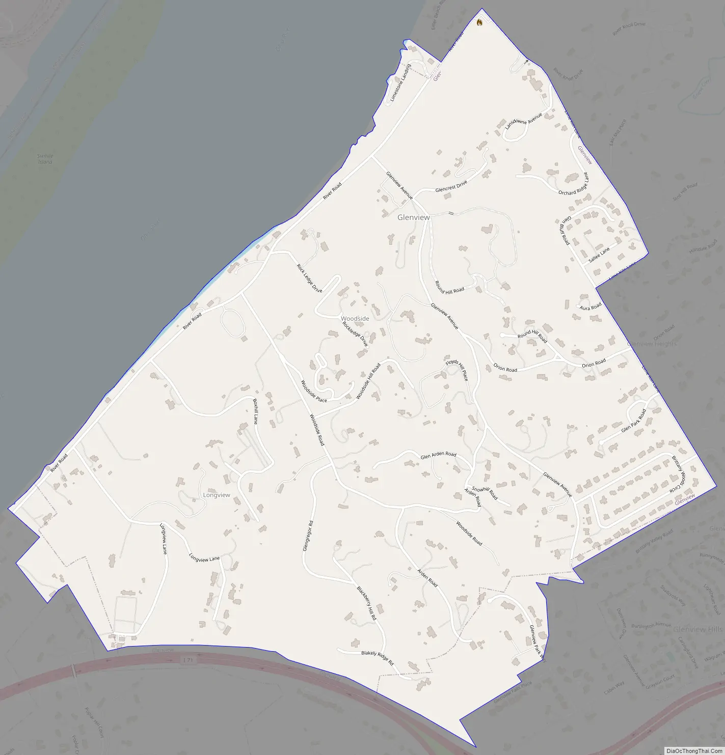
Glenview Road Map
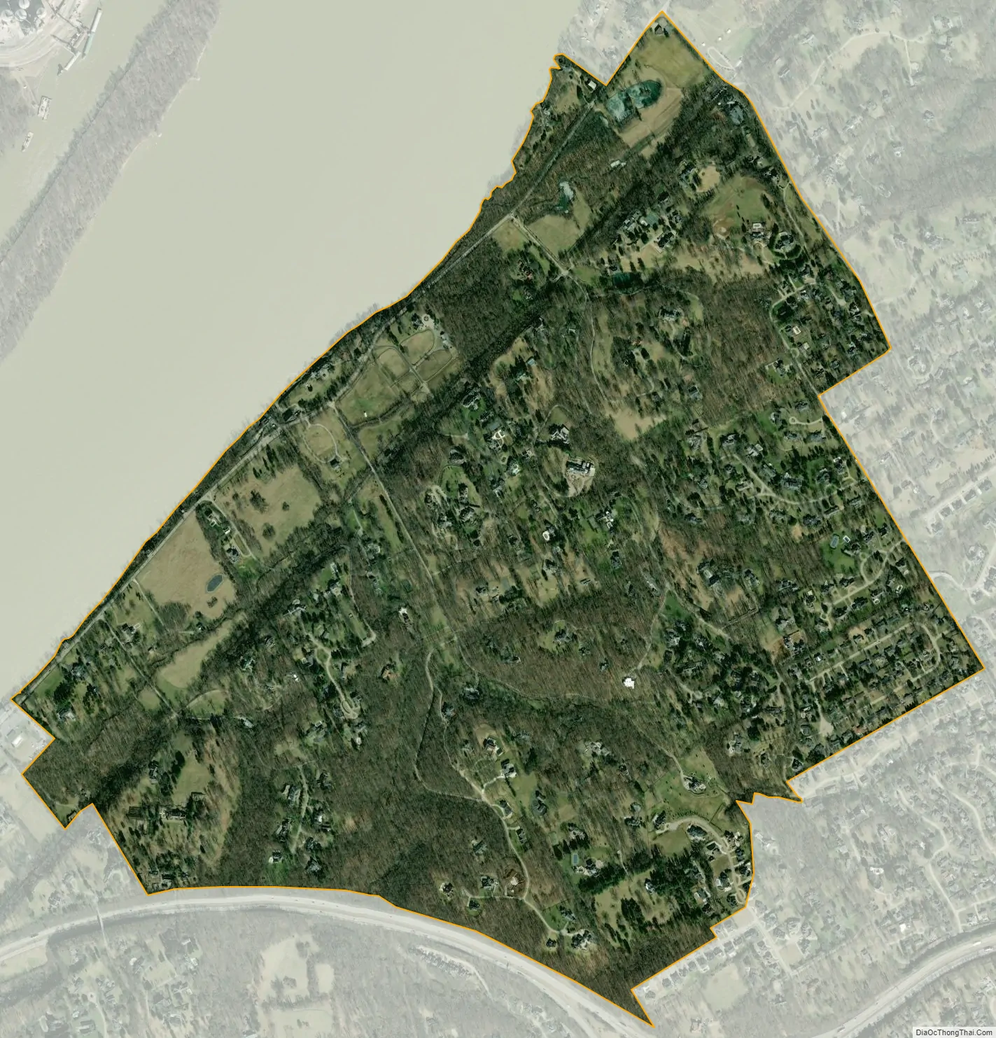
Glenview city Satellite Map
Geography
Glenview is located in northern Jefferson County at 38°18′22″N 85°39′13″W / 38.30611°N 85.65361°W / 38.30611; -85.65361 (38.306069, -85.653640). It is bordered to the northwest by the Ohio River, to the southwest by Indian Hills, and on all other sides by consolidated Louisville/Jefferson County. Interstate 71 runs along the southern edge of the community, but with no direct access. Downtown Louisville is 7 miles (11 km) to the southwest via River Road.
According to the United States Census Bureau, Glenview has a total area of 1.4 square miles (3.7 km), of which 0.01 square miles (0.02 km), or 0.43%, are water.
See also
Map of Kentucky State and its subdivision:- Adair
- Allen
- Anderson
- Ballard
- Barren
- Bath
- Bell
- Boone
- Bourbon
- Boyd
- Boyle
- Bracken
- Breathitt
- Breckinridge
- Bullitt
- Butler
- Caldwell
- Calloway
- Campbell
- Carlisle
- Carroll
- Carter
- Casey
- Christian
- Clark
- Clay
- Clinton
- Crittenden
- Cumberland
- Daviess
- Edmonson
- Elliott
- Estill
- Fayette
- Fleming
- Floyd
- Franklin
- Fulton
- Gallatin
- Garrard
- Grant
- Graves
- Grayson
- Green
- Greenup
- Hancock
- Hardin
- Harlan
- Harrison
- Hart
- Henderson
- Henry
- Hickman
- Hopkins
- Jackson
- Jefferson
- Jessamine
- Johnson
- Kenton
- Knott
- Knox
- Larue
- Laurel
- Lawrence
- Lee
- Leslie
- Letcher
- Lewis
- Lincoln
- Livingston
- Logan
- Lyon
- Madison
- Magoffin
- Marion
- Marshall
- Martin
- Mason
- McCracken
- McCreary
- McLean
- Meade
- Menifee
- Mercer
- Metcalfe
- Monroe
- Montgomery
- Morgan
- Muhlenberg
- Nelson
- Nicholas
- Ohio
- Oldham
- Owen
- Owsley
- Pendleton
- Perry
- Pike
- Powell
- Pulaski
- Robertson
- Rockcastle
- Rowan
- Russell
- Scott
- Shelby
- Simpson
- Spencer
- Taylor
- Todd
- Trigg
- Trimble
- Union
- Warren
- Washington
- Wayne
- Webster
- Whitley
- Wolfe
- Woodford
- Alabama
- Alaska
- Arizona
- Arkansas
- California
- Colorado
- Connecticut
- Delaware
- District of Columbia
- Florida
- Georgia
- Hawaii
- Idaho
- Illinois
- Indiana
- Iowa
- Kansas
- Kentucky
- Louisiana
- Maine
- Maryland
- Massachusetts
- Michigan
- Minnesota
- Mississippi
- Missouri
- Montana
- Nebraska
- Nevada
- New Hampshire
- New Jersey
- New Mexico
- New York
- North Carolina
- North Dakota
- Ohio
- Oklahoma
- Oregon
- Pennsylvania
- Rhode Island
- South Carolina
- South Dakota
- Tennessee
- Texas
- Utah
- Vermont
- Virginia
- Washington
- West Virginia
- Wisconsin
- Wyoming


