Hardin is a home rule-class city in Marshall County, Kentucky, United States. The population was 580 at the 2020 census.
| Name: | Hardin city |
|---|---|
| LSAD Code: | 25 |
| LSAD Description: | city (suffix) |
| State: | Kentucky |
| County: | Marshall County |
| Elevation: | 420 ft (130 m) |
| Total Area: | 0.70 sq mi (1.82 km²) |
| Land Area: | 0.70 sq mi (1.81 km²) |
| Water Area: | 0.00 sq mi (0.00 km²) |
| Total Population: | 580 |
| Population Density: | 827.39/sq mi (319.60/km²) |
| ZIP code: | 42048 |
| Area code: | 270 & 364 |
| FIPS code: | 2134534 |
| GNISfeature ID: | 2403798 |
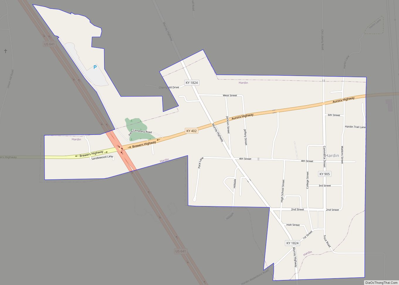
Online Interactive Map
Click on ![]() to view map in "full screen" mode.
to view map in "full screen" mode.
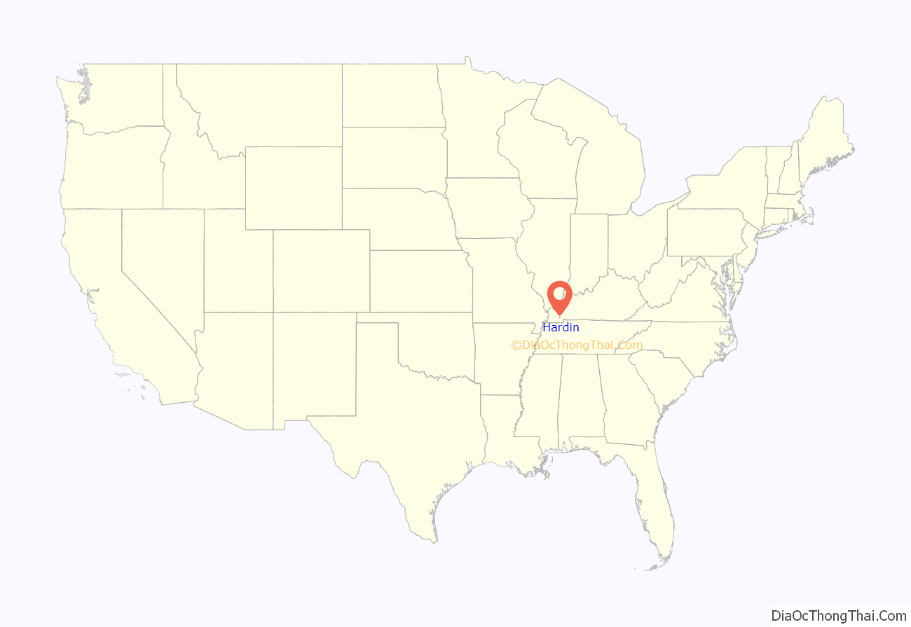
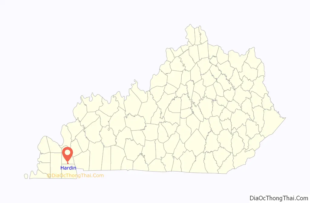
Hardin location map. Where is Hardin city?
History
The Paducah, Tennessee and Alabama Railroad reached the area in 1890. A community grew up around the depot, erected on land purchased from local landowner Hardin D. Irvan. The post office was established on October 31, 1891, but the town was formally incorporated as a city on March 25, 1952.
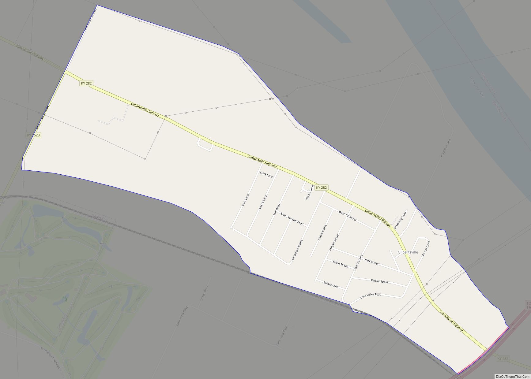
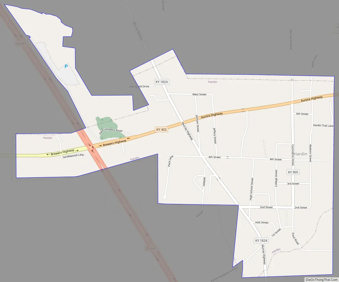
Hardin Road Map
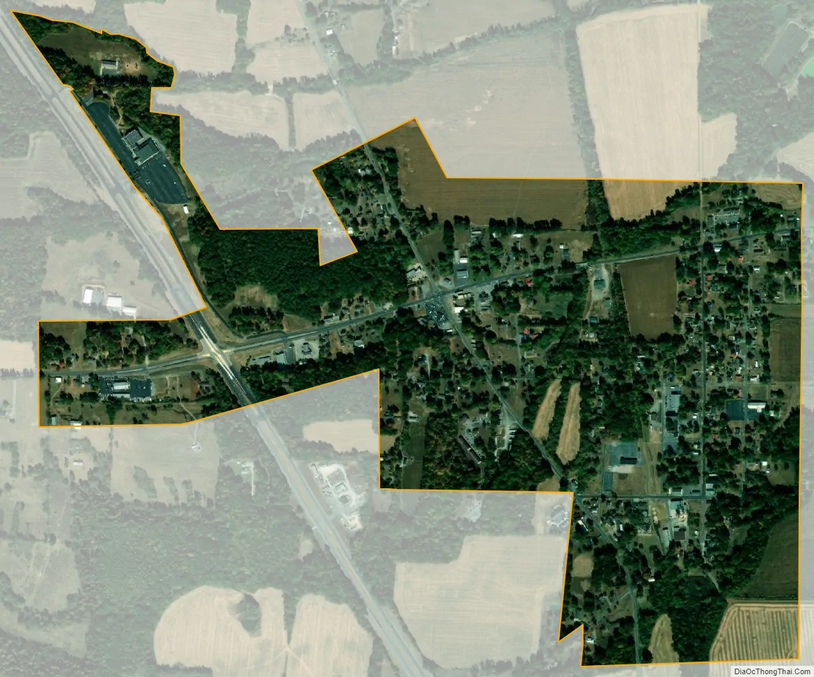
Hardin city Satellite Map
Geography
Hardin is located in southern Marshall County at 36°45′47″N 88°18′0″W / 36.76306°N 88.30000°W / 36.76306; -88.30000 (36.763063, -88.300105). Kentucky Route 402 (Aurora Highway) passes through the north side of the city, while U.S. Route 641 crosses the western part. US 641 leads north 7 miles (11 km) to Benton, the county seat, and south 11 miles (18 km) to Murray. KY 402 leads 9 miles (14 km) to Aurora and west the same distance to Kentucky Route 58 near Brewers.
According to the United States Census Bureau, Hardin has a total area of 0.7 square miles (1.8 km), of which 0.002 square miles (0.005 km), or 0.28%, are water. The city is on the west side of the valley of the Clarks River, a north-flowing tributary of the Tennessee River.
See also
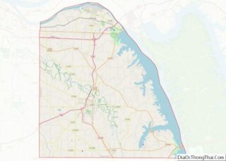
Map of Kentucky State and its subdivision:- Adair
- Allen
- Anderson
- Ballard
- Barren
- Bath
- Bell
- Boone
- Bourbon
- Boyd
- Boyle
- Bracken
- Breathitt
- Breckinridge
- Bullitt
- Butler
- Caldwell
- Calloway
- Campbell
- Carlisle
- Carroll
- Carter
- Casey
- Christian
- Clark
- Clay
- Clinton
- Crittenden
- Cumberland
- Daviess
- Edmonson
- Elliott
- Estill
- Fayette
- Fleming
- Floyd
- Franklin
- Fulton
- Gallatin
- Garrard
- Grant
- Graves
- Grayson
- Green
- Greenup
- Hancock
- Hardin
- Harlan
- Harrison
- Hart
- Henderson
- Henry
- Hickman
- Hopkins
- Jackson
- Jefferson
- Jessamine
- Johnson
- Kenton
- Knott
- Knox
- Larue
- Laurel
- Lawrence
- Lee
- Leslie
- Letcher
- Lewis
- Lincoln
- Livingston
- Logan
- Lyon
- Madison
- Magoffin
- Marion
- Marshall
- Martin
- Mason
- McCracken
- McCreary
- McLean
- Meade
- Menifee
- Mercer
- Metcalfe
- Monroe
- Montgomery
- Morgan
- Muhlenberg
- Nelson
- Nicholas
- Ohio
- Oldham
- Owen
- Owsley
- Pendleton
- Perry
- Pike
- Powell
- Pulaski
- Robertson
- Rockcastle
- Rowan
- Russell
- Scott
- Shelby
- Simpson
- Spencer
- Taylor
- Todd
- Trigg
- Trimble
- Union
- Warren
- Washington
- Wayne
- Webster
- Whitley
- Wolfe
- Woodford
- Alabama
- Alaska
- Arizona
- Arkansas
- California
- Colorado
- Connecticut
- Delaware
- District of Columbia
- Florida
- Georgia
- Hawaii
- Idaho
- Illinois
- Indiana
- Iowa
- Kansas
- Kentucky
- Louisiana
- Maine
- Maryland
- Massachusetts
- Michigan
- Minnesota
- Mississippi
- Missouri
- Montana
- Nebraska
- Nevada
- New Hampshire
- New Jersey
- New Mexico
- New York
- North Carolina
- North Dakota
- Ohio
- Oklahoma
- Oregon
- Pennsylvania
- Rhode Island
- South Carolina
- South Dakota
- Tennessee
- Texas
- Utah
- Vermont
- Virginia
- Washington
- West Virginia
- Wisconsin
- Wyoming