Liberty is a home rule-class city in Casey County, Kentucky, in the United States. It is the seat of its county. Its population was 2,168 at the 2010 U.S. census.
| Name: | Liberty city |
|---|---|
| LSAD Code: | 25 |
| LSAD Description: | city (suffix) |
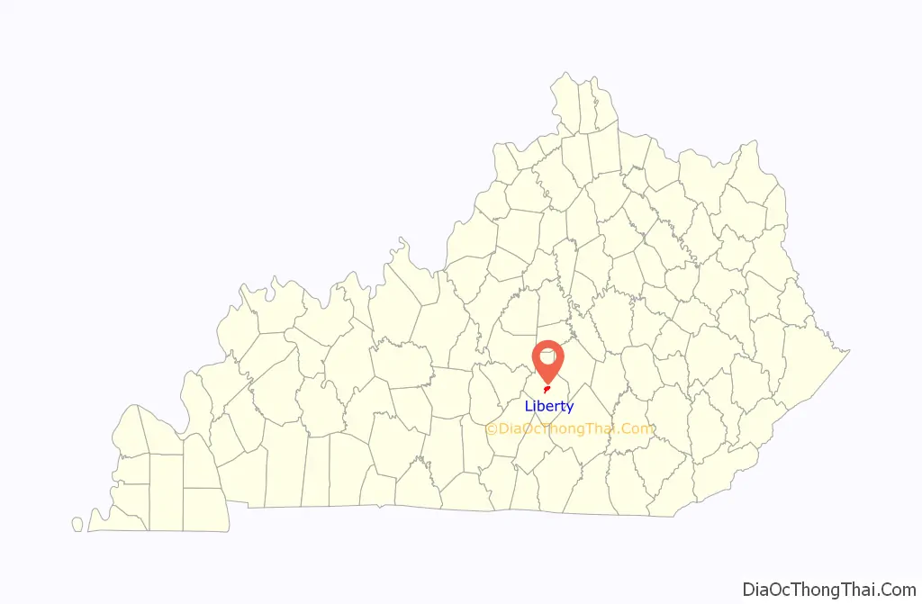
| State: | Kentucky |
| County: | Casey County |
| Incorporated: | 1860 |
| Elevation: | 810 ft (250 m) |
| Total Area: | 1.89 sq mi (4.88 km²) |
| Land Area: | 1.87 sq mi (4.85 km²) |
| Water Area: | 0.01 sq mi (0.04 km²) |
| Total Population: | 2,028 |
| Population Density: | 1,083.91/sq mi (418.50/km²) |
| ZIP code: | 42539 |
| Area code: | 606 |
| FIPS code: | 2146072 |
| GNISfeature ID: | 0496352 |
| Website: | libertykentucky.org |
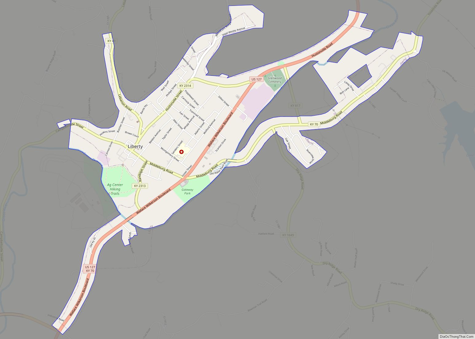
Online Interactive Map
Click on ![]() to view map in "full screen" mode.
to view map in "full screen" mode.
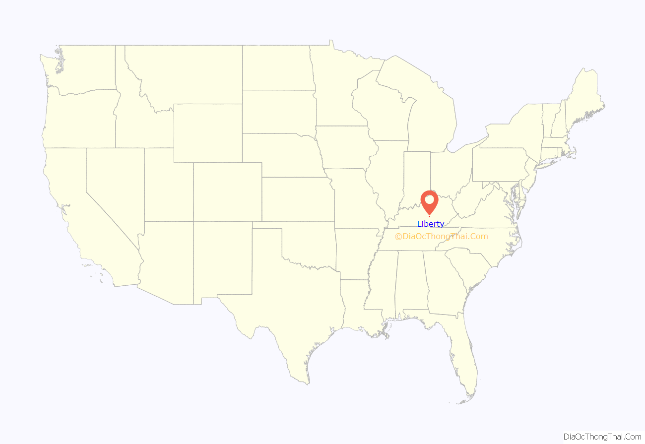
Liberty location map. Where is Liberty city?
History
It was founded prior to 1806 by several Revolutionary War veterans upon their military grants and named out of patriotic sentiment. In 1808, it was made the seat of Casey County owing to its central location. The post office was opened in 1814. The town was formally established by the state assembly in 1830 and incorporated in 1860.
In 2012, the Kentucky Supreme Court struck down Liberty Police using road blocks as a means for writing tickets for failure to display a city sticker. They blasted Liberty for selecting the most intrusive means possible to achieve its goal.
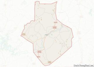
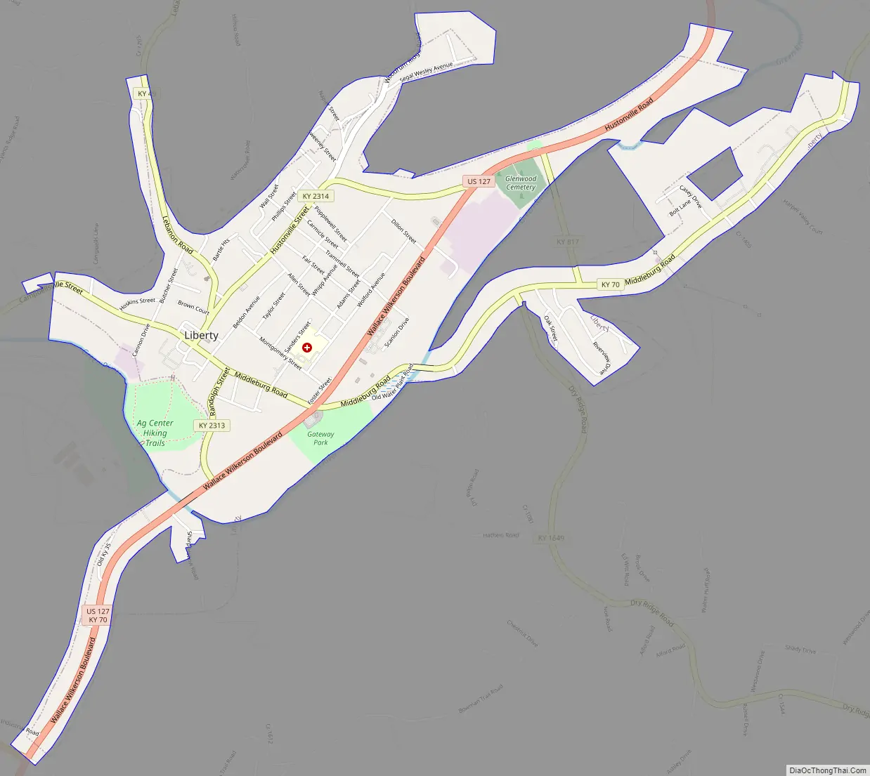
Liberty Road Map
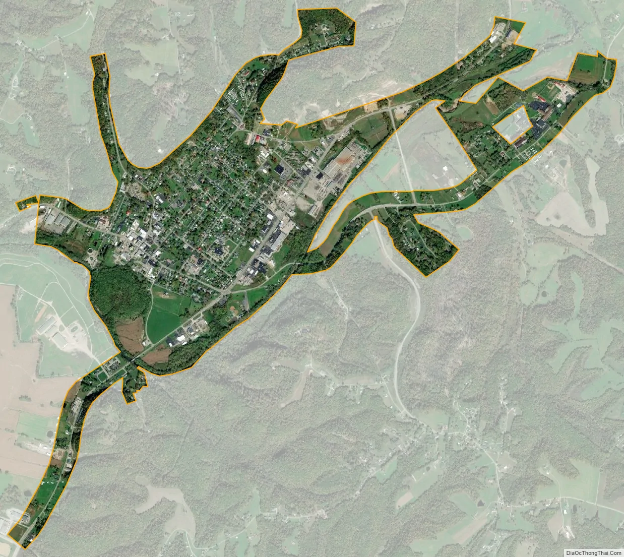
Liberty city Satellite Map
Geography
Liberty is located in central Casey County at 37°19′16″N 84°55′50″W / 37.32111°N 84.93056°W / 37.32111; -84.93056 (37.321195, -84.930513), in the valley of the Green River. U.S. Route 127 passes through the city, leading north 26 miles (42 km) to Danville and south 21 miles (34 km) to Russell Springs. According to the United States Census Bureau, Liberty has a total area of 1.9 square miles (4.9 km), of which 0.01 square miles (0.03 km), or 0.71%, is water.
Climate
The climate in this area is characterized by hot, humid summers and generally mild to cold winters. According to the Köppen Climate Classification system, Liberty has a humid subtropical climate, abbreviated “Cfa” on climate maps.
See also
Map of Kentucky State and its subdivision:- Adair
- Allen
- Anderson
- Ballard
- Barren
- Bath
- Bell
- Boone
- Bourbon
- Boyd
- Boyle
- Bracken
- Breathitt
- Breckinridge
- Bullitt
- Butler
- Caldwell
- Calloway
- Campbell
- Carlisle
- Carroll
- Carter
- Casey
- Christian
- Clark
- Clay
- Clinton
- Crittenden
- Cumberland
- Daviess
- Edmonson
- Elliott
- Estill
- Fayette
- Fleming
- Floyd
- Franklin
- Fulton
- Gallatin
- Garrard
- Grant
- Graves
- Grayson
- Green
- Greenup
- Hancock
- Hardin
- Harlan
- Harrison
- Hart
- Henderson
- Henry
- Hickman
- Hopkins
- Jackson
- Jefferson
- Jessamine
- Johnson
- Kenton
- Knott
- Knox
- Larue
- Laurel
- Lawrence
- Lee
- Leslie
- Letcher
- Lewis
- Lincoln
- Livingston
- Logan
- Lyon
- Madison
- Magoffin
- Marion
- Marshall
- Martin
- Mason
- McCracken
- McCreary
- McLean
- Meade
- Menifee
- Mercer
- Metcalfe
- Monroe
- Montgomery
- Morgan
- Muhlenberg
- Nelson
- Nicholas
- Ohio
- Oldham
- Owen
- Owsley
- Pendleton
- Perry
- Pike
- Powell
- Pulaski
- Robertson
- Rockcastle
- Rowan
- Russell
- Scott
- Shelby
- Simpson
- Spencer
- Taylor
- Todd
- Trigg
- Trimble
- Union
- Warren
- Washington
- Wayne
- Webster
- Whitley
- Wolfe
- Woodford
- Alabama
- Alaska
- Arizona
- Arkansas
- California
- Colorado
- Connecticut
- Delaware
- District of Columbia
- Florida
- Georgia
- Hawaii
- Idaho
- Illinois
- Indiana
- Iowa
- Kansas
- Kentucky
- Louisiana
- Maine
- Maryland
- Massachusetts
- Michigan
- Minnesota
- Mississippi
- Missouri
- Montana
- Nebraska
- Nevada
- New Hampshire
- New Jersey
- New Mexico
- New York
- North Carolina
- North Dakota
- Ohio
- Oklahoma
- Oregon
- Pennsylvania
- Rhode Island
- South Carolina
- South Dakota
- Tennessee
- Texas
- Utah
- Vermont
- Virginia
- Washington
- West Virginia
- Wisconsin
- Wyoming