Poplar Hills is a home rule-class city in Jefferson County, Kentucky, United States. It is a part of the Louisville Metro government, but operates as a city under the Mayor to Commissioner form of government. Per the 2020 census, the population was 380, but the city administration has made several annexation ordinances that have passed and awaits updated information. The current city population is estimated to be 2380. It currently has the highest population density for any city in Kentucky, and is the only Kentucky city that is on the highest population densities of American cities list.
| Name: | Poplar Hills city |
|---|---|
| LSAD Code: | 25 |
| LSAD Description: | city (suffix) |
| State: | Kentucky |
| County: | Jefferson County |
| Incorporated: | 1983 |
| Elevation: | 469 ft (143 m) |
| Total Area: | 0.03 sq mi (0.07 km²) |
| Land Area: | 0.03 sq mi (0.07 km²) |
| Water Area: | 0.00 sq mi (0.00 km²) |
| Total Population: | 2,380 |
| Population Density: | 79,000/sq mi (34,000/km²) |
| ZIP code: | 40213 |
| FIPS code: | 2162370 |
| GNISfeature ID: | 1669496 |
Online Interactive Map
Click on ![]() to view map in "full screen" mode.
to view map in "full screen" mode.
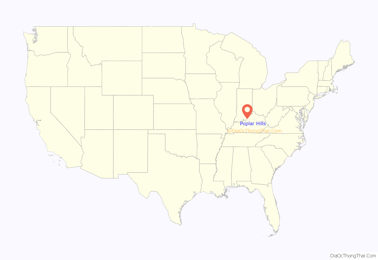
Poplar Hills location map. Where is Poplar Hills city?
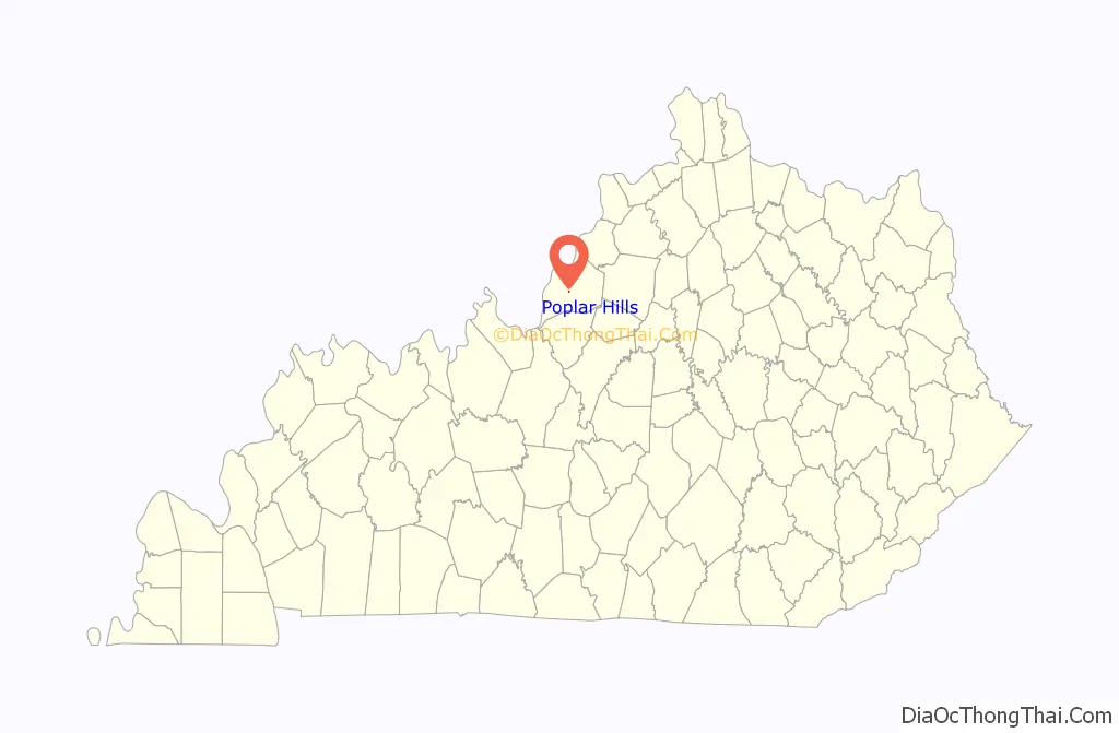
Poplar Hills Road Map
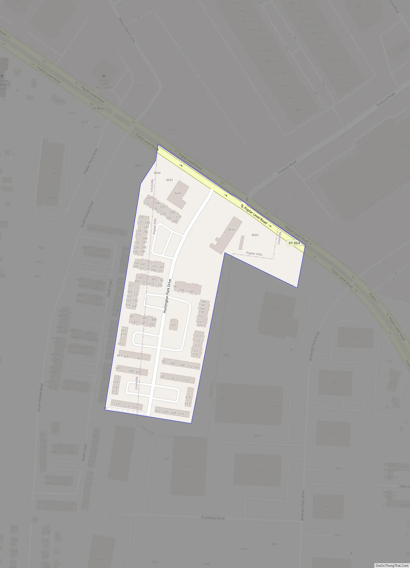
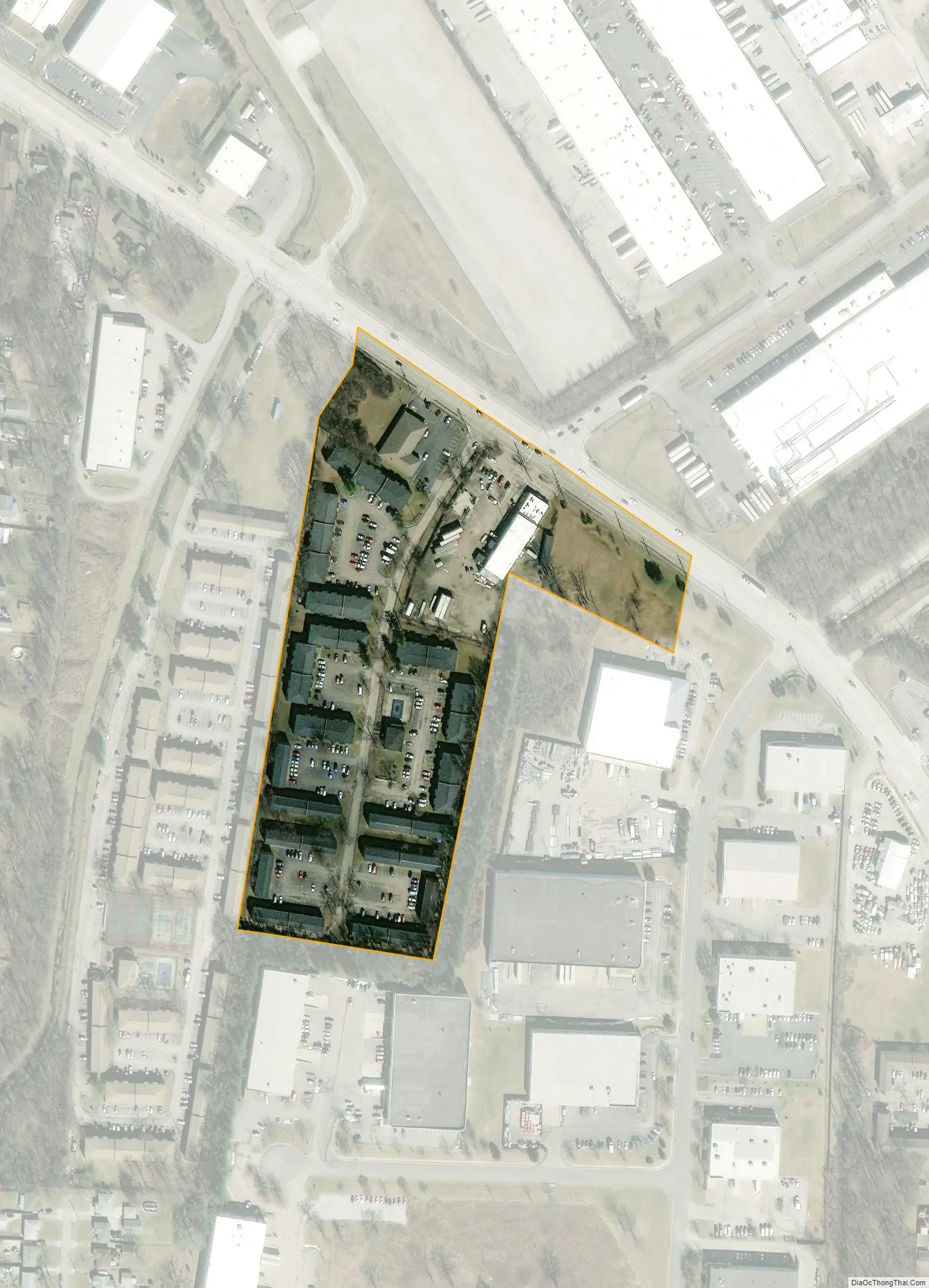
Poplar Hills city Satellite Map
Geography
Poplar Hills is located in central Jefferson County at 38°10′35″N 85°41′37″W / 38.17639°N 85.69361°W / 38.17639; -85.69361 (38.176490, -85.693492). It is bordered to the northeast by Watterson Park and on all other sides by consolidated Louisville/Jefferson County. Kentucky Route 864 (Poplar Level Road) runs along the northeast border of the community. Downtown Louisville is 7 miles (11 km) to the northwest.
According to the United States Census Bureau, Poplar Hills has a total area of 0.03 square miles (0.07 km), all land.
See also
Map of Kentucky State and its subdivision:- Adair
- Allen
- Anderson
- Ballard
- Barren
- Bath
- Bell
- Boone
- Bourbon
- Boyd
- Boyle
- Bracken
- Breathitt
- Breckinridge
- Bullitt
- Butler
- Caldwell
- Calloway
- Campbell
- Carlisle
- Carroll
- Carter
- Casey
- Christian
- Clark
- Clay
- Clinton
- Crittenden
- Cumberland
- Daviess
- Edmonson
- Elliott
- Estill
- Fayette
- Fleming
- Floyd
- Franklin
- Fulton
- Gallatin
- Garrard
- Grant
- Graves
- Grayson
- Green
- Greenup
- Hancock
- Hardin
- Harlan
- Harrison
- Hart
- Henderson
- Henry
- Hickman
- Hopkins
- Jackson
- Jefferson
- Jessamine
- Johnson
- Kenton
- Knott
- Knox
- Larue
- Laurel
- Lawrence
- Lee
- Leslie
- Letcher
- Lewis
- Lincoln
- Livingston
- Logan
- Lyon
- Madison
- Magoffin
- Marion
- Marshall
- Martin
- Mason
- McCracken
- McCreary
- McLean
- Meade
- Menifee
- Mercer
- Metcalfe
- Monroe
- Montgomery
- Morgan
- Muhlenberg
- Nelson
- Nicholas
- Ohio
- Oldham
- Owen
- Owsley
- Pendleton
- Perry
- Pike
- Powell
- Pulaski
- Robertson
- Rockcastle
- Rowan
- Russell
- Scott
- Shelby
- Simpson
- Spencer
- Taylor
- Todd
- Trigg
- Trimble
- Union
- Warren
- Washington
- Wayne
- Webster
- Whitley
- Wolfe
- Woodford
- Alabama
- Alaska
- Arizona
- Arkansas
- California
- Colorado
- Connecticut
- Delaware
- District of Columbia
- Florida
- Georgia
- Hawaii
- Idaho
- Illinois
- Indiana
- Iowa
- Kansas
- Kentucky
- Louisiana
- Maine
- Maryland
- Massachusetts
- Michigan
- Minnesota
- Mississippi
- Missouri
- Montana
- Nebraska
- Nevada
- New Hampshire
- New Jersey
- New Mexico
- New York
- North Carolina
- North Dakota
- Ohio
- Oklahoma
- Oregon
- Pennsylvania
- Rhode Island
- South Carolina
- South Dakota
- Tennessee
- Texas
- Utah
- Vermont
- Virginia
- Washington
- West Virginia
- Wisconsin
- Wyoming


