Shively is a home rule-class city in Jefferson County, Kentucky, United States, and a suburb of Louisville within the Louisville Metro government. As of the 2010 census, the city’s population was 15,264, reflecting an increase of 107 (+0.7%) from 15,157 in 2000.
| Name: | Shively city |
|---|---|
| LSAD Code: | 25 |
| LSAD Description: | city (suffix) |
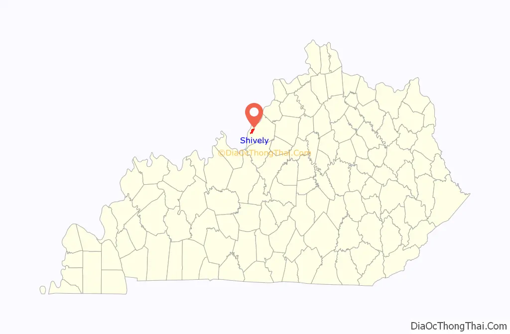
| State: | Kentucky |
| County: | Jefferson County |
| Incorporated: | 1938 |
| Elevation: | 456 ft (139 m) |
| Total Area: | 4.58 sq mi (11.86 km²) |
| Land Area: | 4.57 sq mi (11.84 km²) |
| Water Area: | 0.01 sq mi (0.02 km²) |
| Total Population: | 15,636 |
| Population Density: | 3,419.95/sq mi (1,320.55/km²) |
| ZIP code: | 40216, 40256 |
| Area code: | 502 |
| FIPS code: | 2170284 |
| GNISfeature ID: | 2405462 |
| Website: | www.shivelyky.gov |
Online Interactive Map
Click on ![]() to view map in "full screen" mode.
to view map in "full screen" mode.
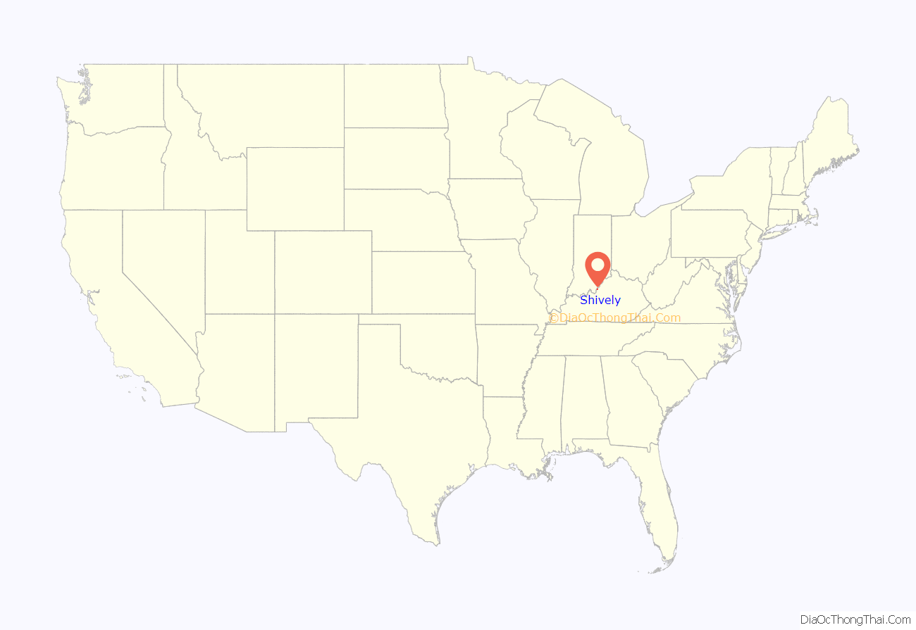
Shively location map. Where is Shively city?
History
After Louisville was founded at the Falls of the Ohio in 1778, farms spread out into the nearby countryside. Early landowners included Col. William Pope, Maj. Abner Field, and the Shivelys, Christian William and Jacob. Christian opened a mill and tavern on his 1,000-acre (400 ha) tract near Mill Creek and the road connecting Louisville to the Salt River. (The road would later be incorporated as the Louisville and Nashville Turnpike.) The buildings became the focus of a settlement known as the “Shively precinct”. In 1816, he donated the land for a church that is today known as Parkview Methodist.
A stagecoach stop was opened in 1831. The Elizabethtown and Paducah Railroad arrived in the 1870s.
Shortly before the Civil War, the area became popular among German immigrants, mostly from Bavaria. In 1897, they erected St. Helen’s Catholic Church. The community was commonly known as “St. Helen’s” for the next few years, but the post office (est. 1902) could not adopt it because there was another community with the name in Lee County.
A streetcar line was extended to the area in 1904.
Eight whiskey distilleries opened nearby after the end of Prohibition. When Louisville tried to annex and tax them during the Great Depression, the distillers talked the residents of Shively into incorporating separately (finalized May 23, 1938) and annexing their district instead. Their $20-million revenue stream left the small city well funded.
During the 1950s, it became the state’s fastest-growing city as white flight and suburbanization reached Louisville.
The area was long de facto segregated as a whites-only neighborhood. In 1954, black Korean War veteran and electrician Andrew Wade IV and his wife Charlotte, who had found themselves unable to buy a home in a suburban neighborhood due to Jim Crow housing discrimination, got help from activists Carl and Anne Braden. The Wades selected a house in Shively that they wanted to buy, and the Bradens bought it on their behalf and deeded it over to them. Soon afterwards, the Wades’ home was repeatedly attacked—including cross burning on an adjacent lot, rocks through their windows, rifle shots into the house, and ultimately a dynamite bomb that exploded under their daughter’s bedroom while they were in the home (no one was injured). The news made national headlines. Anne Braden wrote a 1958 memoir, The Wall Between. No one was ever convicted of the crime. But the Bradens were charged with sedition for their actions. Carl Braden was convicted and sentenced to 15 years in prison; he spent seven months in jail before state-level sedition convictions were overturned by a U.S. Supreme Court ruling in a related case in 1956. After the bombing, the Wades left and very few other blacks attempted to move in, and the community remained a largely white “sundown town” well into the 1960s. Since the 1970s, the black population has grown to about 30 percent, a greater percentage than in the Louisville metropolitan area as a whole, and more than double the percentage in the U.S. population as a whole.
Increased taxes and changing tastes closed most of Shively’s distilleries in the late 1960s. Shively’s population has gradually declined since reaching 19,223 in 1970. Budget surpluses became shortfalls, and Shively tried but failed to annex more suburban territory in Pleasure Ridge Park in 1984. The same year, the town was hit with a scandal when police chief Michael Donio admitted to taking bribes to allow prostitution in the area. Such events led to the community’s reputation as “Lively Shively” (as the name of the town is pronounced with a “long i”, this is a rhyme).
The area’s fortunes have since improved somewhat, with various public works projects occurring and some businesses moving to the area. However, the area along Seventh Street north of Dixie is still known for its seedy adult entertainment businesses. Into the 2000s, the area lagged behind eastern and southern Jefferson County, with one of its few remaining large retail centers, the 150,000-square-foot (14,000 m) Dillard’s on Dixie Highway (est. 1956), closing in 2007 due to slow sales at the location despite the chain’s general profitability in the Louisville area.
Shively remains the site of one major operating distillery: Brown-Forman’s Early Times distillery. Its products include Early Times, which was first produced in 1860, became one of the few brands that was allowed to be produced during the Prohibition era, and was the best-selling whiskey in the country in the mid-1950s. Another is Old Forester; first produced in 1870, it was the first bourbon sold exclusively in sealed bottles and is today the oldest continually produced brand. The former Stitzel-Weller distillery has been converted into a tourist attraction for the Bulleit Bourbon brand, and was included as a stop on the Kentucky Bourbon Trail in 2014. As of October 2014, the Michter’s bourbon brand was working on opening a new distillery in Shively. The Bernheim Distillery site, used by Heaven Hill Distilleries, opened in nearby Louisville around 2000.
On November 5, 2018, Democrat Beverly Chester-Burton became the first African-American to be elected mayor of Shively.
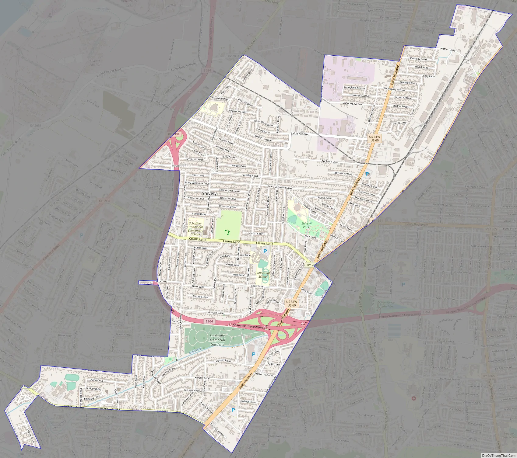
Shively Road Map
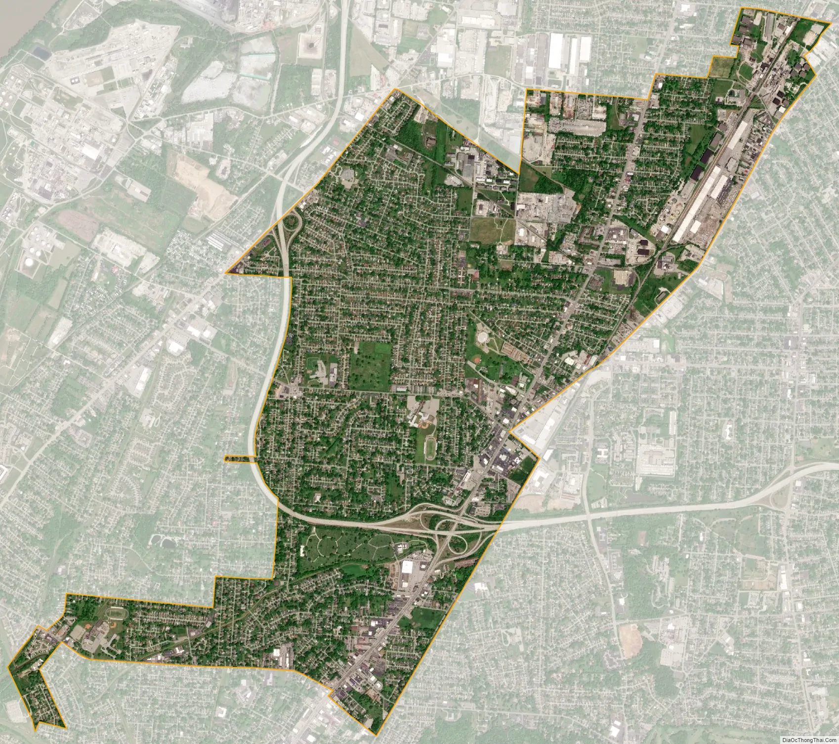
Shively city Satellite Map
Geography
Shively is centered on the junction of US 60 and the Dixie Highway (US 31W) near 38°11′35″N 85°48′58″W / 38.193175°N 85.816166°W / 38.193175; -85.816166. Its modern boundaries are roughly Millers and Bernheim Lane to the north (Louisville’s Algonquin neighborhood); Louisville’s Seventh Street to the east; I-264 and St. Dennis to the west; and Rockford Lane and Pleasure Ridge Park to the south. Shively is 5 miles (8 km) southwest of downtown Louisville.
According to the United States Census Bureau, Shively has a total area of 4.6 square miles (11.9 km), of which 0.01 square miles (0.02 km), or 1.73%, are water.
See also
Map of Kentucky State and its subdivision:- Adair
- Allen
- Anderson
- Ballard
- Barren
- Bath
- Bell
- Boone
- Bourbon
- Boyd
- Boyle
- Bracken
- Breathitt
- Breckinridge
- Bullitt
- Butler
- Caldwell
- Calloway
- Campbell
- Carlisle
- Carroll
- Carter
- Casey
- Christian
- Clark
- Clay
- Clinton
- Crittenden
- Cumberland
- Daviess
- Edmonson
- Elliott
- Estill
- Fayette
- Fleming
- Floyd
- Franklin
- Fulton
- Gallatin
- Garrard
- Grant
- Graves
- Grayson
- Green
- Greenup
- Hancock
- Hardin
- Harlan
- Harrison
- Hart
- Henderson
- Henry
- Hickman
- Hopkins
- Jackson
- Jefferson
- Jessamine
- Johnson
- Kenton
- Knott
- Knox
- Larue
- Laurel
- Lawrence
- Lee
- Leslie
- Letcher
- Lewis
- Lincoln
- Livingston
- Logan
- Lyon
- Madison
- Magoffin
- Marion
- Marshall
- Martin
- Mason
- McCracken
- McCreary
- McLean
- Meade
- Menifee
- Mercer
- Metcalfe
- Monroe
- Montgomery
- Morgan
- Muhlenberg
- Nelson
- Nicholas
- Ohio
- Oldham
- Owen
- Owsley
- Pendleton
- Perry
- Pike
- Powell
- Pulaski
- Robertson
- Rockcastle
- Rowan
- Russell
- Scott
- Shelby
- Simpson
- Spencer
- Taylor
- Todd
- Trigg
- Trimble
- Union
- Warren
- Washington
- Wayne
- Webster
- Whitley
- Wolfe
- Woodford
- Alabama
- Alaska
- Arizona
- Arkansas
- California
- Colorado
- Connecticut
- Delaware
- District of Columbia
- Florida
- Georgia
- Hawaii
- Idaho
- Illinois
- Indiana
- Iowa
- Kansas
- Kentucky
- Louisiana
- Maine
- Maryland
- Massachusetts
- Michigan
- Minnesota
- Mississippi
- Missouri
- Montana
- Nebraska
- Nevada
- New Hampshire
- New Jersey
- New Mexico
- New York
- North Carolina
- North Dakota
- Ohio
- Oklahoma
- Oregon
- Pennsylvania
- Rhode Island
- South Carolina
- South Dakota
- Tennessee
- Texas
- Utah
- Vermont
- Virginia
- Washington
- West Virginia
- Wisconsin
- Wyoming


